
KNOWPIA
WELCOME TO KNOWPIA

Monacillo Urbano, San Juan, Puerto Rico 
Summary
Monacillo Urbano is one of 18 barrios in the municipality of San Juan, Puerto Rico. The barrio was originally part of Monacillo. In 2010, it had a population of 22,342 living in a land area of 3.23 square miles (8.68 km2). Monacillo Urbano is surrounded by Gobernador Piñero barrio to the north, El Cinco barrio to the east, Monacillo barrio to the south, and the municipality of Guaynabo to the west.[3]
Monacillo Urbano | |
|---|---|
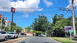 Puerto Rico Highway 841 between Frailes and Monacillo Urbano | |
 Location of Monacillo Urbano shown in yellow. | |
| Coordinates: 18°22′48″N 66°04′52″W / 18.380122°N 66.081235°W[1] | |
| Commonwealth | |
| Municipality | |
| Area | |
| • Total | 3.23 sq mi (8.4 km2) |
| • Land | 3.23 sq mi (8.4 km2) |
| • Water | 0 sq mi (0 km2) |
| Elevation | 141 ft (43 m) |
| Population (2010) | |
| • Total | 22,342 |
| • Density | 6,917.0/sq mi (2,670.7/km2) |
| 2010 census | |
| Time zone | UTC−4 (AST) |
Demographics edit
| Census | Pop. | Note | %± |
|---|---|---|---|
| 1950 | 7,210 | — | |
| 1960 | 18,058 | 150.5% | |
| 1970 | 0 | −100.0% | |
| 1980 | 28,417 | — | |
| 1990 | 28,707 | 1.0% | |
| 2000 | 29,309 | 2.1% | |
| 2010 | 22,342 | −23.8% | |
| U.S. Decennial Census 1900 (N/A)[4] 1910-1930[5] 1930-1950[6] 1980-2000[7] 2010[8] | |||
See also edit
References edit
- ^ a b "US Gazetteer 2019". US Census. US Government.
- ^ U.S. Geological Survey Geographic Names Information System: Monacillo Urbano barrio
- ^ Picó, Rafael; Buitrago de Santiago, Zayda; Berrios, Hector H. Nueva geografía de Puerto Rico: física, económica, y social, por Rafael Picó. Con la colaboración de Zayda Buitrago de Santiago y Héctor H. Berrios. San Juan Editorial Universitaria, Universidad de Puerto Rico,1969.
- Gwillim Law (20 May 2015). Administrative Subdivisions of Countries: A Comprehensive World Reference, 1900 through 1998. McFarland. p. 300. ISBN 978-1-4766-0447-3. Retrieved 25 December 2018.
- Puerto Rico: 2010 Population and Housing Unit Counts.pdf (PDF). U.S. Dept. of Commerce, Economics and Statistics Administration, U.S. Census Bureau. 2010. - ^ "Report of the Census of Porto Rico 1899". War Department Office Director Census of Porto Rico. Archived from the original on July 16, 2017. Retrieved September 21, 2017.
- ^ "Table 3-Population of Municipalities: 1930 1920 and 1910" (PDF). United States Census Bureau. Archived (PDF) from the original on August 17, 2017. Retrieved September 21, 2017.
- ^ "Table 4-Area and Population of Municipalities Urban and Rural: 1930 to 1950" (PDF). United States Census Bureau. Archived (PDF) from the original on August 30, 2015. Retrieved September 21, 2014.
- ^ "Table 2 Population and Housing Units: 1960 to 2000" (PDF). United States Census Bureau. Archived (PDF) from the original on July 24, 2017. Retrieved September 21, 2017.
- ^ Puerto Rico: 2010 Population and Housing Unit Counts.pdf (PDF). U.S. Dept. of Commerce Economics and Statistics Administration U.S. Census Bureau. 2010. Archived (PDF) from the original on 2017-02-20. Retrieved 2019-08-02.