
KNOWPIA
WELCOME TO KNOWPIA

Monterblanc 
Summary
Monterblanc (French pronunciation: [mɔ̃tɛʁblɑ̃]; Breton: Sterwenn) is a commune in the Morbihan department and Brittany region of north-western France.[3]
Monterblanc
Sterwenn | |
|---|---|
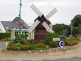 The Ytrac roundabout, in Monterblanc | |
 Coat of arms | |
Location of Monterblanc .mw-parser-output .locmap .od{position:absolute}.mw-parser-output .locmap .id{position:absolute;line-height:0}.mw-parser-output .locmap .l0{font-size:0;position:absolute}.mw-parser-output .locmap .pv{line-height:110%;position:absolute;text-align:center}.mw-parser-output .locmap .pl{line-height:110%;position:absolute;top:-0.75em;text-align:right}.mw-parser-output .locmap .pr{line-height:110%;position:absolute;top:-0.75em;text-align:left}.mw-parser-output .locmap .pv>div{display:inline;padding:1px}.mw-parser-output .locmap .pl>div{display:inline;padding:1px;float:right}.mw-parser-output .locmap .pr>div{display:inline;padding:1px;float:left}html.skin-theme-clientpref-night .mw-parser-output .od,html.skin-theme-clientpref-night .mw-parser-output .od .pv>div,html.skin-theme-clientpref-night .mw-parser-output .od .pl>div,html.skin-theme-clientpref-night .mw-parser-output .od .pr>div{background:#000;color:#fff}html.skin-theme-clientpref-night .mw-parser-output .locmap{filter:grayscale(0.6)}@media(prefers-color-scheme:dark){html.skin-theme-clientpref-os .mw-parser-output .locmap{filter:grayscale(0.6)}html.skin-theme-clientpref-os .mw-parser-output .od,html.skin-theme-clientpref-os .mw-parser-output .od .pv>div,html.skin-theme-clientpref-os .mw-parser-output .od .pl>div,html.skin-theme-clientpref-os .mw-parser-output .od .pr>div{background:#000;color:#fff}}  Monterblanc  Monterblanc | |
| Coordinates: 47°44′36″N 2°40′49″W / 47.7433°N 2.6803°W | |
| Country | France |
| Region | Brittany |
| Department | Morbihan |
| Arrondissement | Vannes |
| Canton | Vannes-3 |
| Intercommunality | Golfe du Morbihan - Vannes Agglomération |
| Government | |
| • Mayor (2020–2026) | Alban Moquet[1] |
| Area 1 | 25.41 km2 (9.81 sq mi) |
| Population (2021)[2] | 3,316 |
| • Density | 130/km2 (340/sq mi) |
| Time zone | UTC+01:00 (CET) |
| • Summer (DST) | UTC+02:00 (CEST) |
| INSEE/Postal code | 56137 /56250 |
| Elevation | 46–151 m (151–495 ft) |
| 1 French Land Register data, which excludes lakes, ponds, glaciers > 1 km2 (0.386 sq mi or 247 acres) and river estuaries. | |
Geography edit
The river Arz forms most of the commune's northern border.
Population edit
| Year | Pop. | ±% p.a. |
|---|---|---|
| 1968 | 1,126 | — |
| 1975 | 1,386 | +3.01% |
| 1982 | 1,794 | +3.75% |
| 1990 | 2,006 | +1.41% |
| 1999 | 1,951 | −0.31% |
| 2007 | 2,592 | +3.61% |
| 2012 | 3,229 | +4.49% |
| 2017 | 3,275 | +0.28% |
| Source: INSEE[4] | ||
In French the inhabitants of Monterblanc are known as Monterblancais.
See also edit
References edit
- ^ "Maires du Morbihan" (PDF). Préfecture du Morbihan. 7 July 2020.
- ^ "Populations légales 2021". The National Institute of Statistics and Economic Studies. 28 December 2023.
- ^ INSEE commune file
- ^ Population en historique depuis 1968, INSEE
External links edit
Wikimedia Commons has media related to Monterblanc.
- Official website (in French)
- Mayors of Morbihan Association (in French)
- Base Mérimée: Search for heritage in the commune, Ministère français de la Culture. (in French)