


Summary
Morske or Morskoye (Ukrainian: Морське; Russian: Морское) is a village in the Sudak Municipality of the Crimea, a territory recognized by a majority of countries as part of Ukraine and annexed by Russia as the Republic of Crimea.[3]
Morske
Морське | |
|---|---|
 Flag  Coat of arms | |
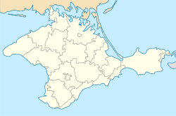 Morske Location of Morske in Crimea | |
| Coordinates: 44°49′50″N 34°48′05″E / 44.83056°N 34.80139°E | |
| Country | Territory of Ukraine, occupied by Russia[1] |
| Republic | Crimea |
| Municipality | Sudak Municipality |
| First mentioned | 1380 |
| Elevation | 43 m (141 ft) |
| Population (2014) | |
| • Total | 2,394 |
| Time zone | UTC+4 (MSK) |
| Postal code | 98033 |
| Area code | +380 6566 |
| Website | http://rada.gov.ua/ |
Previously, the settlement was known as the Kapsikhor village (Crimean Tatar: Qapsihor). Following the forced deportation of the Crimean Tatars in 1944, the Presidium of the Supreme Soviet of the Russian SFSR published a decree on May 18, 1948, renaming the settlement along with many others throughout Crimea from their native Crimean Tatar names to their current variants.[4]
Morske is located on Crimea's southern shore on the Black Sea at an elevation of 43 m (141 ft).[2] Its population was 2,245 in the 2001 Ukrainian census.[3] The current population is 2,394 (2014 Census).[5] The remains of the Choban-Kule fortification are located near the settlement.[6]
References edit
- ^ This place is located on the Crimean peninsula, which is internationally recognized as part of Ukraine, but since 2014 under Russian occupation. According to the administrative-territorial division of Ukraine, there are the Ukrainian divisions (the Autonomous Republic of Crimea and the city with special status of Sevastopol) located on the peninsula. Russia claims these as federal subjects of the Russian Federation (the Republic of Crimea and the federal city of Sevastopol).
- ^ a b "Morske (Crimea region)". weather.in.ua. Retrieved 7 January 2014.
- ^ a b "Morske, Autonomous Republic of Crimea, City of Sudak". Regions of Ukraine and their Structure (in Ukrainian). Verkhovna Rada of Ukraine. Retrieved 7 January 2014.[permanent dead link]
- ^ Presidium of the Supreme Soviet of the Russian SFSR from 18.05.1948 about the renaming of populated settlements in the Crimean Oblast (Указ Президиума ВС РСФСР от 18.05.1948 о переименовании населённых пунктов Крымской области) on the Russian Wikisource.
- ^ Russian Federal State Statistics Service (2014). "Таблица 1.3. Численность населения Крымского федерального округа, городских округов, муниципальных районов, городских и сельских поселений" [Table 1.3. Population of Crimean Federal District, Its Urban Okrugs, Municipal Districts, Urban and Rural Settlements]. Федеральное статистическое наблюдение «Перепись населения в Крымском федеральном округе». ("Population Census in Crimean Federal District" Federal Statistical Examination) (in Russian). Federal State Statistics Service. Retrieved 4 January 2016.
- ^ "Choban-Kule". progylka.com.ua/ (in Ukrainian). Retrieved 7 January 2014.