
KNOWPIA
WELCOME TO KNOWPIA

Mortagne-du-Nord 
Summary
Mortagne-du-Nord (French pronunciation: [mɔʁtaɲ dy nɔʁ]) is a commune in the Nord department in northern France.[3] It lies on the border with Belgium, on the river Scheldt.
Mortagne-du-Nord | |
|---|---|
 The town hall in Mortagne-du-Nord | |
 Coat of arms | |
Location of Mortagne-du-Nord .mw-parser-output .locmap .od{position:absolute}.mw-parser-output .locmap .id{position:absolute;line-height:0}.mw-parser-output .locmap .l0{font-size:0;position:absolute}.mw-parser-output .locmap .pv{line-height:110%;position:absolute;text-align:center}.mw-parser-output .locmap .pl{line-height:110%;position:absolute;top:-0.75em;text-align:right}.mw-parser-output .locmap .pr{line-height:110%;position:absolute;top:-0.75em;text-align:left}.mw-parser-output .locmap .pv>div{display:inline;padding:1px}.mw-parser-output .locmap .pl>div{display:inline;padding:1px;float:right}.mw-parser-output .locmap .pr>div{display:inline;padding:1px;float:left}html.skin-theme-clientpref-night .mw-parser-output .od,html.skin-theme-clientpref-night .mw-parser-output .od .pv>div,html.skin-theme-clientpref-night .mw-parser-output .od .pl>div,html.skin-theme-clientpref-night .mw-parser-output .od .pr>div{background:#000;color:#fff}html.skin-theme-clientpref-night .mw-parser-output .locmap{filter:grayscale(0.6)}@media(prefers-color-scheme:dark){html.skin-theme-clientpref-os .mw-parser-output .locmap{filter:grayscale(0.6)}html.skin-theme-clientpref-os .mw-parser-output .od,html.skin-theme-clientpref-os .mw-parser-output .od .pv>div,html.skin-theme-clientpref-os .mw-parser-output .od .pl>div,html.skin-theme-clientpref-os .mw-parser-output .od .pr>div{background:#000;color:#fff}}  Mortagne-du-Nord  Mortagne-du-Nord | |
| Coordinates: 50°30′18″N 3°27′19″E / 50.505°N 3.4553°E | |
| Country | France |
| Region | Hauts-de-France |
| Department | Nord |
| Arrondissement | Valenciennes |
| Canton | Saint-Amand-les-Eaux |
| Intercommunality | CA Porte du Hainaut |
| Government | |
| • Mayor (2020–2026) | Michel Quiévy[1] |
| Area 1 | 2.18 km2 (0.84 sq mi) |
| Population (2021)[2] | 1,584 |
| • Density | 730/km2 (1,900/sq mi) |
| Time zone | UTC+01:00 (CET) |
| • Summer (DST) | UTC+02:00 (CEST) |
| INSEE/Postal code | 59418 /59158 |
| Elevation | 14–65 m (46–213 ft) (avg. 17 m or 56 ft) |
| 1 French Land Register data, which excludes lakes, ponds, glaciers > 1 km2 (0.386 sq mi or 247 acres) and river estuaries. | |
Heraldry edit
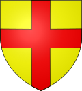 |
The arms of Mortagne-du-Nord are blazoned : Or, a cross gules. (Bruille-Saint-Amand, Flines-lès-Mortagne, Mortagne-du-Nord and Nivelle use the same arms.)
|
See also edit
References edit
- ^ "Répertoire national des élus: les maires". data.gouv.fr, Plateforme ouverte des données publiques françaises (in French). 2 December 2020.
- ^ "Populations légales 2021". The National Institute of Statistics and Economic Studies. 28 December 2023.
- ^ INSEE commune file
Wikimedia Commons has media related to Mortagne-du-Nord.