
KNOWPIA
WELCOME TO KNOWPIA

Motozintla 
Summary
Motozintla (Motozintla de Mendoza) is a city and municipality in the Mexican state of Chiapas in southern Mexico.
Motozintla | |
|---|---|
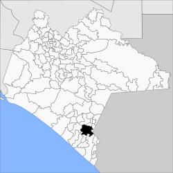 | |
 Motozintla Location in Mexico | |
| Coordinates: 15°22′15″N 92°14′54″W / 15.37083°N 92.24833°W | |
| Country | |
| State | Chiapas |
| Founded | 1620 |
| Town status | 23 October 1912 |
| City status | 10 August 1954 |
| Area | |
| • Total | 782.5 km2 (302.1 sq mi) |
| • City | 5.26 km2 (2.03 sq mi) |
| Population (2020 census)[1] | |
| • Total | 76,398 |
| • Density | 98/km2 (250/sq mi) |
| • City | 27,815 |
| • City density | 5,300/km2 (14,000/sq mi) |
| • Gender | 37,425 males and 38,973 females |
| Website | http://www.motozintla.chiapas.gob.mx/ |
Motozintla occupies part of Mexico's border with Guatemala and is adjacent to the municipalities of Siltepec (to the north), Escuintla and Huixtla (to the west), Tuzantán and Tapachula (to the south), and Mazapa de Madero and El Porvenir (to the northeast). It covers an area of 782.5 km².
As of 2010, the municipality had a total population of 69,119,[2] up from 59,875 as of 2005.[3]
The municipality had 416 localities, the largest of which (with 2010 populations in parentheses) were: Motozintla de Mendoza (23,755), classified as urban, and Belisario Domínguez (2,011), classified as rural.[2]
References edit
- ^ Citypopulation.de Population of Motozintla municipality with localities
- ^ a b "Motozintla". Catálogo de Localidades. Secretaría de Desarrollo Social (SEDESOL). Retrieved 23 April 2014.
- ^ "Motozintla". Enciclopedia de los Municipios de México. Instituto Nacional para el Federalismo y el Desarrollo Municipal / Gobierno del Estado de Chiapas. Archived from the original on May 17, 2011. Retrieved August 1, 2008.