


Summary
Mount Dowe is a mountain in the North West Slopes region of New South Wales, Australia.[1] It is part of an old shield volcano that was active around 18 million years ago. With an elevation of 1,457 metres (4,780 ft) above sea level,[1][2] Mount Dowe is the second highest mountain in the Nandewar Range, only being just short of Mount Kaputar, at 1,508 metres (4,948 ft) above sea level.
| Mount Dowe | |
|---|---|
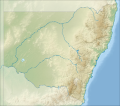 Mount Dowe Location in New South Wales | |
| Highest point | |
| Elevation | 1,457 m (4,780 ft)[1][2] |
| Coordinates | 30°17′S 150°10′E / 30.283°S 150.167°E |
| Geography | |
| Location | New South Wales, Australia |
| Parent range | Nandewar Range |
On the mountain peak are television and radio transmitters which broadcast to locations such as Moree, Tamworth, Gunnedah and Narrabri as it provides a prime location to give television coverage to vast areas in the North West Slopes and Plains region.[3]
The summit of Mount Dowe is often 10 °C (18 °F) colder than the valley floor. Mount Dowe can also receive snow during winter but usually this is only a light dusting.[4]
See also edit
References edit
- ^ a b c "Mount Dowe - NSW". ExplorOz. I.T. Beyond Pty Ltd. 2015. Retrieved 27 May 2015.
- ^ a b "Map of Mount Dowe, NSW". Bonzle Digital Atlas of Australia. Retrieved 27 May 2015.
- ^ "New South Wales Digital TV Transmitter Sites". Oz Digital TV. Retrieved 27 May 2015.
- ^ "Mount Kaputar National Park". NSW National Parks & Wildlife Service. Government of New South Wales. Retrieved 27 May 2015.