


Summary
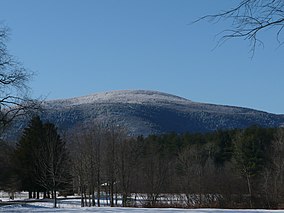
Mount Everett State Reservation is a public recreation area in the towns of Mount Washington and Sheffield, Massachusetts, that offers panoramic views of Massachusetts, Connecticut, and New York from the summit of 2,624-foot (800 m) Mount Everett.[3] The reservation abuts Jug End State Reservation and Wildlife Management Area; Bash Bish Falls State Park and Mount Washington State Forest lie to the west. All are managed by the Massachusetts Department of Conservation and Recreation.
| Mount Everett State Reservation | |
|---|---|
 | |
 Location in Massachusetts  Mount Everett State Reservation (the United States) | |
| Location | Mount Washington, Sheffield, Berkshire, Massachusetts, United States |
| Coordinates | 42°06′06″N 73°25′58″W / 42.10167°N 73.43278°W[1] |
| Area | 2,492 acres (10.08 km2)[2] |
| Elevation | 2,602 ft (793 m)[1] |
| Established | 1908 |
| Operator | Massachusetts Department of Conservation and Recreation |
| Website | Mount Everett State Reservation |
History edit
The state legislature established the Mount Everett Reservation Commission in 1908. The commission was provided a fund of $5000 to purchase land in the towns of Mount Washington and Sheffield that would become the Mount Everett State Reservation.[4] By 1912, a little over half of the appropriation had been used to purchase 815 acres.[5] The commission was abolished in 1975 when management of the reservation was transferred to the Department of Natural Resources.[6]
Old growth forest edit
The reservation has about 530 acres (210 ha) of old-growth forest, most of which is found on the east side of Mount Everett. The forest contains eastern hemlock, eastern white pine, and hardwoods such as sugar and red maple, white and northern red oak, American beech, and sweet and yellow birch. Old-growth forest with a similar composition occurs around Guilder Pond. Mount Everett's summit supports a dwarf forest of pitch pine and bear oak that, aside from clearing for a fire tower and trails, has not been disturbed for centuries.[7][8]
Activities and amenities edit
The Appalachian Trail traverses the entire length of the reservation from south to north, crossing the summit of Mount Everett as it does. Additional trails are available for hiking and cross-country skiing. Picnicking and canoeing are found at Guilder Pond.[3]
References edit
- ^ a b "Mount Everett". Geographic Names Information System. United States Geological Survey, United States Department of the Interior.
- ^ "2012 Acreage Listing" (PDF). Department of Conservation and Recreation. April 2012. Retrieved January 19, 2014.
- ^ a b "Mount Everett State Reservation". MassParks. Executive Office of Energy and Environmental Affairs. Retrieved August 27, 2013.
- ^ "Chapter 571. An act to establish the Mount Everett Reservation in the County of Berkshire". Private and Special Statutes of the Commonwealth of Massachusetts for the Years 1906, 1907, and 1908. Commonwealth of Massachusetts. 1909. p. 928. Retrieved March 13, 2017.
- ^ "Third Annual Report". Mount Everett State Reservation Commission. January 1912. pp. 3–6. Retrieved March 13, 2017.
- ^ "Chapter 806. An act establishing an executive office of environmental affairs" (PDF). Acts, 1974. Commonwealth of Massachusetts. August 12, 1974. pp. 815–816. Retrieved March 13, 2017.
- ^ Davis, Mary Byrd (January 23, 2008). "Massachusetts" (PDF). Old Growth in the East: A Survey. Archived from the original (PDF) on September 19, 2011. Retrieved September 4, 2015.
- ^ See the list of old-growth forests in Massachusetts for details.
External links edit
- Mount Everett State Reservation Department of Conservation and Recreation
- Mt. Washington State Forest Trail Map Department of Conservation and Recreation