


Summary
Mount Jackson (10,052 feet (3,064 m)) is located in the Lewis Range, Glacier National Park in the U.S. state of Montana.[3] Mount Jackson is the fourth tallest mountain in Glacier National Park and it is situated on the Continental Divide. Both the mountain and its namesake Jackson Glacier are easily seen from the Going-to-the-Sun Road. Harrison Glacier, the park's largest remaining glacier, is located on the mountain's southern flank.[1] Based on the Köppen climate classification, Mount Jackson has an alpine climate characterized by long, usually very cold winters, and short, cool to mild summers.[4] Temperatures can drop below −10 °F with wind chill factors below −30 °F.
| Mount Jackson | |
|---|---|
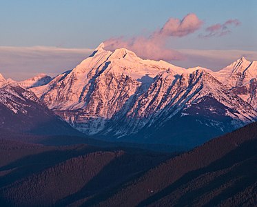
 Cloud cap over Mount Jackson | |
| Highest point | |
| Elevation | 10,052 ft (3,064 m)[1] |
| Prominence | 3,406 ft (1,038 m)[1] |
| Parent peak | Mount Cleveland[1] |
| Listing | Mountains in Flathead County, Montana |
| Coordinates | 48°36′02″N 113°43′19″W / 48.60056°N 113.72194°W[2] |
| Geography | |
 Mount Jackson | |
| Parent range | Lewis Range |
| Topo map | USGS Mount Jackson, MT |
Geology edit
Like other mountains in Glacier National Park, Mount Jackson is composed of sedimentary rock laid down during the Precambrian to Jurassic periods. Formed in shallow seas, this sedimentary rock was initially uplifted beginning 170 million years ago when the Lewis Overthrust fault pushed an enormous slab of precambrian rocks 3 mi (4.8 km) thick, 50 miles (80 km) wide and 160 miles (260 km) long over younger rock of the cretaceous period.[5]
Climate edit
| Climate data for Mount Jackson 48.6002 N, 113.7226 W, Elevation: 9,193 ft (2,802 m) (1991–2020 normals) | |||||||||||||
|---|---|---|---|---|---|---|---|---|---|---|---|---|---|
| Month | Jan | Feb | Mar | Apr | May | Jun | Jul | Aug | Sep | Oct | Nov | Dec | Year |
| Mean daily maximum °F (°C) | 22.5 (−5.3) |
22.0 (−5.6) |
25.8 (−3.4) |
30.8 (−0.7) |
40.2 (4.6) |
48.2 (9.0) |
59.2 (15.1) |
59.7 (15.4) |
51.4 (10.8) |
38.1 (3.4) |
26.2 (−3.2) |
21.2 (−6.0) |
37.1 (2.8) |
| Daily mean °F (°C) | 15.9 (−8.9) |
14.1 (−9.9) |
16.9 (−8.4) |
21.3 (−5.9) |
29.8 (−1.2) |
37.0 (2.8) |
46.3 (7.9) |
46.7 (8.2) |
39.0 (3.9) |
28.6 (−1.9) |
19.8 (−6.8) |
15.0 (−9.4) |
27.5 (−2.5) |
| Mean daily minimum °F (°C) | 9.3 (−12.6) |
6.3 (−14.3) |
7.9 (−13.4) |
11.7 (−11.3) |
19.4 (−7.0) |
25.9 (−3.4) |
33.4 (0.8) |
33.6 (0.9) |
26.7 (−2.9) |
19.1 (−7.2) |
13.4 (−10.3) |
8.8 (−12.9) |
18.0 (−7.8) |
| Average precipitation inches (mm) | 11.73 (298) |
9.89 (251) |
10.54 (268) |
8.06 (205) |
7.39 (188) |
8.89 (226) |
3.08 (78) |
2.98 (76) |
4.96 (126) |
8.48 (215) |
12.08 (307) |
12.30 (312) |
100.38 (2,550) |
| Source: PRISM Climate Group[6] | |||||||||||||
See also edit
References edit
- ^ a b c d "Mount Jackson, Montana". Peakbagger.com. Retrieved 2010-08-29.
- ^ "Mount Jackson". Geographic Names Information System. United States Geological Survey, United States Department of the Interior. Retrieved 2010-08-29.
- ^ "Mount Jackson, Montana" (Map). TopoQuest (USGS Quad). Retrieved 2010-08-29.
- ^ Peel, M. C.; Finlayson, B. L. & McMahon, T. A. (2007). "Updated world map of the Köppen−Geiger climate classification". Hydrol. Earth Syst. Sci. 11: 1633–1644. ISSN 1027-5606.
- ^ Gadd, Ben (2008). "Geology of the Rocky Mountains and Columbias".
{{cite journal}}: Cite journal requires|journal=(help) - ^ "PRISM Climate Group, Oregon State University". PRISM Climate Group, Oregon State University. Retrieved October 4, 2023.
To find the table data on the PRISM website, start by clicking Coordinates (under Location); copy Latitude and Longitude figures from top of table; click Zoom to location; click Precipitation, Minimum temp, Mean temp, Maximum temp; click 30-year normals, 1991-2020; click 800m; click Retrieve Time Series button.
Gallery edit
-
 Mt. Jackson from west at sunset
 -
![Mount Jackson with Jackson Glacier directly to the left of the mountain]](//upload.wikimedia.org/wikipedia/commons/thumb/e/ec/Mount_Jackson_from_Mount_Siyeh.JPG/201px-Mount_Jackson_from_Mount_Siyeh.JPG) Mount Jackson with Jackson Glacier directly to the left of the mountain]
Mount Jackson with Jackson Glacier directly to the left of the mountain] -
 Mount Jackson

![Mount Jackson with Jackson Glacier directly to the left of the mountain]](http://upload.wikimedia.org/wikipedia/commons/thumb/e/ec/Mount_Jackson_from_Mount_Siyeh.JPG/201px-Mount_Jackson_from_Mount_Siyeh.JPG)

External links edit
- Weather forecast: Mount Jackson