


Summary
Mourenx (French pronunciation: [muʁɛ̃ks]; Occitan: Morencs) is a commune in the Pyrénées-Atlantiques department in south-western France.[3]
Mourenx | |
|---|---|
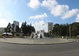 Main route entering Mourenx | |
 Coat of arms | |
Location of Mourenx .mw-parser-output .locmap .od{position:absolute}.mw-parser-output .locmap .id{position:absolute;line-height:0}.mw-parser-output .locmap .l0{font-size:0;position:absolute}.mw-parser-output .locmap .pv{line-height:110%;position:absolute;text-align:center}.mw-parser-output .locmap .pl{line-height:110%;position:absolute;top:-0.75em;text-align:right}.mw-parser-output .locmap .pr{line-height:110%;position:absolute;top:-0.75em;text-align:left}.mw-parser-output .locmap .pv>div{display:inline;padding:1px}.mw-parser-output .locmap .pl>div{display:inline;padding:1px;float:right}.mw-parser-output .locmap .pr>div{display:inline;padding:1px;float:left}html.skin-theme-clientpref-night .mw-parser-output .od,html.skin-theme-clientpref-night .mw-parser-output .od .pv>div,html.skin-theme-clientpref-night .mw-parser-output .od .pl>div,html.skin-theme-clientpref-night .mw-parser-output .od .pr>div{background:#000;color:#fff}html.skin-theme-clientpref-night .mw-parser-output .locmap{filter:grayscale(0.6)}@media(prefers-color-scheme:dark){html.skin-theme-clientpref-os .mw-parser-output .locmap{filter:grayscale(0.6)}html.skin-theme-clientpref-os .mw-parser-output .od,html.skin-theme-clientpref-os .mw-parser-output .od .pv>div,html.skin-theme-clientpref-os .mw-parser-output .od .pl>div,html.skin-theme-clientpref-os .mw-parser-output .od .pr>div{background:#000;color:#fff}}  Mourenx  Mourenx | |
| Coordinates: 43°22′46″N 0°36′25″W / 43.3794°N 0.6069°W | |
| Country | France |
| Region | Nouvelle-Aquitaine |
| Department | Pyrénées-Atlantiques |
| Arrondissement | Pau |
| Canton | Le Cœur de Béarn |
| Intercommunality | Lacq-Orthez |
| Government | |
| • Mayor (2020–2026) | Patrice Laurent[1] |
| Area 1 | 6 km2 (2 sq mi) |
| Population (2021)[2] | 5,846 |
| • Density | 970/km2 (2,500/sq mi) |
| Time zone | UTC+01:00 (CET) |
| • Summer (DST) | UTC+02:00 (CEST) |
| INSEE/Postal code | 64410 /64150 |
| Elevation | 95–182 m (312–597 ft) (avg. 105 m or 344 ft) |
| 1 French Land Register data, which excludes lakes, ponds, glaciers > 1 km2 (0.386 sq mi or 247 acres) and river estuaries. | |
History edit
A settlement of Mourengs existed in the eleventh century. A secular abbey existed, belonging to the Viscount of Béarn. In 1385 the village had 27 hearths.[4]
Natural gas deposits were discovered in nearby Lacq in 1951. A new town was constructed in 1958 to provide accommodation for the workers required at the gas processing plant.[5] The town was designed by architects and urbanists Coulon, Douillet and Maneval. It consisted of three groups of collective housing, three groups of family housing, all around a central area of support facilities.[5]
The well-known French sociologist Henri Lefebvre carried out a study of Mourenx and its inhabitants at the time of its creation.[5]
Population edit
| Year | Pop. | ±% p.a. |
|---|---|---|
| 1968 | 10,734 | — |
| 1975 | 9,469 | −1.78% |
| 1982 | 9,036 | −0.67% |
| 1990 | 7,460 | −2.37% |
| 1999 | 7,576 | +0.17% |
| 2007 | 7,549 | −0.04% |
| 2012 | 6,970 | −1.58% |
| 2017 | 6,485 | −1.43% |
| Source: INSEE[6] | ||
See also edit
References edit
- ^ "Répertoire national des élus: les maires" (in French). data.gouv.fr, Plateforme ouverte des données publiques françaises. 13 September 2022.
- ^ "Populations légales 2021". The National Institute of Statistics and Economic Studies. 28 December 2023.
- ^ INSEE - file of the commune of Mourenx
- ^ Raymond, Paul (1858). Dictionnaire topographique du Département des Basse-Pyrénées, Issue 6, Volume 19. Paris. p. 119.
{{cite book}}: CS1 maint: location missing publisher (link) - ^ a b c Stanek, Lucasz (2011). Henri Lefebvre on Space: Architecture, Urban Research, and the Production of Theory. University of Minnesota Press. pp. 106–116. ISBN 978-0-8166-6617-1.
- ^ Population en historique depuis 1968, INSEE