


Summary
Mozhaysky District (Russian: Можа́йский райо́н) is an administrative[1] and municipal[2] district (raion), one of the thirty-six in Moscow Oblast, Russia. It is located in the west of the oblast and borders with Smolensk Oblast in the west, Kaluga Oblast in the south, Shakhovskoy District in the north, Volokolamsky District in the northeast, Ruzsky District in the east, and with Naro-Fominsky District in the southeast. The area of the district is 2,627.28 square kilometers (1,014.40 sq mi).[2] Its administrative center is the town of Mozhaysk.[1] Population: 72,745 (2010 Census);[3] 70,303 (2002 Census);[8] 42,593 (1989 Soviet census).[9] The population of Mozhaysk accounts for 43.1% of the district's total population.[3]
Mozhaysky District
Можайский район | |
|---|---|
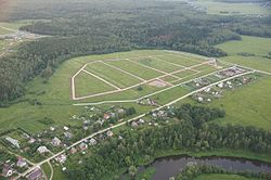 Village Tikhonovo, Mozhaysky District | |
 Flag  Coat of arms | |
 Location of Mozhaysky District in Moscow Oblast (before July 2012) | |
| Coordinates: 55°30′N 36°02′E / 55.500°N 36.033°E | |
| Country | Russia |
| Federal subject | Moscow Oblast[1] |
| Established | 1929 |
| Administrative center | Mozhaysk[1] |
| Area | |
| • Total | 2,627.28 km2 (1,014.40 sq mi) |
| Population | |
| • Total | 72,745 |
| • Estimate (2018)[4] | 70,869 (−2.6%) |
| • Density | 28/km2 (72/sq mi) |
| • Urban | 47.7% |
| • Rural | 52.3% |
| Administrative structure | |
| • Administrative divisions | 1 Towns, 1 Work settlements, 9 Rural settlements |
| • Inhabited localities[5] | 1 cities/towns, 1 Urban-type settlements[6], 356 rural localities |
| Municipal structure | |
| • Municipally incorporated as | Mozhaysky Municipal District[2] |
| • Municipal divisions[2] | 2 urban settlements, 9 rural settlements |
| Time zone | UTC+3 (MSK |
| OKTMO ID | 46633000 |
| Website | http://www.admmozhaysk.ru/ |
Geography edit
The territory of the district is mostly hilly with the highest point of about 310 meters (1,020 ft) above sea level. Major rivers include the Moskva, the Protva, the Luzha, and the Vorya. Mozhaysk Reservoir is located in the district. About 42% of the district's territory is covered by forests.
History edit
The district was established in 1929.[citation needed]
References edit
Notes edit
- ^ a b c d Law #11/2013-OZ
- ^ a b c d e Law #95/2005-OZ
- ^ a b c Russian Federal State Statistics Service (2011). Всероссийская перепись населения 2010 года. Том 1 [2010 All-Russian Population Census, vol. 1]. Всероссийская перепись населения 2010 года [2010 All-Russia Population Census] (in Russian). Federal State Statistics Service.
- ^ "26. Численность постоянного населения Российской Федерации по муниципальным образованиям на 1 января 2018 года". Federal State Statistics Service. Retrieved January 23, 2019.
- ^ Resolution #123-PG
- ^ The count of urban-type settlements may include the work settlements, the resort settlements, the suburban (dacha) settlements, as well as urban-type settlements proper.
- ^ "Об исчислении времени". Официальный интернет-портал правовой информации (in Russian). June 3, 2011. Retrieved January 19, 2019.
- ^ Federal State Statistics Service (May 21, 2004). Численность населения России, субъектов Российской Федерации в составе федеральных округов, районов, городских поселений, сельских населённых пунктов – районных центров и сельских населённых пунктов с населением 3 тысячи и более человек [Population of Russia, Its Federal Districts, Federal Subjects, Districts, Urban Localities, Rural Localities—Administrative Centers, and Rural Localities with Population of Over 3,000] (XLS). Всероссийская перепись населения 2002 года [All-Russia Population Census of 2002] (in Russian).
- ^ Всесоюзная перепись населения 1989 г. Численность наличного населения союзных и автономных республик, автономных областей и округов, краёв, областей, районов, городских поселений и сёл-райцентров [All Union Population Census of 1989: Present Population of Union and Autonomous Republics, Autonomous Oblasts and Okrugs, Krais, Oblasts, Districts, Urban Settlements, and Villages Serving as District Administrative Centers]. Всесоюзная перепись населения 1989 года [All-Union Population Census of 1989] (in Russian). Институт демографии Национального исследовательского университета: Высшая школа экономики [Institute of Demography at the National Research University: Higher School of Economics]. 1989 – via Demoscope Weekly.
Sources edit
- Московская областная Дума. Закон №11/2013-ОЗ от 31 января 2013 г. «Об административно-территориальном устройстве Московской области», в ред. Закона №249/2019-ОЗ от 29 ноября 2019 г. «О внесении изменений в Закон Московской области "Об административно-территориальном устройстве Московской области"». Вступил в силу на следующий день после официального опубликования (13 января 2013 г.). Опубликован: "Ежедневные Новости. Подмосковье", №24, 12 февраля 2013 г. (Moscow Oblast Duma. Law #11/2013-OZ of January 31, 2013 On the Administrative-Territorial Structure of Moscow Oblast, as amended by the Law #249/2019-OZ of November 29, 2019 On amending the Law of Moscow Oblast "On the Administrative-Territorial Structure of Moscow Oblast". Effective as of the day following the day of the official publication (January 13, 2013).).
- Губернатор Московской области. Постановление №123-ПГ от 28 сентября 2010 г. «Об учётных данных административно-территориальных и территориальных единиц Московской области», в ред. Постановления №252-ПГ от 26 июня 2015 г. «О внесении изменения в учётные данные административно-территориальных и территориальных единиц Московской области». Опубликован: "Информационный вестник Правительства МО", №10, 30 октября 2010 г. (Governor of Moscow Oblast. Resolution #123-PG of September 28, 2010 On the Inventory Data of the Administrative-Territorial and Territorial Units of Moscow Oblast, as amended by the Resolution #252-PG of June 26, 2015 On Amending the Inventory Data of the Administrative-Territorial and Territorial Units of Moscow Oblast. ).
- Московская областная Дума. Закон №95/2005-ОЗ от 30 марта 2005 г. «О статусе и границах Можайского муниципального района и вновь образованных в его составе муниципальных образований», в ред. Закона №128/2011-ОЗ от 15 июля 2011 г. «О внесении изменений в Закон Московской области "О статусе и границах Можайского муниципального района и вновь образованных в его составе муниципальных образований"». Вступил в силу со дня официального опубликования. Опубликован: "Ежедневные Новости. Подмосковье", №59, 2 апреля 2005 г. (Moscow Oblast Duma. Law #95/2005-OZ of March 30, 2005 On the Status and the Borders of Mozhaysky Municipal District and the Newly Established Municipal Formations Comprising It, as amended by the Law #128/2011-OZ of July 15, 2011 On Amending the Law of Moscow Oblast "On the Status and the Borders of Mozhaysky Municipal District and the Newly Established Municipal Formations Comprising It". Effective as of the day of the official publication.).