


Summary
Muliyar is a village and Grama Panchayat and in Kasaragod district in the Indian state of Kerala.[2]
Muliyar | |
|---|---|
Town | |
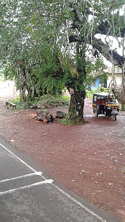 Muliyar bus stop | |
 Muliyar Location in Kerala, India | |
| Coordinates: 12°30′27″N 75°05′44″E / 12.507409°N 75.095684°E | |
| Country | |
| State | Kerala |
| District | Kasaragod |
| Taluk | Kasaragod |
| Government | |
| • Type | Panchayati Raj (India) |
| • Body | Muliyar Grama Panchayat |
| Area | |
| • Total | 34.27 km2 (13.23 sq mi) |
| Population (2011) | |
| • Total | 25,095 |
| • Density | 730/km2 (1,900/sq mi) |
| Languages | |
| • Official | Malayalam, English[1] |
| Time zone | UTC+5:30 (IST) |
| Vehicle registration | KL-14 |
Geography edit
Muliyar is located about 12 kilometres (7.5 mi) east of Kasaragod.[3] It is situated along State Highway 55, to the north of the Chandragiri River.[4] The village covers 34.27 square kilometres (13.23 sq mi) of land in Kasaragod taluk.
Demographics edit
As of 2011 Census, Muliyar village had a population of 25,095 with 12,248 males and 12,847 females. Muliyar village has an area of 34.27 km2 (13.23 sq mi) with 4,980 families residing in it. The average female sex ratio was 1049 lower than the state average of 1084. In Muliyar, 12.4% of the population was under 6 years of age. Muliyar had an average literacy of 88.7% lower than the state average of 94%; male literacy was 92.9% and female literacy was 84.8%.[5]
See also edit
References edit
- ^ "The Kerala Official Language (Legislation) Act, 1969" (PDF).
- ^ "Census of India : Villages with population 5000 & above". Registrar General & Census Commissioner, India. Archived from the original on 8 December 2008. Retrieved 10 December 2008.
- ^ "Cherkala routes with distances". keralatourism.org. Retrieved 22 January 2021.
- ^ "Draft Map" (PDF). keralaczma.gov.in. 2012. Retrieved 22 January 2021.
- ^ "District Census Handbook - Kasaragod District 2011" (PDF). Directorate of Census Operations-Kerala. 1 October 2011. Retrieved 22 January 2021.