


Summary
Myerstown (Pennsylvania Dutch: Moyerschteddel) is a borough located in Lebanon County, Pennsylvania. It is part of the Lebanon, Pennsylvania Metropolitan statistical area. The population was 3,103 at the 2020 census. It is home to over 100 businesses, including a Bayer manufacturing plant, a GAF manufacturing plant, Farmer Boy Ag, Stoneridge Towne Centre and Wengers of Myerstown. The Evangelical Seminary is located on South College Street.
Myerstown, Pennsylvania | |
|---|---|
Borough | |
 The historic Isaac Meier home in Myerstown in October, 2011 | |
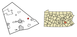 Location of Myerstown in Lebanon County, Pennsylvania. | |
 Myerstown Location in Pennsylvania  Myerstown Location in the United States | |
| Coordinates: 40°22′19″N 76°18′15″W / 40.37194°N 76.30417°W | |
| Country | United States |
| State | Pennsylvania |
| County | Lebanon |
| Settled | 1763 |
| Incorporated | 1912 |
| Government | |
| • Type | Borough Council |
| Area | |
| • Total | 0.86 sq mi (2.22 km2) |
| • Land | 0.86 sq mi (2.22 km2) |
| • Water | 0.00 sq mi (0.00 km2) |
| Population | |
| • Total | 3,094 |
| • Density | 3,614.49/sq mi (1,394.82/km2) |
| Time zone | UTC-5 (Eastern (EST)) |
| • Summer (DST) | UTC-4 (EDT) |
| ZIP Code | 17067 |
| Area code(s) | 717 and 223 |
| FIPS code | 42-52488 |
| Website | myerstownpa |
History edit

On December 24, 1757, 249 acres (1.01 km2) of land was deeded to Isaac Meier and wife Catherine, who built their house at the Hergelrode site on South College Street. As early as 1763 he began deeding out lots and planned to make a town which he called Tulpehocken Town, after the Tulpehocken Creek, which runs through the borough.
Meier was fatally shot by an unknown assassin on July 14, 1770, at the Henry Buch House on 40 West Main Street which was a tavern at that time.[3] After his death the citizens of Tulpehocken Town began to call it Meier's Town after him.
The Isaac Meier Homestead was added to the National Register of Historic Places in 1973.[4]
Geography edit
Myerstown is located at 40°22'19" North, 76°18'15" West (40.372058, -76.304208).[5] According to the U.S. Census Bureau, the borough has a total area of 0.9 square miles (2.3 km2), all land.[5]
Myerstown is completely surrounded by Jackson Township. It has a hot-summer humid continental climate (Dfa) and the local hardiness zone is 6b. Average monthly temperatures range from 29.2 °F in January to 74.1 °F in July.[6]

Demographics edit
| Census | Pop. | Note | %± |
|---|---|---|---|
| 1880 | 1,580 | — | |
| 1890 | 1,880 | 19.0% | |
| 1920 | 2,385 | — | |
| 1930 | 2,593 | 8.7% | |
| 1940 | 2,692 | 3.8% | |
| 1950 | 3,050 | 13.3% | |
| 1960 | 3,268 | 7.1% | |
| 1970 | 3,645 | 11.5% | |
| 1980 | 3,131 | −14.1% | |
| 1990 | 3,236 | 3.4% | |
| 2000 | 3,171 | −2.0% | |
| 2010 | 3,062 | −3.4% | |
| 2020 | 3,103 | 1.3% | |
| 2021 (est.) | 3,107 | [7] | 0.1% |
| Sources:[8][9][10][2] | |||
At the 2000 census, there were 3,171 people, 1,265 households, and 810 families residing in the borough. The population density was 3,559.1 inhabitants per square mile (1,374.2/km2). There were 1,339 housing units at an average density of 1,502.9 per square mile (580.3/km2). The racial makeup of the borough was 97.48% White, 1.41% African American, 0.00% Native American, 0.44% Asian, 0.00% Pacific Islander, 0.22% from other races, and 0.45% from two or more races. 0.95% of the population were Hispanic or Latino of any race.[9] There were 1,265 households, 29.6% had children under the age of 18 living with them, 50.4% were married couples living together, 9.5% had a female householder with no husband present, and 35.9% were non-families. 31.5% of households were made up of individuals, and 16.1% were one person aged 65 or older. The average household size was 2.33 and the average family size was 2.91.
In the borough, the population was spread out, with 22.2% under the age of 18, 7.0% from 18 to 24, 29.6% from 25 to 44, 19.2% from 45 to 64, and 22.0% 65 or older. The median age was 38 years. For every 100 females there were 85.8 males. For every 100 females age 18 and over, there were 81.5 males.
The median household income was $36,563 and the median family income was $45,698. Males had a median income of $31,985 versus $20,684 for females. The per capita income for the borough was $17,177. 6.6% of the population and 4.6% of families were below the poverty line. 8.4% of those under the age of 18 and 9.5% of those 65 and older were living below the poverty line.
Notable person edit
- Kate Stoltz, model
References edit
- ^ "ArcGIS REST Services Directory". United States Census Bureau. Retrieved October 12, 2022.
- ^ a b "Census Population API". United States Census Bureau. Retrieved October 12, 2022.
- ^ "The History of our Borough". Myerstownboro.org. Archived from the original on May 4, 2017. Retrieved June 19, 2023.
- ^ "National Register Information System". National Register of Historic Places. National Park Service. July 9, 2010.
- ^ a b "US Gazetteer files: 2010, 2000, and 1990". United States Census Bureau. February 12, 2011. Retrieved April 23, 2011.
- ^ "PRISM Climate Group, Oregon State U". prism.oregonstate.edu. Retrieved July 1, 2021.
- ^ Bureau, US Census. "City and Town Population Totals: 2020-2021". Census.gov. US Census Bureau. Retrieved July 9, 2022.
- ^ "Census of Population and Housing". U.S. Census Bureau. Retrieved December 11, 2013.
- ^ a b "U.S. Census website". United States Census Bureau. Retrieved January 31, 2008.
- ^ "Incorporated Places and Minor Civil Divisions Datasets: Subcounty Resident Population Estimates: April 1, 2010 to July 1, 2012". Population Estimates. U.S. Census Bureau. Archived from the original on June 11, 2013. Retrieved December 11, 2013.
External links edit
- Official website