
KNOWPIA
WELCOME TO KNOWPIA

Nagamangala 
Summary
Nagamangala is a PuraSabhe and a taluk in Mandya district, in the Indian state of Karnataka.
Nagamangala | |
|---|---|
Town | |
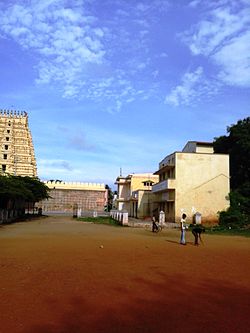 Rotary School, Nagamangala | |
| Coordinates: 12°49′N 76°46′E / 12.82°N 76.76°E | |
| Country | |
| State | Karnataka |
| District | Mandya |
| Area | |
| • Town | 10.43 km2 (4.03 sq mi) |
| • Rural | 1,035.26 km2 (399.72 sq mi) |
| Elevation | 772 m (2,533 ft) |
| Population (2011) | |
| • Town | 24,059 |
| • Density | 2,300/km2 (6,000/sq mi) |
| • Rural | 170,121 [1] |
| Languages | |
| • Official | Kannada |
| Time zone | UTC+5:30 (IST) |
| Vehicle registration | KA-54 |
| Website | www |

Nagamangala lies on the junction between NH-150A and SH-85. It is 43 km from its district headquarter Mandya, 70 km from Mysuru, 115 km from Bengaluru, 261 km from Mangaluru and 425 km from Hubballi. Nearest railway station is B.G.Nagar at 17 km. Nearest airport is Kempegowda International Airport at 140 km.
List of temples in Nagamangala edit

- Sri Yoganarasimha Temple
- Saumyakeshava Temple
- Sri Veerabhadreshwara & Bhadrakali Temple
- Sri Anjenya temple, Kachenahalli
- Sri Muttinamma devi temple, Tuppadamadu
- Sri Malleshwara swamy temple, Tuppadamadu
- Sri Mulkattamma temple, Mulukatte
- Sri Ranganatha temple, Vaddarahalli
- sri Hucchamma devi temple
- Sri Haddinakallu Hanumantharaya Swami temple
- Sri Thirunarayana Temple, ThiruganaHalli
- Sri Prasanna ganapati temple, T. B. Circle
- Sri Varadarayaswamyi Temple, Dandigana Hallly
Demographics edit
As of 2011[update] India census,[2] Nagamangala had a population of 17776. Males constitute 50% of the population and females 50%. Nagamangala has an average literacy rate of 87.01%, higher than the state average of 75.36%: male literacy is 90.16%, and female literacy is 83.98%. In Nagamangala, 12% of the population is under 6 years of age.
References edit
External links edit
Wikimedia Commons has media related to Nagamangala.