


Summary
Nagari is a town in Chittoor district of the Indian state of Andhra Pradesh.[4] It is the mandal headquarters of Nagari mandal in Nagari revenue division.[5][6]
Nagari | |
|---|---|
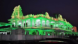 Sri Shirdi Sai Divyadhamam Temple in Nagari. | |
 Nagari Location in Andhra Pradesh, India | |
| Coordinates: 13°19′17″N 79°35′08″E / 13.3214°N 79.5856°E | |
| Country | India |
| State | Andhra Pradesh |
| District | Chittoor |
| Mandal | Nagari |
| Government | |
| • Type | Legislative assembly of Andhra Pradesh |
| • Body | Municipality |
| • MLA | R K Roja |
| Area | |
| • Total | 35.45 km2 (13.69 sq mi) |
| Elevation | 115 m (377 ft) |
| Population (2011)[2] | |
| • Total | 62,253 |
| • Density | 1,800/km2 (4,500/sq mi) |
| Languages | |
| • Official | Telugu |
| • Regional | Telugu,Tamil[3] |
| Time zone | UTC+5:30 (IST) |
| PIN | 517590 |
| Telephone code | 91-8577 |
| Vehicle registration | AP-03, AP-39 (New) |
| Website | Nagari Municipality |
Geography edit
Nagari is located at 13°20′N 79°35′E / 13.33°N 79.58°E.[7] It has an average elevation of 116 metres (380 feet).
Weather edit
| Climate data for Nagari, India | |||||||||||||
|---|---|---|---|---|---|---|---|---|---|---|---|---|---|
| Month | Jan | Feb | Mar | Apr | May | Jun | Jul | Aug | Sep | Oct | Nov | Dec | Year |
| Mean daily maximum °C (°F) | 29.9 (85.8) |
32.8 (91.0) |
36.7 (98.1) |
40.3 (104.5) |
43.3 (109.9) |
40.8 (105.4) |
35.7 (96.3) |
34.8 (94.6) |
34.8 (94.6) |
32.7 (90.9) |
30.1 (86.2) |
28.9 (84.0) |
35.1 (95.1) |
| Mean daily minimum °C (°F) | 18.7 (65.7) |
20.1 (68.2) |
22.6 (72.7) |
26.2 (79.2) |
27.9 (82.2) |
27.2 (81.0) |
25.9 (78.6) |
25.5 (77.9) |
25.1 (77.2) |
23.5 (74.3) |
21.7 (71.1) |
19.9 (67.8) |
23.7 (74.7) |
| Average precipitation mm (inches) | 22.0 (0.87) |
19.7 (0.78) |
2.9 (0.11) |
13.9 (0.55) |
45.7 (1.80) |
69.7 (2.74) |
113.0 (4.45) |
118.6 (4.67) |
119.1 (4.69) |
157.5 (6.20) |
218.7 (8.61) |
130.5 (5.14) |
1,031.3 (40.61) |
| Source: Indian Meteorological Department[8] | |||||||||||||
Demographics edit
As of 2011[update] Census of India, the town had a population of 96,152. The total population constitute, 48,058 males and 48,094 females —a sex ratio of 1000 females per 1000 males, higher than the national average of 940 per 1000.[2][9] 10,518 children are in the age group of 0–6 years, of which 5,471 are boys and 5,047 are girls—a ratio of 922 per 1000. The average literacy rate stands at 65.14% with 62,640 literates, lower than the national average of 73.00%.[2][10]
Education edit
The primary and secondary school education is imparted by government, aided and private schools, under the School Education Department of the state.[11][12]
References edit
- ^ "Municipalities, Municipal Corporations & UDAs" (PDF). Directorate of Town and Country Planning. Government of Andhra Pradesh. Archived from the original (PDF) on 28 January 2016. Retrieved 29 January 2016.
- ^ a b c "Census 2011". The Registrar General & Census Commissioner, India. Retrieved 1 September 2014.
- ^ "Table C-16 Population by Mother Tongue: Andhra Pradesh". Census of India. Registrar General and Census Commissioner of India.
- ^ "Suspend 5 MPTC members for 'ignoring' party whip: Roja". thehindu.com. 27 September 2021. Retrieved 17 October 2021.
- ^ "Chittoor District Mandals" (PDF). Census of India. pp. 482, 516. Retrieved 19 June 2015.
- ^ "District Census Handbook - Chittoor" (PDF). Census of India. pp. 22–23. Retrieved 20 January 2016.
- ^ "Maps, Weather, and Airports for Nagari, India". fallingrain.com.
- ^ "Climatological Data of Important Cities" (PDF). Indian Meteorological Department. Archived from the original (PDF) on 13 April 2015. Retrieved 27 March 2012.
- ^ "Sex Ratio". The Registrar General & Census Commissioner, India. Retrieved 1 September 2014.
- ^ "Chapter–3 (Literates and Literacy rate)" (PDF). Registrar General and Census Commissioner of India. Retrieved 1 September 2014.
- ^ "School Education Department" (PDF). School Education Department, Government of Andhra Pradesh. Archived from the original (PDF) on 7 November 2016. Retrieved 7 November 2016.
- ^ "The Department of School Education - Official AP State Government Portal | AP State Portal". www.ap.gov.in. Archived from the original on 7 November 2016. Retrieved 7 November 2016.