


Summary
Naogaon (Bengali: নওগাঁ) is the district headquarters and most populous town of Naogaon District in northern Bangladesh. It is located on the banks of the Little Jamuna river. As of 2011, the area of the municipality was 38.36 km2 (14.81 sq mi) and the population was 150,549. The literacy rate was 62%.[2]
Naogaon
নওগাঁ | |
|---|---|
Municipality and Town | |
 Clockwise from top: Naogaon K.D. Government High School, Bijoy Monument, Gaza Society office, Shadhinota Monument and Balihar Royal Palace. | |
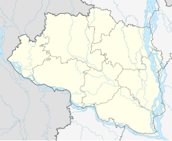 Naogaon Location in Bangladesh  Naogaon Naogaon (Bangladesh) | |
| Coordinates: 24°48′N 88°56′E / 24.800°N 88.933°E | |
| Country | |
| Division | Rajshahi |
| District | Naogaon |
| Upazila | Naogaon Sadar |
| Granted municipality status | 1963 |
| Government | |
| • Type | Municipal government |
| • Mayor | Nazmul Haque Sony[1] |
| Area | |
| • Total | 38.36 km2 (14.81 sq mi) |
| Elevation | 19 m (62 ft) |
| Population (2022) | |
| • Total | 178,635 |
| • Density | 4,700/km2 (12,000/sq mi) |
| Time zone | UTC+6 (Bangladesh Time) |
| Postal code | 6500 |
| Website | naogaonpoura |
In 1961, the urban population was 20,276.[3] Naogaon was made a municipality in 1963.[2] By 1974, the population had grown to 34,395.[3]
Naogaon Government College, established in 1962, is situated in the north-eastern part of the town.[4]
Demographics edit
According to the 2022 Bangladesh census, Naogaon city had a population of 178,635.[6]: 388–394
According to the 2011 Bangladesh census, Naogaon city had 35,923 households and a population of 150,549. 26,164 (17.38%) were under 10 years of age. Naogaon had a literacy rate (age 7 and over) of 65.12%, compared to the national average of 51.8%, and a sex ratio of 947 females per 1000 males.[5]
References edit
- ^ মেয়র পরিচিতি [Introduction of the Mayor]. Naogaon Pourasova (in Bengali).
- ^ a b এক নজরে নওগাঁ পৌরসভা [Naogaon municipality at a glance]. Naogaon District (in Bengali). 1 January 2012. Archived from the original on 6 January 2014. Retrieved 5 January 2014.
- ^ a b Rashid, Haroun Er (2018) [First published 1977]. Geography of Bangladesh. University Press Limited. p. 502. ISBN 978-0-367-01823-8.
- ^ Rahman, Md. Moklesur (2012). "Naogaon Sadar Upazila". In Islam, Sirajul; Jamal, Ahmed A. (eds.). Banglapedia: National Encyclopedia of Bangladesh (Second ed.). Asiatic Society of Bangladesh.
- ^ a b "Population & Housing Census 2011 (Zila Series & Community Series)". bbs.gov.bd. Bangladesh Bureau of Statistics.
- ^ Population and Housing Census 2022 National Report (PDF). Vol. 1. Bangladesh Bureau of Statistics. November 2023.