


Summary
Narromine (/næroʊmaɪn/) is a rural Australian town located approximately 40 kilometres (25 mi) west of Dubbo in the Orana region of New South Wales. The town is at the centre of Narromine Shire. The 2016 census recorded a population of 3,528.[4] Narromine holds strong historical ties to the Australian Military, as it was the location of RAAF No.19 Inland Aircraft Fuel Depot (IAFD) during World War II. The base contributed to the preparation of troops through a training organisation known as the Empire Air Training Scheme (EATS). The town was one of twelve locations for the No.5 Elementary Flying Training School RAAF in 1940.[5]
| Narromine New South Wales | |||||||||
|---|---|---|---|---|---|---|---|---|---|
 Dandaloo St (Mitchell Highway) in Narromine, 2017. | |||||||||
 Narromine | |||||||||
| Coordinates | 32°14′S 148°14′E / 32.233°S 148.233°E | ||||||||
| Population | 3,528 (2016 census)[1] | ||||||||
| Established | 1883[2] | ||||||||
| Postcode(s) | 2821 | ||||||||
| Elevation | 236 m (774 ft)[3] | ||||||||
| Location | |||||||||
| LGA(s) | Narromine Shire | ||||||||
| State electorate(s) | Dubbo | ||||||||
| Federal division(s) | Parkes | ||||||||
| Website | Narromine | ||||||||
| |||||||||
The town and its district was formed on traditional Wiradjuri country, one of the largest Indigenous populations in central New South Wales. The Macquarie River passes through the town. The Mitchell Highway, named after the early explorer Sir Thomas Mitchell, is the main road from Dubbo to the West and also passes through Narromine. Prior to settlement in the early 1800s, Wiradjuri tribes occupied much of the land between Wambool/Wambuul (renamed the Macquarie River by late settlers), the Kalar (the Lachlan River) and the Murrumbidgerie (Murrumbidgee River).[6] In December 2021, the NSW government restored its traditional name and formally assigned the name Wambuul to the riverbed of the Macquarie River.[7] The term Wambuul means 'winding river' in Wiradjuri language and both names are recognised with equal status.
Narromine district has a history of flooding, with the largest flood recorded in 1926. Multiple plant and animal species are found within the Narromine district and is home to many iconic Australian species. Situated in the Murray-Darling Basin region, Narromine's agricultural land is used for many dryland and irrigated agricultural activities.[8] Although Narromine is one of the main growing regions for cotton in the Central West district of New South Wales,[8] the production of beans, wheat and grain, as well as livestock products including wool, mutton, lamb and beef are all common. The Burrendong Dam has facilitated irrigation schemes that have greatly aided local agriculture in the town and its surrounding districts.[9] The town's rural history has organically bought tourism to the area, with the Narromine Aviation Museum, Aero Club and Mungery Picnic Races being highlight attractions. Rugby teams are represented by the Narromine Jets and Narromine Gorillas.
History edit
The town name comes from a pastoral property, which in turn came from the Wiradjuri word 'ngarru-mayiny' meaning 'honey people'.[4][10] The land lay within Wangaibon territory.
The first European to visit the district was John Oxley who traced the course of the Macquarie River in 1818.[11]

The Main West railway line extension between Dubbo and Nevertire, which included Narromine, was officially opened on 20 October 1882.[12] The town was established after the railway opened, the first structures in the town being the railway platforms.[13] The township was gazetted in 1883, and the railway station opened on 1 May 1883.[2][14] It was renamed to its current spelling in October 1889.[14] Narramine Post Office opened on 20 October 1882 and was renamed Narromine in November 1900.[15] The village of Narramine was proclaimed in July 1883, and numerous buildings followed, including the police station built in 1890, the store (1890) and the Royal Hotel (1890).[16][2][17] A bridge over the Macquarie River was built in 1897.[2] After federation, the population of Narromine was 2,228 in the 1911 census, and in 1947 the population was 1,816.[18][19]
Early history and settlement edit
Early history reports that British explorer and surveyor of Australia John Oxley, was the first man to pass by the site of the town of Narromine in June 1818.[20] From a study of the map showing his route, Oxley set out with boats and horses to trace the course of the Macquarie River, that ran directly through the Narromine district during the early 1800s. From 1818 onwards, other notable explorations by Robert Dixon, Major Mitchell and Captain Charles Sturt. In later years, the land became settled and the land became property of the Crown, meaning that is belonged to the monarch.[20] Today, Crown land under Commonwealth territories are separate to the monarch's private estate and is deemed public land to Australia. However, in Narromine during 1844, squatters began to take possession of extensive areas of Crown land that lead to a list of licence holders of property (known as the Government Gazette of 1848).[20] Most notably, William Charles Wentworth was the first landowner of formally named "Narramine".
The following stations were first retained by landowners as a part of the Government Gazette of 1848:[20]
- "Terramungamine" and "Burroway" – E. Brook Cornish
- "Minore" – Benajamin Boyd
- "Graddell" – J. Corse
- "Mungery" – John Dargin
- "Bulgandramine" and "Tomingley" – J. Gilmore
- "Wallanbillan" – Samuel Phillips
- "Timbrebungan" – Robert Smith
- "Euromedah" or "Mount Park", "Weemabah" and "Gunningbar" – Saul Samuel
The Court House Hotel edit
Situated on the corner of Burraway Street and Merilba Street, the Court House Hotel was initially established by David Fitch in 1889 and originally opened as Fitch's Court House Hotel.
Narromine in literature edit
The town of Narromine is featured in the famous work of Banjo Patterson, The City of Dreadful Thirst published originally in 1889.[21] The poem references the town exactly nine times and satirically narrates the culture of the people of Narromine as well as the floods, dusty plains and landscape of the town. The poem is found within the Collective Versus of A.B Patterson and is 48 lines long.
The stranger came from Narromine and made his little joke—
"They say we folks in Narromine are narrow-minded folk.
But all the smartest men down here are puzzled to define
A kind of new phenomenon that came to Narromine.[21]

Military history edit

During World War II, Narromine was the location of RAAF No.19 Inland Aircraft Fuel Depot (IAFD), completed in 1942 and closed on 14 June 1944. Usually consisting of 4 tanks, 31 fuel depots were built across Australia for the storage and supply of aircraft fuel for the RAAF and the US Army Air Forces at a total cost of £900,000 ($1,800,000).[22]
World War II Empire Air Training Scheme edit
Australia contributed to the preparation of troops for World War II and provided a training organisation known as the Empire Air Training Scheme (EATS). The outbreak of war in Europe, 1939, saw the RAAF headquarters in Melbourne, Australia launch a plan to provide basic training to 28,000 aircrew over a three-year agreement.[23] The facilitation of this training scheme produced forty schools in air navigation, bombing and gunnery, flying, and technical training for ground staff, come to fruition in the late 1930s. Narromine is listed as one of twelve locations for the training scheme as No.5 Elementary Flying Training School RAAF formed in 1940.[5]
Indigenous history edit
Wiradjuri country is one of the largest Indigenous populations in central New South Wales and are traditional owners of the land in the Narromine district. Skilled in hunting and gathering, Wiradjuri tribes occupied much of the land between Wambool/Wambuul (renamed the Macquarie River by late settlers), the Kalar (the Lachlan River) and the Murrumbidgerie (Murrumbidgee River).[6] Early European settlers appropriated Wiradjuri country from the 1820s, with the early establishment of the village of Dubbo in 1849,[24] 52 km east of Narromine.
For hundreds of years, the Macquarie River has been the homeland for many Wiradjuri tribes. However, for the past 200 years, its indigenous name "Wambuul" has been an excluded point of reference for the winding waterway. In December 2021, the NSW government restored its traditional name and formally assigned the name Wambuul to the riverbed.[7] The process was brought about by the Bathurst Local Aboriginal Land Council (BLALC) in 2020 and became immediately into effect. The towns situated on and around the Macquarie/Wambuul River including Narromine, will now use the names individually or combined as both are recognised with equal status.[7] The term Wambuul means 'winding river' in Wiradjuri language.[25]
Geography edit
The Narromine Shire edit
There are a variety of small towns situated on the outskirts of the town but are within the Narromine district that make up the Narromine Shire local government. They are well-known areas to the Narromine community, as many residents travel and reside between towns on farms.
The main four neighbouring towns include:
- Tomingley (approximately 37 km South of Narromine along the Newell Highway)
- Trangie (approximately 46 km North-West of Narromine along the Mitchell Highway)
- Burroway (approximately 34 km North of Narromine along the McGrane Way)
- Dandaloo (approximately 65 km West of Narromine along Dandaloo Road)
Floods edit
Due to its proximity to the Macquarie River, the Narromine township has parts which are flood liable.[26] In late March 1926, Narromine experienced its biggest flood since 1893, with the Macquarie River peaking at 50 feet (15 m) at 5 am on 27 March.[27][28] Narromine was isolated due to floodwaters cutting roads, telephone lines and the railway line.[28] A large area of country around the town was covered in water. Very little damage was reported.[28] In the floods of April 1990, the river peaked at Narromine at a record 15.93 metres (52.3 ft).[29]
Flora edit
Multiple plant species are found within the Narromine district with some iconic Australian species noted for the area below:[30]
- Grey Box Eucalyptus
- Leopardwood Tree
- False Sandalwood
- Old Man Saltbush
- River Red Gum
- Wilga Shrub
- Weeping Myall
Fauna edit
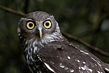

Narromine is home to many native Australian wildlife with some species noted below:[30]
Agricultural practices edit

Situated in the Murray-Darling Basin region, Narromine's agricultural land is used for many dryland agricultural activities[8] to remain adaptable when the rainfall is absent in a given cropping cycle. The production of beans, wheat and grain, as well as livestock products including wool, mutton, lamb and beef are all common agricultural practices in the Narromine district. Like many towns of the Central West region of New South Wales, traditionally the area is known to have adopted hybrid farming systems to integrate both cropping and livestock.[8] This transition into hybrid farming was caused by the industrial revolution of the industry and technological advances.
Cotton farming edit
Narromine is one of the main growing regions for cotton in the Central West district of New South Wales, Australia, with irrigation agricultural activities remaining a major contributor to the area's economy.[8] Cotton is a natural fibre, planted in spring, grown over summer and harvested in autumn for the region, cotton farming requires irrigated watering systems that are controlled.[31] The production levels of cotton in Narromine, are dependent on water availability, with the quality of harvest reflected in rainfall and fluctuating river levels. Cotton in the area is produced from a variety of irrigation methods including flood irrigation, drip irrigation, spray irrigation and others. The Burrendong Dam was built between 1946 and 1967, which facilitated irrigation schemes that have greatly aided local agriculture in the town and its surrounding districts.[9] Cotton farming came to the area as a result of advances in knowledge and technology/machinery around irrigation and utilising the water available from the surrounding water catchments.
Economy edit
Agriculture, including sheep, cattle, wool, cereal and cotton production, has long been a central feature of the local economy. The town also has "major commercial nurseries and research facilities" supporting "the national forestry and vegetable industries".[32] In 2014 gold mining commenced at nearby Tomingley.[33]
Tourism edit
Narromine Aviation Museum and Aero Club edit
With records of flights from Narromine dating back to early 1919, Narromine is known for Australia's longest standing aero club, with recorded flights dating back to 1919. The Aero Club was established ten years later in 1929.[34] In 1935, commercial flights from Sydney to Narromine commenced for a limited number of passengers.[35] The introduction of a small airline was celebrated at the time, with records showing the first fifty passengers published in newspapers weeks later to gain traction on the occasion.[35] It has developed to international standards of flying, with planes transporting rural citizens daily to main Australian cities and towns. The plans to build the Narromine Aviation Museum begun in the early 1990s, with a committee forming and a National Tourism Development Program grant secured.[34] The museum opened its doors in October 2002, with Australian aviator Nancy-Bird Walton launching the ceremony.[34] The museum facilitates an auditorium to its local community, with a 200-person seating capacity available to hire for town events and meetings. It exhibits long standing and related artefacts, photographs, documents and records to the history of the towns influence in World War II. The museum is home to three distinct and well recognised aircraft including:
- A flyable replica of the 1907 Wright Flyer Model A (2005)
- An original Corben Super Ace homebulit (1938)
- An original Hawkridge Venture glider (1953)
Mungery picnic races edit
Held annually on the outskirts of Narromine and on the banks of the Bogan River, is the Mungery Picnic horse racing.[36] Traditional to Australian country races, are events such fashion in the field that includes best dressed lady, best dressed man, best dressed couple and best dressed juniors. Events such as race auctions, dash for cash activities, bookmakers and betting, as well as children's entertainment, food and drink services are also provided at the Mungery Picnic Races.
Population edit
| Year | Pop. | ±% |
|---|---|---|
| 1921 | 1,399 | — |
| 1933 | 1,617 | +15.6% |
| 1947 | 1,816 | +12.3% |
| 1954 | 1,975 | +8.8% |
| 1961 | 2,282 | +15.5% |
| 1966 | 2,466 | +8.1% |
| 1971 | 2,727 | +10.6% |
| 1976 | 2,802 | +2.8% |
| 1981 | 2,994 | +6.9% |
| 1986 | 3,205 | +7.0% |
| 1991 | 3,378 | +5.4% |
| 1996 | 3,486 | +3.2% |
| 2001 | 3,548 | +1.8% |
| 2006 | 3,599 | +1.4% |
| 2011 | 3,789 | +5.3% |
| 2016 | 3,528 | −6.9% |
| 2021 | 3,507 | −0.6% |
| Source: Australian Bureau of Statistics data.[37][38] | ||
According to the 2016 census of Population, there were 3,528 people in Narromine.
- Aboriginal and Torres Strait Islander people made up 24.4% of the population.
- 86.4% of people were born in Australia and 89.6% of people spoke only English at home
- The most common responses for religion were Catholic 28.8%, Anglican 25.9% and No Religion 17.2%.[1]
Personalities edit

The town of Narromine has produced several success stories, most recently sports personalities Glenn McGrath (Australian cricket team: Fast bowler ), Melinda Gainsford-Taylor (Sprinter: Commonwealth Games medallist), Disney animator Adam Phillips and Justin Smith (rugby league: North Queensland Cowboys). Other notable sportsmen to represent Australia at the International level include David Gillespie (Australian Rugby League) and David Jansen (International Gliding Championships).
The 1958 Melbourne Cup Winner, Baystone, was owned by the Burns family from Narromine – Robert Burns, and his two sons Norman and Noel.
A statue of Glenn McGrath was installed in Tom Perry Park in 2009.[39]
Sporting teams edit
Narromine is involved in regional sporting competitions.
In Rugby League, Narromine is represented by the Narromine Jets in the Group 11 Country Rugby League competition. Narromine has had a significant amount of success in this competition. Particularly, in 2002/2003 when their U18's took out the Group 11 competition with relative ease. The team defeated Dubbo CYMS in the 2002 grand final after completing the regular season undefeated. In 2003 the team lost only one game before defeating Dubbo Macquarie Raiders in a one sided affair.
Rugby League team:
 Narromine Jets
The town also boasts a successful Rugby Union team known as the Narromine Gorillas. Founded in 1982, the Gorillas have been a major force across the central west competitions and currently compete in the Blowes Clothing Cup. The Gorillas had a successful 2017 season in which they won the Graincorp cup (north) without tasting defeat the entire year. The Grand Final saw them take on the Molong Magpies, with the final score being 31–10. Despite winning the premiership, the most significant achievement of 2017 might've been the reclaiming of "The Ashes" from cross shire rivals the Trangie Tigers. The infamous urn had never been held by Narromine in the 33 years since its inception, and this was the first time it had been contested since 1994. Prior to this recent success the first grade side won the 2009 Blowes Cup defeating the Bathurst Bulldogs in the grand final, and also registered three straight minor premierships from 2009 to 2011. As well as senior teams, the Gorillas has a fantastic junior rugby program with U/13's, U/15's and U/17's teams, plus sub-juniors.
References edit
- ^ a b Australian Bureau of Statistics (27 June 2017). "Narromine (Urban Centre/Locality)". 2016 Census QuickStats. Retrieved 2 May 2019.
- ^ a b c d "Narromine". Australian Heritage. Heritage Australia Publishing. Archived from the original on 21 March 2014. Retrieved 13 March 2019.
- ^ a b "Monthly Rainfall – Narromine (Alagalah St)". Climate Data Online. Bureau of Meteorology. Retrieved 15 April 2013.
- ^ a b "Narromine". Geographical Names Register (GNR) of NSW. Geographical Names Board of New South Wales. Retrieved 7 November 2009.
- ^ a b Ashworth, N (2000). How Not to Run an Air Force! The Higher Command of the Royal Australian Air Force During the Second World War. Canberra: Air Power Studies Centre. ISBN 0-642-26551-8.
- ^ a b Davison, G.; Brodie, M. (2005). Struggle Country. Clayton, Vic: Monash University ePress.
- ^ a b c Gorman, M. (2021). "NSW government signs off on dual naming of Macquarie River with traditional Aboriginal name of Wambuul". ABC News.
- ^ a b c d e Patton, D. A.; Mullen, J.D. (2001). Farming systems in the Central West of NSW: an economic analysis. New South Wales Department of Primary Industries Research Economists. doi:10.22004/ag.econ.27998.
- ^ a b "Narromine". The Sydney Morning Herald. 9 October 2008. Retrieved 25 May 2022.
- ^ "PLACE NAMES". The Australian Women's Weekly. National Library of Australia. 13 May 1964. p. 61. Retrieved 22 February 2011.
- ^ Narromine - A Railway History McKillop, Robert F. Australian Railway Historical Society Bulletin, January 1997 pp 3-22.
- ^ "EXTENSION OF THE RAILWAY FROM DUBBO TO NEVERTIRE". The Sydney Morning Herald. National Library of Australia. 21 October 1882. p. 12. Retrieved 15 April 2013.
- ^ Developing the Inland: The Great Western Railway to Bourke McKillop, Bob Australian Railway Historical Society Bulletin, September 2002 pp 328-340.
- ^ a b "Narromine Station". NSWrail.net. Rolfe Bozier. Retrieved 15 April 2013.
- ^ "Post Office Details - Narromine". Premier Postal. Retrieved 2 May 2019.
- ^ "SITE FOR VILLAGE AT NARROMINE". New South Wales Government Gazette. No. 303. New South Wales, Australia. 16 July 1883. p. 3838. Retrieved 2 May 2019 – via National Library of Australia.
- ^ "Narromine Timeline". Macquarie Regional Library. Archived from the original on 18 February 2017. Retrieved 13 March 2019.
- ^ "CENSUS OF THE COMMONWEALTH OF AUSTRALIA 1911 – Part XIV Summary" (PDF). Census of the Commonwealth of Australia 1911. Australian Bureau of Statistics. 1911. p. 229. Retrieved 15 April 2013.
- ^ "CENSUS OF THE COMMONWEALTH OF AUSTRALIA 30th June, 1947 – PART VIII. – POPULATION AND OCCUPIED DWELLINGS IN LOCALITIES" (PDF). CENSUS OF THE COMMONWEALTH OF AUSTRALIA 30th June, 1947. Australian Bureau of Statistics. p. 43. Retrieved 15 April 2013.
- ^ a b c d King, Phillip K. (1979). A History of Narromine and District. Dubbo: Timbrebongie Shire Council and Narromine Municipal Council.
- ^ a b Patterson, A. B. (1921). The Collective Versus of A.B Patterson. London: Angus & Robertson. p. 117.
- ^ Australia. Royal Australian Air Force. Historical Section (1995), Logistics units, AGPS Press, ISBN 978-0-644-42798-2
- ^ McCarthy, J (1988). A last call of empire: Australian aircrew, Britain and the Empire Air Training Scheme. Canberra, Australia: Australian War Memorial.
- ^ Woodley, P.A. (2021). "'We are a farming class': community, class and place in Dubbo's farmlands, 1870–1950" (PDF). The Australian National University.
- ^ Rushton, G. (2021). "Dual name adopted for major NSW river". Seven News.
- ^ "Flooding". Narromine Shire Council.
- ^ "THE FLOODS". The Sydney Morning Herald. National Library of Australia. 29 March 1926. p. 11. Retrieved 15 April 2013.
- ^ a b c "MACQUARIE RIVER". The Sydney Morning Herald. National Library of Australia. 29 March 1926. p. 11. Retrieved 15 April 2013.
- ^ "Macquarie Region". FloodSafe. NSW State Emergency Service. Retrieved 15 April 2013.
- ^ a b "Atlas Living Australia Database (ALAD)".
- ^ "Cotton Australia". 2022.
- ^ Welcome to Narromine Shire, narromine.nsw.gov.au. Retrieved 5 September 2020.
- ^ Tomingley Gold Project, New South Wales, mining-technology.com. Retrieved 5 September 2020.
- ^ a b c "History timeline". Narromine Aviation Museum. 2017.
- ^ a b Woodley, P.A (2021). "'We are a farming class': community, class and place in Dubbo's farmlands, 1870–1950". The Australian National University.
- ^ "Mungery Picnic Races: An Overview". Visit NSW.
- ^ "Statistics by Catalogue Number". Australian Bureau of Statistics. Retrieved 19 January 2024.
- ^ "Search Census data". Australian Bureau of Statistics. Retrieved 19 January 2024.
- ^ Rowles, Lucy (7 June 2009). "Cricket star humbled by statue in his honour". Daily Liberal. Retrieved 21 August 2019.
External links edit
![]() Media related to Narromine at Wikimedia Commons
Media related to Narromine at Wikimedia Commons
- Narromine Online – Community website
- Narromine Shire Council – Official Council website