


Summary
National Highway 3, or NH 3, is a national highway in India.[1] It starts from Atari adjacent to India-Pakistan border and near Amritsar and terminates at Leh in Ladakh, via Manali in Himachal Pradesh.[2]
 | ||||
|---|---|---|---|---|
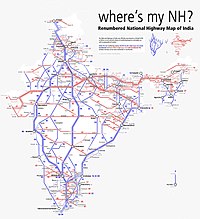
 Map of the National Highway in red | ||||
 Rohtang Pass on NH 3 | ||||
| Route information | ||||
| Part of | ||||
| Maintained by NHAI | ||||
| Length | 556 km (345 mi) | |||
| Major junctions | ||||
| West end | Attari, Punjab | |||
| East end | Leh, Ladakh | |||
| Location | ||||
| Country | India | |||
| States | Punjab, Himachal Pradesh, Ladakh | |||
| Primary destinations | Attari, Amritsar, Kartarpur, Jalandhar, Hoshiarpur, Gagret, Nadaun, Hamirpur, Sarkaghat, Kotli, Mandi, Kullu, Manali, Gramphoo, Kyelong, Leh | |||
| Highway system | ||||
| ||||
History edit
After renumbering of all national highways by National Highway Authority of India in 2010, parts of the former NH 1 and NH 70 have been combined with parts of former NH 21 to create the new NH 3.
Mountain passes edit
Part of national Highway 3 runs through the upper reaches of Himachal Pradesh and Ladakh, crossing some high elevation mountain passes. First major pass comes after Manali, which is Rohtang pass at an elevation of 3,978 m. Rohtang pass provides connectivity between the Kullu valley and the Lahaul and Spiti valleys of Himachal Pradesh. Next major pass on NH3 is Baralacha La at an elevation of 4,890 m in Zanskar range. In Leh district, NH 3 crosses over Nakee La (4739 m, 15547 ft), Lachulung La (5064 m, 16616 ft) and Taglang La.[3]
Route edit
National Highway 3 route runs through three states.
- Punjab
Attari, Amritsar, Jalandhar, Hoshiarpur - H.P. border (178.44 km).[4]
- Himachal Pradesh
Punjab border - Gagret, Amb, Nadaun, Hamirpur, Tauni Devi, Awah Devi, Sarkaghat, Kotli, Mandi, Kullu, Manali, Gramphoo, Kyelong - J & K border (208 km).[5][6]
- Ladakh
Construction and upgradation edit
Process for upgrading of road from two to four lanes on Jalandhar to Hoshiarpur section was started by NHAI to improve connectivity. Traffic congestion is encountered at Adampur and Rama Mandi on this 58 km stretch.[7] 39.4 km of this project is assigned to the public works department, Punjab.[8]
Junctions list edit

- Terminal at Wagah India/Pakistan border.
 NH 54 near Amritsar.
 NH 354 near Amritsar.
 NH 503A near Amritsar.
 NH 44 near Jalandhar.
 NH 703 near Jalandhar.
 NH 703A near Jalandhar.
 NH 344B near Hoshiarpur.
- NH 503A near Hoshiarpur.
 NH 503 near Mubarakpur.
 NH 303 near Nadaun.
 NH 103 near Hamirpur.
 NH 305 near Aut.
 NH 505 near Gramphoo.
 NH 1 Terminal point near Leh.
Interactive map edit

See also edit
References edit
- ^ "New Numbering of National Highways notification - Government of India" (PDF). The Gazette of India. Retrieved 5 July 2018.
- ^ "Route substitution notification for national highways 3 and 503" (PDF). The Gazette of India. Retrieved 5 July 2018.
- ^ "Manali - Leh - Srinagar - 12 Mountain Passes". Retrieved 22 November 2018.
- ^ "National highways in Punjab". Public Works Department - Government of Punjab. Retrieved 10 September 2018.
- ^ "National highways in H.P. as on 31.8.2015" (PDF). Public Works Department - Government of Himachal Pradesh. Retrieved 10 September 2018.
- ^ a b "State-wise length of National Highways (NH) in India as on 30.06.2017". Ministry of Road Transport and Highways. Retrieved 5 July 2018.
- ^ "NHAI starts process for widening of 58 km stretch of Jalandhar-Hoshiarpur road". The Tribune India. 9 January 2015. Retrieved 11 September 2018.
- ^ "Work on Doaba four-laning projects set to gather pace". Hindustan Times. 16 January 2018. Retrieved 11 September 2018.
External links edit
Route mapRoute map
NH 3 on OpenStreetMap
![]()