
KNOWPIA
WELCOME TO KNOWPIA

National Register of Historic Places listings in Chesterfield County, Virginia 
Summary
This is a list of the National Register of Historic Places listings in Chesterfield County, Virginia.

This is intended to be a complete list of the properties and districts on the National Register of Historic Places in Chesterfield County, Virginia, United States. The locations of National Register properties and districts for which the latitude and longitude coordinates are included below, may be seen in an online map.[1]
There are 29 properties and districts listed on the National Register in the county.
This National Park Service list is complete through NPS recent listings posted April 12, 2024.[2]
Current listings edit
| [3] | Name on the Register[4] | Image | Date listed[5] | Location | City or town | Description |
|---|---|---|---|---|---|---|
| 1 | Azurest South |  |
December 30, 1993 (#93001464) |
2900 Boisseau St. 37°14′26″N 77°25′02″W / 37.240417°N 77.417222°W | Petersburg | |
| 2 | Beach Station |  |
February 22, 2008 (#08000067) |
11410 and 11400 Beach Rd. 37°21′21″N 77°35′41″W / 37.355833°N 77.594722°W | Chesterfield | Boundaries decreased on March 24, 2010 |
| 3 | Bellona Arsenal |  |
May 6, 1971 (#71000975) |
Off Old Gun Rd., northwest of its junction with State Route 147 37°33′16″N 77°37′03″W / 37.554444°N 77.617500°W | Midlothian | |
| 4 | Bellwood |  |
December 12, 1978 (#78003013) |
8000 U.S. Route 301 37°24′50″N 77°26′19″W / 37.413889°N 77.438611°W | Richmond | Plantation house originally known as Sheffields and later as Auburn Chase.[6] Boundary increase on August 1, 2013. |
| 5 | Bethel Baptist Church |  |
February 22, 1999 (#99000141) |
1100 Huguenot Springs Rd. 37°30′35″N 77°42′40″W / 37.509861°N 77.711111°W | Midlothian | |
| 6 | Bon Air Historic District |  |
November 15, 1988 (#88002178) |
Roughly bounded by Forest Hill Rd., N. Robert, W. Bon View Dr., and McRae Rd. 37°31′34″N 77°33′26″W / 37.526111°N 77.557222°W | Richmond | |
| 7 | Bridge at Falling Creek |  |
October 12, 1995 (#95001171) |
U.S. Routes 1/301 at Falling Creek 37°26′23″N 77°26′21″W / 37.439722°N 77.439167°W | Richmond | |
| 8 | Castlewood |  |
November 21, 1976 (#76002099) |
State Route 10 37°22′30″N 77°30′10″W / 37.375000°N 77.502778°W | Chesterfield | |
| 9 | Chester Presbyterian Church |  |
November 21, 1976 (#76002098) |
Junction of State Route 10 and Osborne Rd. 37°21′34″N 77°25′51″W / 37.359444°N 77.430833°W | Chester | |
| 10 | Chesterfield County Courthouse and Courthouse Square |  |
August 18, 1992 (#92001008) |
Northern side of State Route 10, 350 feet (110 m) east of its junction with Beach Rd. 37°22′36″N 77°30′25″W / 37.376667°N 77.506944°W | Chesterfield | |
| 11 | Dale's Pale Archeological District |  |
January 19, 2007 (#06001012) |
Western terminus of the Bermuda Hundred peninsula[7] 37°20′27″N 77°17′41″W / 37.340833°N 77.294722°W | Chester | |
| 12 | Dinwiddie County Pullman Car |  |
July 3, 1991 (#91000834) |
Hallsboro Yard, northeast of the junction of Mount Hermon and County Line Rds. 37°28′59″N 77°44′12″W / 37.483056°N 77.736667°W | Midlothian | |
| 13 | Eppington |  |
November 12, 1969 (#69000230) |
South of the junction of River and Eppes Falls Rds. 37°17′45″N 77°43′38″W / 37.295972°N 77.727222°W | Winterpock | |
| 14 | Falling Creek Ironworks Archeological Site |  |
March 29, 1995 (#95000242) |
Just above the waterfalls on Falling Creek[8] 37°26′20″N 77°26′07″W / 37.438889°N 77.435278°W | Richmond | |
| 15 | Falling Creek UDC Jefferson Davis Highway Marker |  |
January 23, 2013 (#12001220) |
U.S. Route 1 at the Falling Creek Wayside 37°26′20″N 77°26′20″W / 37.439000°N 77.439000°W | Richmond | |
| 16 | Fuqua Farm |  |
June 5, 2017 (#100001039) |
8700 Bethia Rd. 37°23′12″N 77°40′55″W / 37.386667°N 77.681944°W | Chesterfield | |
| 17 | Hallsboro Store |  |
March 10, 2005 (#05000133) |
920 Hallsboro Rd. 37°29′19″N 77°43′35″W / 37.488611°N 77.726389°W | Midlothian | |
| 18 | Hallsborough Tavern |  |
March 17, 1980 (#80004181) |
West of Midlothian on U.S. Route 60 37°30′31″N 77°42′39″W / 37.508611°N 77.710972°W | Midlothian | |
| 19 | Henrico |  |
April 13, 1972 (#72001400) |
251 Henricus Park Rd.[9] 37°22′31″N 77°21′41″W / 37.375278°N 77.361389°W | Dutch Gap | |
| 20 | Kingsland |  |
September 18, 1975 (#75002019) |
1608 Willis Rd. 37°24′14″N 77°24′48″W / 37.403889°N 77.413333°W | Chimney Corner | |
| 21 | Magnolia Grange | 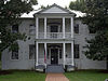 |
March 17, 1980 (#80004179) |
State Route 10 37°22′30″N 77°30′24″W / 37.375000°N 77.506667°W | Chesterfield | |
| 22 | Olive Hill |  |
April 3, 1975 (#75002017) |
0.5 miles (0.80 km) west of Matoaca off State Route 36 37°13′32″N 77°29′44″W / 37.225417°N 77.495417°W | Matoaca | |
| 23 | Pleasant View |  |
June 10, 1975 (#75002018) |
1.5 miles (2.4 km) east of Midlothian on Old Buckingham Rd. 37°30′42″N 77°37′17″W / 37.511667°N 77.621389°W | Midlothian | |
| 24 | Pocahontas State Park Historic District | 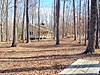 |
February 8, 2016 (#15001054) |
10301 State Park Rd. 37°23′06″N 77°35′04″W / 37.385000°N 77.584444°W | Chesterfield | |
| 25 | Point of Rocks |  |
March 10, 2005 (#05000134) |
1005 Point of Rocks Rd. 37°19′12″N 77°20′14″W / 37.320000°N 77.337222°W | Chester | |
| 26 | Proctor Creek, Jefferson Davis Highway Marker | 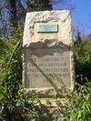 |
September 12, 2008 (#08000892) |
9300 block of U.S. Route 301 37°23′49″N 77°25′51″W / 37.396806°N 77.430833°W | Richmond | |
| 27 | Swift Creek Mill | 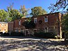 |
January 11, 1974 (#74002113) |
North of Colonial Heights on U.S. Route 1 37°17′00″N 77°24′41″W / 37.283333°N 77.411389°W | Colonial Heights | |
| 28 | Town of Bermuda Hundred Historic District |  |
November 8, 2006 (#06001011) |
Both sides of Bermuda Hundred and Allied Rds. 37°20′29″N 77°16′22″W / 37.341389°N 77.272778°W | Chester | |
| 29 | Vawter Hall and Old President's House |  |
May 7, 1980 (#80004180) |
Virginia State University campus 37°14′06″N 77°25′04″W / 37.235000°N 77.417778°W | Ettrick |
See also edit
Wikimedia Commons has media related to National Register of Historic Places in Chesterfield County, Virginia.
References edit
- ^ The latitude and longitude information provided in this table was derived originally from the National Register Information System, which has been found to be fairly accurate for about 99% of listings. Some locations in this table may have been corrected to current GPS standards.
- ^ National Park Service, United States Department of the Interior, "National Register of Historic Places: Weekly List Actions", retrieved April 12, 2024.
- ^ Numbers represent an alphabetical ordering by significant words. Various colorings, defined here, differentiate National Historic Landmarks and historic districts from other NRHP buildings, structures, sites or objects.
- ^ "National Register Information System". National Register of Historic Places. National Park Service. April 24, 2008.
- ^ The eight-digit number below each date is the number assigned to each location in the National Register Information System database, which can be viewed by clicking the number.
- ^ "Bellwood National Register of Historic Places Nomination Form" (PDF). Virginia Department of Historic Resources. 1978. Retrieved 21 December 2008.
- ^ Stevenson, Christopher M. National Register of Historic Places Multiple Property Documentation Form: Prehistoric Through Historic Archaeological Resources and Architectural Resources at Bermuda Hundred. National Park Service, 2006-06, 20.
- ^ Higgins, Thomas F., III. National Register of Historic Places Inventory/Nomination: Falling Creek Ironworks Archeological Site. National Park Service, 1994-04-19, 28.
- ^ "Henricus Historical Park". Retrieved 18 December 2014.