
KNOWPIA
WELCOME TO KNOWPIA

National Register of Historic Places listings in Essex County, New Jersey 
Summary
List of the National Register of Historic Places listings in Essex County, New Jersey

| Atlantic – Bergen (Closter, Franklin Lakes, Ridgewood, Saddle River, Wyckoff) – Burlington – Camden – Cape May – Cumberland – Essex – Gloucester – Hudson – Hunterdon – Mercer – Middlesex – Monmouth – Morris – Ocean – Passaic – Salem – Somerset – Sussex – Union – Warren |
This is intended to be a complete list of properties and districts listed on the National Register of Historic Places in Essex County, New Jersey. Latitude and longitude coordinates of the sites listed on this page may be displayed in an online map.[1]
Historic resources in the Montclair, New Jersey area were surveyed in 1986, leading to a number of separate listings.[2]
This National Park Service list is complete through NPS recent listings posted April 12, 2024.[3]
| [4] | Name on the Register[5] | Image | Date listed[6] | Location | City or town | Description |
|---|---|---|---|---|---|---|
| 1 | Ahavas Sholom |  |
December 13, 2000 (#00001530) |
145 Broadway 40°45′19″N 74°10′12″W / 40.755278°N 74.17°W | Newark | Now site of Jewish Museum of New Jersey |
| 2 | Ambrose-Ward Mansion |  |
September 20, 1982 (#82003272) |
132 S. Harrison St. 40°45′51″N 74°13′20″W / 40.764167°N 74.222222°W | East Orange | |
| 3 | Ampere Station |  |
June 22, 1984 (#84002628) |
Ampere Plaza and Whitney Place 40°45′55″N 74°11′40″W / 40.765278°N 74.194444°W | East Orange | The station was closed in 1991 and demolished shortly after. Part of the Operating Passenger Railroad Stations TR. |
| 4 | The Anchorage |  |
July 1, 1988 (#86003061) |
155 Wildwood Avenue 40°50′13″N 74°12′15″W / 40.836944°N 74.204167°W | Montclair | part of the Montclair Multiple Resource Area (MRA) |
| 5 | Anderson Park |  |
December 11, 2009 (#09001073) |
SE corner of Bellevue and North Mountain Ave. 40°50′30″N 74°12′38″W / 40.841578°N 74.210464°W | Montclair | First park in first county parks system in country. |
| 6 | John Ballantine House |  |
October 2, 1973 (#73001093) |
43 Washington St. 40°50′00″N 74°10′16″W / 40.833333°N 74.171111°W | Newark | Now part of Newark Museum |
| 7 | Joseph Bardsley House |  |
July 1, 1988 (#86003059) |
345 Park St. 40°50′11″N 74°12′09″W / 40.836389°N 74.2025°W | Montclair | part of the Montclair MRA |
| 8 | Belleville Avenue Congregational Church |  |
August 13, 1986 (#86001505) |
151 Broadway 40°45′19″N 74°10′12″W / 40.755278°N 74.17°W | Newark | |
| 9 | Bethany Baptist Church |  |
May 10, 1989 (#88000466) |
117 W. Market St. 40°44′25″N 74°11′01″W / 40.740278°N 74.183611°W | Newark | Photo shows the replacement church. The original has been demolished |
| 10 | Bloomfield Green Historic District |  |
April 20, 1978 (#78001757) |
Bounded by Belleville Ave., Montgomery, Spruce, State, Liberty, and Franklin Sts. 40°47′48″N 74°11′44″W / 40.796667°N 74.195556°W | Bloomfield | |
| 11 | Bloomfield Station |  |
June 22, 1984 (#84002631) |
Washington St. and Glenwood Ave. 40°47′33″N 74°12′03″W / 40.7925°N 74.200833°W | Bloomfield | part of the Operating Passenger Railroad Stations TR |
| 12 | Bradner`s Pharmacy |  |
July 1, 1988 (#86003010) |
33 Watchung Plaza 40°49′48″N 74°12′21″W / 40.83°N 74.205833°W | Montclair | part of the Montclair MRA |
| 13 | Branch Brook Park |  |
January 12, 1981 (#81000392) |
Roughly bounded by Belleville Park, Washington and Clifton Aves., 6th and Orange Sts. 40°46′05″N 74°10′32″W / 40.768056°N 74.175556°W | Newark and Belleville | |
| 14 | Brick Church Station |  |
June 22, 1984 (#84002636) |
Brick Church Plaza 40°45′56″N 74°13′10″W / 40.765556°N 74.219444°W | East Orange | part of the Operating Passenger Railroad Stations TR |
| 15 | Caldwell Presbyterian Church Manse |  |
November 16, 1977 (#77000861) |
207 Bloomfield Avenue 40°50′15″N 74°16′22″W / 40.8375°N 74.272778°W | Caldwell | Birthplace of Grover Cleveland |
| 16 | Canfield-Morgan House |  |
November 7, 1995 (#95001265) |
899-903 Pompton Ave. (NJ 23) 40°51′48″N 74°13′51″W / 40.863333°N 74.230833°W | Cedar Grove | |
| 17 | Carnegie Library |  |
July 1, 1988 (#86003074) |
Church St. at Valley Rd. 40°48′55″N 74°13′15″W / 40.815278°N 74.220833°W | Montclair | part of the Montclair MRA |
| 18 | Casa Deldra |  |
July 1, 1988 (#86003062) |
35 Afterglow Way 40°49′18″N 74°13′42″W / 40.821667°N 74.228333°W | Montclair | part of the Montclair MRA |
| 19 | Catedral Evangelica Reformada |  |
October 26, 1972 (#72000773) |
27 Lincoln Park and Halsey St. 40°43′38″N 74°10′43″W / 40.727222°N 74.178611°W | Newark | |
| 20 | Cathedral of the Sacred Heart |  |
December 22, 1976 (#76001151) |
89 Ridge St. 40°45′18″N 74°10′43″W / 40.755°N 74.178611°W | Newark | |
| 21 | Central Avenue Commercial Historic District |  |
August 26, 1983 (#83001600) |
560-654 Central Ave. 40°45′42″N 74°13′29″W / 40.761667°N 74.224722°W | East Orange | |
| 22 | Central Presbyterian Church |  |
November 14, 1986 (#86003051) |
46 Park St. 40°49′04″N 74°13′04″W / 40.817778°N 74.217778°W | Montclair | part of the Montclair MRA |
| 23 | J. M. Chapman House |  |
July 1, 1988 (#86002975) |
10 Rockledge 40°49′22″N 74°13′38″W / 40.822778°N 74.227222°W | Montclair | part of the Montclair MRA |
| 24 | Church Street School |  |
August 25, 1995 (#95001042) |
65 Church St., Nutley Township 40°49′07″N 74°09′49″W / 40.818747°N 74.163583°W | Nutley | |
| 25 | William Clark House |  |
November 10, 1977 (#77000863) |
346 Mount Prospect Ave. 40°45′50″N 74°10′20″W / 40.763889°N 74.172222°W | Newark | |
| 26 | Cliffside Hose Company No. 4 |  |
July 1, 1988 (#86003077) |
588 Valley Rd. 40°50′24″N 74°12′34″W / 40.84°N 74.209444°W | Montclair | part of the Montclair MRA |
| 27 | Collins House |  |
July 3, 2017 (#100001264) |
108 Baldwin St. 40°48′26″N 74°11′29″W / 40.807178°N 74.191295°W | Bloomfield Township | |
| 28 | Community Hospital |  |
March 22, 2004 (#04000224) |
130 W. Kinney Street 40°43′50″N 74°10′58″W / 40.73042°N 74.18264°W | Newark | Formerly Kenney Memorial Hospital, now New Salem Baptist Church |
| 29 | Congregational Church |  |
July 1, 1988 (#86003050) |
42 S. Fullerton Ave. 40°48′45″N 74°13′11″W / 40.8125°N 74.219722°W | Montclair | part of the Montclair MRA |
| 30 | Israel Crane House |  |
March 14, 1973 (#73001091) |
110 Orange Road 40°48′41″N 74°13′26″W / 40.811389°N 74.223889°W | Montclair | |
| 31 | Day Street Public School |  |
August 28, 2012 (#12000568) |
29 N. Day St. 40°46′23″N 74°13′44″W / 40.773124°N 74.228978°W | Orange | |
| 32 | Dock Bridge |  |
October 3, 1980 (#80002484) |
Spans Passaic River 40°44′09″N 74°09′43″W / 40.735833°N 74.161944°W | Newark | |
| 33 | East Orange Station |  |
June 22, 1984 (#84002638) |
65 City Hall Plaza 40°45′40″N 74°12′40″W / 40.761111°N 74.211111°W | East Orange | part of the Operating Passenger Railroad Stations TR |
| 34 | East Orange VA Hospital |  |
September 4, 2018 (#100002831) |
385 Tremont Avenue 40°45′16″N 74°14′09″W / 40.7544°N 74.2359°W | East Orange | Known as East Orange VA Medical Center, part of United States Third Generation Veterans Hospitals MPS |
| 35 | Eastward |  |
July 1, 1988 (#86002980) |
50 Lloyd Rd. 40°49′07″N 74°13′45″W / 40.818611°N 74.229167°W | Montclair | part of the Montclair MRA |
| 36 | Edison National Historic Site |  |
October 15, 1966 (#66000052) |
Main St. between Alden and Lakeside Sts. 40°47′13″N 74°14′16″W / 40.78694°N 74.23778°W | West Orange | |
| 37 | Edison Storage Battery Company Building |  |
February 28, 1996 (#96000055) |
177 Main St. 40°46′57″N 74°14′07″W / 40.7825°N 74.235278°W | West Orange | |
| 38 | Thomas Edison National Historical Park |  |
April 17, 2023 (#100008826) |
211 Main St. and 12 Honeysuckle Ave. 40°47′03″N 74°14′03″W / 40.7841°N 74.2341°W | West Orange | |
| 39 | Egbert Farm |  |
July 1, 1988 (#86002996) |
128 N. Mountain Ave. 40°49′39″N 74°13′08″W / 40.8275°N 74.218889°W | Montclair | part of the Montclair MRA |
| 40 | Eighteenth Avenue School |  |
April 14, 2015 (#15000151) |
229-243 18th Ave. 40°43′45″N 74°11′31″W / 40.7292°N 74.1919°W | Newark | |
| 41 | Enclosure Historic District |  |
December 31, 1974 (#74001160) |
Enclosure and Calico Lane 40°49′11″N 74°09′16″W / 40.819722°N 74.154444°W | Nutley | |
| 42 | Essex Club |  |
February 22, 1991 (#91000110) |
52 Park Place 40°44′20″N 74°10′07″W / 40.7389°N 74.1687°W | Newark | |
| 43 | Essex County Courthouse |  |
June 26, 1975 (#75001135) |
470 High Street 40°44′13″N 74°10′45″W / 40.736944°N 74.179167°W | Newark | |
| 44 | Essex County Jail |  |
September 3, 1991 (#91001366) |
21 Wilsey St. 40°44′40″N 74°10′58″W / 40.744444°N 74.182778°W | Newark | |
| 45 | Essex County Park Commission Administration Building |  |
November 11, 1977 (#77000864) |
115 Clifton Ave. 40°45′12″N 74°10′41″W / 40.753333°N 74.178056°W | Newark | |
| 46 | The Everett Court Apartments |  |
June 28, 2021 (#100006672) |
76-80 Court St. 40°43′56″N 74°10′43″W / 40.7322°N 74.1787°W | Newark | |
| 47 | Evergreen Cemetery |  |
July 9, 1991 (#91000882) |
1137 N. Broad St. 40°41′32″N 74°12′39″W / 40.692222°N 74.210833°W | Newark | |
| 48 | Fairfield Dutch Reformed Church |  |
October 7, 1975 (#75001134) |
Fairfield Rd. 40°53′04″N 74°16′57″W / 40.884444°N 74.2825°W | Fairfield | |
| 49 | Feigenspan Mansion |  |
October 5, 1977 (#77000865) |
710 High St. 40°43′41″N 74°10′58″W / 40.728056°N 74.182778°W | Newark | |
| 50 | Henry Fenn House |  |
July 1, 1988 (#86002988) |
208 N. Mountain Ave. 40°49′59″N 74°13′02″W / 40.833056°N 74.217222°W | Montclair | part of the Montclair MRA |
| 51 | First Baptist Peddie Memorial Church |  |
October 30, 1972 (#72000774) |
Broad and Fulton Sts. 40°44′29″N 74°10′09″W / 40.741389°N 74.169167°W | Newark | |
| 52 | First Methodist Episcopal Church |  |
July 1, 1988 (#86003048) |
24 N. Fullerton Ave. 40°48′55″N 74°13′06″W / 40.815278°N 74.218333°W | Montclair | part of the Montclair MRA |
| 53 | First National State Bank Building |  |
August 10, 1977 (#77000866) |
810 Broad St. 40°44′04″N 74°10′22″W / 40.734444°N 74.172778°W | Newark | |
| 54 | Forest Hill Historic District |  |
August 3, 1990 (#90001193) |
Roughly bounded by Verona Ave., Mt. Prospect Ave., 2nd Ave., and Branch Brook Park 40°46′22″N 74°10′14″W / 40.772778°N 74.170556°W | Newark | |
| 55 | Four Corners Historic District |  |
September 8, 2000 (#00001061) |
Roughly bounded by Raymond Blvd., Mulberry St., Hill St. and Washington St. 40°44′06″N 74°10′26″W / 40.735°N 74.173889°W | Newark | |
| 56 | Free Public Library, Upper Montclair Branch |  |
July 1, 1988 (#86003076) |
185 Bellevue Avenue, Upper Montclair 40°50′29″N 74°12′19″W / 40.841389°N 74.205278°W | Montclair | part of the Montclair MRA |
| 57 | Glen Ridge Historic District |  |
August 9, 1982 (#82004784) |
Roughly bounded by Bay St., Essex and Midland Aves., Adams Pl., Spencer Rd., and Franklin Pl. • Boundary increase (listed November 14, 1988, refnum 88002155): North side roughly along Ridgewood and Forest Ave. from Bay to Gray St., south side along Hawthorne, Carteret, and Midland Ave. • Boundary increase (listed July 9, 2013, refnum 13000480): Ridgewood, Sommer, Hawthorne, Victor, Forest, Oakwood, Watchung, Prescott & Sunset Aves., Brooklawn & Stonehouse Rds. 40°47′52″N 74°12′19″W / 40.797778°N 74.205278°W | Glen Ridge | |
| 58 | Glencoe |  |
October 1, 1991 (#91001481) |
698 Martin Luther King Blvd. 40°43′42″N 74°10′56″W / 40.728333°N 74.182222°W | Newark | |
| 59 | Frank Goodwillie House |  |
July 1, 1988 (#86003058) |
17 Wayside Pl. 40°48′16″N 74°13′51″W / 40.804444°N 74.230833°W | Montclair | part of the Montclair MRA |
| 60 | Grace Church |  |
November 2, 1972 (#72000776) |
Broad and Walnut Sts. 40°43′50″N 74°10′28″W / 40.730556°N 74.174444°W | Newark | |
| 61 | Griffith Building |  |
May 24, 1984 (#84002641) |
605-607 Broad Street 40°44′27″N 74°10′11″W / 40.740833°N 74.169722°W | Newark | |
| 62 | Hahne and Company |  |
August 30, 1994 (#94001005) |
609 Broad Street 40°44′25″N 74°10′14″W / 40.740278°N 74.170556°W | Newark | |
| 63 | Samuel Orton Harrison House |  |
June 30, 1980 (#80002488) |
153 Orton Rd. 40°49′50″N 74°18′15″W / 40.830556°N 74.304167°W | West Caldwell | |
| 64 | Haskell`s Bloomfield Villa |  |
July 1, 1988 (#86003002) |
84 Llewellyn Rd. 40°48′16″N 74°13′35″W / 40.804444°N 74.226389°W | Montclair | part of the Montclair MRA |
| 65 | Home Office Building |  |
June 17, 1982 (#82003273) |
8-12 Park Pl. 40°44′25″N 74°10′07″W / 40.740278°N 74.168611°W | Newark | |
| 66 | House at 147 Park Street |  |
July 1, 1988 (#86003064) |
147 Park St. 40°49′23″N 74°12′40″W / 40.823056°N 74.211111°W | Montclair | part of the Montclair MRA |
| 67 | House at 18 Brunswick Road |  |
July 1, 1988 (#86003035) |
18 Brunswick Rd. 40°49′33″N 74°12′51″W / 40.825833°N 74.214167°W | Montclair | part of the Montclair MRA |
| 68 | House at 21 Stonebridge Road |  |
July 1, 1988 (#86003073) |
21 Stonebridge Rd. 40°48′04″N 74°13′41″W / 40.801111°N 74.228056°W | Montclair | part of the Montclair MRA |
| 69 | House at 52 Wayside Place |  |
July 1, 1988 (#86003041) |
52 Wayside Pl. 40°48′05″N 74°13′52″W / 40.801389°N 74.231111°W | Montclair | part of the Montclair MRA |
| 70 | House at 53 Lloyd Road |  |
July 1, 1988 (#86002973) |
53 Lloyd Rd. 40°49′03″N 74°13′45″W / 40.8175°N 74.229167°W | Montclair | part of the Montclair MRA |
| 71 | House at 67 Warren Place |  |
July 1, 1988 (#86003004) |
67 Warren Pl. 40°48′20″N 74°13′36″W / 40.805556°N 74.226667°W | Montclair | part of the Montclair MRA |
| 72 | House at 68 Eagle Rock Way |  |
July 1, 1988 (#86003009) |
68 Eagle Rock Way 40°50′28″N 74°12′33″W / 40.841111°N 74.209167°W | Montclair | part of the Montclair MRA |
| 73 | House at 7 South Mountain Terrace |  |
November 15, 1986 (#86003235) |
7 S. Mountain Terr. 40°48′37″N 74°13′51″W / 40.810278°N 74.230833°W | Montclair | part of the Montclair MRA |
| 74 | House at 80 Lloyd Road |  |
July 1, 1988 (#86003003) |
80 Lloyd Rd. 40°48′57″N 74°13′50″W / 40.815833°N 74.230556°W | Montclair | part of the Montclair MRA |
| 75 | House at 97 Warren Place |  |
July 1, 1988 (#86003070) |
97 Warren Pl. 40°48′39″N 74°13′44″W / 40.810833°N 74.228889°W | Montclair | part of the Montclair MRA |
| 76 | House of Prayer Episcopal Church and Rectory |  |
October 30, 1972 (#72000777) |
Broad and State Sts. 40°44′53″N 74°10′17″W / 40.748056°N 74.171389°W | Newark | |
| 77 | The House that Lives |  |
July 1, 1988 (#86002976) |
83 Watchung Ave. 40°49′52″N 74°12′34″W / 40.831111°N 74.209444°W | Montclair | part of the Montclair MRA |
| 78 | Indian and the Puritan |  |
October 28, 1994 (#94001256) |
Opposite 5 Washington Street 40°44′38″N 74°10′13″W / 40.743889°N 74.170278°W | Newark | part of the Public Sculpture in Newark, New Jersey Multiple Property Submission |
| 79 | Interstate Hosiery Mills, Inc. Mill Building |  |
December 30, 2009 (#09001176) |
110 N. Fulton St. 40°47′16″N 74°12′27″W / 40.787803°N 74.207631°W | Bloomfield | |
| 80 | Jacobus House |  |
April 1, 1975 (#75001133) |
178 Grove Ave. 40°51′03″N 74°14′06″W / 40.850833°N 74.235°W | Cedar Grove | |
| 81 | James Street Commons Historic District |  |
January 9, 1978 (#78001758) |
Roughly bounded by Halsey, Warren, Boyden, Bleeker, Orange, and Broad Streets 40°44′36″N 74°10′25″W / 40.743333°N 74.173611°W | Newark | Boundary increase approved September 22, 1983 |
| 82 | Eugene V. Kelly Carriage House |  |
November 10, 1975 (#75001136) |
S. Orange Ave., Seton Hall University campus 40°44′40″N 74°14′38″W / 40.744444°N 74.243889°W | South Orange | Historic building from 1887, with 5 acres, now on Seton Hall University campus |
| 83 | Kingsland Manor |  |
March 24, 1978 (#78001762) |
3 Kingsland Street 40°49′35″N 74°08′35″W / 40.826389°N 74.143056°W | Nutley | |
| 84 | Krueger Mansion |  |
November 9, 1972 (#72000778) |
601 High St. 40°43′57″N 74°10′54″W / 40.7325°N 74.181667°W | Newark | |
| 85 | Lincoln Park Historic District |  |
January 5, 1984 (#84002646) |
Lincoln Park, Clinton Avenue, and Spruce and Broad Streets 40°43′35″N 74°10′46″W / 40.726389°N 74.179444°W | Newark | |
| 86 | Llewellyn Park Historic District |  |
February 28, 1986 (#86000423) |
Roughly bounded by Eagle Rock Ave., Main St., Pleasant Ave., and NJ 280 40°47′37″N 74°14′25″W / 40.793611°N 74.240278°W | West Orange | |
| 87 | Maple Avenue School |  |
February 6, 2020 (#100004957) |
33 Maple Ave. 40°42′31″N 74°12′55″W / 40.7086°N 74.2152°W | Newark | |
| 88 | Maplewood Memorial Park |  |
August 3, 2015 (#15000489) |
Bounded by Oakland & Dunnell Rds., Valley & Baker Sts. 40°43′51″N 74°16′23″W / 40.73079°N 74.27297°W | Maplewood | |
| 89 | Maplewood Municipal Building |  |
October 1, 2014 (#14000810) |
574 Valley St. 40°43′48″N 74°16′18″W / 40.7301°N 74.2716°W | Maplewood | |
| 90 | Maplewood Village Historic District |  |
April 25, 2022 (#100007649) |
Maplewood Ave., Durand Rd., Baker St., Highland, Inwood and Lenox Pls. 40°43′49″N 74°16′42″W / 40.7304°N 74.2784°W | Maplewood | |
| 91 | Marlboro Park Historic District |  |
July 22, 1988 (#86002967) |
Roughly along Fairfield St., Waterbury Rd., Montclair Ave., and Watchung Ave. between N. Fullerton and Grove Sts. 40°49′46″N 74°12′09″W / 40.829444°N 74.2025°W | Montclair | part of the Montclair MRA |
| 92 | Marsellis House |  |
July 1, 1988 (#86003031) |
190 Cooper Ave. 40°50′19″N 74°12′21″W / 40.838611°N 74.205833°W | Montclair | part of the Montclair MRA |
| 93 | Military Park Commons Historic District |  |
June 18, 2004 (#04000649) |
Roughly bounded by Washington Place, McCarter Highway, E. Park Street and Raymond Boulevard 40°44′19″N 74°10′09″W / 40.738631°N 74.169286°W | Newark | |
| 94 | Miller Street Historic District |  |
July 1, 1988 (#86002971) |
Miller and Fulton Sts. between Elmwood Ave., Elm, and New Sts. 40°48′26″N 74°12′53″W / 40.807222°N 74.214722°W | Montclair | part of the Montclair MRA |
| 95 | George A. Miller House |  |
July 1, 1988 (#86002979) |
275 Claremont Ave. 40°49′13″N 74°13′11″W / 40.820278°N 74.219722°W | Montclair | part of the Montclair MRA |
| 96 | Montclair Art Museum |  |
November 14, 1986 (#86002984) |
3 S. Mountain Ave. 40°49′07″N 74°13′27″W / 40.818611°N 74.224167°W | Montclair | part of the Montclair MRA |
| 97 | Montclair Railroad Station | 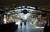 |
January 8, 1973 (#73001092) |
Lackawanna Plaza 40°48′41″N 74°12′48″W / 40.811389°N 74.213333°W | Montclair | |
| 98 | Montrose Park Historic District |  |
August 29, 1997 (#97000978) |
Roughly bounded by S. Orange, Sanford, and Heywood Aves., and Holland Rd. 40°44′57″N 74°14′52″W / 40.749167°N 74.247778°W | South Orange | |
| 99 | Morris Canal | 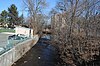 |
October 1, 1974 (#74002228) |
Irregular line beginning at Phillipsburg and ending at Jersey City 40°41′08″N 75°09′49″W / 40.685556°N 75.163611°W | Not Applicable | |
| 100 | Mount Pleasant Cemetery | 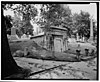 |
October 28, 1988 (#87000836) |
375 Broadway 40°45′50″N 74°09′51″W / 40.763889°N 74.164167°W | Newark | |
| 101 | Mountain Avenue Station |  |
June 22, 1984 (#84002654) |
451 Upper Mountain Avenue, Upper Montclair 40°50′57″N 74°12′21″W / 40.849167°N 74.205833°W | Montclair | part of the Operating Passenger Railroad Stations TR |
| 102 | Mountain District |  |
July 22, 1988 (#86002970) |
Roughly bounded by Highland, Bradford, Upper Mountain, and Claremont Aves. 40°49′52″N 74°13′10″W / 40.831111°N 74.219444°W | Montclair | part of the Montclair MRA |
| 103 | Mountain Station | 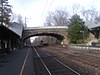 |
September 29, 1984 (#84002656) |
449 Vose Ave. 40°45′17″N 74°15′13″W / 40.754722°N 74.253611°W | South Orange | part of the Operating Passenger Railroad Stations TR |
| 104 | Mulford House |  |
July 1, 1988 (#86003038) |
207 Union St. 40°48′42″N 74°13′50″W / 40.811667°N 74.230556°W | Montclair | part of the Montclair MRA |
| 105 | Murphy Varnish Works |  |
March 9, 1979 (#79001484) |
McWhorter, Vesey, and Chestnut Sts. 40°43′28″N 74°10′14″W / 40.724444°N 74.170556°W | Newark | |
| 106 | Mutual Benefit Life Insurance Company | 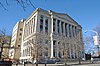 |
November 17, 1983 (#83004031) |
300 Broadway and 2nd St. 40°45′40″N 74°10′10″W / 40.761111°N 74.169444°W | Newark | |
| 107 | New Jersey Bell Headquarters Building | 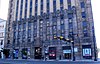 |
September 21, 2005 (#05001054) |
540 Broad St. 40°44′42″N 74°10′08″W / 40.745°N 74.168889°W | Newark | |
| 108 | New Point Baptist Church |  |
November 2, 1972 (#72000779) |
17 E. Kinney St. 40°43′41″N 74°10′32″W / 40.728056°N 74.175556°W | Newark | |
| 109 | Newark Broad Street Station |  |
June 22, 1984 (#84002662) |
Broad and University Streets 40°44′50″N 74°10′20″W / 40.747222°N 74.172222°W | Newark | part of the Operating Passenger Railroad Stations TR |
| 110 | Newark City Hall | 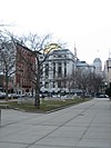 |
February 17, 1978 (#78001759) |
920 Broad St. 40°43′54″N 74°10′27″W / 40.731667°N 74.174167°W | Newark | |
| 111 | Newark Female Charitable Society |  |
September 12, 1979 (#79001485) |
305 Halsey St., 41-43 Hill St. 40°43′56″N 74°10′36″W / 40.732222°N 74.176667°W | Newark | |
| 112 | Newark Metropolitan Airport Buildings |  |
December 12, 1980 (#80002485) |
U.S. 22 40°42′23″N 74°09′45″W / 40.706389°N 74.1625°W | Newark | |
| 113 | Newark Orphan Asylum | 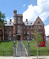 |
June 19, 1973 (#73001094) |
High and Bleeker Sts., Newark College of Engineering 40°44′36″N 74°15′37″W / 40.743333°N 74.260278°W | Newark | |
| 114 | North Broad Street Historic District |  |
July 23, 1996 (#96000813) |
136-148 Broad St. 40°45′27″N 74°10′08″W / 40.7575°N 74.168889°W | Newark | |
| 115 | North Reformed Church |  |
October 5, 1972 (#72000780) |
510 Broad St. 40°44′39″N 74°10′10″W / 40.744167°N 74.169444°W | Newark | |
| 116 | Oakes Estate |  |
August 6, 1981 (#81000390) |
240 Belleville Ave. 40°47′56″N 74°11′27″W / 40.798889°N 74.190833°W | Bloomfield | |
| 117 | Old First Presbyterian Church |  |
November 2, 1972 (#72000781) |
820 Broad St. 40°44′03″N 74°10′22″W / 40.734167°N 74.172778°W | Newark | |
| 118 | Orange Free Public Library |  |
September 28, 1981 (#81000393) |
348 Main St. 40°46′21″N 74°13′56″W / 40.7725°N 74.232222°W | Orange | |
| 119 | Orange Memorial Hospital Historic District |  |
November 17, 2015 (#15000797) |
180 S. Essex Ave. 40°46′05″N 74°14′02″W / 40.768157°N 74.233936°W | Orange | |
| 120 | Orange Station |  |
June 22, 1984 (#84002665) |
73 Lincoln Avenue 40°46′18″N 74°14′02″W / 40.771667°N 74.233889°W | Orange | part of the Operating Passenger Railroad Stations TR |
| 121 | Pan American C.M.A. Church |  |
July 31, 1972 (#72000782) |
76 Prospect St. 40°43′48″N 74°09′47″W / 40.73°N 74.163056°W | Newark | |
| 122 | Passaic Machine Works-Watts, Campbell & Company |  |
August 13, 1986 (#86001503) |
1270 McCarter Hwy. 40°45′02″N 74°10′04″W / 40.750556°N 74.167778°W | Newark | |
| 123 | Pennsylvania Station |  |
December 20, 1978 (#78001760) |
Raymond Plaza West 40°44′03″N 74°09′53″W / 40.734167°N 74.164722°W | Newark | |
| 124 | Pine Street Historic District |  |
March 16, 2000 (#00000175) |
Roughly bounded by Glenridge Ave., the NJ TRANSIT Boonton Line, Pine and Baldwin Sts. 40°48′35″N 74°12′28″W / 40.809722°N 74.207778°W | Montclair | |
| 125 | Post Office Building, Upper Montclair |  |
July 1, 1988 (#86003012) |
242-244 Bellevue Avenue, Upper Montclair 40°50′28″N 74°12′33″W / 40.841111°N 74.209167°W | Montclair | part of the Montclair MRA |
| 126 | Presby Memorial Iris Gardens Horticultural Center | 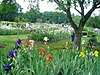 |
September 17, 1980 (#80002483) |
474 Upper Mountain Ave. 40°51′05″N 74°12′23″W / 40.851389°N 74.206389°W | Montclair | |
| 127 | Protestant Foster Home | 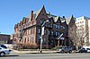 |
February 13, 1986 (#86000211) |
272-284 Broadway 40°45′37″N 74°10′11″W / 40.760278°N 74.169722°W | Newark | |
| 128 | Queen of Angels Church |  |
October 26, 1972 (#72000783) |
Belmont Ave. at Morton St. 40°43′00″N 74°11′22″W / 40.716667°N 74.189444°W | Newark | |
| 129 | M. F. Reading House |  |
July 1, 1988 (#86003006) |
87 Midland Ave. 40°49′10″N 74°13′01″W / 40.819444°N 74.216944°W | Montclair | part of the Montclair MRA |
| 130 | Red Gables |  |
July 1, 1988 (#86002992) |
99 S. Fullerton Ave. 40°48′29″N 74°13′08″W / 40.808056°N 74.218889°W | Montclair | part of the Montclair MRA |
| 131 | Reformed Dutch Church of Second River |  |
December 21, 1978 (#78001756) |
171 Main St. 40°47′12″N 74°08′58″W / 40.786667°N 74.149444°W | Belleville | |
| 132 | Riverbank Park |  |
April 16, 1998 (#98000351) |
Roughly bounded by Van Buren, Market, and Somme Sts., and Passaic R. 40°43′55″N 74°09′09″W / 40.731944°N 74.1525°W | Newark | |
| 133 | Route 1 Extension |  |
August 12, 2005 (#05000880) |
US 1 and 9 milepoint: 51.25-54.55, NJ 139 milepoint 0-1.45 40°44′09″N 74°05′30″W / 40.73583°N 74.09167°W | Newark | Includes Pulaski Skyway. Also listed in Hudson County section. |
| 134 | Salaam Temple |  |
October 5, 1977 (#77000867) |
1020 Broad St. 40°43′40″N 74°10′35″W / 40.727778°N 74.176389°W | Newark | Later became Newark Symphony Hall |
| 135 | Charles S. Shultz House |  |
July 22, 1979 (#79001482) |
30 N. Mountain Ave. 40°49′17″N 74°13′24″W / 40.821389°N 74.223333°W | Montclair | |
| 136 | Seated Lincoln | 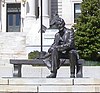 |
March 30, 1995 (#95000303) |
Junction of Springfield and Market Streets, Essex County Courthouse 40°44′13″N 74°10′40″W / 40.736944°N 74.177778°W | Newark | part of the Public Sculpture in Newark, New Jersey Multiple Property Submission |
| 137 | Second Reformed Dutch Church |  |
March 7, 1979 (#79001486) |
178-184 Edison Pl. 40°43′57″N 74°09′51″W / 40.7325°N 74.164167°W | Newark | |
| 138 | Short Hills Park Historic District |  |
September 18, 1980 (#80002482) |
Off NJ 24 40°43′53″N 74°19′38″W / 40.731389°N 74.327222°W | Millburn | |
| 139 | S. C. Smith House |  |
July 1, 1988 (#86002978) |
40 Northview Ave. 40°50′23″N 74°12′25″W / 40.839722°N 74.206944°W | Montclair | part of the Montclair MRA |
| 140 | South Orange Fire Department | 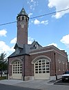 |
March 19, 1998 (#98000255) |
Junction of First and Sloan Sts. 40°44′43″N 74°15′39″W / 40.745278°N 74.260833°W | South Orange Village | |
| 141 | South Orange Station |  |
June 22, 1984 (#84002669) |
19 Sloan St. 40°44′45″N 74°15′39″W / 40.745833°N 74.260833°W | South Orange | part of the Operating Passenger Railroad Stations TR |
| 142 | South Orange Village Hall | 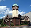 |
May 28, 1976 (#76001152) |
S. Orange Ave. and Scotland Rd. 40°44′46″N 74°15′30″W / 40.746111°N 74.258333°W | South Orange | |
| 143 | South Park Calvary United Presbyterian Church |  |
December 5, 1972 (#72000784) |
1035 Broad Street 40°43′34″N 74°10′31″W / 40.726111°N 74.175278°W | Newark | |
| 144 | St. Barnabas' Episcopal Church |  |
October 18, 1972 (#72000785) |
W. Market St. and Sussex and Roseville Aves. 40°45′04″N 74°11′38″W / 40.751111°N 74.193889°W | Newark | |
| 145 | St. Casimir's Roman Catholic Church |  |
July 9, 1997 (#97000773) |
164 Nichols St. 40°43′24″N 74°09′32″W / 40.723333°N 74.158889°W | Newark | |
| 146 | St. Columba's Church | 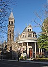 |
October 30, 1972 (#72000786) |
Pennsylvania Ave. and Brunswick St. 40°43′28″N 74°10′49″W / 40.724444°N 74.180278°W | Newark | |
| 147 | St. James' A. M. E. Church |  |
October 18, 1972 (#72000787) |
High and Court Sts. 40°43′57″N 74°10′52″W / 40.7325°N 74.181111°W | Newark | |
| 148 | St. John's Church |  |
October 30, 1972 (#72000789) |
22-26 Mulberry St. 40°44′17″N 74°09′58″W / 40.738056°N 74.166111°W | Newark | |
| 149 | St. Joseph's Roman Catholic Church Rectory and School | 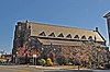 |
December 8, 1980 (#80002486) |
W. Market St. 40°44′35″N 74°11′11″W / 40.743056°N 74.186389°W | Newark | |
| 150 | St. Lucy's Church | 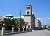 |
December 31, 1998 (#98001570) |
19-26 Ruggiero Plaza 40°45′01″N 74°10′36″W / 40.750278°N 74.176667°W | Newark | |
| 151 | St. Luke's Church |  |
July 1, 1988 (#86003045) |
69 S. Fullerton Ave. 40°48′36″N 74°13′06″W / 40.81°N 74.218333°W | Montclair | part of the Montclair MRA |
| 152 | St. Mark's Episcopal Church |  |
September 22, 1977 (#77000868) |
13 Main St. 40°46′37″N 74°14′21″W / 40.776944°N 74.239167°W | West Orange | |
| 153 | St. Mary's Abbey Church |  |
November 3, 1972 (#72000790) |
High and William Sts. 40°44′09″N 74°17′13″W / 40.735833°N 74.286944°W | Newark | |
| 154 | St. Patrick's Pro Cathedral | 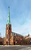 |
November 3, 1972 (#72000791) |
Washington St. and Central Ave. 40°44′31″N 74°10′21″W / 40.741944°N 74.1725°W | Newark | |
| 155 | St. Rocco's Roman Catholic Church |  |
September 29, 1980 (#80002487) |
212-216 Hunterdon St. 40°44′15″N 74°11′35″W / 40.7375°N 74.193056°W | Newark | |
| 156 | St. Stephan's Church |  |
October 5, 1972 (#72000792) |
Ferry St. and Wilson Ave. 40°43′40″N 74°09′20″W / 40.727778°N 74.155556°W | Newark | |
| 157 | Stanley Theater |  |
August 28, 1986 (#86001957) |
985 S. Orange Ave. 40°44′48″N 74°13′46″W / 40.746667°N 74.229444°W | Newark | |
| 158 | State Street Public School |  |
August 3, 1990 (#90001201) |
15 State St. 40°44′56″N 74°10′18″W / 40.748889°N 74.171667°W | Newark | |
| 159 | Stone Eagles |  |
July 1, 1988 (#86003005) |
60 Undercliff Road 40°48′27″N 74°14′02″W / 40.8075°N 74.233889°W | Montclair | part of the Montclair MRA |
| 160 | Stone House by the Stone House Brook |  |
November 22, 1991 (#87001333) |
219 S. Orange Ave. 40°44′42″N 74°15′13″W / 40.745°N 74.253611°W | South Orange | Built prior to 1680; expanded into a Queen Anne Victorian in 1877 by William Brewer, Jr. |
| 161 | Sydenham House |  |
July 29, 1970 (#70000384) |
Old Road to Bloomfield, at Heller Pkwy. 40°46′36″N 74°10′21″W / 40.776667°N 74.1725°W | Newark | |
| 162 | Symington House |  |
March 2, 1979 (#79001487) |
2 Park Place 40°44′26″N 74°10′07″W / 40.740556°N 74.168611°W | Newark | |
| 163 | Temple B'Nai Abraham |  |
April 26, 2007 (#07000358) |
621 Clinton Ave. 40°43′23″N 74°12′25″W / 40.723056°N 74.206944°W | Newark | |
| 164 | Trinity Cathedral |  |
November 3, 1972 (#72000793) |
Broad and Rector Sts. 40°44′25″N 74°10′09″W / 40.740278°N 74.169167°W | Newark | |
| 165 | Upper Montclair Station |  |
June 22, 1984 (#84002673) |
275 Bellevue Avenue, Upper Montclair 40°50′31″N 74°12′35″W / 40.841944°N 74.209722°W | Montclair | part of the Operating Passenger Railroad Stations TR |
| 166 | Van Ness House |  |
July 29, 1977 (#77000862) |
236 Little Falls Road 40°52′59″N 74°15′35″W / 40.883056°N 74.259722°W | Fairfield | |
| 167 | Van Reyper-Bond House |  |
January 22, 1979 (#79001483) |
848 Valley Rd. 40°51′23″N 74°12′00″W / 40.856389°N 74.2°W | Montclair | |
| 168 | Von Schmid House |  |
July 1, 1988 (#86002974) |
580 Park St. 40°51′07″N 74°11′49″W / 40.851944°N 74.196944°W | Montclair | part of the Montclair MRA |
| 169 | Vreeland Homestead |  |
October 14, 1994 (#94001217) |
216 Chestnut Street 40°49′09″N 74°10′12″W / 40.819167°N 74.17°W | Nutley | |
| 170 | Ward-Force House and Condit Family Cook House |  |
December 29, 1981 (#81000391) |
366 S. Livingston Ave. 40°46′54″N 74°19′00″W / 40.781667°N 74.316667°W | Livingston | |
| 171 | Wars of America | 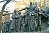 |
October 28, 1994 (#94001257) |
Military Park, 614-706 Broad St. 40°44′20″N 74°10′11″W / 40.7388°N 74.1697°W | Newark | part of the Public Sculpture in Newark, New Jersey Multiple Property Submission |
| 172 | Watchung Avenue Station |  |
June 22, 1984 (#84002674) |
Park St. 40°49′46″N 74°12′25″W / 40.829444°N 74.206944°W | Montclair | part of the Operating Passenger Railroad Stations TR |
| 173 | Weequahic High School | April 11, 2024 (#100010170) |
279 Chancellor Avenue 40°42′33″N 74°13′13″W / 40.7092°N 74.2203°W | Newark | ||
| 174 | Weequahic Park Historic District | 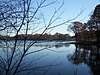 |
February 12, 2003 (#03000013) |
Roughly bounded by Meeker Ave., Dayton St., the Union County border and Maple Ave. 40°42′06″N 74°12′19″W / 40.701667°N 74.205278°W | Newark | |
| 175 | Wickcliffe Presbyterian Church | 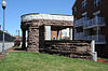 |
May 22, 1978 (#78001761) |
111 13th Ave. 40°44′19″N 74°11′05″W / 40.738611°N 74.184722°W | Newark | |
| 176 | Allyn Wight House |  |
July 1, 1988 (#86003007) |
75 Gates Ave. 40°48′25″N 74°13′08″W / 40.806944°N 74.218889°W | Montclair | part of the Montclair MRA |
| 177 | Williams-Harrison House | 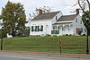 |
March 13, 1979 (#79001488) |
126 Eagle Rock Ave. 40°49′14″N 74°17′24″W / 40.820556°N 74.29°W | Roseland | |
| 178 | Woman's Club of Upper Montclair |  |
September 4, 2012 (#12000594) |
200 Cooper Avenue, Upper Montclair 40°50′21″N 74°12′24″W / 40.839171°N 74.206595°W | Montclair | part of the Clubhouses of New Jersey Women's Clubs MPS |
Former listings edit
| [4] | Name on the Register | Image | Date listed | Date removed | Location | City or town | Description |
|---|---|---|---|---|---|---|---|
| 1 | First United Methodist Church | October 26, 1972 (#72000775) | February 17, 1977 | 227 Market St. | Newark | Demolished in 1977. | |
| 2 | St. James Church | November 2, 1972 (#72000788) | January 10, 1984 | Lafayette and Jefferson Sts. | Newark | Demolished in 1979. Not to be confused with St. James AME Church at High and Court Streets, which remains on the list in Essex County. |
See also edit
References edit
Wikimedia Commons has media related to National Register of Historic Places in Essex County, New Jersey.
- ^ The latitude and longitude information provided in this table was derived originally from the National Register Information System, which has been found to be fairly accurate for about 99% of listings. Some locations in this table may have been corrected to current GPS standards.
- ^ Eleanor McArevey Price (1986). "National Register of Historic Places Inventory/Nomination: Historic Resources of Montclair Multiple Resources Area". National Park Service. Retrieved January 15, 2018..
- ^ National Park Service, United States Department of the Interior, "National Register of Historic Places: Weekly List Actions", retrieved April 12, 2024.
- ^ a b Numbers represent an alphabetical ordering by significant words. Various colorings, defined here, differentiate National Historic Landmarks and historic districts from other NRHP buildings, structures, sites or objects.
- ^ "National Register Information System". National Register of Historic Places. National Park Service. April 24, 2008.
- ^ The eight-digit number below each date is the number assigned to each location in the National Register Information System database, which can be viewed by clicking the number.