
KNOWPIA
WELCOME TO KNOWPIA

National Register of Historic Places listings in Fulton County, Georgia 
Summary
This is a list of properties and districts in Fulton County, Georgia that are listed on the National Register of Historic Places (NRHP). It covers most of the NRHP properties in Atlanta; other Atlanta listings are covered in National Register of Historic Places listings in DeKalb County, Georgia.
This National Park Service list is complete through NPS recent listings posted April 19, 2024.[1]
Current listings edit
| [2] | Name on the Register | Image | Date listed[3] | Location | City or town | Description |
|---|---|---|---|---|---|---|
| 1 | 61 16th Street Apartment Building | 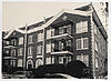 |
August 30, 2006 (#06000732) |
61 16th St. 33°47′34″N 84°23′03″W / 33.7928°N 84.3842°W | Atlanta | |
| 2 | 63 Mangum Street Industrial Building | 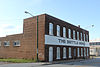 |
June 28, 1996 (#96000696) |
63–69 Mangum St. and 398–400 Markham St. 33°45′09″N 84°24′01″W / 33.7525°N 84.4003°W | Atlanta | |
| 3 | 696 Peachtree Street Apartments |  |
May 8, 2013 (#13000240) |
826 Peachtree St. 33°46′39″N 84°23′04″W / 33.7775°N 84.3844°W | Atlanta | |
| 4 | 705 Piedmont Avenue Apartments | 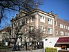 |
December 19, 1991 (#91001853) |
705 Piedmont Ave. 33°46′25″N 84°22′52″W / 33.7736°N 84.3811°W | Atlanta | Designed by architect Russell Conklin in 1924. |
| 5 | Academy of Medicine |  |
April 30, 1980 (#80001070) |
875 W. Peachtree St., NE. 33°46′45″N 84°23′13″W / 33.7792°N 84.3869°W | Atlanta | |
| 6 | Adair Park Historic District |  |
June 2, 2000 (#00000563) |
Bounded by Metropolitan Parkway, Lexington Ave., Norfolk Southern RR and Shelton Ave. 33°43′52″N 84°24′34″W / 33.7311°N 84.4094°W | Atlanta | |
| 7 | Charles R. Adams Park |  |
January 14, 2013 (#12001167) |
1690 Delowe Dr. 33°42′37″N 84°27′48″W / 33.7103°N 84.4632°W | Atlanta | Boundary increase approved April 12, 2021. |
| 8 | Jack and Helen Adams Lustron House |  |
March 18, 1996 (#96000212) |
832 Burchill St., SW. 33°42′44″N 84°24′57″W / 33.7122°N 84.4158°W | Atlanta | A Lustron house |
| 9 | Alberta Drive-Mathieson Drive-West Shadowlawn Avenue Historic District | January 27, 2015 (#14001208) |
Roughly centered on W. Shadowlawn Ave., Alberta & Mathieson Drs., NE. 33°50′42″N 84°22′36″W / 33.845°N 84.3767°W | Atlanta | ||
| 10 | Cecil and Hermione Alexander House | March 25, 2010 (#10000116) |
2232 Mt. Paran Rd, N.W. 33°51′23″N 84°26′15″W / 33.8564°N 84.4376°W | Atlanta | ||
| 11 | Ansley Park Historic District |  |
April 20, 1979 (#79000717) |
Roughly bounded by RR tracks, Beverly Rd., Piedmont Ave., Spring, 15th & Peachtree Sts. 33°47′34″N 84°22′45″W / 33.7929°N 84.3792°W | Atlanta | |
| 12 | Apartments at 2 Collier Road |  |
September 10, 2007 (#07000937) |
2 Collier Rd. 33°48′31″N 84°23′39″W / 33.8086°N 84.3942°W | Atlanta | |
| 13 | Apartments at 22–24 Collier Road |  |
September 10, 2007 (#07000938) |
22–24 Collier Rd. 33°48′32″N 84°23′42″W / 33.8089°N 84.395°W | Atlanta | |
| 14 | Thomas P. Arnold House |  |
May 10, 1984 (#84001074) |
518 S. Main St. 33°30′40″N 84°40′18″W / 33.5111°N 84.6717°W | Palmetto | |
| 15 | Ashby Street Car Barn |  |
August 6, 1998 (#98000972) |
981 Ashby St. NW. 33°47′02″N 84°25′01″W / 33.7839°N 84.4169°W | Atlanta | |
| 16 | Atkins Park District |  |
August 30, 1982 (#82004619) |
St. Augustine St., St. Charles, and St. Louis Pls. between N. Highland Ave. and Briarcliff Rd. 33°46′31″N 84°21′01″W / 33.7753°N 84.3503°W | Atlanta | |
| 17 | Atlanta and West Point Railroad Freight Depot | March 26, 1976 (#76000620) |
215 Decatur St. 33°45′32″N 84°22′58″W / 33.7589°N 84.3828°W | Atlanta | Building no longer exists. | |
| 18 | Atlanta Biltmore Hotel and Biltmore Apartments |  |
January 20, 1980 (#80001071) |
817 W. Peachtree St. 33°46′36″N 84°23′11″W / 33.7767°N 84.3864°W | Atlanta | |
| 19 | Atlanta Buggy Company and Warehouse-Hatcher Bros. Furniture Company |  |
August 21, 1992 (#92001070) |
530–544 Means St. 33°46′21″N 84°24′20″W / 33.7725°N 84.4056°W | Atlanta | |
| 20 | Atlanta City Hall |  |
July 13, 1983 (#83000227) |
68 Mitchell St. SW. 33°44′56″N 84°23′25″W / 33.7489°N 84.3903°W | Atlanta | |
| 21 | Atlanta Spring and Bed Company-Block Candy Company |  |
July 28, 1995 (#95000910) |
512 Means St. 33°46′20″N 84°24′19″W / 33.7722°N 84.4053°W | Atlanta | |
| 22 | Atlanta Stockade |  |
June 25, 1987 (#87000948) |
760 Glenwood Ave. 33°44′30″N 84°21′44″W / 33.741667°N 84.362222°W | Atlanta | |
| 23 | Atlanta University Center District | 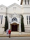 |
July 12, 1976 (#76000621) |
Roughly bounded by transit right-of-way, Northside Dr., Walnut, Fair, Roach, W. End Dr., Euralee and Chestnut Sts. 33°45′00″N 84°24′33″W / 33.75°N 84.409167°W | Atlanta | |
| 24 | Atlanta Waterworks Hemphill Avenue Station |  |
March 29, 1978 (#78000982) |
1210 Hemphill Ave., NW. 33°47′14″N 84°24′30″W / 33.787222°N 84.408333°W | Atlanta | |
| 25 | Atlanta Women's Club |  |
January 31, 1979 (#79000718) |
1150 Peachtree St., NE. 33°47′09″N 84°22′59″W / 33.785833°N 84.383056°W | Atlanta | |
| 26 | Levi Ballard House |  |
October 22, 1980 (#80001080) |
U.S. 29 and GA 154 33°31′46″N 84°39′43″W / 33.529444°N 84.661944°W | Palmetto | Evidently torn down, according to a facebook page. |
| 27 | Baltimore Block | 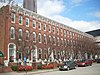 |
June 3, 1976 (#76000622) |
5,7,9,11,13,15,17,19 Baltimore Pl. 33°46′06″N 84°23′16″W / 33.768333°N 84.387778°W | Atlanta | |
| 28 | Barrington Hall |  |
December 9, 1971 (#71000275) |
60 Marietta St. 34°00′47″N 84°21′50″W / 34.013056°N 84.363889°W | Roswell | |
| 29 | Bass Furniture Building |  |
January 8, 1979 (#79000719) |
142–150 Mitchell St. 33°45′07″N 84°23′32″W / 33.751944°N 84.392222°W | Atlanta | |
| 30 | John F. Beavers House |  |
March 29, 1984 (#84001075) |
Northwest of Fairburn off GA 92 33°39′14″N 84°40′16″W / 33.653889°N 84.671111°W | Fairburn | |
| 31 | Berkeley Park Historic District |  |
June 23, 2003 (#03000536) |
Roughly bounded by Bellemeade Rd., Northside Dr., Atlanta Waterworks and Howell Mill Rd. 33°48′00″N 84°24′47″W / 33.8°N 84.413056°W | Atlanta | |
| 32 | Dr. Brailsford R. Brazeal House | April 8, 2005 (#05000278) |
193 Joseph E. Lowery Boulevard 33°45′03″N 84°25′05″W / 33.750833°N 84.418056°W | Atlanta | ||
| 33 | Briarcliff Hotel |  |
September 9, 1982 (#82002415) |
1050 Ponce de Leon Ave. 33°46′26″N 84°21′11″W / 33.773889°N 84.353056°W | Atlanta | |
| 34 | Briarcliff Plaza |  |
April 20, 2020 (#100005182) |
1027 and 1061 Ponce de Leon Ave. NE 33°46′26″N 84°21′10″W / 33.7738°N 84.3529°W | Atlanta | |
| 35 | Dr. Marion Luther Brittain Sr. House |  |
September 23, 1993 (#93000999) |
1109 W. Peachtree St. 33°47′06″N 84°23′15″W / 33.785009°N 84.387420°W | Atlanta | Demolished in 2017.[4] |
| 36 | Brookhaven Historic District | 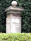 |
January 24, 1986 (#86000134) |
East of Peachtree-Dunwoody and north and east of Peachtree Rds. 33°51′49″N 84°21′02″W / 33.863611°N 84.350556°W | Atlanta | |
| 37 | Brookwood Hills Historic District |  |
December 21, 1979 (#79003776) |
Off U.S. 19 and GA 9 33°48′21″N 84°23′23″W / 33.805833°N 84.389722°W | Atlanta | |
| 38 | Building at 161 Spring St. |  |
June 14, 2001 (#01000644) |
161 Spring St., NW. 33°45′37″N 84°23′23″W / 33.760278°N 84.389722°W | Atlanta | |
| 39 | Building at 760–768 Confederate Avenue | October 2, 2018 (#100003037) |
760 Confederate Avenue SE. 33°44′01″N 84°21′54″W / 33.7335°N 84.3649°W | Atlanta | ||
| 40 | Buildings at 523-549 Stewart Avenue | October 31, 2023 (#100009517) |
565 Northside Dr SW, 523 to 529 Metropolitan Parkway, 523 Stewart Avenue, 35 Stewart Avenue 33°44′24″N 84°24′30″W / 33.7399°N 84.4084°W | Atlanta | ||
| 41 | Bulloch Hall |  |
May 27, 1971 (#71000276) |
Bulloch Ave. 34°00′55″N 84°22′04″W / 34.015278°N 84.367778°W | Roswell | |
| 42 | Burns Cottage |  |
December 1, 1983 (#83003572) |
988 Alloway Pl., SE. 33°43′37″N 84°21′20″W / 33.7269°N 84.3556°W | Atlanta | |
| 43 | Butler Street Colored Methodist Episcopal Church |  |
May 9, 1983 (#83000228) |
23 Butler St., SE. 33°45′13″N 84°22′51″W / 33.7536°N 84.3808°W | Atlanta | |
| 44 | Cabbagetown District |  |
January 1, 1976 (#76000623) |
Bounded by Boulevard, Pearl St., Memorial Dr., and railroad tracks 33°44′59″N 84°21′59″W / 33.7497°N 84.3664°W | Atlanta | |
| 45 | Campbell County Courthouse |  |
March 26, 1976 (#76000634) |
E. Broad and Cole Sts. 33°34′00″N 84°34′46″W / 33.5667°N 84.5794°W | Fairburn | Courthouse for the defunct Campbell County, Georgia |
| 46 | Candler Building |  |
August 24, 1977 (#77000424) |
127 Peachtree St., NE. 33°45′25″N 84°23′16″W / 33.7569°N 84.3879°W | Atlanta | |
| 47 | Canton Apartments |  |
December 8, 1980 (#80004456) |
2846–2840 Peachtree Rd. 33°49′57″N 84°23′04″W / 33.8325°N 84.3844°W | Atlanta | |
| 48 | Capital City Club |  |
September 15, 1977 (#77000425) |
7 Harris St., NW. 33°45′39″N 84°23′16″W / 33.7608°N 84.3878°W | Atlanta | |
| 49 | Capitol View Apartments | November 13, 2023 (#100009520) |
1191 Metropolitan Parkway 33°43′21″N 84°24′29″W / 33.7224°N 84.4080°W | Atlanta | ||
| 50 | Capitol View Historic District | April 22, 2016 (#16000195) |
Roughly bounded by Hartford Pl., Fairbanks St., Perkerson Park, Sylvan Rd., and Division Pl. 33°42′59″N 84°25′01″W / 33.7163°N 84.4170°W | Atlanta | ||
| 51 | Capitol View Manor Historic District |  |
December 3, 2013 (#13000876) |
Roughly bounded by Norfolk Southern RR, Hillside Dr., SW., I-75, Deckner Ave., SW. & Metropolitan Pkwy., SW. 33°43′03″N 84°24′21″W / 33.7176°N 84.4057°W | Atlanta | |
| 52 | Cascade Heights Commercial Historic District | November 23, 2020 (#100005817) |
Centered on the jct. of Cascade Rd. SW and Benjamin E. Hayes Dr. SW 33°43′21″N 84°27′49″W / 33.7224°N 84.4636°W | Atlanta | ||
| 53 | Castleberry Hill Historic District |  |
August 8, 1985 (#85001742) |
Roughly bounded by Nelson St., Southern & Central of Georgia RR, McDaniel, Peters & Walker Sts. 33°44′52″N 84°24′03″W / 33.7478°N 84.4008°W | Atlanta | |
| 54 | Central Presbyterian Church |  |
March 13, 1986 (#86000366) |
201 Washington St. SW. 33°44′59″N 84°23′21″W / 33.7497°N 84.3892°W | Atlanta | |
| 55 | Church of the Sacred Heart of Jesus |  |
May 13, 1976 (#76000625) |
335 Ivy St. [Peachtree Center], NE. 33°45′50″N 84°23′07″W / 33.7639°N 84.3853°W | Atlanta | |
| 56 | Citizens and Southern Bank Building |  |
August 18, 1977 (#77000426) |
35 Broad St. 33°45′17″N 84°23′23″W / 33.7547°N 84.3897°W | Atlanta | |
| 57 | Coca-Cola Building Annex |  |
October 18, 1996 (#96001138) |
187 Edgewood Ave. 33°45′21″N 84°22′53″W / 33.7558°N 84.3814°W | Atlanta | |
| 58 | College Park Historic District | November 15, 1996 (#96001338) |
Roughly bounded by Vesta Ave., Yale Ave., Madison St., Harris St., and Washington Rd. 33°39′38″N 84°27′12″W / 33.6606°N 84.4533°W | College Park | ||
| 59 | College Street School |  |
July 21, 1995 (#95000902) |
580 College St. 33°39′20″N 84°24′31″W / 33.6556°N 84.4086°W | Hapeville | |
| 60 | Collier Heights Historic District | June 23, 2009 (#09000457) |
Bounded approximately by Hamilton E. Holmes Drive on the east, Donald Lee Hollowell Parkway on the north, Interstate 285 on the west, and Interstate 20 on the south 33°46′19″N 84°29′02″W / 33.7719°N 84.4839°W | Atlanta | ||
| 61 | Collier-Perry-Bentley House |  |
March 26, 2021 (#100006307) |
1649 Lady Marian Ln. 33°47′58″N 84°22′53″W / 33.7995°N 84.3813°W | Atlanta | |
| 62 | F. J. Cooledge and Sons, Company-Hastings' Seed Company |  |
October 31, 1995 (#95001229) |
434 Marietta St. 33°45′53″N 84°23′52″W / 33.7647°N 84.3978°W | Atlanta | |
| 63 | Cox-Carlton Hotel |  |
November 1, 2006 (#06000960) |
683 Peachtree St., NE. 33°46′28″N 84°23′05″W / 33.7744°N 84.3847°W | Atlanta | Designed by Atlanta architectural firm Pringle and Smith in 1925 |
| 64 | Crescent Apartments |  |
June 21, 1996 (#96000649) |
979 Crescent Ave., NW. 33°46′52″N 84°23′04″W / 33.7811°N 84.3844°W | Atlanta | Where Margaret Mitchell wrote much of Gone With the Wind |
| 65 | William H. Crogman School | 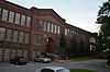 |
July 14, 2005 (#05000692) |
1093 West Ave SW 33°43′30″N 84°23′47″W / 33.7249°N 84.3963°W | Atlanta | |
| 66 | Cyclorama of the Battle of Atlanta |  |
December 9, 1971 (#71000274) |
Cherokee Ave., Grant Park 33°43′33″N 84°22′16″W / 33.725833°N 84.371111°W | Atlanta | |
| 67 | H. B. Davis Building-Hotel Roxy |  |
September 11, 1997 (#97001123) |
764–772 Marietta St. 33°46′32″N 84°24′16″W / 33.7756°N 84.4044°W | Atlanta | |
| 68 | Degive's Grand Opera House |  |
June 17, 1977 (#77000427) |
157 Peachtree St., NE. 33°45′27″N 84°23′13″W / 33.7575°N 84.3869°W | Atlanta | |
| 69 | Dixie Coca-Cola Bottling Company Plant |  |
July 20, 1977 (#77000428) |
125 Edgewood Ave. 33°45′16″N 84°23′03″W / 33.7544°N 84.3842°W | Atlanta | National Historic Landmark |
| 70 | East Point Industrial District |  |
September 5, 1985 (#85001971) |
Roughly bounded by Martin and Taylor Sts. Norman Berry Dr. and RR tracks 33°40′42″N 84°26′19″W / 33.6783°N 84.4386°W | East Point | |
| 71 | Rutherford and Martha Ellis House | May 6, 2009 (#09000269) |
543 W. Wesley Rd., NW. 33°49′47″N 84°24′20″W / 33.8298°N 84.4055°W | Atlanta | ||
| 72 | Empire Manufacturing Company Building |  |
February 20, 2002 (#02000078) |
575 Glen Iris Dr., NE. 33°46′19″N 84°22′01″W / 33.7719°N 84.3669°W | Atlanta | |
| 73 | English-American Building |  |
March 26, 1976 (#76000626) |
74 Peachtree St. 33°45′22″N 84°23′19″W / 33.7561°N 84.3886°W | Atlanta | |
| 74 | English Avenue School |  |
March 23, 2020 (#100005101) |
627 English Ave. NW. 33°46′18″N 84°24′46″W / 33.7717°N 84.4129°W | Atlanta | |
| 75 | Thomas and Rae Epting Lustron House | March 18, 1996 (#96000210) |
1692 Brewer Boulevard, SW. 33°42′31″N 84°25′01″W / 33.7086°N 84.4169°W | Atlanta | A Lustron house | |
| 76 | Fairburn Commercial Historic District |  |
October 20, 1988 (#88002015) |
Roughly along W. Broad St. and RR tracks between Smith and Dodd Sts. 33°34′00″N 84°34′54″W / 33.5667°N 84.5817°W | Fairburn | |
| 77 | Fairlie-Poplar Historic District |  |
September 9, 1982 (#82002416) |
Roughly bounded by Peachtree, Luckie, Cone, and Marietta Sts. 33°45′22″N 84°23′24″W / 33.7561°N 84.39°W | Atlanta | |
| 78 | Farlinger | September 30, 1982 (#82002417) |
343 Peachtree St., NE. 33°45′49″N 84°23′09″W / 33.7636°N 84.3858°W | Atlanta | Demolished in 1988 | |
| 79 | Fire Station No. 11 |  |
February 12, 1980 (#80001073) |
30 North Ave. 33°46′17″N 84°23′09″W / 33.7714°N 84.3858°W | Atlanta | Architects were Morgan & Dillon. Built 1907. First fire station to respond to Winecoff Hotel fire in 1946. |
| 80 | First Congregational Church |  |
January 19, 1979 (#79000720) |
105 Courtland St., NE. 33°45′27″N 84°23′01″W / 33.7575°N 84.3836°W | Atlanta | |
| 81 | First Methodist Episcopal Church, South |  |
December 7, 2010 (#10001000) |
360 Peachtree St., NW 33°45′52″N 84°23′09″W / 33.7644°N 84.3858°W | Atlanta | |
| 82 | First Presbyterian Church of Atlanta |  |
May 29, 2020 (#100005252) |
1328 Peachtree St. NE 33°47′27″N 84°23′07″W / 33.7909°N 84.3854°W | Atlanta | |
| 83 | Ford Motor Company Assembly Plant |  |
May 10, 1984 (#84001080) |
699 Ponce de Leon Ave. 33°46′22″N 84°21′52″W / 33.7728°N 84.3644°W | Atlanta | |
| 84 | Forscom Command Sergeant Major's Quarters | February 25, 1975 (#75000595) |
Bldg. 532 33°42′44″N 84°26′14″W / 33.712222°N 84.437222°W | Fort McPherson | ||
| 85 | Fort Peace |  |
September 18, 2018 (#100002982) |
87 15th St. 33°47′18″N 84°23′05″W / 33.7884°N 84.3848°W | Atlanta | |
| 86 | Fox Theatre |  |
May 17, 1974 (#74002230) |
600 Peachtree St. 33°46′20″N 84°23′12″W / 33.772222°N 84.386667°W | Atlanta | National Historic Landmark |
| 87 | Fox Theatre Historic District |  |
October 7, 1978 (#78003178) |
Peachtree St. and Ponce de Leon Ave. 33°46′20″N 84°23′12″W / 33.772222°N 84.386667°W | Atlanta | |
| 88 | Freeman Ford Building |  |
August 6, 1998 (#98000968) |
75 John Wesley Dobbs Ave. 33°45′31″N 84°23′04″W / 33.758611°N 84.384444°W | Atlanta | |
| 89 | Fulton County Almshouse | February 8, 2014 (#13001169) |
215 W. Wieuca Rd., NW. 33°52′31″N 84°23′34″W / 33.8753683°N 84.3928313°W | Atlanta | ||
| 90 | Fulton County Courthouse |  |
September 18, 1980 (#80001074) |
160 Pryor St., SW. 33°45′03″N 84°23′27″W / 33.750833°N 84.390833°W | Atlanta | |
| 91 | Garden Hills Historic District |  |
August 17, 1987 (#87001362) |
Roughly bounded by Delmont and Brentwood and N. Hills Drs., Piemont, E. Wesley, and Peachtree Rds. 33°49′54″N 84°22′45″W / 33.831667°N 84.379167°W | Atlanta | |
| 92 | Garrison Apartments |  |
January 29, 1979 (#79000721) |
1325–1327 Peachtree St., NE. 33°47′27″N 84°23′05″W / 33.790833°N 84.384722°W | Atlanta | |
| 93 | General Electric Company Repair Shop Warehouse |  |
October 10, 2008 (#08000968) |
488 Glenn Ave. 33°44′17″N 84°24′13″W / 33.738136°N 84.403533°W | Fulton | |
| 94 | Georgia Institute of Technology Historic District |  |
August 25, 1978 (#78000983) |
225 North Ave. 33°46′21″N 84°23′40″W / 33.7725°N 84.394444°W | Atlanta | |
| 95 | Georgia State Capitol |  |
December 9, 1971 (#71001099) |
Capitol Sq. 33°44′56″N 84°23′17″W / 33.748889°N 84.388056°W | Atlanta | National Historic Landmark |
| 96 | Jeremiah S. Gilbert House |  |
April 17, 1980 (#80001075) |
2238 Perkerson Rd., SW. 33°41′36″N 84°24′38″W / 33.693333°N 84.410556°W | Atlanta | |
| 97 | Glenn Building |  |
April 29, 2008 (#08000350) |
110 Marietta St. 33°45′25″N 84°23′34″W / 33.756992°N 84.392672°W | Atlanta | |
| 98 | May Patterson Goodrum House | May 1, 2013 (#13000215) |
320 West Paces Ferry Rd., NW. 33°50′38″N 84°23′46″W / 33.843865°N 84.396114°W | Atlanta | ||
| 99 | Grady Hospital |  |
August 13, 1981 (#81000652) |
36 Butler St., SE. 33°45′12″N 84°22′51″W / 33.753333°N 84.380833°W | Atlanta | |
| 100 | Grant Park Historic District |  |
July 20, 1979 (#79000722) |
Roughly bounded by Glenwood and Atlanta Aves., Kelly and Eloise Sts. 33°44′10″N 84°22′18″W / 33.736111°N 84.371667°W | Atlanta | |
| 101 | Grant Park North |  |
March 17, 1986 (#86000462) |
Roughly bounded by Woodward Ave., Boulevard, I-20, and Hill St. 33°44′42″N 84°22′25″W / 33.745°N 84.373611°W | Atlanta | |
| 102 | W. D. Grant Building |  |
January 8, 1979 (#79003318) |
44 Broad St., NW. 33°45′20″N 84°23′24″W / 33.755556°N 84.39°W | Atlanta | |
| 103 | Great Atlantic & Pacific Tea Company |  |
October 27, 2004 (#04001183) |
881 Memorial Dr. 33°44′52″N 84°21′44″W / 33.7478°N 84.3622°W | Atlanta | |
| 104 | Griffith School of Music |  |
May 12, 1999 (#99000552) |
650 Bonaventore Ave., NE. 33°46′26″N 84°21′41″W / 33.7739°N 84.3614°W | Atlanta | |
| 105 | Habersham Memorial Hall |  |
June 7, 1974 (#74000676) |
15th St., west of the junction with Piedmont Ave. 33°47′18″N 84°22′40″W / 33.7883°N 84.3778°W | Atlanta | |
| 106 | Hapeville Historic District | October 14, 2009 (#09000824) |
Bounded by I-75 on the east, Mt. Zion Rd. on the north, I-85 on the west, Airport Loop Rd. on the south, and Sylvan and Springdale Rds. west of I-85 33°39′36″N 84°24′37″W / 33.6601°N 84.4102°W | Hapeville | ||
| 107 | Joel Chandler Harris House |  |
October 15, 1966 (#66000281) |
1050 Gordon St., SW. 33°44′15″N 84°25′20″W / 33.7376°N 84.4222°W | Atlanta | National Historic Landmark |
| 108 | Healey Building |  |
August 12, 1977 (#77000429) |
57 Forsyth St. 33°45′22″N 84°23′23″W / 33.7561°N 84.3897°W | Atlanta | |
| 109 | Herndon Home |  |
February 16, 2000 (#00000261) |
587 University Place, NW. 33°45′21″N 84°24′25″W / 33.75581°N 84.40686°W | Atlanta | National Historic Landmark |
| 110 | Highland School |  |
November 1, 2006 (#06000959) |
978 North Ave., NE. 33°46′22″N 84°21′19″W / 33.7728°N 84.3553°W | Atlanta | |
| 111 | Home Park School |  |
July 26, 1989 (#89000851) |
1031 State St., NW. 33°46′58″N 84°23′54″W / 33.7828°N 84.3983°W | Atlanta | |
| 112 | B. Mifflin Hood Brick Company Building |  |
December 6, 2018 (#100003173) |
686 Greenwood Ave. NE 33°46′36″N 84°21′53″W / 33.7768°N 84.3648°W | Atlanta | Built in 1909 as the headquarters for the B. Mifflin Hood Brick Company. Located adjacent to the BeltLine. |
| 113 | Hotel Clermont |  |
March 29, 2021 (#100006310) |
789 Ponce de Leon Ave. NE 33°46′25″N 84°21′41″W / 33.7735°N 84.3613°W | Atlanta | |
| 114 | Hotel Row Historic District |  |
July 20, 1989 (#89000802) |
205–235 Mitchell St. 33°45′08″N 84°23′43″W / 33.7522°N 84.3953°W | Atlanta | |
| 115 | House at 690 South Boulevard | December 6, 2018 (#100003174) |
690 S Boulevard 33°44′08″N 84°22′06″W / 33.7356°N 84.3682°W | Atlanta | ||
| 116 | Howell Interlocking Historic District | July 25, 2003 (#03000676) |
Roughly centered on Howell Interlocking at Marietta, W. Marietta Sts., Howell Mill Rd. and Lowery Boulevard 33°47′03″N 84°24′51″W / 33.7842°N 84.4142°W | Atlanta | ||
| 117 | Howell Station Historic District | April 17, 1997 (#97000352) |
Roughly bounded by W. Marietta, Rice, Baylor, and Herndon Sts., Niles Cir., and Longley Ave. 33°47′06″N 84°25′11″W / 33.785°N 84.4197°W | Atlanta | ||
| 118 | Mrs. George Arthur Howell Jr. House | January 11, 1991 (#90002101) |
400 W. Paces Ferry Rd. NW. 33°50′38″N 84°23′52″W / 33.8440°N 84.3978°W | Atlanta | ||
| 119 | Hurt Building |  |
April 13, 1977 (#77000431) |
45 Edgewood Ave., NE. 33°45′15″N 84°23′13″W / 33.7542°N 84.3869°W | Atlanta | |
| 120 | Imperial Hotel |  |
March 31, 1983 (#83000229) |
355 Peachtree St. 33°45′50″N 84°23′08″W / 33.7639°N 84.3856°W | Atlanta | |
| 121 | Inman Park Historic District |  |
July 23, 1973 (#73000621) |
Roughly bounded by I-485, DeKalb and Lake Aves.; also roughly bounded by Lake, Hurt, and DeKalb Aves. and Krog St. 33°45′20″N 84°21′34″W / 33.7556°N 84.3594°W | Atlanta | Second set of boundaries represents a boundary increase of September 16, 2001 |
| 122 | Inman Park-Moreland Historic District | 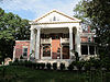 |
June 5, 1986 (#86001209) |
Roughly bounded by N. Highland, Seminole and Euclid, DeKalb, and Degress and Nashita Aves.; also roughly bounded by Cleburne, Moreland and DeKalb Aves., Battery Place, and a city park 33°45′50″N 84°21′07″W / 33.7639°N 84.3519°W | Atlanta | Extends into DeKalb County. Second set of boundaries represents a boundary increase of October 13, 2003 |
| 123 | Island Ford Lodge |  |
November 4, 2016 (#16000747) |
1978 Island Ford Parkway 33°59′14″N 84°19′31″W / 33.9872°N 84.3253°W | Sandy Springs | In the Chattahoochee River National Recreation Area. |
| 124 | King Plow Company |  |
March 28, 1996 (#96000337) |
887 W. Marietta St. 33°46′53″N 84°24′58″W / 33.7814°N 84.4161°W | Atlanta | |
| 125 | Martin Luther King, Jr., Historic District |  |
May 2, 1974 (#74000677) |
Bounded roughly by Irwin, Randolph, Edgewood, Jackson, and Auburn Aves.; also roughly bounded by Freedom Parkway, John Wesley Dobbs Ave., Decatur St., the former Southern railroad tracks, and Interstates 75/85 33°45′18″N 84°22′20″W / 33.755°N 84.3722°W | Atlanta | Second set of boundaries represents a boundary increase of June 12, 2001, is a National Historic Landmark |
| 126 | Martin Luther King, Jr., National Historic Site |  |
October 10, 1980 (#80000435) |
Roughly bounded by Courtland, Randolph, Chamberlain Sts. and Irwin Ave. 33°45′18″N 84°22′20″W / 33.755°N 84.3722°W | Atlanta | |
| 127 | M.C. Kiser Company Building | May 28, 2019 (#100003966) |
210 Pryor St. SW 33°44′57″N 84°23′34″W / 33.7491°N 84.3928°W | Atlanta | ||
| 128 | William and Ruth Knight Lustron House | March 18, 1996 (#96000208) |
9166 Northside Dr. 33°49′06″N 84°24′28″W / 33.8183°N 84.4078°W | Atlanta | A Lustron house | |
| 129 | Knox Apartments, Cauthorn House and Peachtree Road Apartments Historic District |  |
March 19, 1998 (#98000248) |
2214–2230 Peachtree Rd. 33°48′54″N 84°23′31″W / 33.815°N 84.3919°W | Atlanta | |
| 130 | Victor H. Kriegshaber House |  |
January 8, 1979 (#79000723) |
292 Moreland Ave., NE. 33°45′44″N 84°20′58″W / 33.7622°N 84.3494°W | Atlanta | |
| 131 | Lakewood Heights Historic District |  |
July 5, 2002 (#02000712) |
Junction of Jonesboro Rd. and Lakewood Ave. 33°42′23″N 84°22′53″W / 33.7064°N 84.3814°W | Atlanta | |
| 132 | Lindridge-Martin Manor Historic District | July 14, 2015 (#15000412) |
Roughly bounded by Armand Rd., NE., Lindridge, Melante, & Cardova Drs., NE., Armand Ct., NE. 33°49′07″N 84°21′22″W / 33.8187°N 84.356°W | Atlanta | ||
| 133 | Crawford W. Long Memorial Hospital |  |
September 1, 1988 (#88001465) |
35 Linden Ave., NE. 33°46′10″N 84°23′09″W / 33.7694°N 84.3858°W | Atlanta | Davis-Fischer Sanitarium (Crawford Long Hospital) designed by Atlanta architect Eugene C. Wachendorff in 1911. |
| 134 | Manuel's Tavern |  |
May 29, 2020 (#100005253) |
602 North Highland Ave. NE 33°46′15″N 84°21′09″W / 33.7708°N 84.3526°W | Atlanta | |
| 135 | Means Street Historic District | 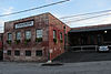 |
June 14, 2001 (#01000648) |
Bounded by Marietta St., Bankhead and Ponders Aves., and the Southern rail liNE. 33°46′22″N 84°24′18″W / 33.7728°N 84.405°W | Atlanta | |
| 136 | Medical Arts Building |  |
December 6, 2016 (#16000816) |
384 Peachtree St. NE. 33°45′54″N 84°23′09″W / 33.7649°N 84.3857°W | Atlanta | |
| 137 | Memorial to the Six Million |  |
April 21, 2008 (#08000351) |
1173 Cascade Ave. SW. 33°43′26″N 84°26′57″W / 33.7240°N 84.4491°W | Atlanta | |
| 138 | Kenneth and Hazel Meredith House | 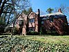 |
November 30, 2018 (#100003150) |
417 Hillside Dr. NW 33°52′12″N 84°24′03″W / 33.8699°N 84.4009°W | Atlanta | |
| 139 | Methodist Cemetery | April 2, 2021 (#100006327) |
100 Woodstock St. 34°01′47″N 84°21′25″W / 34.0296°N 84.3570°W | Atlanta | ||
| 140 | Methodist Center | June 9, 2023 (#100008493) |
159 Ralph McGill Blvd. NE 33°45′51″N 84°22′57″W / 33.7641°N 84.3825°W | Atlanta | ||
| 141 | Midtown Historic District |  |
February 12, 1999 (#99000161) |
Roughly bounded by 10th St., Ponce de Leon Ave., Piedmont Ave., and Lakeview Ave. 33°46′40″N 84°22′28″W / 33.7778°N 84.3744°W | Atlanta | |
| 142 | Mozley Park Historic District |  |
August 11, 1995 (#95000909) |
Roughly bounded by Westview Dr., West Lake Ave., Seaboard Coast Line RR tracks and M. L. King and Rockmart Dr. 33°45′04″N 84°26′14″W / 33.7511°N 84.4372°W | Atlanta | |
| 143 | National NuGrape Company |  |
December 20, 1996 (#96001502) |
794 Ralph McGill Boulevard 33°46′09″N 84°21′42″W / 33.7692°N 84.3617°W | Atlanta | |
| 144 | New Hope African Methodist Episcopal Church and Cemetery | 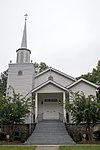 |
January 9, 2009 (#08001281) |
3012 Arden Rd., NW. 33°50′15″N 84°24′14″W / 33.8376°N 84.4039°W | Atlanta | |
| 145 | Newtown Elementary School |  |
August 30, 2006 (#06000739) |
3115 Old Alabama Rd. 34°01′14″N 84°16′08″W / 34.0206°N 84.2689°W | Johns Creek | |
| 146 | William P. Nicolson House |  |
March 25, 1977 (#77000432) |
821 Piedmont Ave. 33°46′36″N 84°22′52″W / 33.7767°N 84.3811°W | Atlanta | |
| 147 | North Avenue Presbyterian Church |  |
November 17, 1978 (#78000984) |
607 Peachtree Ave., NE. 33°46′16″N 84°23′04″W / 33.7711°N 84.3844°W | Atlanta | Designed by Bruce & Morgan. Built 1900. |
| 148 | Oakland Cemetery |  |
April 28, 1976 (#76000627) |
248 Oakland Ave., SE. 33°44′55″N 84°22′17″W / 33.7486°N 84.3714°W | Atlanta | |
| 149 | Oakland City Historic District |  |
April 11, 2003 (#03000198) |
Bounded by Donnelly St., Lee St., Campbellton Rd., and Ingram Rd., Cascade Ave., Westmont Rd., and Epworth Rd. 33°43′41″N 84°25′40″W / 33.7281°N 84.4278°W | Atlanta | |
| 150 | Odd Fellows Building and Auditorium |  |
May 2, 1975 (#75000594) |
228–250 Auburn Ave., NE. 33°45′20″N 84°22′46″W / 33.7556°N 84.3794°W | Atlanta | |
| 151 | Omega Chapter of the Chi Phi Fraternity |  |
June 17, 1982 (#82002419) |
720 Fowler St., NW. 33°46′27″N 84°23′38″W / 33.7742°N 84.3939°W | Atlanta | |
| 152 | J. K. Orr Shoe Company |  |
September 29, 1995 (#95001135) |
16 William Holmes Borders Sr. Ave. 33°45′14″N 84°22′29″W / 33.7539°N 84.3747°W | Atlanta | |
| 153 | Paces Ferry Tower | November 30, 2023 (#100009574) |
374 East Paces Ferry Road 33°50′20″N 84°22′30″W / 33.8390°N 84.3751°W | Atlanta | ||
| 154 | Palmer House and Phelan House Apartments |  |
October 27, 2004 (#04001182) |
952 Peachtree St. and 81 and 93 Peachtree Place 33°46′56″N 84°23′04″W / 33.7822°N 84.3844°W | Atlanta | |
| 155 | Park Street Methodist Episcopal Church, South | May 9, 1997 (#97000405) |
793 Park St., SW. 33°44′38″N 84°24′49″W / 33.7439°N 84.4136°W | Atlanta | ||
| 156 | Peachtree Center Historic District |  |
March 19, 2018 (#100002207) |
Roughly bounded by Andrew Young International Blvd, Peachtree Center Ave, Courtland St., Baker St, and Williams St. 33°45′40″N 84°23′15″W / 33.7610°N 84.3876°W | Atlanta | |
| 157 | Peachtree Christian Church |  |
May 17, 1984 (#84001082) |
1580 Peachtree St. NW. 33°47′48″N 84°23′22″W / 33.7967°N 84.3894°W | Atlanta | |
| 158 | Peachtree Heights Park | December 8, 1980 (#80004457) |
Peachtree, Habersham, and Wesley Rds., Andrews Dr., and Peachtree Battle Ave. 33°49′34″N 84°23′34″W / 33.8261°N 84.3928°W | Atlanta | ||
| 159 | Peachtree Highlands Historic District | June 5, 1986 (#86001252) |
Roughly bounded by Highland Dr., Martina Dr., E. Pace Ferry, and Piedmont Rds. 33°50′32″N 84°22′02″W / 33.8422°N 84.3672°W | Atlanta | Superseded in 2008 by the larger Peachtree Highlands-Peachtree Park Historic District | |
| 160 | Peachtree Highlands-Peachtree Park Historic District |  |
April 25, 2008 (#08000325) |
Roughly bounded by Piedmont & Peachtree Rds., GA 400 & MARTA N-S line. 33°50′08″N 84°21′50″W / 33.8355°N 84.3640°W | Atlanta | |
| 161 | Peachtree Southern Railway Station |  |
September 14, 1976 (#76000628) |
1688 Peachtree St., NW. 33°47′58″N 84°23′34″W / 33.7994°N 84.3927°W | Atlanta | Southern Railway's 1918 facility, named Peachtree Station but known locally as Brookwood Station, has been Atlanta's only long-distance passenger rail stop since 1970. Amtrak took over Southern's Crescent route in the '70s, which (as of 2015) continues to operate between New Orleans and N.Y. City. |
| 162 | Edward C. Peters House |  |
January 20, 1972 (#72000384) |
179 Ponce de Leon Ave. 33°46′51″N 84°22′50″W / 33.7808°N 84.3806°W | Atlanta | A Queen Anne style house |
| 163 | Piedmont Park |  |
May 13, 1976 (#76000629) |
Bounded by 10th St., Southern Rwy. and Piedmont Rd. 33°47′17″N 84°22′27″W / 33.7881°N 84.3742°W | Atlanta | |
| 164 | Piedmont Park Apartments |  |
October 28, 2003 (#03001104) |
266 11th St. 33°46′58″N 84°22′43″W / 33.7827°N 84.3786°W | Atlanta | Designed by Leila Ross Wilburn |
| 165 | Thomas H. Pitts House and Dairy | June 27, 1979 (#79000724) |
3105 Cascade Rd., SW. 33°43′16″N 84°29′22″W / 33.7211°N 84.4894°W | Atlanta | ||
| 166 | Pittsburgh Historic District | June 14, 2006 (#06000503) |
Roughly bordered by Shelton Ave. Stewart Ave., University Ave., and the RR 33°43′44″N 84°24′07″W / 33.7289°N 84.4019°W | Atlanta | ||
| 167 | William G. Raoul House | December 15, 1986 (#86003298) |
848 Peachtree St. 33°46′40″N 84°23′06″W / 33.7778°N 84.385°W | Atlanta | ||
| 168 | Retail Credit Company Home Office Building |  |
January 8, 1980 (#80001076) |
90 Fairlie St., SW. 33°45′25″N 84°23′24″W / 33.7569°N 84.39°W | Atlanta | |
| 169 | Reynoldstown Historic District |  |
April 3, 2003 (#02001405) |
Roughly bounded by the CSX rail line, Memorial Dr., Pearl St., and Moreland 33°45′07″N 84°21′16″W / 33.7519°N 84.3544°W | Atlanta | |
| 170 | Rhodes Memorial Hall |  |
March 1, 1974 (#74000678) |
1516 Peachtree St. 33°47′45″N 84°23′18″W / 33.7958°N 84.3883°W | Atlanta | |
| 171 | Rhodes-Haverty Building |  |
January 19, 1979 (#79000725) |
134 Peachtree St., NW. 33°45′26″N 84°23′17″W / 33.7572°N 84.3881°W | Atlanta | Architects: Pringle and Smith (1929) |
| 172 | Isaac Roberts House |  |
April 10, 2008 (#08000262) |
9725 Roberts Dr. 34°00′12″N 84°20′55″W / 34.0032°N 84.3486°W | Sandy Springs | [5] |
| 173 | Rock Spring Presbyterian Church |  |
May 24, 1990 (#90000804) |
1824 Piedmont Ave. NE. 33°48′17″N 84°22′05″W / 33.8047°N 84.3681°W | Atlanta | |
| 174 | Roscoe-Dunaway Gardens Historic District |  |
December 6, 1996 (#96001414) |
Roughly bounded by the Chattahoochee R., Cedar Cr., Hood Branch, and White Oak Cr. 33°29′54″N 84°50′00″W / 33.4983°N 84.8333°W | Roscoe | |
| 175 | Rufus M. Rose House |  |
September 20, 1977 (#77000433) |
537 Peachtree St. 33°46′08″N 84°23′05″W / 33.7689°N 84.3847°W | Atlanta | Designed by architect Emil Charles Seiz. Built in 1901. Late Victorian/simplified Queen-Anne. Rare 19th-century town house of the affluent. Tiny yard is singular survivor from Peachtree Road's residential heyday. |
| 176 | F.H. Ross & Company Laundry Warehouse | December 17, 2020 (#100005906) |
833 Memorial Dr. 33°44′48″N 84°21′37″W / 33.7466°N 84.3603°W | Atlanta | ||
| 177 | Roswell Historic District |  |
May 2, 1974 (#74000682) |
Roughly bounded by Big Creek, King and Dam Sts., SW along New Marietta Hwy. 34°00′54″N 84°21′42″W / 34.015°N 84.3617°W | Roswell | Historic district including Roswell's town square, with 28 contributing buildings. |
| 178 | Simeon and Jane Rucker Log House |  |
April 18, 1997 (#97000353) |
755 Old Rucker Rd. 34°04′43″N 84°20′23″W / 34.0786°N 84.3397°W | Alpharetta | |
| 179 | St. Andrews Apartments |  |
June 13, 1986 (#86001260) |
1041 W. Peachtree St. 33°47′04″N 84°23′14″W / 33.7844°N 84.3872°W | Atlanta | |
| 180 | St. Mark Methodist Church |  |
November 2, 1987 (#87001911) |
781 Peachtree St. 33°46′37″N 84°23′02″W / 33.7769°N 84.3839°W | Atlanta | Architect: Willis Franklin Denny. Built 1902-1903. |
| 181 | Sardis Methodist Church and Cemetery |  |
October 9, 2012 (#12000840) |
3725 Powers Ferry Road 33°51′27″N 84°23′01″W / 33.8575°N 84.3836°W | Atlanta | |
| 182 | Charles E. Sciple House | March 1, 1984 (#84001084) |
1112 Peachtree St. 33°47′06″N 84°23′00″W / 33.785°N 84.3833°W | Atlanta | ||
| 183 | Sears, Roebuck and Co. Mail-Order Warehouse and Retail Store |  |
November 15, 2016 (#16000769) |
675 Ponce de Leon Ave., NE. 33°46′23″N 84°21′58″W / 33.7731°N 84.3660°W | Atlanta | Now Ponce City Market |
| 184 | Selig Company Building |  |
February 22, 1996 (#96000158) |
330–346 Marietta St. 33°45′43″N 84°23′49″W / 33.7619°N 84.3969°W | Atlanta | |
| 185 | Shrine of the Immaculate Conception |  |
December 12, 1976 (#76000630) |
48 Hunter St., SW. 33°45′01″N 84°23′22″W / 33.7503°N 84.3894°W | Atlanta | |
| 186 | Archibald Smith House |  |
August 30, 2006 (#06000740) |
935 Alpharetta St. 34°01′26″N 84°21′36″W / 34.0239°N 84.36°W | Roswell | |
| 187 | Tullie Smith House |  |
November 20, 1970 (#70000204) |
3099 Andrews Dr., NW. 33°50′26″N 84°23′08″W / 33.8406°N 84.3856°W | Atlanta | |
| 188 | Southern Bell Telephone Company Building | 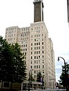 |
December 1, 1978 (#78000985) |
51 Ivy St., NE. 33°45′20″N 84°23′08″W / 33.7556°N 84.3856°W | Atlanta | |
| 189 | Southern Belting Company Building |  |
August 10, 1988 (#88001174) |
236 Forsyth St., SW. 33°44′53″N 84°23′48″W / 33.7481°N 84.3967°W | Atlanta | |
| 190 | Southern Dairies |  |
August 21, 2002 (#02000872) |
593 Glen Iris Dr. 33°46′21″N 84°22′03″W / 33.7725°N 84.3675°W | Atlanta | |
| 191 | Southern Railway North Avenue Yards Historic District | July 16, 2002 (#02000539) |
539 John St. NW. 33°46′09″N 84°24′00″W / 33.7692°N 84.4°W | Atlanta | ||
| 192 | Southern Spring Bed Company | 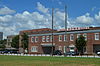 |
March 1, 2007 (#07000088) |
300 Martin Luther King Jr. Dr. 33°44′57″N 84°22′33″W / 33.7492°N 84.3758°W | Atlanta | |
| 193 | Sperry & Hutchinson Company Warehouse | February 25, 2021 (#100006164) |
2181 Sylvan Rd. 33°41′42″N 84°25′08″W / 33.695°N 84.4189°W | East Point | ||
| 194 | Spotswood Hall | February 5, 2002 (#01001556) |
555 Argonne Dr., NW. 33°50′13″N 84°24′19″W / 33.8369°N 84.4053°W | Atlanta | ||
| 195 | Staff Row and Old Post Area-Fort McPherson | November 5, 1974 (#74000679) |
NE corner of Fort McPherson; also 1777 Hardee Avenue 33°42′40″N 84°25′50″W / 33.7111°N 84.4306°W | Atlanta | Second set of boundaries represents a boundary increase of September 6, 2013 | |
| 196 | Stewart Avenue Methodist Episcopal Church South |  |
March 2, 1989 (#89000154) |
867 Stewart Ave., SW. 33°43′52″N 84°24′30″W / 33.7311°N 84.4083°W | Atlanta | |
| 197 | Stone Hall, Atlanta University |  |
December 2, 1974 (#74000680) |
Morris-Brown College campus 33°45′16″N 84°24′31″W / 33.7544°N 84.4086°W | Atlanta | National Historic Landmark |
| 198 | Stonewall Park Historic District | December 10, 2020 (#100005890) |
Roughly Gift, Lytle, Florida, Sanders, and Glenwood Aves. SE, portions of Hemlock Cir. 33°44′28″N 84°21′09″W / 33.7411°N 84.3524°W | Atlanta | ||
| 199 | Swan House |  |
September 13, 1977 (#77000434) |
3099 Andrews Dr., NW. 33°50′25″N 84°23′17″W / 33.8403°N 84.3881°W | Atlanta | |
| 200 | Sweet Auburn Historic District |  |
December 8, 1976 (#76000631) |
Auburn Ave. 33°45′14″N 84°22′52″W / 33.7539°N 84.3811°W | Atlanta | National Historic Landmark |
| 201 | Techwood Homes Historic District |  |
June 29, 1976 (#76000632) |
Roughly bounded by North Ave., Parker, Williams, and Lovejoy Sts. 33°46′04″N 84°23′30″W / 33.7678°N 84.3917°W | Atlanta | |
| 202 | The Temple |  |
September 9, 1982 (#82002420) |
1589 Peachtree St. 33°47′52″N 84°23′21″W / 33.7978°N 84.3892°W | Atlanta | |
| 203 | The Texas |  |
June 19, 1973 (#73002234) |
Cyclorama Bldg., Grant Park 33°44′02″N 84°22′15″W / 33.7339°N 84.3708°W | Atlanta | Steam locomotive that chased in the Great Locomotive Chase |
| 204 | Albert E. Thornton House | December 8, 1980 (#80004458) |
105 W. Paces Ferry Rd. 33°50′41″N 84°23′27″W / 33.8447°N 84.3908°W | Atlanta | ||
| 205 | Thorton Building | 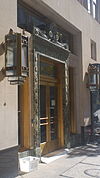 |
February 23, 1984 (#84001107) |
10 Pryor St. (10 Park Place South) 33°45′15″N 84°23′19″W / 33.7542°N 84.3886°W | Atlanta | |
| 206 | Henry B. Tompkins House |  |
December 12, 1976 (#76000633) |
125 W. Wesley Rd., NW. 33°49′44″N 84°23′29″W / 33.8289°N 84.3914°W | Atlanta | |
| 207 | Trio Steam Laundry | 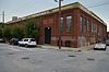 |
September 18, 1997 (#97001122) |
19 Hilliard St. 33°41′32″N 84°22′46″W / 33.6922°N 84.3794°W | Atlanta | |
| 208 | Troy Peerless Laundry Building |  |
September 9, 1999 (#99001100) |
650 Glen Iris Dr. 33°46′32″N 84°22′05″W / 33.7756°N 84.3681°W | Atlanta | |
| 209 | Trust Company of Georgia Northeast Freeway Branch |  |
February 20, 2018 (#100002093) |
2160 Monroe Dr. NE 33°48′39″N 84°22′12″W / 33.8108°N 84.3700°W | Atlanta | Built in 1962[6] |
| 210 | Trygveson | December 8, 1980 (#80004241) |
3418 Pinestream Rd., NW. 33°50′54″N 84°25′21″W / 33.8483°N 84.4225°W | Atlanta | ||
| 211 | Mary Elizabeth Tyler House | January 30, 2006 (#05001598) |
2887 Howell Mill Rd. 33°50′02″N 84°25′03″W / 33.8339°N 84.4175°W | Atlanta | ||
| 212 | Tyree Building |  |
July 15, 1982 (#82002421) |
679 Durant Pl., NE. 33°46′23″N 84°22′31″W / 33.7731°N 84.3753°W | Atlanta | |
| 213 | U.S. Post Office and Courthouse |  |
May 2, 1974 (#74000681) |
76 Forsyth St. 33°45′23″N 84°23′25″W / 33.7564°N 84.3903°W | Atlanta | Many key cases from the civil rights movement first heard here, is a National Historic Landmark |
| 214 | Underground Atlanta Historic District |  |
July 24, 1980 (#80001077) |
Roughly bounded by Martin Luther King Jr. Dr., Central Ave., Wall and Peachtree Sts. 33°45′07″N 84°23′21″W / 33.7519°N 84.3892°W | Atlanta | |
| 215 | United States Post Office, Federal Annex |  |
February 10, 2006 (#04001217) |
77 Forsyth St. 33°45′16″N 84°23′40″W / 33.7544°N 84.3944°W | Atlanta | |
| 216 | Utoy Cemetery |  |
February 23, 2015 (#15000025) |
1465 Cahaba Dr. 33°42′57″N 84°26′59″W / 33.7158°N 84.4498°W | Atlanta | |
| 217 | E. Van Winkle Gin and Machine Works |  |
September 10, 1979 (#79000726) |
Foster St. 33°47′08″N 84°24′59″W / 33.7856°N 84.4164°W | Atlanta | Goat Farm Arts Center |
| 218 | Villa Lamar | June 8, 1988 (#88001152) |
801 West Paces Ferry Rd. 33°51′01″N 84°24′47″W / 33.8503°N 84.4131°W | Atlanta | ||
| 219 | Virginia-Highland Historic District |  |
May 10, 2005 (#05000402) |
Roughly bounded by Amsterdam Ave., Rosedale Rd., Ponce de Leon Ave., and the Norfolk Southern Railroad 33°46′59″N 84°21′25″W / 33.7831°N 84.3569°W | Atlanta | |
| 220 | Anne Wallace Branch-Carnegie Library of Atlanta |  |
December 4, 2003 (#03001223) |
523 Luckie St. NW. 33°46′14″N 84°23′46″W / 33.7706°N 84.3961°W | Atlanta | |
| 221 | Washington Carver Homes | January 18, 2023 (#100008543) |
1100 Washington Cir. 33°40′33″N 84°25′42″W / 33.6757°N 84.4283°W | East Point | ||
| 222 | Washington Park Historic District | February 28, 2000 (#00000071) |
Junction of Martin Luther King Jr. Dr. and Ashby St. 33°45′36″N 84°25′16″W / 33.76°N 84.4211°W | Atlanta | ||
| 223 | Booker T. Washington High School |  |
March 18, 1986 (#86000437) |
45 Whitehouse Dr. SW. 33°45′12″N 84°25′18″W / 33.7533°N 84.4217°W | Atlanta | |
| 224 | West End Historic District |  |
February 25, 1999 (#97000621) |
Roughly Bounded by US 20, Lee, White, and Langhorn Sts. 33°44′16″N 84°25′23″W / 33.7378°N 84.4231°W | Atlanta | |
| 225 | Western Electric Company Building |  |
November 8, 2000 (#00001329) |
820 Ralph McGill Boulevard 33°46′11″N 84°21′40″W / 33.7697°N 84.3611°W | Atlanta | |
| 226 | Westinghouse Electric Company Building |  |
February 9, 2001 (#01000080) |
426 Marietta St., NW. 33°46′00″N 84°23′52″W / 33.7667°N 84.3978°W | Atlanta | |
| 227 | Westview Cemetery |  |
June 4, 2020 (#100005254) |
1680 Ralph David Abernathy Blvd. SW 33°44′46″N 84°26′35″W / 33.7462°N 84.4431°W | Atlanta | |
| 228 | Whitehall Street Retail Historic District |  |
August 6, 2020 (#100005409) |
Centered on Peachtree St. and Martin Luther King Jr. Dr. including Forsyth, Broad, Peachtree, and Mitchell Sts. 33°45′08″N 84°23′32″W / 33.7522°N 84.3921°W | Atlanta | |
| 229 | Whittier Mills Historic District |  |
September 13, 2001 (#01000972) |
Roughly the junction of Bolton Rd. and Parrot Ave., approximately 7 miles (11 km) northwest of the central business district of Atlanta 33°48′42″N 84°29′01″W / 33.8117°N 84.4836°W | Atlanta | |
| 230 | Winecoff Hotel |  |
March 31, 2009 (#09000185) |
179 Peachtree Street, NW. 33°49′30″N 84°23′16″W / 33.8249°N 84.3878°W | Atlanta | |
| 231 | Winnwood Apartments |  |
April 15, 2021 (#100006379) |
1460 West Peachtree St. NW. 33°47′40″N 84°23′17″W / 33.7945°N 84.3881°W | Atlanta | |
| 232 | George Jr. and Emily Winship House | May 10, 2005 (#05000404) |
2626 Brookwood Dr., NE. 33°49′40″N 84°22′53″W / 33.8278°N 84.3814°W | Atlanta | ||
| 233 | Stuart Witham House | December 22, 1978 (#78000986) |
2922 Andrews Dr., NW. 33°50′06″N 84°23′35″W / 33.835°N 84.3931°W | Atlanta | ||
| 234 | Wynne-Claughton Building |  |
March 26, 2012 (#12000148) |
141 Carnegie Way, NW. 33°45′30″N 84°23′18″W / 33.7582°N 84.3882°W | Atlanta | |
| 235 | Yonge Street School |  |
January 24, 1980 (#80001079) |
89 Yonge St. 33°45′06″N 84°22′31″W / 33.7517°N 84.3753°W | Atlanta |
Former listings edit
| [2] | Name on the Register | Image | Date listed | Date removed | Location | City or town | Description |
|---|---|---|---|---|---|---|---|
| 1 | Carnegie Library of Atlanta |  |
October 22, 1976 (#76000624) | October 26, 1977 | 126 Carnegie Way, NW | Atlanta | Demolished in 1977 to build the current Atlanta Central Library. |
| 2 | Glenridge Hall | June 17, 1982 (#82002418) | September 17, 2015 | 6615 Glenridge Dr. 33°56′09″N 84°21′50″W / 33.935833°N 84.363889°W | Sandy Springs | Demolished April 9, 2015[7] | |
| 3 | Hillyer Trust Building | July 25, 1977 (#77000430) | April 8, 1980 | 140 Peachtree St. | Atlanta | Delisted due to the removal of the top 5 floors of the building in 1978. | |
| 4 | Western and Atlantic Railroad Zero Milepost |  |
September 19, 1977 (#77000435) | April 26, 2019 | Central Ave. between Wall St. and Railroad Ave. 33°45′08″N 84°23′19″W / 33.752222°N 84.388611°W | Atlanta | |
| 5 | Judge William Wilson House |  |
February 15, 1980 (#80001078) | November 27, 2020 | 501 Fairburn Rd., SW. 33°44′46″N 84°30′41″W / 33.7461°N 84.5114°W | Atlanta | Demolished. |
See also edit
Wikimedia Commons has media related to National Register of Historic Places in Fulton County, Georgia.
References edit
- ^ National Park Service, United States Department of the Interior, "National Register of Historic Places: Weekly List Actions", retrieved April 19, 2024.
- ^ a b Numbers represent an alphabetical ordering by significant words. Various colorings, defined here, differentiate National Historic Landmarks and historic districts from other NRHP buildings, structures, sites or objects.
- ^ The eight-digit number below each date is the number assigned to each location in the National Register Information System database, which can be viewed by clicking the number.
- ^ Kahn, Michael (January 11, 2018). "Entire Midtown block bulldozed for massive mixed-use project". Curbed Atlanta. Retrieved July 20, 2018.
- ^ Article about this house and others\
- ^ announcement
- ^ 11Alive Staff, WXIA. "Glenridge Hall demolished". 11Alive. Gannett Satellite Information Network. Archived from the original on April 10, 2015. Retrieved May 3, 2015.
{{cite web}}: CS1 maint: numeric names: authors list (link)