
KNOWPIA
WELCOME TO KNOWPIA

National Register of Historic Places listings in Grenada County, Mississippi 
Summary
This is a list of the National Register of Historic Places listings in Grenada County, Mississippi.

This is intended to be a complete list of the properties and districts on the National Register of Historic Places in Grenada County, Mississippi, United States. Latitude and longitude coordinates are provided for many National Register properties and districts; these locations may be seen together in a map.[1]
There are 16 properties and districts listed on the National Register in the county.
This National Park Service list is complete through NPS recent listings posted April 12, 2024.[2]
Current listings edit
| [3] | Name on the Register[4] | Image | Date listed[5] | Location | City or town | Description |
|---|---|---|---|---|---|---|
| 1 | Confederate Earthworks | July 2, 1973 (#73001008) |
West of Grenada off Mississippi Highway 8 33°47′46″N 89°46′23″W / 33.796111°N 89.773056°W | Grenada | ||
| 2 | Confederate Redoubt |  |
May 29, 2015 (#15000296) |
Springhill Rd. 33°46′36″N 89°49′11″W / 33.776635°N 89.819641°W | Grenada | |
| 3 | Evergreen Plantation |  |
October 18, 1977 (#77000786) |
4 miles north of Grenada on Hardy Rd. 33°50′10″N 89°50′38″W / 33.836111°N 89.843889°W | Grenada | |
| 4 | Glenwild Plantation Manager's House |  |
May 12, 1999 (#99000499) |
3557 U.S. Highway 51, S. 33°43′11″N 89°46′49″W / 33.719722°N 89.780278°W | Grenada | |
| 5 | Grenada Bank |  |
November 28, 1978 (#78001598) |
223 1st St. 33°47′02″N 89°48′07″W / 33.783889°N 89.801944°W | Grenada | |
| 6 | Grenada Downtown Historic District |  |
September 10, 2014 (#14000563) |
Bounded by Pearl, Mound, 2nd, South, Lynch & Doak Sts. 33°47′04″N 89°48′09″W / 33.7845°N 89.8025°W | Grenada | |
| 7 | Grenada Masonic Temple |  |
January 20, 1988 (#87002307) |
210 S. Main St. 33°46′58″N 89°48′09″W / 33.782778°N 89.8025°W | Grenada | |
| 8 | Illinois Central Depot |  |
April 7, 1988 (#87002308) |
643 1st St. 33°46′57″N 89°47′51″W / 33.7825°N 89.7975°W | Grenada | Now used by the Grenada Railroad. |
| 9 | Lee-Dubard House | January 20, 1988 (#87002312) |
317 3rd St. 33°46′53″N 89°48′08″W / 33.78145°N 89.80210°W | Grenada | ||
| 10 | Margin St. Historic District | 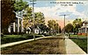 |
April 7, 1988 (#87002338) |
Margin St. and part of Line St. between Commerce and Green Sts. 33°46′57″N 89°48′25″W / 33.7825°N 89.806944°W | Grenada | |
| 11 | Odd Fellows and Confederate Cemetery |  |
January 20, 1988 (#87002341) |
Corner of Cemetery and Commerce Sts. 33°46′28″N 89°48′39″W / 33.774444°N 89.810833°W | Grenada | |
| 12 | Providence Cemetery |  |
October 2, 1991 (#91001423) |
Providence Rd. east of Grenada 33°42′53″N 89°37′04″W / 33.714722°N 89.617778°W | Grenada | |
| 13 | South Main Historic District | 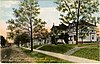 |
January 20, 1988 (#87002345) |
S. Main St. 33°46′51″N 89°48′13″W / 33.780833°N 89.803611°W | Grenada | |
| 14 | US Post Office-Grenada |  |
January 9, 1985 (#85000117) |
178 S. Main St. 33°47′00″N 89°48′09″W / 33.78335°N 89.80241°W | Grenada | |
| 15 | Sen. Edward C. Walthall House |  |
January 20, 1988 (#87002349) |
73 College Boulevard 33°46′40″N 89°48′14″W / 33.777778°N 89.803889°W | Grenada | |
| 16 | Wild Wings Mounds (22Gr713) | December 14, 1988 (#88002704) |
Address restricted[6] | Holcomb |
See also edit
Wikimedia Commons has media related to National Register of Historic Places in Grenada County, Mississippi.
References edit
- ^ The latitude and longitude information provided in this table was derived originally from the National Register Information System, which has been found to be fairly accurate for about 99% of listings. Some locations in this table may have been corrected to current GPS standards.
- ^ National Park Service, United States Department of the Interior, "National Register of Historic Places: Weekly List Actions", retrieved April 12, 2024.
- ^ Numbers represent an alphabetical ordering by significant words. Various colorings, defined here, differentiate National Historic Landmarks and historic districts from other NRHP buildings, structures, sites or objects.
- ^ "National Register Information System". National Register of Historic Places. National Park Service. March 13, 2009.
- ^ The eight-digit number below each date is the number assigned to each location in the National Register Information System database, which can be viewed by clicking the number.
- ^ Federal and state laws and practices restrict general public access to information regarding the specific location of this resource. In some cases, this is to protect archeological sites from vandalism, while in other cases it is restricted at the request of the owner. See: Knoerl, John; Miller, Diane; Shrimpton, Rebecca H. (1990), Guidelines for Restricting Information about Historic and Prehistoric Resources, National Register Bulletin, National Park Service, U.S. Department of the Interior, OCLC 20706997.