
KNOWPIA
WELCOME TO KNOWPIA

National Register of Historic Places listings in James City County, Virginia 
Summary
This is a list of the National Register of Historic Places listings in James City County, Virginia.

This is intended to be a complete list of the properties and districts on the National Register of Historic Places in James City County, Virginia, United States. The locations of National Register properties and districts for which the latitude and longitude coordinates are included below, may be seen in an online map.[1]
There are 19 properties and districts listed on the National Register in the county, including one National Historic Landmark.
This National Park Service list is complete through NPS recent listings posted April 12, 2024.[2]
Current listings edit
| [3] | Name on the Register[4] | Image | Date listed[5] | Location | City or town | Description |
|---|---|---|---|---|---|---|
| 1 | Amblers |  |
February 17, 2015 (#15000016) |
2205 State Route 31 37°13′36″N 76°47′14″W / 37.226667°N 76.787222°W | Jamestown | |
| 2 | Archeological Site No. 44JC308 | June 26, 1993 (#93000507) |
18th hole at the Two Rivers Country Club[6] 37°14′55″N 76°52′18″W / 37.248611°N 76.871667°W | Williamsburg | Paspahegh settlement site | |
| 3 | Carter's Grove |  |
November 12, 1969 (#69000249) |
Southwest of U.S. Route 60 37°12′25″N 76°37′29″W / 37.206944°N 76.624722°W | Williamsburg | Georgian country house and plantation near Williamsburg, recently closed and sold to a private owner |
| 4 | Chickahominy Shipyard Archeological Site | June 28, 1979 (#79003048) |
Address Restricted | Toano | ||
| 5 | Colonial National Historical Park |  |
October 15, 1966 (#66000839) |
Colonial Parkway 37°13′15″N 76°46′16″W / 37.220833°N 76.771111°W | Jamestown | |
| 6 | Croaker Landing Archaeological Site (44JC70) |  |
May 14, 1987 (#87000753) |
Address Restricted | Croaker | |
| 7 | Governor's Land Archeological District | 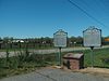 |
September 21, 1973 (#73002025) |
Roughly bounded by Powhatan Creek, State Route 5, Greensprings Rd., the First Colony community, and the James River[7]: 24 37°14′06″N 76°46′57″W / 37.235000°N 76.782500°W | Jamestown | |
| 8 | Green Spring |  |
December 29, 1978 (#78000261) |
Centerville Rd.[7]: 19 37°15′30″N 76°48′12″W / 37.258333°N 76.803333°W | Williamsburg | |
| 9 | Hickory Neck Church |  |
July 2, 1973 (#73002023) |
North of Toano on U.S. Route 60 37°23′35″N 76°48′11″W / 37.393056°N 76.803056°W | Toano | |
| 10 | Jamestown National Historic Site |  |
October 15, 1966 (#66000840) |
Jamestown Island 37°12′31″N 76°46′42″W / 37.208611°N 76.778333°W | Jamestown | |
| 11 | Kingsmill Plantation |  |
April 26, 1972 (#72001401) |
Kingsmill Resort, 5 miles (8.0 km) south of Williamsburg 37°13′43″N 76°40′35″W / 37.228611°N 76.676389°W | Williamsburg | |
| 12 | Norge Train Depot |  |
May 5, 2009 (#08000256) |
7770 Croaker Rd. 37°22′36″N 76°46′17″W / 37.376667°N 76.771389°W | Williamsburg | |
| 13 | Pinewoods |  |
November 12, 1971 (#71000983) |
1.4 miles (2.3 km) southwest of the junction of Centerville and Brick Bat Rds. 37°16′21″N 76°49′32″W / 37.272500°N 76.825694°W | Lightfoot | |
| 14 | Powhatan |  |
September 15, 1970 (#70000803) |
Ironbound Rd., north of its junction with State Route 5 37°15′47″N 76°46′09″W / 37.263056°N 76.769167°W | Five Forks | |
| 15 | Riverview |  |
December 6, 1996 (#96001446) |
124 Riverview Plantation Dr. 37°23′08″N 76°41′12″W / 37.385556°N 76.686528°W | Williamsburg | |
| 16 | Stone House Site | August 14, 1973 (#73002024) |
Address Restricted | Toano | ||
| 17 | Toano Historic District | 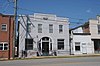 |
April 3, 2019 (#100003605) |
7852-7960 Richmond Rd. 37°22′47″N 76°48′13″W / 37.3797°N 76.8037°W | Toano | |
| 18 | White Hall |  |
March 30, 2007 (#07000234) |
3200 Rochambeau Rd. 37°24′07″N 76°48′17″W / 37.401944°N 76.804722°W | Toano | |
| 19 | Windsor Castle |  |
December 14, 1987 (#87002149) |
1812 Forge Rd. 37°22′33″N 76°51′15″W / 37.375833°N 76.854167°W | Toano |
See also edit
Wikimedia Commons has media related to National Register of Historic Places in James City County, Virginia.
References edit
- ^ The latitude and longitude information provided in this table was derived originally from the National Register Information System, which has been found to be fairly accurate for about 99% of listings. Some locations in this table may have been corrected to current GPS standards.
- ^ National Park Service, United States Department of the Interior, "National Register of Historic Places: Weekly List Actions", retrieved April 12, 2024.
- ^ Numbers represent an alphabetical ordering by significant words. Various colorings, defined here, differentiate National Historic Landmarks and historic districts from other NRHP buildings, structures, sites or objects.
- ^ "National Register Information System". National Register of Historic Places. National Park Service. April 24, 2008.
- ^ The eight-digit number below each date is the number assigned to each location in the National Register Information System database, which can be viewed by clicking the number.
- ^ Governor's Land, A Part of History, Governor's Land at Two Rivers, n.d. Accessed 2017-08-16 via archive.org.
- ^ a b Green Spring Colonial National Historical Park : Final General Management Plan Amendment and Abbreviated Final Environmental Impact Statement. Washington, D.C.: National Park Service, 2003.