
KNOWPIA
WELCOME TO KNOWPIA

National Register of Historic Places listings in Madison Parish, Louisiana 
Summary
This is a list of the National Register of Historic Places listings in Madison Parish, Louisiana.

This is intended to be a complete list of the properties on the National Register of Historic Places in Madison Parish, Louisiana, United States. The locations of National Register properties for which the latitude and longitude coordinates are included below, may be seen in a map.[1]
There are 14 properties listed on the National Register in the parish.
This National Park Service list is complete through NPS recent listings posted April 12, 2024.[2]
Current listings edit
| [3] | Name on the Register | Image | Date listed[4] | Location | City or town | Description |
|---|---|---|---|---|---|---|
| 1 | Bear Lake Club, Ltd. Clubhouse | March 2, 2001 (#01000118) |
Along Bear Lake Road West, about 6.2 miles (10.0 km) northwest of Tallulah 32°28′02″N 91°16′03″W / 32.46721°N 91.26741°W | Tallulah vicinity | ||
| 2 | Bloom's Arcade | January 19, 1989 (#88003214) |
102 Depot Street 32°24′35″N 91°11′28″W / 32.40986°N 91.1911°W | Tallulah | ||
| 3 | Crescent Plantation | 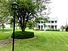 |
October 18, 1984 (#84000144) |
Along LA 602, about 3 miles (4.8 km) southeast of Tallulah, Louisiana 32°22′07″N 91°09′52″W / 32.36851°N 91.16436°W | Tallulah vicinity | |
| 4 | Hermione |  |
November 23, 1998 (#98001422) |
305 North Mulberry Street 32°24′35″N 91°11′06″W / 32.40967°N 91.18503°W | Tallulah | Originally listed in 1988 as ref #88002652. Relisted in 1998 when the building was moved from its original location into Tallulah. Now a historical society museum. |
| 5 | Kell House | June 23, 1988 (#88000900) |
502 North Mulberry Street 32°24′39″N 91°11′01″W / 32.41076°N 91.18352°W | Tallulah | ||
| 6 | Madison Parish Courthouse |  |
February 21, 1989 (#89000044) |
100 North Cedar Street 32°24′30″N 91°11′15″W / 32.40825°N 91.18746°W | Tallulah | |
| 7 | Mississippi River Bridge |  |
February 14, 1989 (#88002423) |
Spans the Mississippi River on Old U.S. Route 80 32°18′53″N 90°54′21″W / 32.31483°N 90.90575°W | Delta | Extends into Warren County, Mississippi |
| 8 | Montrose Plantation House |  |
October 5, 1982 (#82000444) |
Along LA 603, about 6.5 miles (10.5 km) southeast of Tallulah 32°19′24″N 91°08′28″W / 32.32336°N 91.14115°W | Tallulah vicinity | |
| 9 | Scottland Plantation House |  |
November 2, 1982 (#82000445) |
903 Bayou Drive 32°24′08″N 91°11′45″W / 32.40228°N 91.19574°W | Tallulah | |
| 10 | Shirley Field | February 14, 1985 (#85000270) |
Along Airport Road, about 2.2 miles (3.5 km) east of Tallulah 32°24′59″N 91°09′03″W / 32.41625°N 91.15076°W | Tallulah vicinity | ||
| 11 | Tallulah Book Club Building | November 7, 1991 (#91001660) |
515 Dabney Street 32°24′22″N 91°11′14″W / 32.40624°N 91.18731°W | Tallulah | ||
| 12 | Tallulah Coca-Cola Bottling Plant | January 23, 2013 (#12001205) |
Corner of North Plum Street and East Green Street 32°24′26″N 91°11′04″W / 32.40727°N 91.18454°W | Tallulah | ||
| 13 | Tallulah Men's Club Building | November 7, 1991 (#91001658) |
108 North Cedar Street 32°24′28″N 91°11′12″W / 32.4079°N 91.18677°W | Tallulah | ||
| 14 | Francis Thompson Site (16 MA 112) | October 8, 1991 (#91001464) |
Address restricted[5] | Delhi vicinity |
See also edit
Wikimedia Commons has media related to National Register of Historic Places in Madison Parish, Louisiana.
References edit
- ^ The latitude and longitude information provided in this table was derived originally from the National Register Information System, which has been found to be fairly accurate for about 99% of listings. Some locations in this table may have been corrected to current GPS standards.
- ^ National Park Service, United States Department of the Interior, "National Register of Historic Places: Weekly List Actions", retrieved April 12, 2024.
- ^ Numbers represent an alphabetical ordering by significant words. Various colorings, defined here, differentiate National Historic Landmarks and historic districts from other NRHP buildings, structures, sites or objects.
- ^ The eight-digit number below each date is the number assigned to each location in the National Register Information System database, which can be viewed by clicking the number.
- ^ Federal and state laws and practices restrict general public access to information regarding the specific location of this resource. In some cases, this is to protect archeological sites from vandalism, while in other cases it is restricted at the request of the owner. See: Knoerl, John; Miller, Diane; Shrimpton, Rebecca H. (1990), Guidelines for Restricting Information about Historic and Prehistoric Resources, National Register Bulletin, National Park Service, U.S. Department of the Interior, OCLC 20706997.