
KNOWPIA
WELCOME TO KNOWPIA

National Register of Historic Places listings in Marion County, South Carolina 
Summary
This is a list of the National Register of Historic Places listings in Marion County, South Carolina.

This is intended to be a complete list of the properties and districts on the National Register of Historic Places in Marion County, South Carolina, United States. The locations of National Register properties and districts for which the latitude and longitude coordinates are included below, may be seen in a map.[1]
There are 13 properties and districts listed on the National Register in the county, including 2 National Historic Landmarks. An additional 2 properties were once listed, but have been removed.
This National Park Service list is complete through NPS recent listings posted April 12, 2024.[2]
Current listings edit
| [3] | Name on the Register[4] | Image | Date listed[5] | Location | City or town | Description |
|---|---|---|---|---|---|---|
| 1 | A.H. Buchan Company Building |  |
August 3, 1984 (#84003817) |
Laurel St. 34°12′13″N 79°15′12″W / 34.203611°N 79.253333°W | Mullins | |
| 2 | Dew Barn | August 3, 1984 (#84003818) |
Northwest of Zion 34°17′04″N 79°21′29″W / 34.284444°N 79.358056°W | Zion | ||
| 3 | Dillard Barn |  |
September 28, 2005 (#05001101) |
719 Virginia Dr. 34°10′04″N 79°14′09″W / 34.167778°N 79.235833°W | Mullins | |
| 4 | Imperial Tobacco Company Building |  |
August 3, 1984 (#84003820) |
416 N. Mullins St. 34°12′21″N 79°15′00″W / 34.205833°N 79.25°W | Mullins | |
| 5 | Liberty Warehouse |  |
August 3, 1984 (#84003821) |
Park St. 34°12′10″N 79°15′03″W / 34.202778°N 79.250833°W | Mullins | |
| 6 | Marion High School |  |
June 6, 2001 (#01000631) |
719 N. Main St. 34°11′06″N 79°24′05″W / 34.185°N 79.401389°W | Marion | Former high school, now the headquarters for the Marion County School District[6] |
| 7 | Marion Historic District |  |
October 4, 1973 (#73001720) |
Roughly bounded by E. and W. Dozier, N. Montgomery, W. Baptist, and N. Wilcox Sts.; also roughly bounded by Railroad and N. Wilcox Aves., N. Main and W. Dozier Sts., and Wheeler, Lee, and Arch Sts. 34°10′40″N 79°23′53″W / 34.177778°N 79.398056°W | Marion | Second set of boundaries represents a boundary increase of April 20, 1979 |
| 8 | Mt. Olive Baptist Church |  |
June 15, 2000 (#00000695) |
301 Church St. 34°12′37″N 79°15′01″W / 34.210278°N 79.250278°W | Mullins | |
| 9 | Mullins Commercial Historic District | 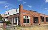 |
July 20, 2003 (#03000662) |
Along portions of Main, Front, and W. Wine Sts. 34°12′13″N 79°15′20″W / 34.203611°N 79.255556°W | Mullins | |
| 10 | Neal and Dixon's Warehouse |  |
August 3, 1984 (#84003822) |
S. Main St. 34°12′09″N 79°15′10″W / 34.2025°N 79.252778°W | Mullins | |
| 11 | Old Ebenezer Church | March 30, 1973 (#73001719) |
5 miles south of Latta on South Carolina Highway 38 34°17′20″N 79°23′10″W / 34.288889°N 79.386111°W | Latta | ||
| 12 | Rasor and Clardy Company Building |  |
October 29, 1982 (#82001522) |
202 S. Main St. 34°12′13″N 79°15′15″W / 34.203611°N 79.254167°W | Mullins | |
| 13 | Richardson-Godbold House | June 25, 2018 (#100002599) |
8447 S SC 41 33°59′12″N 79°20′55″W / 33.9867°N 79.3487°W | Marion vicinity |
Former listings edit
| [3] | Name on the Register | Image | Date listed | Date removed | Location | City or town | Description |
|---|---|---|---|---|---|---|---|
| 1 | Old Brick Warehouse | August 3, 1984 (#84003828) | August 9, 2016 | Northwest corner of Main and Wine Sts. 34°12′24″N 79°15′20″W / 34.206667°N 79.255556°W | Mullins | Demolished in August, 2014.[7] | |
| 2 | J.C. Teasley House |  |
May 30, 2001 (#01000609) | August 9, 2016 | 131 E. Wine St. 34°12′29″N 79°15′15″W / 34.208056°N 79.254167°W | Mullins | Demolished in 2015[8] |
See also edit
Wikimedia Commons has media related to National Register of Historic Places in Marion County, South Carolina.
References edit
- ^ The latitude and longitude information provided in this table was derived originally from the National Register Information System, which has been found to be fairly accurate for about 99% of listings. Some locations in this table may have been corrected to current GPS standards.
- ^ National Park Service, United States Department of the Interior, "National Register of Historic Places: Weekly List Actions", retrieved April 12, 2024.
- ^ a b Numbers represent an alphabetical ordering by significant words. Various colorings, defined here, differentiate National Historic Landmarks and historic districts from other NRHP buildings, structures, sites or objects.
- ^ "National Register Information System". National Register of Historic Places. National Park Service. March 13, 2009.
- ^ The eight-digit number below each date is the number assigned to each location in the National Register Information System database, which can be viewed by clicking the number.
- ^ Marion County School District Archived 2013-03-20 at the Wayback Machine
- ^ "Brick warehouse is demolished". The State. August 6, 2014. p. B4. Retrieved August 23, 2022 – via Newspapers.com.
- ^ "Mullins city councilwoman accused of wrongly demolishing home". 5 November 2015.