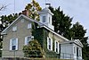
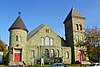
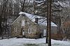
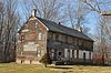
County Routes 632 and 643, Maple Avenue, Kitchen Road, and School Street 40°41′53″N75°00′50″W / 40.698056°N 75.013889°W / 40.698056; -75.013889 (Asbury Historic District)
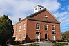
Market and Race streets; Greenwich and Mansfield avenues; and the Pequest River 40°49′45″N75°04′37″W / 40.829167°N 75.076944°W / 40.829167; -75.076944 (Belvidere Historic District)
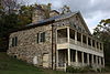
Main Street, East Avenue, Douglas Street, Water Street, Blair Place 40°58′59″N74°57′35″W / 40.983056°N 74.959722°W / 40.983056; -74.959722 (Blairstown Historic District)
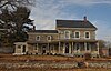
Ann, Clinton, Charles, and Valley Streets, Delaware Road, NJ 46 and Ferry Lane 40°53′44″N75°03′51″W / 40.895556°N 75.064167°W / 40.895556; -75.064167 (Delaware Historic District)
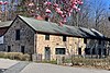
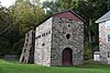
County Route 627; Mountain, Musconetcong, Mount Joy and Bellis roads 40°36′32″N75°10′04″W / 40.608889°N 75.167778°W / 40.608889; -75.167778 (Finesville–Seigletown Historic District)
Imlaydale Road and surrounding land between NJ 31 and the Musconetcong River, Washington and Lebanon Townships 40°42′47″N74°58′07″W / 40.713056°N 74.968611°W / 40.713056; -74.968611 (Imlaydale Historic District)
NJ 519 and 661 and adjacent parts of Mott and Allamuchy Roads, Johnsonburg 40°57′59″N74°52′36″W / 40.966389°N 74.876667°W / 40.966389; -74.876667 (Johnsonburg Historic District)
Irregular line beginning at Phillipsburg and ending at Jersey City 40°41′08″N75°09′49″W / 40.685556°N 75.163611°W / 40.685556; -75.163611 (Morris Canal)
Not Applicable
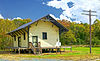
Delaware River Portal, the western terminus, is in Phillispburg
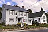
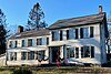
W of Hackettstown at intersection of Mount Bethel Rd. and Snyder Rd. 40°49′32″N74°54′07″W / 40.825556°N 74.901944°W / 40.825556; -74.901944 (Mount Bethel Methodist Church)
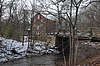
Rymon Road over the Musconetcong River 40°43′14″N74°57′49″W / 40.720556°N 74.963611°W / 40.720556; -74.963611 (New Hampton Pony Pratt Truss Bridge)
NJ Route 31; Belvidere, Buckley, and Washington avenues; Jonestown and Mine Hill roads; Academy and Church streets, and vicinity 40°47′55″N74°59′42″W / 40.798611°N 74.995°W / 40.798611; -74.995 (Oxford Industrial Historic District)
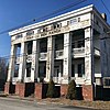
29-169 S. Main St., 60-178 S. Main St., 3 Hudson St., 9 and 12-30 Morris St./Main St., 7-11, 17, and 21-27 Union Sq. 40°41′29″N75°12′08″W / 40.691389°N 75.202222°W / 40.691389; -75.202222 (Phillipsburg Commercial Historic District)
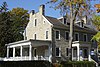
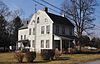
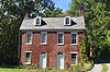
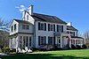
Roughly, Port Murray Road from Cherry Tree Bend Road to Hoffman Road, Port Murray 40°47′31″N74°54′51″W / 40.791944°N 74.914167°W / 40.791944; -74.914167 (Port Murray Historic District)
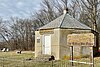
Spring Valley Rd., 0.5 mi (0.80 km). E of Hardwick Center 41°00′20″N74°56′23″W / 41.005556°N 74.939722°W / 41.005556; -74.939722 (Spring Valley Christian Church Site)
Wikimedia Commons has media related to National Register of Historic Places in Warren County, New Jersey.
^The latitude and longitude information provided in this table was derived originally from the National Register Information System, which has been found to be fairly accurate for about 99% of listings. Some locations in this table may have been corrected to current GPS standards.
^Numbers represent an alphabetical ordering by significant words. Various colorings, defined here, differentiate National Historic Landmarks and historic districts from other NRHP buildings, structures, sites or objects.
^The eight-digit number below each date is the number assigned to each location in the National Register Information System database, which can be viewed by clicking the number.