
KNOWPIA
WELCOME TO KNOWPIA

National Register of Historic Places listings in Worcester County, Massachusetts 
Summary
This is a list of the National Register of Historic Places (NRHP) designated in Worcester County, Massachusetts. The locations of NRHP properties and districts for which the latitude and longitude coordinates are included below, may be seen in a map.[1]

|
Barnstable | Berkshire | Bristol | Dukes | Essex | Franklin | Hampden | Hampshire | Middlesex | Nantucket | Norfolk | Plymouth | Suffolk | Worcester |
This National Park Service list is complete through NPS recent listings posted April 5, 2024.[2]
Cities and towns listed separately edit
The following Worcester County cities and towns have large numbers of sites listed in the National Register of Historic Places. Lists of their sites are on separate pages, linked below.
| Community | Image | First date listed | Last date listed | Count |
|---|---|---|---|---|
| Northern Worcester County | 
|
December 30, 1970 | December 1, 2022 | 74 |
| Southbridge | 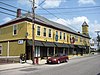
|
September 7, 1979 | May 3, 2023 | 85 |
| Uxbridge | 
|
November 23, 1971 | January 20, 1984 | 53 |
| Eastern Worcester | 
|
April 7, 1971 | July 3, 2017 | 98 |
| Northwestern Worcester | 
|
November 24, 1968 | May 27, 2022 | 111 |
| Southwestern Worcester | 
|
March 5, 1980 | December 1, 2022 | 82 |
Other cities and towns in central and southern Worcester County edit
| [3] | Name on the Register[4] | Image | Date listed[5] | Location | City or town | Description |
|---|---|---|---|---|---|---|
| 1 | 1767 Milestones |  |
April 7, 1971 (#71000084) |
Between Boston and Springfield along the old Upper Boston Post Road. 42°17′35″N 71°44′58″W / 42.2931°N 71.7494°W | Brookfield, East Brookfield, Leicester, Northborough, Shrewsbury, Spencer, Warren, and West Brookfield | Also includes markers located in Worcester, as well as Hampden, Middlesex, Norfolk, and Suffolk Counties. |
| 2 | Nathan C. Aldrich House and Resthaven Chapel |  |
May 17, 2006 (#06000399) |
111 Providence St. 42°05′13″N 71°31′57″W / 42.0869°N 71.5325°W | Mendon | |
| 3 | Ethan Allen House and Gun Shop |  |
October 12, 1995 (#95001167) |
37 Waterville St. 42°14′14″N 71°42′23″W / 42.2372°N 71.7064°W | Grafton | |
| 4 | Bancroft Memorial Library |  |
February 12, 1999 (#99000188) |
50 Hopedale St. 42°07′49″N 71°32′30″W / 42.130278°N 71.541667°W | Hopedale | |
| 5 | Barlin Acres |  |
November 26, 1982 (#82000487) |
284 School St. 42°20′04″N 71°43′22″W / 42.3344°N 71.7228°W | Boylston | Now occupied by a golf course. |
| 6 | Barnes-Hill House |  |
January 26, 2016 (#15001007) |
12 N. Brookfield Rd. 42°15′41″N 72°00′50″W / 42.2613°N 72.0139°W | Spencer | |
| 7 | Barre Common District |  |
May 4, 1976 (#76000298) |
Bounded roughly by South, Exchange, Main, Pleasant, Broad, School and Grove Sts. 42°25′20″N 72°06′20″W / 42.4222°N 72.1056°W | Barre | |
| 8 | Bartlett's Bridge |  |
February 10, 2000 (#00000077) |
Clara Barton Rd. over the French River 42°09′17″N 71°52′59″W / 42.1547°N 71.8831°W | Oxford | |
| 9 | Clara Barton Homestead |  |
September 22, 1977 (#77000202) |
3 mi (4.8 km) west of Oxford on Clara Barton Rd. 42°09′12″N 71°53′45″W / 42.1533°N 71.8958°W | Oxford | |
| 10 | Beaman Memorial Public Library |  |
May 16, 2016 (#16000251) |
8 Newton St. 42°21′54″N 71°46′59″W / 42.365057°N 71.783178°W | West Boylston | |
| 11 | Berlin Town Hall |  |
September 15, 2011 (#11000663) |
12 Woodward Ave. 42°22′55″N 71°38′13″W / 42.3819°N 71.6369°W | Berlin | |
| 12 | Bigelow Carpet Company Woolen Mills |  |
October 6, 1983 (#83004107) |
Main St. 42°25′01″N 71°41′26″W / 42.4169°N 71.6906°W | Clinton | |
| 13 | Bigelow Carpet Mill |  |
December 22, 1978 (#78000467) |
Union and High Sts. 42°24′55″N 71°41′10″W / 42.4153°N 71.6861°W | Clinton | |
| 14 | Bigelow Tavern Historic District |  |
September 24, 1992 (#92000043) |
60, 64 and 65 Worcester St. 42°21′55″N 71°46′55″W / 42.3653°N 71.7819°W | West Boylston | |
| 15 | Black Tavern |  |
May 9, 1985 (#85000981) |
140, 142 Dudley Center Rd. 42°02′45″N 71°55′47″W / 42.0458°N 71.9297°W | Dudley | |
| 16 | Blackstone Canal Historic District |  |
August 15, 1995 (#73000328) |
Blackstone to Worcester, Massachusetts 41°56′30″N 71°27′50″W / 41.9417°N 71.464°W | Blackstone, Grafton, Millbury, Millville, Northbridge, and Sutton | Initial listing was for 3.5 mile section of canal in Northbridge and Uxbridge; expanded to include entire length in Massachusetts in 1995 (#95001004). |
| 17 | Blackstone Manufacturing Company Historic District |  |
August 25, 1995 (#95001038) |
Roughly the area surrounding Butler, Canal, Church, County, Ives, Main, Mendon, Old Mendon, and School Sts. 42°00′58″N 71°32′41″W / 42.0161°N 71.5447°W | Blackstone | |
| 18 | Blackstone Viaduct |  |
February 5, 2002 (#01001558) |
Canal, Farnum and Mill Sts. 42°00′55″N 71°32′00″W / 42.015278°N 71.533333°W | Blackstone | |
| 19 | Bolton Center Historic District |  |
November 17, 1997 (#97001296) |
Roughly along Main St. between Harvard Rd. and Interstate 495 42°26′07″N 71°36′35″W / 42.435278°N 71.609722°W | Bolton | |
| 20 | Bowers School |  |
November 10, 1983 (#83004108) |
411 Water St. 42°25′09″N 71°40′18″W / 42.419167°N 71.671667°W | Clinton | |
| 21 | J.D.C. Bradley House |  |
February 26, 1999 (#99000260) |
5 Sadie Hutt Lane 42°18′59″N 71°32′34″W / 42.3164°N 71.5428°W | Southborough | Register listing is at 60 Sears Rd. |
| 22 | Brookfield Cemetery |  |
May 9, 2003 (#03000384) |
Main St. 42°13′02″N 72°06′49″W / 42.217222°N 72.113611°W | Brookfield | |
| 23 | Brookfield Common Historic District |  |
February 23, 1990 (#90000161) |
Roughly Howard, Sherman, Prouty, W. Main, Main, and Upper River Sts. 42°12′51″N 72°06′09″W / 42.214167°N 72.1025°W | Brookfield | |
| 24 | Brown-Davis-Frost Farm |  |
December 13, 1995 (#95001444) |
17 Whitney St. 42°22′29″N 71°53′19″W / 42.3747°N 71.8886°W | Jefferson | |
| 25 | Bullard House | 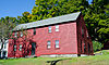 |
September 15, 2011 (#11000664) |
4 Woodward Ave. 42°22′54″N 71°38′14″W / 42.381667°N 71.637222°W | Berlin | |
| 26 | Camp Atwater | 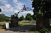 |
April 15, 1982 (#82004477) |
Shore Rd. 42°14′22″N 72°03′00″W / 42.2394°N 72.05°W | North Brookfield | |
| 27 | Cedar Swamp Archeological District |  |
May 23, 1988 (#88000587) |
Along the border with Hopkinton in Middlesex County[6] 42°15′36″N 71°35′06″W / 42.26°N 71.585°W | Westborough | Extends into Hopkinton, Middlesex County |
| 28 | Central Street Historic District | 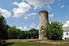 |
June 20, 2003 (#03000550) |
Roughly bounded by Central, Quaker, West, Chesley, Bow, Prospect, and Fletcher Sts. 42°01′29″N 71°34′57″W / 42.02467°N 71.582623°W | Millville | |
| 29 | Charlton Center Historic District | 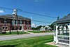 |
October 20, 1995 (#95001227) |
Roughly Main St. from Mugget Hill Rd. to Masonic Home Rd. and adjacent roads 42°08′02″N 71°58′09″W / 42.133889°N 71.969167°W | Charlton | |
| 30 | Chestnut Hill Meetinghouse |  |
November 13, 1984 (#84000434) |
Chestnut and Thayer Sts. 42°02′27″N 71°34′58″W / 42.040833°N 71.582778°W | Millville | |
| 31 | George Clapp House |  |
August 21, 1997 (#97000919) |
44 North St. 42°12′43″N 71°40′51″W / 42.211944°N 71.680833°W | Grafton | |
| 32 | Olney Cook Artisan Shop |  |
December 2, 2019 (#100004699) |
54 Hartford Ave. E. 42°05′41″N 71°31′24″W / 42.0947°N 71.5233°W | Mendon | |
| 33 | Corcoran School |  |
February 4, 2000 (#00000039) |
40 Walnut St. 42°25′00″N 71°41′03″W / 42.416667°N 71.684167°W | Clinton | |
| 34 | Crossman Bridge |  |
December 27, 2010 (#10001065) |
Gilbert Rd. over Quaboag River 42°12′37″N 72°14′44″W / 42.210278°N 72.245556°W | Warren | |
| 35 | Dana Common Historic and Archaeological District |  |
March 4, 2013 (#13000052) |
Gate 40 off Hardwick Rd. 42°26′57″N 72°12′24″W / 42.449048°N 72.206619°W | Petersham | |
| 36 | District Five Schoolhouse |  |
June 5, 1991 (#91000697) |
School St. between Boyden and 1st Sts. 42°02′34″N 71°52′58″W / 42.0428°N 71.8828°W | Webster | Now houses the Dudley-Webster Historical Society. |
| 37 | District No. 4 School |  |
October 11, 2016 (#16000713) |
191 East St. 42°29′18″N 72°09′10″W / 42.488405°N 72.152903°W | Petersham | |
| 38 | District No. 5 School |  |
July 18, 2016 (#16000455) |
311 East St. 42°29′06″N 72°07′59″W / 42.485047°N 72.132921°W | Petersham | |
| 39 | District No. 5 School |  |
August 27, 2013 (#13000622) |
2 Old Mill Rd. 42°17′29″N 71°44′29″W / 42.291342°N 71.741323°W | Shrewsbury | |
| 40 | Downtown Clinton Historic District |  |
February 21, 1985 (#85000319) |
Roughly bounded by Union and Prospects Sts. on High and Church Sts. 42°25′02″N 71°40′59″W / 42.417222°N 71.683056°W | Clinton | |
| 41 | Dudley Hill Historic District |  |
December 2, 2019 (#100004707) |
Center, Dudley Oxford Rd., Dudley Southbridge, Ramshorn & Tanyard Rds. 42°02′49″N 71°55′45″W / 42.0469°N 71.9292°W | Dudley | |
| 42 | Eagleville Historic District |  |
September 24, 2010 (#10000786) |
Main St., Princeton St., High St 42°21′35″N 71°52′55″W / 42.3597°N 71.8819°W | Holden | |
| 43 | East Blackstone Friends Meetinghouse |  |
August 22, 1995 (#95001035) |
197 Elm St. 42°03′09″N 71°31′23″W / 42.0525°N 71.523056°W | Blackstone | |
| 44 | East Blackstone Village Historic District |  |
September 6, 1995 (#95001040) |
Roughly the area along Elm St. at the junction with Summer St. 42°02′39″N 71°30′57″W / 42.044167°N 71.515833°W | Blackstone | |
| 45 | East Princeton Village Historic District |  |
March 18, 2004 (#04000188) |
Roughly Main St. and Leominster Rd. 42°28′23″N 71°50′14″W / 42.473056°N 71.837222°W | Princeton | |
| 46 | Eddy Block |  |
December 3, 1980 (#80000470) |
119-131 Main St. and 4 Davis St. 42°02′56″N 71°53′05″W / 42.048889°N 71.884722°W | Webster | |
| 47 | Elm Hill Farm Historic District |  |
May 16, 1991 (#91000600) |
E. Main St. east of its junction with Brookfield Rd. 42°13′16″N 72°05′10″W / 42.221111°N 72.086111°W | Brookfield | |
| 48 | Farnum's Gate Historic District |  |
August 25, 1995 (#95001039) |
Roughly the area surrounding the junction of Main and Blackstone Sts. 42°01′08″N 71°31′56″W / 42.018889°N 71.532222°W | Blackstone | |
| 49 | Farnumsville Historic District |  |
February 16, 1996 (#96000052) |
Roughly bounded by Providence Rd., Cross, Main, Harding and Depot Sts. and Maple Ave. 42°10′28″N 71°41′03″W / 42.174444°N 71.684167°W | Grafton | |
| 50 | Fernside-Vacation House for Working Girls |  |
June 27, 2002 (#02000695) |
162 Mountain Rd. 42°28′06″N 71°53′04″W / 42.468333°N 71.884444°W | Princeton | |
| 51 | First Baptist Church of Northborough |  |
April 12, 2016 (#16000157) |
52 Main St. 42°19′11″N 71°38′19″W / 42.319607°N 71.638721°W | Northborough | |
| 52 | First Methodist Church |  |
November 2, 1990 (#90001720) |
75 Walnut St. 42°25′00″N 71°41′03″W / 42.416667°N 71.684167°W | Clinton | |
| 53 | First Presbyterian Society Meeting House |  |
September 9, 2010 (#10000722) |
20 Main St. 42°11′32″N 71°45′37″W / 42.192222°N 71.760278°W | Millbury | |
| 54 | Nathan Fisher House |  |
March 25, 1980 (#80001679) |
34 West Main St.[7] 42°17′03″N 71°37′30″W / 42.284167°N 71.625°W | Westborough | |
| 55 | Fisherville Historic District |  |
February 16, 1996 (#96000056) |
Roughly bounded by Main, Elmwood, Ferry and Sampson Sts. 42°10′37″N 71°41′40″W / 42.1769°N 71.6944°W | Grafton | |
| 56 | Fobes-O'Donnell House |  |
March 7, 2018 (#100002197) |
1221 Old Turnpike Rd., 42°22′03″N 72°04′08″W / 42.367425°N 72.068914°W | Oakham | |
| 57 | Jedediah Foster Homesite |  |
August 27, 2013 (#13000623) |
Foster Hill Rd., 42°13′55″N 72°07′40″W / 42.232°N 72.1278°W | West Brookfield | |
| 58 | Four Corners-Goodnow Farm Historic District |  |
August 10, 2015 (#15000510) |
Gates, Goodnow, Old Colony, Rhodes & Thompson Rds. 42°27′43″N 71°55′47″W / 42.4619°N 71.9297°W | Princeton | |
| 59 | Freegrace Marble Farm Historic District |  |
November 13, 1989 (#89001967) |
80 Burbank Rd. 42°09′44″N 71°45′02″W / 42.1622°N 71.7506°W | Sutton | |
| 60 | Gay Farm | 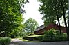 |
September 22, 1977 (#77000201) |
South of Petersham off Nichewaug Rd. 42°27′50″N 72°11′06″W / 42.4639°N 72.185°W | Petersham | |
| 61 | Rev. Samuel Gay House | 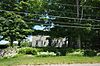 |
November 24, 1997 (#97001450) |
10 Williamsville Rd. 42°28′44″N 72°00′55″W / 42.4789°N 72.0153°W | Hubbardston | |
| 62 | Gilbertville Historic District |  |
December 26, 1991 (#91001848) |
Roughly Main, Church, High, North, Broad and Bridge Sts. 42°18′24″N 72°12′32″W / 42.306667°N 72.208889°W | Hardwick | |
| 63 | Gillon Block | 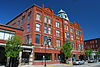 |
October 21, 1982 (#82000488) |
189 Main St. 42°08′26″N 71°31′15″W / 42.140556°N 71.520833°W | Milford | |
| 64 | Goddard Rocket Launching Site |  |
November 13, 1966 (#66000654) |
Ninth fairway, Pakachoag Golf Course, Pakachoag Rd. 42°13′06″N 71°48′46″W / 42.218333°N 71.812778°W | Auburn | National Historic Landmark |
| 65 | John B. Gough House |  |
March 19, 1974 (#74001763) |
215 Main St. 42°19′42″N 71°45′22″W / 42.328333°N 71.756111°W | Boylston | National Historic Landmark |
| 66 | Grafton Common Historic District | 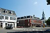 |
June 22, 1988 (#88000707) |
Roughly Worcester, Oak, Millbury, Church, South, Upton, and North Sts. 42°12′22″N 71°41′10″W / 42.206111°N 71.686111°W | Grafton | |
| 67 | Grafton Inn |  |
June 16, 1980 (#80001675) |
25 Central Sq. 42°12′23″N 71°41′08″W / 42.206389°N 71.685556°W | Grafton | |
| 68 | Grove Street School |  |
July 5, 1996 (#96000737) |
23 Grove St. 42°14′48″N 71°59′34″W / 42.246667°N 71.992778°W | Spencer | |
| 69 | Hardwick Village Historic District |  |
December 19, 1991 (#91001849) |
Petersham, Barre, Greenwich, Ruggles Hill and Gilbertville Rds. 42°20′54″N 72°11′49″W / 42.348333°N 72.196944°W | Hardwick | |
| 70 | Hassanamisco Reservation |  |
September 6, 2011 (#11000615) |
80 Brigham Hill Rd. 42°12′39″N 71°42′18″W / 42.210833°N 71.705°W | Grafton | |
| 71 | Stephen Hastings House |  |
December 6, 2005 (#05001363) |
20 Squareshire Rd. 42°24′29″N 71°44′26″W / 42.4081°N 71.7406°W | Sterling | |
| 72 | Hayward Mill |  |
June 17, 1991 (#91000695) |
Junction of North and Cook Sts., on the Mumford River 42°04′30″N 71°42′43″W / 42.075°N 71.7119°W | Douglas | |
| 73 | Holden Center Historic District |  |
December 22, 1977 (#77000194) |
Main, Maple, Highland, and Reservoir Sts. 42°21′03″N 71°51′47″W / 42.3508°N 71.8631°W | Holden | |
| 74 | Holland-Towne House |  |
August 13, 1990 (#89002327) |
North Street 42°30′01″N 72°11′06″W / 42.5003°N 72.185°W | Petersham | |
| 75 | Hopedale Village Historic District |  |
June 12, 2002 (#02000635) |
Roughly bounded by Milford Town Line, Malquin Dr., Mendon Town Line and Upton Town Line 42°07′35″N 71°32′12″W / 42.1264°N 71.5368°W | Hopedale | |
| 76 | Hubbard-Dawson House |  |
December 13, 1995 (#95001443) |
925 Main St. 42°20′37″N 71°51′08″W / 42.3436°N 71.8522°W | Holden | |
| 77 | Hubbardston Public Library |  |
August 19, 1998 (#98000989) |
7 Main St. 42°28′30″N 72°00′28″W / 42.475°N 72.0078°W | Hubbardston | |
| 78 | Hubbardston Town Common Historic District |  |
November 22, 2000 (#00001396) |
Main and Brigham Sts. 42°28′30″N 72°00′22″W / 42.475°N 72.006111°W | Hubbardston | |
| 79 | Hudson House |  |
February 8, 1978 (#78000480) |
Northeast of Oxford on Hudson Rd. 42°08′32″N 71°50′12″W / 42.142222°N 71.836667°W | Oxford | |
| 80 | Huguenot Fort |  |
April 27, 1988 (#88000424) |
Fort Hill Rd. 42°05′55″N 71°50′50″W / 42.098611°N 71.847222°W | Oxford | |
| 81 | E. N. Jenckes Store |  |
January 28, 1988 (#87002558) |
Main St. 42°04′18″N 71°42′51″W / 42.071667°N 71.714167°W | Douglas | |
| 82 | Knowlton Hat Factory |  |
June 1, 1982 (#82004467) |
134 Main St. 42°10′10″N 71°37′27″W / 42.169444°N 71.624167°W | Upton | |
| 83 | Lancaster Mills |  |
January 29, 2010 (#10000005) |
1-55, 75, 99, 1-R Green St., 20 Cameron St. 42°24′42″N 71°40′48″W / 42.411561°N 71.680131°W | Clinton | |
| 84 | Linwood Historic District |  |
June 16, 1989 (#88002753) |
Roughly Linwood Ave., Maple Ct., and Pine Ct. 42°05′54″N 71°38′49″W / 42.098333°N 71.646944°W | Northbridge | |
| 85 | Joseph Lothrop House |  |
March 27, 1980 (#80001680) |
208 Turnpike Rd. 42°17′01″N 71°37′34″W / 42.283611°N 71.626111°W | Westborough | Listed in the "Shrewsbury vicinity". |
| 86 | Lyman School for Boys |  |
July 25, 1994 (#94000693) |
Junction of Oak and South Sts. 42°17′24″N 71°37′50″W / 42.29°N 71.630556°W | Westborough | |
| 87 | Main Street Historic District |  |
May 10, 2006 (#06000360) |
Main, Lincoln, Preston, Walnut Sts., Chestnut Hill Rd., Burns Ave. 42°01′40″N 71°34′44″W / 42.027778°N 71.578889°W | Millville | |
| 88 | Main Street Historic District |  |
April 6, 1982 (#82004484) |
175-299 and 228-274 Main St. 42°02′57″N 71°52′56″W / 42.049167°N 71.882222°W | Webster | |
| 89 | Manchaug Village Historic District |  |
January 26, 2018 (#100002026) |
Roughly bounded by Putnam Hill, Whitins, Morse, Mumford & Manchaug Rds. Ledge, Main, 3rd & Maple Sts., Stevens Pond 42°05′39″N 71°44′50″W / 42.094047°N 71.747176°W | Sutton | |
| 90 | Manning-Ball House |  |
December 13, 1995 (#95001442) |
370 Manning St. 42°23′10″N 71°50′08″W / 42.3861°N 71.8356°W | Jefferson | |
| 91 | Maples Cottage |  |
March 25, 1980 (#80001681) |
East of Shrewsbury on Oak St. 42°17′08″N 71°37′38″W / 42.285556°N 71.627222°W | Westborough | |
| 92 | Marlborough Brook Filter Beds |  |
January 18, 1990 (#89002286) |
Framingham Rd. 42°19′47″N 71°32′09″W / 42.3297°N 71.5358°W | Southborough | Extends into Marlborough, Middlesex County |
| 93 | Matthews Fulling Mill Site |  |
November 12, 1975 (#75000302) |
Address restricted[8] | North Brookfield | 1749 mill site near New Braintree line |
| 94 | Memorial Hall |  |
May 9, 1985 (#85000983) |
30 School St. 42°08′32″N 71°31′10″W / 42.14223°N 71.519322°W | Milford | |
| 95 | Mendon Center Historic District |  |
June 19, 2003 (#03000552) |
Roughly bounded by Main, Hastings, Maple, North, Washington, and George Sts. 42°06′28″N 71°33′13″W / 42.107838°N 71.553569°W | Mendon | |
| 96 | Milford Town Hall |  |
September 22, 1977 (#77000200) |
52 Main St. 42°08′33″N 71°31′02″W / 42.1425°N 71.517222°W | Milford | |
| 97 | Moore State Park Historic District |  |
May 21, 2004 (#04000535) |
off Massachusetts Route 31 42°19′06″N 71°57′26″W / 42.3182°N 71.9572°W | Paxton | |
| 98 | Mount Vernon Cemetery |  |
May 29, 2008 (#08000465) |
Church St. 42°21′52″N 71°46′52″W / 42.364569°N 71.781106°W | West Boylston | |
| 99 | Azariah Newton House |  |
October 14, 1999 (#99001252) |
44 Silver Hill Rd. 42°10′02″N 71°32′08″W / 42.167222°N 71.535556°W | Milford | |
| 100 | No. 4 Schoolhouse |  |
June 22, 1988 (#88000711) |
Farrington Rd. 42°26′43″N 72°05′05″W / 42.4453°N 72.0847°W | Barre | |
| 101 | North Avenue Rural Historic District |  |
July 25, 2003 (#03000683) |
85-147 North Ave., 6-8 Trask Rd., 4-16 Hopedale St. 42°07′34″N 71°34′01″W / 42.1261°N 71.5669°W | Mendon | |
| 102 | North Brookfield Town House |  |
October 28, 2001 (#01001185) |
185 N. Main St. 42°16′07″N 72°05′06″W / 42.2687°N 72.0851°W | North Brookfield | |
| 103 | Northside Village Historic District |  |
October 5, 1977 (#77000195) |
Stafford St., Northside and Cemetery Rds. 42°09′53″N 71°57′24″W / 42.1647°N 71.9567°W | Charlton | |
| 104 | Oakdale Village Historic District |  |
July 5, 1996 (#96000738) |
11-68 N. Main, 8–24 May, 6-10 Green, 12-23 High, 4-68 Laurel, 14-34 Waushacum, and park at Thomas and N. Main 42°23′20″N 71°47′48″W / 42.3889°N 71.7967°W | West Boylston | |
| 105 | Oakham Center Historic District |  |
February 6, 2020 (#100004337) |
Roughly bounded by Coldbrook Rd., Maple St., Barre Rd., & Deacon Allen Dr. 42°21′13″N 72°02′34″W / 42.3535°N 72.0427°W | Oakham | |
| 106 | Old Douglas Center Historic District |  |
October 28, 2001 (#01001186) |
Roughly bounded by Church, Common, Main, NW. Main, SW. Main, and Webster Sts. 42°03′14″N 71°44′23″W / 42.0538°N 71.7397°W | Douglas | |
| 107 | Old Indian Cemetery |  |
May 17, 2006 (#06000400) |
50 Cottage St. 42°14′12″N 72°08′47″W / 42.2367°N 72.1464°W | West Brookfield | |
| 108 | Old Stone Church |  |
April 13, 1973 (#73000329) |
Off MA 140 42°22′29″N 71°46′59″W / 42.3747°N 71.7831°W | West Boylston | |
| 109 | Oxford Main Street Historic District |  |
August 24, 2011 (#11000586) |
Barton, Charlton, Church, E. Main, Elm, Fremont, & Main Sts., Quobaug Ave., Sigourney St., Sutton Ave., West St. Jackson 42°07′01″N 71°51′53″W / 42.1169°N 71.8647°W | Oxford | |
| 110 | Paddock Farm |  |
February 23, 1996 (#96000143) |
259 Salisbury St. 42°20′02″N 71°50′57″W / 42.3339°N 71.8492°W | Holden | |
| 111 | Pan Burying Ground | 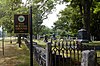 |
July 11, 2007 (#07000682) |
477 Main St. 42°25′50″N 71°35′24″W / 42.4306°N 71.59°W | Bolton | |
| 112 | Pan Historic District | 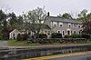 |
August 16, 2018 (#100002783) |
Main St., Annie Moore, Burnham, Hudson & Long Hill Rds. 42°25′45″N 71°34′33″W / 42.4293°N 71.5757°W | Bolton | |
| 113 | Petersham Common Historic District | 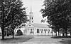 |
May 11, 1982 (#82004481) |
MA 32/122 42°29′25″N 72°11′08″W / 42.4903°N 72.1856°W | Petersham | |
| 114 | Pleasant Street School |  |
July 5, 1996 (#96000736) |
54 Pleasant St. 42°14′54″N 71°59′51″W / 42.2483°N 71.9975°W | Spencer | |
| 115 | Prescott Town House | 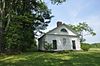 |
February 21, 1989 (#89000043) |
MA 32 42°29′56″N 72°11′01″W / 42.4989°N 72.1836°W | Petersham | Former town hall of Prescott, Massachusetts. |
| 116 | Princeton Center Historic District |  |
February 26, 1999 (#99000259) |
Junction of Hubbardston and Mountain Rds. 42°26′57″N 71°52′43″W / 42.4492°N 71.8786°W | Princeton | Boundary increase (added 2006-03-10): Princeton, MA |
| 117 | Prospect Heights Historic District |  |
September 5, 1990 (#90001344) |
Roughly bounded by Prospect Heights, Prospect, and Water Sts. 42°08′10″N 71°31′55″W / 42.1361°N 71.5319°W | Milford | |
| 118 | Gen. Rufus Putnam House |  |
November 28, 1972 (#72001330) |
344 Main St. 42°22′29″N 71°58′15″W / 42.3747°N 71.9708°W | Rutland | National Historic Landmark |
| 119 | Quinapoxet River Bridge |  |
April 8, 1990 (#89002292) |
Thomas St. over the Quinapoxet River at the Wachusett Reservoir 42°23′06″N 71°47′52″W / 42.385°N 71.7978°W | West Boylston | |
| 120 | Rider Tavern |  |
May 19, 1976 (#76000292) |
Stafford St. at Northside Rd. 42°09′52″N 71°57′14″W / 42.1644°N 71.9539°W | Charlton | |
| 121 | Rock Castle School |  |
June 7, 1989 (#89000437) |
Prospect St. 42°03′13″N 71°52′41″W / 42.0536°N 71.8781°W | Webster | Converted to residential use. |
| 122 | Rockdale Common Housing District |  |
March 31, 1983 (#83000611) |
4-20 McBride, 46-58 Plantation, and 37-42 Taft Sts. 42°09′09″N 71°38′50″W / 42.1525°N 71.6472°W | Northbridge | |
| 123 | Rogers House |  |
June 1, 1982 (#82004471) |
28 Boyden Rd. 42°20′59″N 71°51′29″W / 42.3497°N 71.8581°W | Holden | |
| 124 | Rural Glen Cemetery |  |
September 4, 2020 (#100005076) |
Worcester Rd. 42°27′55″N 71°59′54″W / 42.4653°N 71.9984°W | Hubbardston | |
| 125 | Russell Corner Historic District |  |
February 22, 2006 (#06000060) |
Merriam, Gregory Hill, East Princeton and Sterling Rds. and Bullock Lane 42°27′14″N 71°52′06″W / 42.4539°N 71.8683°W | Princeton | |
| 126 | Sawyer Homestead |  |
September 13, 2000 (#00001036) |
108 Maple St. 42°25′59″N 71°43′49″W / 42.4331°N 71.7303°W | Sterling | |
| 127 | Shrewsbury Historic District |  |
October 8, 1976 (#76000309) |
Church Rd., Main, Prospect, Boylston, and Grafton Sts. 42°17′53″N 71°42′50″W / 42.2981°N 71.7139°W | Shrewsbury | |
| 128 | Shumway Block |  |
December 3, 1980 (#80000468) |
112-116 Main St. 42°02′55″N 71°53′07″W / 42.0486°N 71.8853°W | Webster | |
| 129 | South Union School |  |
February 18, 2011 (#11000021) |
21 Highland St. 42°16′05″N 71°31′49″W / 42.2681°N 71.5303°W | Southborough | |
| 130 | Southborough Center Historic District |  |
December 29, 2021 (#100007264) |
Main and Common Sts., Middle, Cordaville, and Latisquama Rds. 42°18′22″N 71°31′43″W / 42.3060°N 71.5286°W | Southborough | |
| 131 | Southwick-Daniels Farm |  |
August 22, 1995 (#95001030) |
286 Mendon St. 42°03′26″N 71°32′54″W / 42.0572°N 71.5483°W | Blackstone | |
| 132 | Spaulding Block |  |
December 3, 1980 (#80000466) |
141-143 Main St. 42°02′56″N 71°53′05″W / 42.0489°N 71.8847°W | Webster | |
| 133 | Spencer Town Center Historic District |  |
June 26, 1986 (#86001399) |
Main between High and North Sts.; also 215-270 and 35-73 Main, 2-16 Linden, 3-24 Ash, 26-73 Cherry, 6–19 May, and 8 Park Sts.; also 10-29 Grove, 1-51 High, 9-85 Mechanic, 13-72 Pleasant, 5-62 Wall Sts., and parts of Prouty, Lincoln, Cherry and Jones Sts.; also Luther Hill Park 42°14′42″N 71°59′33″W / 42.245°N 71.9925°W | Spencer | District has been enlarged three times; each set of addresses represents an increase. |
| 134 | John Spurr House |  |
April 26, 1976 (#76000293) |
Main St. 42°08′06″N 71°58′10″W / 42.135°N 71.9694°W | Charlton | |
| 135 | Sterling Center Historic District | 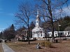 |
April 14, 1988 (#88000425) |
Roughly bounded by Meetinghouse Hill and Main, Maple and Kendall Hill, Boulding, Worcester and Princeton 42°26′10″N 71°45′41″W / 42.4361°N 71.7614°W | Sterling | |
| 136 | Stevens Linen Works Historic District |  |
September 17, 2010 (#10000751) |
8–10 Mill St., 2 W. Main St., 2 Curfew Ln., Ardlock Pl. 42°03′01″N 71°53′24″W / 42.0503°N 71.89°W | Dudley | Includes the main factory, related industrial buildings, and worker housing. |
| 137 | Joseph Stone House |  |
January 9, 1986 (#86000028) |
35 Stone St. 42°11′07″N 71°49′51″W / 42.1853°N 71.8308°W | Auburn | |
| 138 | Lucy Stone Home Site |  |
February 8, 2021 (#100006122) |
69 Coy Hill Rd. 42°15′23″N 72°11′32″W / 42.2565°N 72.1923°W | West Brookfield | |
| 139 | Stony Farm |  |
December 13, 1995 (#95001441) |
428 Salisbury St. 42°19′37″N 71°51′04″W / 42.3269°N 71.8511°W | Holden | |
| 140 | Sturbridge Common Historic District |  |
November 9, 1977 (#77000656) |
Main St. between Hall Rd. and Interstate 84 42°06′25″N 72°04′44″W / 42.1069°N 72.0789°W | Sturbridge | |
| 141 | Sudbury Dam Historic District | 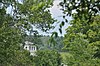 |
January 18, 1990 (#89002265) |
Southeastern end of Sudbury Reservoir off MA 30 42°18′21″N 71°29′30″W / 42.3058°N 71.4917°W | Southborough | Extends into Framingham, Middlesex County |
| 142 | Sutton Center Historic District | 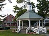 |
May 25, 2001 (#01000541) |
Roughly Boston Rd., Singletary Ave., and Uxbridge Rd. 42°09′05″N 71°45′54″W / 42.1514°N 71.765°W | Sutton | |
| 143 | Tantiusques Reservation |  |
October 6, 1983 (#83004141) |
Leadmine Rd. 42°03′26″N 72°07′52″W / 42.0572°N 72.1311°W | Sturbridge | |
| 144 | Ted's Diner | November 29, 2000 (#00001395) |
67 Main St. 42°08′34″N 71°31′05″W / 42.1428°N 71.5181°W | Milford | Demolished in 2002.[9] | |
| 145 | Benjamin Thayer House |  |
December 30, 2009 (#09001174) |
200 Farm St. 42°02′49″N 71°31′47″W / 42.047°N 71.5297°W | Blackstone | |
| 146 | Thom Block |  |
June 23, 1983 (#83003435) |
83-89 Main St. 42°08′32″N 71°31′07″W / 42.1422°N 71.5186°W | Milford | |
| 147 | Thompson School |  |
June 7, 1989 (#89000436) |
Prospect St. 42°03′02″N 71°52′42″W / 42.0506°N 71.8783°W | Webster | Converted to residential use. |
| 148 | Tobin's Beach Site |  |
July 22, 1986 (#86003808) |
Address restricted[8] | Brookfield | Boundary increase approved December 17, 2018 |
| 149 | Tuttle Square School |  |
March 8, 2002 (#02000129) |
41 South St. 42°11′29″N 71°50′06″W / 42.1914°N 71.835°W | Auburn | |
| 150 | Upton State Forest-Civilian Conservation Corps Resources Historic District |  |
October 8, 2014 (#14000841) |
205 Westborough Rd. 42°12′33″N 71°36′29″W / 42.2091°N 71.6081°W | Upton | |
| 151 | Upton Center Historic District |  |
January 14, 2015 (#14001150) |
Church, Main, Milford, Nelson, N. Main, Plain, Pleasant, School & Warren Sts. 42°10′26″N 71°36′11″W / 42.1739°N 71.6031°W | Upton | |
| 152 | Upton Town Hall |  |
February 12, 1999 (#99000185) |
1 Main St. 42°10′26″N 71°35′32″W / 42.1739°N 71.5922°W | Upton | |
| 153 | US Post Office-Millbury Main |  |
October 15, 1987 (#87001764) |
119 Elm St. 42°11′27″N 71°44′59″W / 42.1908°N 71.7497°W | Millbury | |
| 154 | US Post Office-Whitinsville Main | 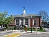 |
October 15, 1987 (#86003433) |
58 Church St. 42°06′38″N 71°39′47″W / 42.1106°N 71.6631°W | Northbridge | |
| 155 | Vintonville Historic District |  |
August 23, 2006 (#06000717) |
Roughly bounded by Cottage, Green, Pine, Brigham, Beach Sts., and rear of properties along the east side of South St. 42°15′59″N 71°36′33″W / 42.2664°N 71.6092°W | Westborough | |
| 156 | Wachusett Aqueduct Linear District |  |
January 18, 1990 (#89002276) |
Along Wachusett Aqueduct from Wachusett Reservoir to Sudbury Reservoir 42°20′01″N 71°35′27″W / 42.3336°N 71.5908°W | Berlin, Clinton, and Northborough, Southborough | Extends into Marlborough, Middlesex County |
| 157 | Wachusett Dam Historic District | 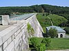 |
January 18, 1990 (#89002269) |
Northern end of Wachusett Reservoir at Lancaster Millpond 42°24′17″N 71°41′17″W / 42.4047°N 71.6881°W | Clinton | |
| 158 | Gen. Artemas Ward Homestead |  |
May 4, 1976 (#76000308) |
Main St., opposite Dean Park 42°17′42″N 71°41′50″W / 42.295°N 71.6972°W | Shrewsbury | |
| 159 | Ware-Hardwick Covered Bridge |  |
May 8, 1986 (#86001006) |
Old Gilbertville Rd. and Bridge St. 42°18′37″N 72°12′45″W / 42.3103°N 72.2125°W | Hardwick | |
| 160 | Warren First Congregational Church-Federated Church |  |
November 27, 2004 (#04001258) |
25 Winthrop Terrace 42°12′49″N 72°11′31″W / 42.2136°N 72.1919°W | Warren | |
| 161 | Warren Public Library |  |
March 13, 2000 (#00000146) |
Main St. at Bacon St. 42°12′48″N 72°11′35″W / 42.2132°N 72.1931°W | Warren | |
| 162 | Warren Town Hall | 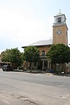 |
June 14, 2001 (#01000650) |
1 Main St. 42°12′46″N 72°11′43″W / 42.2128°N 72.1953°W | Warren | |
| 163 | Jonah Warren House |  |
November 5, 1998 (#98001331) |
64 Warren St. 42°14′54″N 71°36′12″W / 42.2483°N 71.6033°W | Westborough | |
| 164 | Washburn Square-Leicester Common Historic District |  |
February 22, 2006 (#06000062) |
Main St., Washburn Sq., 3 Paxton St. 42°14′46″N 71°54′13″W / 42.2461°N 71.9036°W | Leicester | |
| 165 | Waters Farm |  |
April 4, 1985 (#85000695) |
53 Waters Rd. 42°06′21″N 71°47′02″W / 42.1058°N 71.7839°W | Sutton | |
| 166 | Asa Waters Mansion |  |
February 14, 1978 (#78000479) |
123 Elm St. 42°11′24″N 71°45′46″W / 42.19°N 71.7628°W | Millbury | |
| 167 | Webster Municipal Buildings Historic District |  |
March 27, 2012 (#12000152) |
350 Main, 29 Negus, & 2 Lake Sts. 42°02′59″N 71°52′48″W / 42.0496°N 71.880°W | Webster | |
| 168 | West Brick School |  |
March 1, 2011 (#11000070) |
1592 Old Turnpike Rd. 42°21′44″N 72°04′54″W / 42.3622°N 72.0817°W | Oakham | |
| 169 | West Brookfield Center Historic District |  |
June 28, 1990 (#90000885) |
Roughly Central and Cottage Sts. from Sherman St. to Lake St. and west, N. and S. Main Sts. from Chapman Ave. to Maple St. 42°14′04″N 72°08′30″W / 42.2344°N 72.1417°W | West Brookfield | |
| 170 | West Main Street Historic District |  |
June 16, 1987 (#87000884) |
Roughly bounded by Milk, Main, Blake, and Fay Sts.; also 83-118 W. Main St.; also roughly bounded by Charles, Forbes, South and Cross Sts.; also portions of E. Main St., High St., Lincoln St., Milk St., Prospect and Spring Sts. 42°16′07″N 71°37′04″W / 42.2686°N 71.6178°W | Westborough | Second, third, and fourth sets of boundaries represent boundary increases of December 6, 1990, June 16, 1987, and May 29, 2009 respectively |
| 171 | West Sutton Historic District |  |
August 8, 2001 (#01000871) |
Central Turnpike and Douglas, Town Farm, and West Sutton Rds. 42°07′02″N 71°48′11″W / 42.1172°N 71.8031°W | Sutton | |
| 172 | West Village Historic District |  |
October 16, 2009 (#09000827) |
Allen Hill, Goodnow, Hubbardston, and Radford Rds. 42°27′06″N 71°53′05″W / 42.4518°N 71.8847°W | Princeton | |
| 173 | Westborough State Hospital |  |
January 21, 1994 (#93001488) |
Along Lyman St. north of Chauncy Lake, and the junction of South St. and MA 9 42°18′04″N 71°36′37″W / 42.3011°N 71.6103°W | Westborough | |
| 174 | Weston Aqueduct Linear District |  |
January 18, 1990 (#89002274) |
Along Weston Aqueduct from Sudbury Reservoir to Weston Reservoir 42°20′00″N 71°22′32″W / 42.3333°N 71.3756°W | Southborough | Extends into Middlesex County |
| 175 | White Homestead-Salem Cross Inn |  |
April 14, 1975 (#09000619) |
260 West Main Street 42°14′41″N 72°10′25″W / 42.2446°N 72.1735°W | West Brookfield | |
| 176 | Whitcomb Inn and Farm |  |
May 2, 2002 (#02000431) |
43 Old Sugar Rd. 42°26′44″N 71°34′54″W / 42.4456°N 71.5817°W | Bolton | |
| 177 | Whitinsville Historic District |  |
April 7, 1983 (#83000613) |
Church, East, Fletcher, Hill, Woodland, Lake, and Water Sts., Castle Hill Rd., and Linwood Ave. 42°06′28″N 71°40′00″W / 42.1078°N 71.6667°W | Northbridge | |
| 178 | Wickaboag Valley Historic District |  |
October 27, 2000 (#00001201) |
Roughly bounded by the Wickaboag Pond, Mill Stone Rd., Madden Rd., and the New Braintree border 42°15′11″N 72°09′14″W / 42.2530°N 72.154°W | West Brookfield | |
| 179 | Oliver Wight House |  |
June 1, 1982 (#82004483) |
Main St. 42°06′41″N 72°05′22″W / 42.1114°N 72.0894°W | Sturbridge | |
| 180 | Willard House and Clock Museum |  |
June 1, 1982 (#82004470) |
11 Willard St. 42°14′20″N 71°40′25″W / 42.2389°N 71.6736°W | Grafton | |
| 181 | Willard-Fisk House |  |
February 23, 1996 (#96000163) |
121 Whitney St. 42°22′44″N 71°53′11″W / 42.3789°N 71.8864°W | Holden | |
| 182 | Woodlawn Cemetery |  |
July 23, 2013 (#13000535) |
2 Woodlawn St. 42°25′09″N 71°41′29″W / 42.4193°N 71.6913°W | Clinton |
Former listing edit
| [3] | Name on the Register | Image | Date listed | Date removed | Location | City or town | Description |
|---|---|---|---|---|---|---|---|
| 1 | Northborough Town Hall | February 23, 1972 (#72000151) | May 5, 2000 | NE corner of W. Main and Blake St. | Northborough | Destroyed by fire September 18, 1985.[10][11] |
References edit
- ^ The latitude and longitude information provided in this table was derived originally from the National Register Information System, which has been found to be fairly accurate for about 99% of listings. Some locations in this table may have been corrected to current GPS standards.
- ^ National Park Service, United States Department of the Interior, "National Register of Historic Places: Weekly List Actions", retrieved April 5, 2024.
- ^ a b Numbers represent an alphabetical ordering by significant words. Various colorings, defined here, differentiate National Historic Landmarks and historic districts from other NRHP buildings, structures, sites or objects.
- ^ "National Register Information System". National Register of Historic Places. National Park Service. April 24, 2008.
- ^ The eight-digit number below each date is the number assigned to each location in the National Register Information System database, which can be viewed by clicking the number.
- ^ Coordinates derived from the location of Cedar Swamp along the county line on USGS topographical maps; the NRIS lists the site as "Address Restricted."
- ^ "Weekly list of actions taken on properties: 2/25/13 through 3/01/13". National Park Service. March 8, 2013. Retrieved March 14, 2013.
- ^ a b Federal and state laws and practices restrict general public access to information regarding the specific location of this resource. In some cases, this is to protect archeological sites from vandalism, while in other cases it is restricted at the request of the owner. See: Knoerl, John; Miller, Diane; Shrimpton, Rebecca H. (1990), Guidelines for Restricting Information about Historic and Prehistoric Resources, National Register Bulletin, National Park Service, U.S. Department of the Interior, OCLC 20706997.
- ^ "MACRIS Inventory Record for Ted's Diner". Commonwealth of Massachusetts. Retrieved 2013-01-10.
- ^ "Old town hall levelled". The Boston Globe. September 19, 1985. p. 45. Retrieved July 6, 2022 – via Newspapers.com.
- ^ "Town Hall, Town Common, Town Mistake? - Northborough, MA Patch". Archived from the original on 2012-04-14. Retrieved 2012-04-04.
Wikimedia Commons has media related to National Register of Historic Places in Worcester County, Massachusetts.