
KNOWPIA
WELCOME TO KNOWPIA

Neave Island 
Summary
Neave Island (Scottish Gaelic: Eilean na Naoimh, "Isle of the Saint") or Coomb(e) Island is an island on the north coast of the Scottish mainland.
| Scottish Gaelic name | Eilean naomha[1] or Eilean na Coomb[2] |
|---|---|
| Meaning of name | holy[1] |
| Location | |
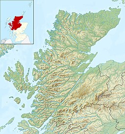 Neave Island Neave Island shown within Highland Scotland | |
| OS grid reference | NC663643 |
| Coordinates | 58°32′N 4°17′W / 58.54°N 4.29°W |
| Physical geography | |
| Island group | Highland / Islands of Sutherland |
| Area | 30 ha (74 acres)[3] |
| Highest elevation | 70 m (230 ft) |
| Administration | |
| Sovereign state | United Kingdom |
| Country | Scotland |
| Council area | Highland |
| Demographics | |
| Population | 0 |
| References | [4] |
Neave Island is a small rugged island to the east of Eilean nan Ròn in Sutherland, separated from the mainland by a narrow channel, Caol Beag.[2] It is just over 1⁄2 mile (800 metres) offshore from the mainland settlement of Skerray and is known for its sandy beach on the far eastern end of the island.[5] There are remains of an ancient church, identified as St. Coloumba's Church on an 1874 map of the island.[6][7]
Footnotes edit
- ^ a b Haswell-Smith, Hamish (2004). The Scottish Islands. Edinburgh: Canongate. ISBN 978-1-84195-454-7.
- ^ a b "Coomb Island". Gazetteer for Scotland. Retrieved 22 November 2009.
- ^ Rick Livingstone’s Tables of the Islands of Scotland (pdf) Argyll Yacht Charters. Retrieved 12 Dec 2011.
- ^ Ordnance Survey. OS Maps Online (Map). 1:25,000. Leisure.
- ^ "An island to myself". John o'Groat Journal. 28 May 2008. Retrieved 22 November 2009.
- ^ Scotflyer / Alan Moar. "Neave Island". Flickr. Retrieved 22 November 2009.
- ^ "Historical perspective for Coomb Island". Gazetteer for Scotland. Retrieved 22 November 2009.
Wikimedia Commons has media related to Neave Island.
58°32′48″N 4°17′53″W / 58.54667°N 4.29806°W