


Summary
Neemrana (/ niːmərɑːɳɑː / ) is an ancient historical town in Kot Behror of Rajasthan, India, 66 km (41 mi) from Alwar city, 122 km (76 mi) from New Delhi and 150 km (93 mi) from Jaipur, on the Delhi - Jaipur highway in Neemrana tehsil. It was one of the three capitals of the Chauhans of Ajmer and the last refuge of their descendants after the loss of Delhi. It is between Behror and Shahajahanpur.
Neemrana | |
|---|---|
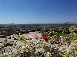 Neemrana Fort Palace terrace and the town below in Rath Kshetra (RJ) | |
| Nickname: Neemrana | |
 Neemrana Location in Rajasthan, India  Neemrana Neemrana (India) | |
| Coordinates: 27°59′20″N 76°23′18″E / 27.98889°N 76.38833°E | |
| Country | |
| State | Rajasthan |
| District | Kotputli-Behror district |
| Government | |
| • Type | Municipal Corporation |
| • Body | Nagar Palika Neemrana |
| Languages | |
| • Official | Hindi, Hirwati |
| Time zone | UTC+5:30 (IST) |
| PIN | 301705 |
| Nearest city | Behror |
Etymology edit
According to the most commonly accepted legend, Neemrana is said to be named after the defeated chieftain, Nimola Meva. Another legend says it is named after Neem (Azadirachta indica) trees.
History edit
Neemrana Fort Palace was constructed in 1464 AD by Maharaja of Parmar Rajputs, and supported by Chauhans of Ajmer. Subsequently, converted into the first heritage hotel of India in the mid 1970s. Chauhans of Ajmer after the loss of Delhi, returned to Neemrana village.
Topography edit
Neemrana town proper is surrounded by the Aravalli Hills to the north and acts as a gateway to the Sahibi River Valley. The soil surrounding the hills is not fertile. There are scanty surface water resources. Sahibi river, which flows around 5 km south east, is usually dry. Various small streams used to emerge from the hills but are now dry.
Industry edit

The Rajasthan government, through the Rajasthan State Industrial Development & Investment Corporation (RIICO), has developed industrial zones in various stages in Neemrana in the past several years. Apart from the usual industrial areas, the Export Promotion Industrial Park (EPIP) and the Japanese Industrial Zone in Majra Kath are particularly noteworthy. India's first Japanese SEZ which is tax-concession-based was established here. Besides major industries like Hero Motocorp, Daikin and Parle Agro present here, India's first microgrid solar power plant was established in Neemrana.[1]
Transport edit
The only mode of connectivity to other cities is by road. There is no railway connectivity. NH 48 connects it to Delhi - 110 km and to Jaipur - 140 km. The nearest railway station is at Kund. The nearest airstrip is the Bachhod Airstrip - 20 km. The nearest international airport is the Indira Gandhi International Airport - 100 km.
Education edit
Neemrana has many Universities and Colleges, chief among them:
- NIIT University
- Raffles University
- Parle School
- Vrindavan School
- Aeronautics College
- Nalanda University.
References edit
- ^ "Mini-Nippon in Rajasthan's Neemrana - Times of India". The Times of India. Retrieved 20 August 2018.