


Summary
Nemansky District (Russian: Нема́нский райо́н) is an administrative district (raion), one of the fifteen in Kaliningrad Oblast, Russia.[1] As a municipal division, it is incorporated as Nemansky Municipal District.[4] It is located in the north of the oblast. The area of the district is 699.3 square kilometers (270.0 sq mi).[citation needed] Its administrative center is the town of Neman.[2] Population: 20,132 (2010 Russian census);[3] 22,536 (2002 Census);[6] 8,904 (1989 Soviet census).[7][8] The population of Neman accounts for 58.6% of the district's total population.[3]
Nemansky District
Неманский район | |
|---|---|
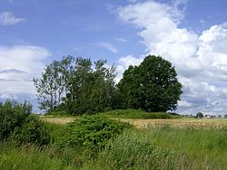 Landscape in Nemansky District | |
 Flag  Coat of arms | |
 Location of Nemansky District in Kaliningrad Oblast | |
| Coordinates: 54°02′N 22°02′E / 54.033°N 22.033°E | |
| Country | Russia |
| Federal subject | Kaliningrad Oblast[1] |
| Established | 7 April 1946 |
| Administrative center | Neman[2] |
| Area | |
| • Total | 699.3 km2 (270.0 sq mi) |
| Population | |
| • Total | 20,132 |
| • Density | 29/km2 (75/sq mi) |
| • Urban | 58.6% |
| • Rural | 41.4% |
| Administrative structure | |
| • Administrative divisions | 1 Towns of district significance, 2 Rural okrugs |
| • Inhabited localities[2] | 1 cities/towns, 49 rural localities |
| Municipal structure | |
| • Municipally incorporated as | Nemansky Municipal District[4] |
| • Municipal divisions[4] | 1 urban settlements, 2 rural settlements |
| Time zone | UTC+2 (MSK–1 |
| OKTMO ID | 27621000 |
| Website | http://neman.gov39.ru/ |
Geography edit
The district borders Lithuania along the Neman River. It surrounds the town of Sovetsk, which is not a part of the district. The railway line from Chernyakhovsk to Sovetsk passes through the district, as well as a cargo line from Sovetsk to Neman, and the main road Kaliningrad–Talpaki–Sovetsk, which carries the major part of traffic to St. Petersburg via Lithuania and Latvia.
Nemansky District is sparsely populated; forests and steppe pasture-land prevail.
References edit
Notes edit
- ^ a b Law #463
- ^ a b c Resolution #639
- ^ a b c Russian Federal State Statistics Service (2011). Всероссийская перепись населения 2010 года. Том 1 [2010 All-Russian Population Census, vol. 1]. Всероссийская перепись населения 2010 года [2010 All-Russia Population Census] (in Russian). Federal State Statistics Service.
- ^ a b c Law #257
- ^ "Об исчислении времени". Официальный интернет-портал правовой информации (in Russian). June 3, 2011. Retrieved January 19, 2019.
- ^ Federal State Statistics Service (May 21, 2004). Численность населения России, субъектов Российской Федерации в составе федеральных округов, районов, городских поселений, сельских населённых пунктов – районных центров и сельских населённых пунктов с населением 3 тысячи и более человек [Population of Russia, Its Federal Districts, Federal Subjects, Districts, Urban Localities, Rural Localities—Administrative Centers, and Rural Localities with Population of Over 3,000] (XLS). Всероссийская перепись населения 2002 года [All-Russia Population Census of 2002] (in Russian).
- ^ Всесоюзная перепись населения 1989 г. Численность наличного населения союзных и автономных республик, автономных областей и округов, краёв, областей, районов, городских поселений и сёл-райцентров [All Union Population Census of 1989: Present Population of Union and Autonomous Republics, Autonomous Oblasts and Okrugs, Krais, Oblasts, Districts, Urban Settlements, and Villages Serving as District Administrative Centers]. Всесоюзная перепись населения 1989 года [All-Union Population Census of 1989] (in Russian). Институт демографии Национального исследовательского университета: Высшая школа экономики [Institute of Demography at the National Research University: Higher School of Economics]. 1989 – via Demoscope Weekly.
- ^ In 1989, Neman was administratively incorporated separately from the district, so the 1989 Census data do not include its population.
Sources edit
- Калининградская областная Дума. Закон №463 от 27 мая 2010 г. «Об административно-территориальном устройстве Калининградской области», в ред. Закона №450 от 3 июля 2015 г. «О внесении изменений в Закон Калининградской области "Об административно-территориальном устройстве Калининградской области"». Вступил в силу со дня официального опубликования. Опубликован: "Калининградская правда" (вкладыш "Ведомости Правительства Калининградской области"), №112, 26 июня 2010 г. (Kaliningrad Oblast Duma. Law #463 of May 27, 2010 On the Administrative-Territorial Structure of Kaliningrad Oblast, as amended by the Law #450 of July 3, 2015 On Amending the Law of Kaliningrad Oblast "On the Administrative-Territorial Structure of Kaliningrad Oblast". Effective as of the day of the official publication.).
- Правительство Калининградской области. Постановление №640 от 30 августа 2011 г. «Об утверждении реестра объектов административно-территориального деления Калининградской области», в ред. Постановления №877 от 21 ноября 2011 г «О внесении изменения в Постановление Правительства Калининградской области от 30 августа 2011 г. №640». Вступил в силу со дня официального опубликования. Опубликован: "Калининградская правда" (вкладыш "Официально"), №170, 15 сентября 2011 г. (Government of Kaliningrad Oblast. Resolution #640 of August 30, 2011 On the Adoption of the Registry of the Objects of the Administrative-Territorial Divisions of Kaliningrad Oblast, as amended by the Resolution #877 of November 21, 2011 On Amending the Resolution of the Government of Kaliningrad Oblast #640 of August 30, 2011. Effective as of the day of the official publication.).
- Калининградская областная Дума. Закон №257 от 30 июня 2008 г. «Об организации местного самоуправления на территории муниципального образования "Неманский городской округ"», в ред. Закона №89 от 15 февраля 2012 г «О внесении изменений в Закон Калининградской области "Об организации местного самоуправления на территории муниципального образования "Неманский городской округ"». Вступил в силу со дня официального опубликования. Опубликован: "Калининградская правда", №124, 11 июля 2008 г. (Kaliningrad Oblast Duma. Law #257 of June 30, 2008 On the Organization of the Local Self-Government on the Territory of the Municipal Formation of "Nemansky Urban Okrug", as amended by the Law #89 of February 15, 2012 On Amending the Law of Kaliningrad Oblast "On the Organization of the Local Self-Government on the Territory of the Municipal Formation of "Nemansky Urban Okrug". Effective as of the day of the official publication.).
External links edit
- Official website of Nemansky District (in Russian)
- Nemanskiye Vesti newspaper (in Russian)