
KNOWPIA
WELCOME TO KNOWPIA

Neuve-Chapelle 
Summary
Neuve-Chapelle (West Flemish: Nieuwkappel) is a commune in the Pas-de-Calais department in the Hauts-de-France region of France.[3] It was the site of a First World War battle in 1915.
Neuve-Chapelle
Nieuwkappel | |
|---|---|
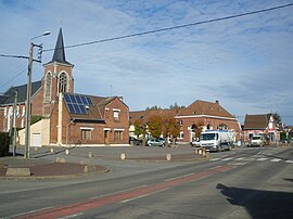 The centre of Neuve-Chapelle | |
 Coat of arms | |
Location of Neuve-Chapelle .mw-parser-output .locmap .od{position:absolute}.mw-parser-output .locmap .id{position:absolute;line-height:0}.mw-parser-output .locmap .l0{font-size:0;position:absolute}.mw-parser-output .locmap .pv{line-height:110%;position:absolute;text-align:center}.mw-parser-output .locmap .pl{line-height:110%;position:absolute;top:-0.75em;text-align:right}.mw-parser-output .locmap .pr{line-height:110%;position:absolute;top:-0.75em;text-align:left}.mw-parser-output .locmap .pv>div{display:inline;padding:1px}.mw-parser-output .locmap .pl>div{display:inline;padding:1px;float:right}.mw-parser-output .locmap .pr>div{display:inline;padding:1px;float:left}html.skin-theme-clientpref-night .mw-parser-output .od,html.skin-theme-clientpref-night .mw-parser-output .od .pv>div,html.skin-theme-clientpref-night .mw-parser-output .od .pl>div,html.skin-theme-clientpref-night .mw-parser-output .od .pr>div{background:#000;color:#fff}html.skin-theme-clientpref-night .mw-parser-output .locmap{filter:grayscale(0.6)}@media(prefers-color-scheme:dark){html.skin-theme-clientpref-os .mw-parser-output .locmap{filter:grayscale(0.6)}html.skin-theme-clientpref-os .mw-parser-output .od,html.skin-theme-clientpref-os .mw-parser-output .od .pv>div,html.skin-theme-clientpref-os .mw-parser-output .od .pl>div,html.skin-theme-clientpref-os .mw-parser-output .od .pr>div{background:#000;color:#fff}}  Neuve-Chapelle  Neuve-Chapelle | |
| Coordinates: 50°35′04″N 2°46′52″E / 50.5844°N 2.7811°E | |
| Country | France |
| Region | Hauts-de-France |
| Department | Pas-de-Calais |
| Arrondissement | Béthune |
| Canton | Beuvry |
| Intercommunality | CA Béthune-Bruay, Artois-Lys Romane |
| Government | |
| • Mayor (2020–2026) | Tanguy Robiquet[1] |
| Area 1 | 1.86 km2 (0.72 sq mi) |
| Population (2021)[2] | 1,419 |
| • Density | 760/km2 (2,000/sq mi) |
| Time zone | UTC+01:00 (CET) |
| • Summer (DST) | UTC+02:00 (CEST) |
| INSEE/Postal code | 62606 /62840 |
| Elevation | 17–20 m (56–66 ft) (avg. 19 m or 62 ft) |
| 1 French Land Register data, which excludes lakes, ponds, glaciers > 1 km2 (0.386 sq mi or 247 acres) and river estuaries. | |
Geography edit
Neuve-Chapelle is situated some 8 miles (13 km) northeast of Béthune and 16 miles (26 km) southwest of Lille, near the junction of the D947 and D171 roads.
History edit
The village gave its name to a battle of the First World War that began on 10 March 1915, and in which it was captured, not for the first time, by the IV and I Indian Corps. It was later adopted by the County Borough of Blackpool and was awarded the Croix de Guerre in 1922.
Population edit
| Year | Pop. | ±% p.a. |
|---|---|---|
| 1968 | 462 | — |
| 1975 | 471 | +0.28% |
| 1982 | 548 | +2.19% |
| 1990 | 864 | +5.86% |
| 1999 | 958 | +1.15% |
| 2007 | 1,373 | +4.60% |
| 2012 | 1,319 | −0.80% |
| 2017 | 1,440 | +1.77% |
| Source: INSEE[4] | ||
Places of interest edit
- The church of St. Christophe, rebuilt, as was much of the commune, after World War I.
- The Commonwealth War Graves Commission cemeteries and memorials.
- The Neuve-Chapelle Indian Memorial of the British Indian Army.
- Finds from the battlefield, in the mairie.
See also edit
References edit
- ^ "Répertoire national des élus: les maires". data.gouv.fr, Plateforme ouverte des données publiques françaises (in French). 2 December 2020.
- ^ "Populations légales 2021". The National Institute of Statistics and Economic Studies. 28 December 2023.
- ^ INSEE commune file
- ^ Population en historique depuis 1968, INSEE
External links edit
Wikimedia Commons has media related to Neuve-Chapelle.
- Website about the battle of Neuve-Chapelle
- The CWGC Indian memorial
- Neuve-Chapelle Farm CWGC cemetery
- The CWGC British cemetery