


Summary
Nickerson is a city in Reno County, Kansas, United States.[1] As of the 2020 census, the population of the city was 1,058.[3] It was named in honor of Thomas Nickerson, former president of Atchison, Topeka and Santa Fe Railway.[4][5]
Nickerson, Kansas | |
|---|---|
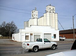 Grain elevator (2003) | |
 Location within Reno County and Kansas | |
 KDOT map of Reno County (legend) | |
| Coordinates: 38°08′56″N 98°05′18″W / 38.14889°N 98.08833°W[1] | |
| Country | United States |
| State | Kansas |
| County | Reno |
| Founded | 1870s |
| Platted | 1872 |
| Incorporated | 1879 |
| Named for | Thomas Nickerson |
| Area | |
| • Total | 1.29 sq mi (3.35 km2) |
| • Land | 1.29 sq mi (3.35 km2) |
| • Water | 0.00 sq mi (0.00 km2) |
| Elevation | 1,595 ft (486 m) |
| Population | |
| • Total | 1,058 |
| • Density | 820/sq mi (320/km2) |
| Time zone | UTC-6 (CST) |
| • Summer (DST) | UTC-5 (CDT) |
| ZIP code | 67561 |
| Area code | 620 |
| FIPS code | 20-50525 |
| GNIS ID | 485630[1] |
| Website | nickersonks.org |
History edit
Nickerson was laid out in 1872 when the Atchison, Topeka and Santa Fe Railway was extended to that point. The first houses were built at the site in 1875. Nickerson was incorporated as a city in 1879.[6]
Geography edit
According to the United States Census Bureau, the city has a total area of 1.35 square miles (3.50 km2), all of it land.[7]
Climate edit
The climate in this area is characterized by hot, humid summers and generally mild to cool winters. According to the Köppen Climate Classification system, Nickerson has a humid subtropical climate, abbreviated "Cfa" on climate maps.[8]
Films edit
Demographics edit
| Census | Pop. | Note | %± |
|---|---|---|---|
| 1880 | 597 | — | |
| 1890 | 1,662 | 178.4% | |
| 1900 | 1,038 | −37.5% | |
| 1910 | 1,195 | 15.1% | |
| 1920 | 1,049 | −12.2% | |
| 1930 | 1,052 | 0.3% | |
| 1940 | 1,052 | 0.0% | |
| 1950 | 1,013 | −3.7% | |
| 1960 | 1,091 | 7.7% | |
| 1970 | 1,187 | 8.8% | |
| 1980 | 1,292 | 8.8% | |
| 1990 | 1,137 | −12.0% | |
| 2000 | 1,194 | 5.0% | |
| 2010 | 1,070 | −10.4% | |
| 2020 | 1,058 | −1.1% | |
| U.S. Decennial Census | |||
2020 census edit
The 2020 United States census counted 1,058 people, 399 households, and 278 families in Nickerson.[10][11] The population density was 817.0 per square mile (315.4/km2). There were 476 housing units at an average density of 367.6 per square mile (141.9/km2).[11][12] The racial makeup was 89.22% (944) white or European American (87.81% non-Hispanic white), 0.38% (4) black or African-American, 0.19% (2) Native American or Alaska Native, 0.28% (3) Asian, 0.38% (4) Pacific Islander or Native Hawaiian, 2.55% (27) from other races, and 6.99% (74) from two or more races.[13] Hispanic or Latino of any race was 5.58% (59) of the population.[14]
Of the 399 households, 34.8% had children under the age of 18; 49.9% were married couples living together; 23.1% had a female householder with no spouse or partner present. 24.3% of households consisted of individuals and 8.8% had someone living alone who was 65 years of age or older.[11] The average household size was 2.4 and the average family size was 2.9.[15] The percent of those with a bachelor’s degree or higher was estimated to be 11.0% of the population.[16]
29.4% of the population was under the age of 18, 6.4% from 18 to 24, 23.6% from 25 to 44, 23.4% from 45 to 64, and 17.1% who were 65 years of age or older. The median age was 37.9 years. For every 100 females, there were 100.8 males.[11] For every 100 females ages 18 and older, there were 101.3 males.[11]
The 2016-2020 5-year American Community Survey estimates show that the median household income was $53,224 (with a margin of error of +/- $5,923) and the median family income was $54,250 (+/- $5,809).[17] Males had a median income of $39,375 (+/- $6,621) versus $27,930 (+/- $3,995) for females. The median income for those above 16 years old was $33,810 (+/- $5,277).[18] Approximately, 6.3% of families and 7.4% of the population were below the poverty line, including 16.3% of those under the age of 18 and 1.9% of those ages 65 or over.[19][20]
2010 census edit
As of the census[21] of 2010, there were 1,070 people, 422 households, and 318 families residing in the city. The population density was 792.6 inhabitants per square mile (306.0/km2). There were 493 housing units at an average density of 365.2 per square mile (141.0/km2). The racial makeup of the city was 98.7% White, 0.4% African American, 0.1% Native American, 0.1% from other races, and 0.7% from two or more races. Hispanic or Latino of any race were 2.1% of the population.
There were 422 households, of which 32.2% had children under the age of 18 living with them, 55.7% were married couples living together, 13.0% had a female householder with no husband present, 6.6% had a male householder with no wife present, and 24.6% were non-families. 21.8% of all households were made up of individuals, and 10.4% had someone living alone who was 65 years of age or older. The average household size was 2.54 and the average family size was 2.91.
The median age in the city was 38.8 years. 26.2% of residents were under the age of 18; 7.1% were between the ages of 18 and 24; 24.4% were from 25 to 44; 26.5% were from 45 to 64; and 15.7% were 65 years of age or older. The gender makeup of the city was 50.7% male and 49.3% female.
2000 census edit
As of the census[22] of 2000, there were 1,194 people, 460 households, and 333 families residing in the city. The population density was 883.8 inhabitants per square mile (341.2/km2). There were 507 housing units at an average density of 375.3 per square mile (144.9/km2). The racial makeup of the city was 96.40% White, 0.25% African American, 0.59% Native American, 1.01% from other races, and 1.76% from two or more races. Hispanic or Latino of any race were 2.85% of the population.
There were 460 households, out of which 36.1% had children under the age of 18 living with them, 58.3% were married couples living together, 10.2% had a female householder with no husband present, and 27.4% were non-families. 24.3% of all households were made up of individuals, and 10.2% had someone living alone who was 65 years of age or older. The average household size was 2.58 and the average family size was 3.03.
In the city, the population was spread out, with 28.6% under the age of 18, 8.2% from 18 to 24, 27.8% from 25 to 44, 22.2% from 45 to 64, and 13.1% who were 65 years of age or older. The median age was 36 years. For every 100 females, there were 99.0 males. For every 100 females age 18 and over, there were 92.8 males.
The median income for a household in the city was $33,269, and the median income for a family was $34,188. Males had a median income of $29,091 versus $18,313 for females. The per capita income for the city was $13,609. About 10.3% of families and 13.0% of the population were below the poverty line, including 15.8% of those under age 18 and 10.1% of those age 65 or over.
Government edit
- City Hall, 15 N. Nickerson St.
Education edit
The community is served by Nickerson–South Hutchinson USD 309 public school district. The district's schools, which have an average enrollment of 350 students annually, include Nickerson High School and Nickerson Grade School.[citation needed]
Infrastructure edit
Transportation edit
Highway edit
K-96 / K-14 state highway previously passed through Nickerson. In 2023, it was replaced by a new limited access freeway that was completed east of the cities of Nickerson and Sterling. Initially it was constructed as a super two freeway, but right-of-way has been secured to enable future expansion to four lanes.[23][24][25]
Rail edit
The Kansas and Oklahoma Railroad passes through the city.
Gallery edit
-
 Nickerson High School 2005
 -
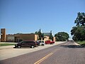
 Nickerson Main Street
 -
 United Methodist Church
 -
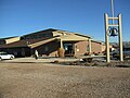
 Panther Den


References edit
- ^ a b c d U.S. Geological Survey Geographic Names Information System: Nickerson, Kansas
- ^ "2019 U.S. Gazetteer Files". United States Census Bureau. Retrieved July 24, 2020.
- ^ a b "Profile of Nickerson, Kansas in 2020". United States Census Bureau. Archived from the original on March 28, 2022. Retrieved March 28, 2022.
- ^ "Nickerson - KS-Cyclopedia - 1912". Archived from the original on September 14, 2005. Retrieved July 29, 2005.
- ^ The Atchison, Topeka, and Santa Fe Railway and Auxiliary Companies - Annual Meetings, and Directors and Officers; January 1, 1902
- ^ Blackmar, Frank Wilson (1912). Kansas: A Cyclopedia of State History, Volume 2. Standard Publishing Company. pp. 369.
- ^ "US Gazetteer files 2010". United States Census Bureau. Archived from the original on January 25, 2012. Retrieved July 6, 2012.
- ^ Climate Summary for Nickerson, Kansas
- ^ Shaffer, Bill (Spring 2005). "The Summer of Picnic" (PDF). Kansas Heritage. 13 (1): 11. Retrieved September 14, 2016.
- ^ "US Census Bureau, Table P16: HOUSEHOLD TYPE". data.census.gov. Retrieved January 3, 2024.
- ^ a b c d e "US Census Bureau, Table DP1: PROFILE OF GENERAL POPULATION AND HOUSING CHARACTERISTICS". data.census.gov. Retrieved January 3, 2024.
- ^ Bureau, US Census. "Gazetteer Files". Census.gov. Retrieved December 30, 2023.
- ^ "US Census Bureau, Table P1: RACE". data.census.gov. Retrieved January 3, 2024.
- ^ "US Census Bureau, Table P2: HISPANIC OR LATINO, AND NOT HISPANIC OR LATINO BY RACE". data.census.gov. Retrieved January 3, 2024.
- ^ "US Census Bureau, Table S1101: HOUSEHOLDS AND FAMILIES". data.census.gov. Retrieved January 3, 2024.
- ^ "US Census Bureau, Table S1501: EDUCATIONAL ATTAINMENT". data.census.gov. Retrieved January 3, 2024.
- ^ "US Census Bureau, Table S1903: MEDIAN INCOME IN THE PAST 12 MONTHS (IN 2020 INFLATION-ADJUSTED DOLLARS)". data.census.gov. Retrieved January 3, 2024.
- ^ "US Census Bureau, Table S2001: EARNINGS IN THE PAST 12 MONTHS (IN 2020 INFLATION-ADJUSTED DOLLARS)". data.census.gov. Retrieved January 3, 2024.
- ^ "US Census Bureau, Table S1701: POVERTY STATUS IN THE PAST 12 MONTHS". data.census.gov. Retrieved January 3, 2024.
- ^ "US Census Bureau, Table S1702: POVERTY STATUS IN THE PAST 12 MONTHS OF FAMILIES". data.census.gov. Retrieved January 3, 2024.
- ^ "U.S. Census website". United States Census Bureau. Retrieved July 6, 2012.
- ^ "U.S. Census website". United States Census Bureau. Retrieved January 31, 2008.
- ^ "Officials welcome new K-14 realignment between Hutch & Sterling". Great Bend Post. June 16, 2023. Archived from the original on July 12, 2023.
- ^ "Kansas Department of Transportation finally awards contract for Northwest Passage highway project". The Hutchinson News. March 17, 2021. Archived from the original on July 12, 2023.
- ^ "K-96 Location Study" (PDF). Kansas Department of Transportation (KDOT). December 2010. Archived (PDF) from the original on July 13, 2023.
Further reading edit
External links edit
- Nickerson - Official
- Nickerson - Directory of Public Officials
- Nickerson city map, KDOT