


Summary
Nikolskoye (Russian: Нико́льское, Finnish: Lomkka) is a town in Tosnensky District of Leningrad Oblast, Russia, located on the Tosna River 40 kilometers (25 mi) southeast of the center of St. Petersburg. Population: 19,280 (2010 Russian census);[3] 17,309 (2002 Census);[8] 17,215 (1989 Soviet census).[9]
Nikolskoye
Никольское | |
|---|---|
 Welcome sign at the western entry to Nikolskoye | |
Location of Nikolskoye .mw-parser-output .locmap .od{position:absolute}.mw-parser-output .locmap .id{position:absolute;line-height:0}.mw-parser-output .locmap .l0{font-size:0;position:absolute}.mw-parser-output .locmap .pv{line-height:110%;position:absolute;text-align:center}.mw-parser-output .locmap .pl{line-height:110%;position:absolute;top:-0.75em;text-align:right}.mw-parser-output .locmap .pr{line-height:110%;position:absolute;top:-0.75em;text-align:left}.mw-parser-output .locmap .pv>div{display:inline;padding:1px}.mw-parser-output .locmap .pl>div{display:inline;padding:1px;float:right}.mw-parser-output .locmap .pr>div{display:inline;padding:1px;float:left}html.skin-theme-clientpref-night .mw-parser-output .od,html.skin-theme-clientpref-night .mw-parser-output .od .pv>div,html.skin-theme-clientpref-night .mw-parser-output .od .pl>div,html.skin-theme-clientpref-night .mw-parser-output .od .pr>div{background:#000;color:#fff}html.skin-theme-clientpref-night .mw-parser-output .locmap{filter:grayscale(0.6)}@media(prefers-color-scheme:dark){html.skin-theme-clientpref-os .mw-parser-output .locmap{filter:grayscale(0.6)}html.skin-theme-clientpref-os .mw-parser-output .od,html.skin-theme-clientpref-os .mw-parser-output .od .pv>div,html.skin-theme-clientpref-os .mw-parser-output .od .pl>div,html.skin-theme-clientpref-os .mw-parser-output .od .pr>div{background:#000;color:#fff}}  Nikolskoye Location of Nikolskoye 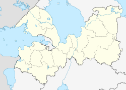 Nikolskoye Nikolskoye (Leningrad Oblast) | |
| Coordinates: 59°42′N 30°47′E / 59.700°N 30.783°E | |
| Country | Russia |
| Federal subject | Leningrad Oblast[1] |
| Administrative district | Tosnensky District[1] |
| Settlement municipal formation | Nikolskoye Settlement Municipal Formation[1] |
| Established | 1710[2] |
| Town status since | August 6, 1990[2] |
| Elevation | 30 m (100 ft) |
| Population | |
| • Total | 19,280 |
| • Estimate (2018)[4] | 22,286 (+15.6%) |
| • Capital of | Nikolskoye Settlement Municipal Formation[1] |
| • Municipal district | Tosnensky Municipal District[5] |
| • Urban settlement | Nikolskoye Urban Settlement[5] |
| • Capital of | Nikolskoye Urban Settlement[5] |
| Time zone | UTC+3 (MSK |
| Postal code(s)[7] | 187026 |
| OKTMO ID | 41648108001 |
| Website | www |
History edit
It was founded in 1710, when Peter the Great resettled here a number of masons from Central Russia to serve newly founded St. Petersburg and surroundings.[2] There were quarries around Nikolskoye and the settlement supplied stone, brick, and timber to St. Petersburg. The name was given because the settlers brought an icon of Saint Nicholas and built a church to host the icon.[2]
In the course of the administrative reform carried out in 1708 by Peter the Great, the area was included into Ingermanland Governorate (known since 1710 as St. Petersburg Governorate).[citation needed] In 1727, it became a part of Sankt-Peterburgsky Uyezd.[citation needed]
In 1876, colonel Boris Vinner bought a piece of land from the peasants of the selo of Nikolskoye and in 1877 he opened there a privately owned gunpowder works, known as Yekaterininsky Zavod. Around the same time, a glass factory was opened. It belonged to merchant Maximilian Frank and was eventually destroyed during World War II. Quarries around Nikolskoye stopped operating in the 1920s.[2]
Sankt-Peterburgsky Uyezd was renamed Petrogradsky in 1914[citation needed] and then Leningradsky in January 1924.[10] On August 1, 1927, the uyezds were abolished and Kolpinsky District, with the administrative center in the town of Kolpino, was established.[11] The governorates were also abolished and the district became a part of Leningrad Okrug of Leningrad Oblast.[11] Nikolskoye became a part of Kolpinsky District.[11] On August 15, 1930, the okrugs were abolished as well and the districts were directly subordinated to the oblast.[12] On August 19, 1930, the district was abolished.[11] Nikolskoye became a part of newly established Tosnensky District.[13]
Between September 1941 and January 1944, during World War II, Tosnensky District was occupied by German troops.[13] Nikolskoye was lying basically at the front line during the Siege of Leningrad, and was greatly damaged.[2]
Nikolskoye was granted urban-type settlement status on June 9, 1958[13] and town status on August 6, 1990.[2]
Administrative and municipal status edit
Within the framework of administrative divisions, it is, together with three rural localities, incorporated within Tosnensky District as Nikolskoye Settlement Municipal Formation.[1] As a municipal division, Nikolskoye Settlement Municipal Formation is incorporated within Tosnensky Municipal District as Nikolskoye Urban Settlement.[5]
Economy edit
Industry edit
In Nikolskoye, there are several factories producing materials for construction.[14]
Transportation edit
The railway in Nikolskoye is not used for passenger traffic. The closest railway stations are Ivanovskaya on the line connecting St. Petersburg and Mga, Popovka and Sablino on the line connecting St. Petersburg and Moscow, and Pustynka on the line connecting Mga and Gatchina. All these stations are served by suburban trains.
Nikolskoye is connected by roads with Otradnoye, Ulyanovka, and Krasny Bor. Via Ulyanovka, it has access to the M10 Highway, which connects St. Petersburg and Moscow.
Culture and recreation edit

The town contains two objects classified as cultural and historical heritage of local significance.[15] They commemorate events of World War II.
There are two churches: the original town-founding church dedicated to Saint Nicholas and modern wooden church dedicated to Saint Tsar Nicholas II.[16]
References edit
Notes edit
- ^ a b c d e f Oblast Law #32-oz
- ^ a b c d e f g История Никольского (in Russian). City Information Portal. Retrieved March 14, 2014.
{{cite web}}: Check|url=value (help) - ^ a b Russian Federal State Statistics Service (2011). Всероссийская перепись населения 2010 года. Том 1 [2010 All-Russian Population Census, vol. 1]. Всероссийская перепись населения 2010 года [2010 All-Russia Population Census] (in Russian). Federal State Statistics Service.
- ^ "26. Численность постоянного населения Российской Федерации по муниципальным образованиям на 1 января 2018 года". Federal State Statistics Service. Retrieved January 23, 2019.
- ^ a b c d Law #116-oz
- ^ "Об исчислении времени". Официальный интернет-портал правовой информации (in Russian). June 3, 2011. Retrieved January 19, 2019.
- ^ Почта России. Информационно-вычислительный центр ОАСУ РПО. (Russian Post). Поиск объектов почтовой связи (Postal Objects Search) (in Russian)
- ^ Federal State Statistics Service (May 21, 2004). Численность населения России, субъектов Российской Федерации в составе федеральных округов, районов, городских поселений, сельских населённых пунктов – районных центров и сельских населённых пунктов с населением 3 тысячи и более человек [Population of Russia, Its Federal Districts, Federal Subjects, Districts, Urban Localities, Rural Localities—Administrative Centers, and Rural Localities with Population of Over 3,000] (XLS). Всероссийская перепись населения 2002 года [All-Russia Population Census of 2002] (in Russian).
- ^ Всесоюзная перепись населения 1989 г. Численность наличного населения союзных и автономных республик, автономных областей и округов, краёв, областей, районов, городских поселений и сёл-райцентров [All Union Population Census of 1989: Present Population of Union and Autonomous Republics, Autonomous Oblasts and Okrugs, Krais, Oblasts, Districts, Urban Settlements, and Villages Serving as District Administrative Centers]. Всесоюзная перепись населения 1989 года [All-Union Population Census of 1989] (in Russian). Институт демографии Национального исследовательского университета: Высшая школа экономики [Institute of Demography at the National Research University: Higher School of Economics]. 1989 – via Demoscope Weekly.
- ^ Петроградский уезд (1917 г. - январь 1924 г.), Ленинградский уезд (январь 1924 г.- август 1927 г.) (in Russian). Система классификаторов исполнительных органов государственной власти Санкт-Петербурга. Archived from the original on December 28, 2013. Retrieved March 14, 2014.
- ^ a b c d Колпинский район (август 1927 г . – август 1930 г.) (in Russian). Система классификаторов исполнительных органов государственной власти Санкт-Петербурга. Archived from the original on March 14, 2014. Retrieved January 24, 2013.
- ^ "00344" Ленинградская область (in Russian). Справочник по истории Коммунистической партии и Советского Союза 1898–1991. Retrieved March 14, 2014.
- ^ a b c Тосненский район (август 1930 г.) (in Russian). Система классификаторов исполнительных органов государственной власти Санкт-Петербурга. Archived from the original on October 29, 2013. Retrieved March 14, 2014.
- ^ "Никольское – кластер производителей стройматериалов". Ленинградская область Экономика и Инвестиции (68). Saint Petersburg. 2011.
- ^ Памятники истории и культуры народов Российской Федерации (in Russian). Russian Ministry of Culture. Retrieved June 2, 2016.
- ^ (in English) TEMPLE OF SAINT TSAR NICHOLAS II THE PASSION-BEARER (official site)
Sources edit
- Законодательное собрание Ленинградской области. Областной закон №32-оз от 15 июня 2010 г. «Об административно-территориальном устройстве Ленинградской области и порядке его изменения», в ред. Областного закона №23-оз от 8 мая 2014 г. «Об объединении муниципальных образований "Приморское городское поселение" Выборгского района Ленинградской области и "Глебычевское сельское поселение" Выборгского района Ленинградской области и о внесении изменений в отдельные Областные законы». Вступил в силу со дня официального опубликования. Опубликован: "Вести", №112, 23 июня 2010 г. (Legislative Assembly of Leningrad Oblast. Oblast Law #32-oz of June 15, 2010 On the Administrative-Territorial Structure of Leningrad Oblast and on the Procedures for Its Change, as amended by the Oblast Law #23-oz of May 8, 2014 On Merging the Municipal Formations of "Primorskoye Urban Settlement" in Vyborgsky District of Leningrad Oblast and "Glebychevskoye Rural Settlement" in Vyborgsky District of Leningrad Oblast and on Amending Various Oblast Laws. Effective as of the day of the official publication.).
- Законодательное собрание Ленинградской области. Областной закон №116-оз от 22 декабря 2004 г. «Об установлении границ и наделении соответствующим статусом муниципального образования Тосненский муниципальный район и муниципальных образований в его составе», в ред. Областного закона №17-оз от 6 мая 2010 г «О внесении изменений в некоторые областные законы в связи с принятием федерального закона "О внесении изменений в отдельные законодательные акты Российской Федерации в связи с совершенствованием организации местного самоуправления"». Вступил в силу через 10 дней со дня официального опубликования (9 января 2005 г.). Опубликован: "Вестник Правительства Ленинградской области", №44, 30 декабря 2004 г. (Legislative Assembly of Leningrad Oblast. Oblast Law #116-oz of December 22, 2004 On Establishing the Borders of and Granting an Appropriate Status to the Municipal Formation of Tosnensky Municipal District and to the Municipal Formations It Comprises, as amended by the Oblast Law #17-oz of May 6, 2010 On Amending Various Oblast Laws Due to the Adoption of the Federal Law "On Amending Various Legislative Acts of the Russian Federation Due to the Improvement of the Organization of the Local Self-Government". Effective as of after 10 days from the day of the official publication (January 9, 2005).).