


Summary
Nizhniye Sergi (Russian: Ни́жние Серги́) is a town and the administrative center of Nizhneserginsky District in Sverdlovsk Oblast, Russia, located on a rolling plain surrounded by the Ural Mountains, on the Serga River 120 kilometers (75 mi) from Yekaterinburg, the administrative center of the oblast. Population: 10,336 (2010 Census);[2] 12,567 (2002 Census);[11] 14,938 (1989 Census).[12]
Nizhniye Sergi
Нижние Серги | |
|---|---|
 Flag  Coat of arms | |
Location of Nizhniye Sergi .mw-parser-output .locmap .od{position:absolute}.mw-parser-output .locmap .id{position:absolute;line-height:0}.mw-parser-output .locmap .l0{font-size:0;position:absolute}.mw-parser-output .locmap .pv{line-height:110%;position:absolute;text-align:center}.mw-parser-output .locmap .pl{line-height:110%;position:absolute;top:-0.75em;text-align:right}.mw-parser-output .locmap .pr{line-height:110%;position:absolute;top:-0.75em;text-align:left}.mw-parser-output .locmap .pv>div{display:inline;padding:1px}.mw-parser-output .locmap .pl>div{display:inline;padding:1px;float:right}.mw-parser-output .locmap .pr>div{display:inline;padding:1px;float:left}html.skin-theme-clientpref-night .mw-parser-output .od,html.skin-theme-clientpref-night .mw-parser-output .od .pv>div,html.skin-theme-clientpref-night .mw-parser-output .od .pl>div,html.skin-theme-clientpref-night .mw-parser-output .od .pr>div{background:#000;color:#fff}html.skin-theme-clientpref-night .mw-parser-output .locmap{filter:grayscale(0.6)}@media(prefers-color-scheme:dark){html.skin-theme-clientpref-os .mw-parser-output .locmap{filter:grayscale(0.6)}html.skin-theme-clientpref-os .mw-parser-output .od,html.skin-theme-clientpref-os .mw-parser-output .od .pv>div,html.skin-theme-clientpref-os .mw-parser-output .od .pl>div,html.skin-theme-clientpref-os .mw-parser-output .od .pr>div{background:#000;color:#fff}}  Nizhniye Sergi Location of Nizhniye Sergi 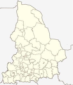 Nizhniye Sergi Nizhniye Sergi (Sverdlovsk Oblast) | |
| Coordinates: 56°40′N 59°19′E / 56.667°N 59.317°E | |
| Country | Russia |
| Federal subject | Sverdlovsk Oblast[1] |
| Administrative district | Nizhneserginsky District[1] |
| Town | Nizhniye Sergi[1] |
| Founded | 1743 |
| Elevation | 320 m (1,050 ft) |
| Population | |
| • Total | 10,336 |
| • Estimate (2018)[3] | 9,243 (−10.6%) |
| • Capital of | Nizhneserginsky District,[4] town of Nizhniye Sergi[5] |
| • Municipal district | Nizhneserginsky Municipal District[6] |
| • Urban settlement | Nizhneserginskoye Urban Settlement[6] |
| • Capital of | Nizhneserginsky Municipal District,[7] Nizhneserginskoye Urban Settlement[8] |
| Time zone | UTC+5 (MSK+2 |
| Postal code(s)[10] | 623090, 623091, 623093, 623094, 623099 |
| Dialing code(s) | +7 34396 |
| OKTMO ID | 65628101001 |
History edit
It was founded in 1743.[citation needed]
Administrative and municipal status edit
Within the framework of the administrative divisions, Nizhniye Sergi serves as the administrative center of Nizhneserginsky District.[4] As an administrative division, it is, together with eleven rural localities, incorporated within Nizhneserginsky District as the Town of Nizhniye Sergi.[1] As a municipal division, the Town of Nizhniye Sergi is incorporated within Nizhneserginsky Municipal District as Nizhneserginskoye Urban Settlement.[6][1]
Economy edit
The town is an industrial center. The basis of its economy is mainly a plant that produces nails, wires, and other products of ferrous metallurgy. Most of the production output is exported.
Tourism edit
Nizhniye Sergi, with its Lake Montayevo health resort, is a popular destination in the Ural region. The health resort is known for its mineral water that includes thirty-seven chemical elements.
References edit
Notes edit
- ^ a b c d e f Order #120-P
- ^ a b Russian Federal State Statistics Service (2011). Всероссийская перепись населения 2010 года. Том 1 [2010 All-Russian Population Census, vol. 1]. Всероссийская перепись населения 2010 года [2010 All-Russia Population Census] (in Russian). Federal State Statistics Service.
- ^ "26. Численность постоянного населения Российской Федерации по муниципальным образованиям на 1 января 2018 года". Federal State Statistics Service. Retrieved January 23, 2019.
- ^ a b Государственный комитет Российской Федерации по статистике. Комитет Российской Федерации по стандартизации, метрологии и сертификации. №ОК 019-95 1 января 1997 г. «Общероссийский классификатор объектов административно-территориального деления. Код 65 228», в ред. изменения №278/2015 от 1 января 2016 г.. (State Statistics Committee of the Russian Federation. Committee of the Russian Federation on Standardization, Metrology, and Certification. #OK 019-95 January 1, 1997 Russian Classification of Objects of Administrative Division (OKATO). Code 65 228, as amended by the Amendment #278/2015 of January 1, 2016. ).
- ^ Государственный комитет Российской Федерации по статистике. Комитет Российской Федерации по стандартизации, метрологии и сертификации. №ОК 019-95 1 января 1997 г. «Общероссийский классификатор объектов административно-территориального деления. Код 65 228 501», в ред. изменения №278/2015 от 1 января 2016 г.. (State Statistics Committee of the Russian Federation. Committee of the Russian Federation on Standardization, Metrology, and Certification. #OK 019-95 January 1, 1997 Russian Classification of Objects of Administrative Division (OKATO). Code 65 228 501, as amended by the Amendment #278/2015 of January 1, 2016. ).
- ^ a b c Law #85-OZ
- ^ Федеральная служба государственной статистики. Федеральное агентство по технологическому регулированию и метрологии. №ОК 033-2013 1 января 2014 г. «Общероссийский классификатор территорий муниципальных образований. Код 65 628». (Federal State Statistics Service. Federal Agency on Technological Regulation and Metrology. #OK 033-2013 January 1, 2014 Russian Classification of Territories of Municipal Formations. Code 65 628. ).
- ^ Федеральная служба государственной статистики. Федеральное агентство по технологическому регулированию и метрологии. №ОК 033-2013 1 января 2014 г. «Общероссийский классификатор территорий муниципальных образований. Код 65 628 101». (Federal State Statistics Service. Federal Agency on Technological Regulation and Metrology. #OK 033-2013 January 1, 2014 Russian Classification of Territories of Municipal Formations. Code 65 628 101. ).
- ^ "Об исчислении времени". Официальный интернет-портал правовой информации (in Russian). June 3, 2011. Retrieved January 19, 2019.
- ^ Почта России. Информационно-вычислительный центр ОАСУ РПО. (Russian Post). Поиск объектов почтовой связи (Postal Objects Search) (in Russian)
- ^ Russian Federal State Statistics Service (May 21, 2004). Численность населения России, субъектов Российской Федерации в составе федеральных округов, районов, городских поселений, сельских населённых пунктов – районных центров и сельских населённых пунктов с населением 3 тысячи и более человек [Population of Russia, Its Federal Districts, Federal Subjects, Districts, Urban Localities, Rural Localities—Administrative Centers, and Rural Localities with Population of Over 3,000] (XLS). Всероссийская перепись населения 2002 года [All-Russia Population Census of 2002] (in Russian).
- ^ Всесоюзная перепись населения 1989 г. Численность наличного населения союзных и автономных республик, автономных областей и округов, краёв, областей, районов, городских поселений и сёл-райцентров [All Union Population Census of 1989: Present Population of Union and Autonomous Republics, Autonomous Oblasts and Okrugs, Krais, Oblasts, Districts, Urban Settlements, and Villages Serving as District Administrative Centers]. Всесоюзная перепись населения 1989 года [All-Union Population Census of 1989] (in Russian). Институт демографии Национального исследовательского университета: Высшая школа экономики [Institute of Demography at the National Research University: Higher School of Economics]. 1989 – via Demoscope Weekly.
Sources edit
- Министерство строительства и развития инфраструктуры Свердловской области. Приказ №120-П от 21 апреля 2014 г. «Об утверждении списка административно-территориальных единиц и населённых пунктов Свердловской области». (Sverdlovsk Oblast Ministry of Construction and Infrastructure Development. Order #120-P of April 21, 2014 On Adopting the Registry of the Administrative-Territorial Units and Inhabited Localities in Sverdlovsk Oblast. ).
- Областная Дума Законодательного Собрания Свердловской области. Закон №85-ОЗ от 12 июля 2007 г. «О границах муниципальных образований, расположенных на территории Свердловской области», в ред. Закона №107-ОЗ от 29 октября 2013 г. «Об упразднении отдельных населённых пунктов, расположенных на территории города Ивделя, и о внесении изменений в Приложение 39 к Закону Свердловской области "О границах муниципальных образований, расположенных на территории Свердловской области"». Вступил в силу через 10 дней после официального опубликования. Опубликован: "Областная газета", №232–249, 17 июля 2007 г. (Oblast Duma of the Legislative Assembly of Sverdlovsk Oblast. Law #85-OZ of July 12, 2007 On the Borders of the Municipal Formations on the Territory of Sverdlovsk Oblast, as amended by the Law #107-OZ of October 29, 2013 On Abolishing Several Inhabited Localities on the Territory of the Town of Ivdul and on Amending the Law of Sverdlovsk Oblast "On the Borders of the Municipal Formations on the Territory of Sverdlovsk Oblast". Effective as of the day which is 10 days after the official publication.).