


Summary
Noklak District is the 12th district of the Indian state of Nagaland. It was established on January 20, 2021. Noklak, the eponymous town, is the headquarters of the district.[5]
Noklak District | |
|---|---|
 | |
| Nickname: The Frontier District | |
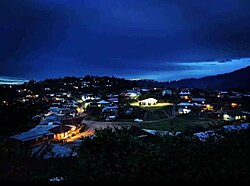
 Noklak District in Nagaland | |
| Country | |
| State | Nagaland |
| Headquarters | Noklak |
| Government | |
| • Lok Sabha Constituency | Nagaland |
| • MP[1] | Tokheho Yepthomi, NDPP |
| • Deputy Commissioner[2] | Hiazu Meru (NCS) |
| • Assembly constituencies | 3 constituencies |
| Area | |
| • Total | 1,152 km2 (445 sq mi) |
| Population (2011)[6] | |
| • Total | 59,300 |
| • Density | 51/km2 (130/sq mi) |
| Time zone | UTC+05:30 (IST) |
| Website | noklak |
History edit
Noklak district was created on 21 December 2017 as the 12th district of Nagaland. The new district has the same boundaries as the former Noklak sub-division of Tuensang district.[7] Noklak sub-division contained the five admin circles of Noklak, Thonoknyu, Nokhu, Panso and Chingmei.[8][9]
Demands for upgrading the ADC office in Noklak town had been made by the Eastern Nagaland Peoples' Organisation (ENPO) in 2008.[10]
Geography edit
Noklak district covers an area of 1,152 km2.[11] Noklak district is a hilly region, with broad leaved forests.[5] It is bordered by Mon district to the north, Tuensang and Shamator districts to the west, Kiphire district to the south and the Naga SAZ of Sagaing Region of Myanmar to the east. The climate is sub-tropical with a monsoon season.[5]
Administration edit
The district covers five taluks (administrative circles), which are Noklak, Thonoknyu, Nokhu, Panso and Chingmei.[9] While a subdivision of Tuensang, an Additional Deputy Commissioner (ADC) office was located in Noklak circle, a Sub-Divisional Officer (SDO) was located in Thonoknyu circle, and Extra Assistant Commissioner EAC headquarters were located in Nokhu, Panso and Chingmei circles.[12]
There are also police stations in Noklak and Panso Headquarters and a police outpost at Thonoknyu.[13]
Noklak district contains three rural development blocks (RD blocks), which are Noklak, covering Noklak, Nokhu, and Chingmei taluks, Panso RDB covering Panso taluk and Thonoknyu RDB covering Thonoknyu taluk.[5]: 68
The district has two seats in the state legislature.[14][15]
Dr. Pritpal Kaur, IPS[16] assumed charge as the first Superintendent of Police of Noklak District which is Nagaland's youngest district and the last district that borders Myanmar. [17][18]
Demographics edit
According to the 2011 census of India, the present population of Noklak district is 59,300. Nokhu, Noklak, Panso, Chingmei and Thonoknyu subdivisions are parts of the present Noklak district. Noklak district has a sex ratio of 922 females per 1000 males. Scheduled Tribes make up 57,868 (97.59%) of the population.[5]
Christianity is the religion of 99.07% of the inhabitants. Other religions followed are Hinduism by 0.4% of the population, Islam by 0.3%, Buddhism by 0.2%, and a few Sikhs.[19]
At the time of the 2011 census, 90.59% of the population spoke Khiamniungan, 6.18% Chang and 1.69% Tikhir as their first language.[20]
Towns and villages edit
As of 2011[update], the 2011 census the erstwhile sub-division held 39 villages, spread over four administrative circles as follows:
| Circle | Population[5]: 24 | Area km2[3] |
Villages | Source |
|---|---|---|---|---|
| Noklak | 19,507 | 164.92 | Noklak HQ (7,674), Noklak Village (4,205), New Pangsha (2,575), Nokyan (1,542), Old Pangsha (1,121), Wansoi (924), Dan (636), Kusong (467), Nokyan B (363). | |
| Thonoknyu | 18,600 | 491.36 | Sanglao (3,881), Peshu (3,447), Chipur (2,973), Thonoknyu Hq (1,485), Pang (1,174), Kenjong (1,035), Thonoknyu Vill. (923), Chilliso (839), Thoktsur (757), Wui (756), New Sanglao (331), Thongsonyu (296), Thongtsou (239), Jejeiking (238), Peshu Nokya (226). | |
| Nokhu | 6,291 | 218.94 | Choklangan (2,027), Nokhu (1,875), Langnok (1,307), Aniashu (568), Nokhu Hq. (306), Kingpao (148), Kenking (60). | |
| Panso | 11,036 | 148.33 | Pathso Nokeng (2,880), Pathso (2,117), Lengnyu (1,255), Yokao (1,083), Panso Hq (1,063), Kingniu (1,026), Tsuwao (901), Ekhao (390), Tsangkoi (213), Lumoking (108). | |
| Chingmei | 3,866 | 128.79 | Chingmei (1,685), Chendang Saddle (801), Waoshu (512), Yimpang (387), Taknyu (309), Chingmei Hq. (172) | |
| Total | 59,300 | 1,152 |
Transportation edit
Air edit
The nearest airport is Jorhat Airport in Assam located 250 kilometres from district headquarters Noklak. There is a helipad in Noklak as well.[21]
Rail edit
The nearest railway stations are Amguri railway station and Jorhat Town railway station located 206 kilometres and 243 kilometres from Noklak respectively.
Road edit
The district is connected with roads. The Noklak Road passes through the district alongside other intra-district roads. The NH 202 and NH 702B are the nearest highways to the district. Both the highways pass through Tuensang.
See also edit
References edit
- ^ "Lok Sabha Members". Lok Sabha. Retrieved 17 July 2021.
- ^ "Noklak DC". Noklak district website. Retrieved 17 July 2021.
- ^ a b "Tuensang District Population, Nagaland, List of Taluks in Tuensang". Censusindia2011.com.
- ^ total area of the 5 circles.[3]
- ^ a b c d e f g "District Census Hand Book – Tuensang" (PDF). Census of India. Registrar General and Census Commissioner of India.
- ^ total population of the 5 circles.[5]
- ^ "Noklak is Nagaland's youngest district". Eastern Mirror. 21 December 2017.
- ^ "News Press Releases 06 08 2012". Government of Nagaland. 6 August 2012.
Noklak Sub-Division which comprises of 37 recognized villages and 8 un-recognized villages and 5 Administrative headquarters namely Noklak ADC, Thonoknyu SDO, EAC Hqs are Panso, Nokhu and Chengmei
- ^ a b "District Disaster Management Plan, Tuensang" (PDF). Nagaland State Disaster Management Authority. November 2011. p. 17.
- ^ "ENPO supports demand for Noklak district headquarter". Nagaland Post News. 27 December 2008.
- ^ "Noklak Taluk Population Tuensang, Nagaland, List of Villages & Towns in Noklak Taluk". Census of India. 2017. Retrieved 22 December 2017.
- ^ "Profile of Tuensang District (Land of Culture)". Department of Information & Public Relations, Nagaland Official Website. 2016.
- ^ "Tuensang District Profile". tuensang.nic.in.
- ^ "Noklak sub-div is now a district". Nagaland Page. 22 December 2017.
- ^ "List of Polling Stations" (PDF). Government of Nagaland. pp. 19, 23.
- ^ Group, C. H. D. (5 January 2023). "Meet Dr Pritpal Kaur - Nagaland's living leadership inspiration". CHD Group. Retrieved 7 October 2023.
- ^ "Nagaland's Youngest District and the SP Who Came Here from Haryana". Retrieved 17 November 2022.
- ^ "Meet the first SP of Nagaland's youngest district, Noklak - Eastern Mirror". easternmirrornagaland.com. 3 August 2020. Retrieved 17 November 2022.
- ^ "Population by Religion - Nagaland". Census of India. Registrar General and Census Commissioner of India. 2011.
- ^ "Table C-16 Population by Mother Tongue: Nagaland". Census of India. Registrar General and Census Commissioner of India.
- ^ "Helicopter services resume at Noklak". DIPR Nagaland. Retrieved 23 March 2021.
External links edit
- Official site
26°13′00″N 94°59′31″E / 26.2167°N 94.9919°E