


Summary
North Pickenham is a village in the Breckland district of mid-Norfolk, East Anglia, England. It lies three miles from the Georgian market town of Swaffham.
| North Pickenham | |
|---|---|
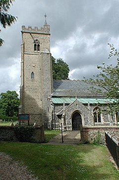 St Andrew's church | |
 North Pickenham Location within Norfolk | |
| Area | 10.15 km2 (3.92 sq mi) |
| Population | 472 UK census 2011[1] |
| • Density | 47/km2 (120/sq mi) |
| OS grid reference | TF8646606864 |
| District | |
| Shire county | |
| Region | |
| Country | England |
| Sovereign state | United Kingdom |
| Post town | SWAFFHAM |
| Postcode district | PE37 |
| Dialling code | 01760 |
| Police | Norfolk |
| Fire | Norfolk |
| Ambulance | East of England |
| UK Parliament | |
At the 2001 census it had a population of 500 and an area of 1,015 hectares (3.92 square miles)[2] reducing to 472 at the 2011 Census. Norfolk (pop. 832,400) has about one-thirtieth of the population density of Central London, the tenth lowest density county in the country, with 38% of the county's population living in the three major urban areas of Norwich (194,200), Great Yarmouth (66,400) and King's Lynn (40,700).[3]
The River Wissey cuts through the village at Houghton Lane bridge,[4] following the course of Meadow Lane, close to the river's source at Bradenham. Its sister village South Pickenham is two miles away through pretty, narrow country lanes.
North Pickenham has a Parish Council Tax (Band D).[5]
History edit
The village is after its Saxon leader Pinca,[6] Pica[7][8] or maybe Piccea with ham meaning homestead, it became a pagan Anglo Saxon settlement in the 5th century AD. It remained part of a Saxon kingdom until the Norman Conquest in 1066[9] when it became part of the honour of the Earl of Richmond, Yorkshire. The old village sign showed a Saxon (left) and a Norman (right) warrior (see Great Britain in the Middle Ages) with Richmond Castle and the river Wissey in the background; The sign was designed by Ben Ripper, a local historian, and carved by Steve Eggleton. A new village statue by Tom Yorke replaced the deteriorating old sign and was unveiled by the incumbent MP George Freeman on 22 October 2010.[10] Due to an insect infestation the statue was removed in 2018 and in 2020 the old village sign was refurbished and re-erected in its place.
It was once in the Hundred of South Greenhoe.[11][12][13]
The former Royal Air Force station, RAF North Pickenham, was located nearby hosting American B-24 Liberator bombers during World War II.[14] In the late 1950s and early 1960s three PGM-17 Thor nuclear missiles were located here[15] with early cases of CND acts of civil disobedience.[16][17] The airbase is now the site of a turkey farm owned by Bernard Matthews,[18] a karting circuit and an eight-turbine wind farm run by North Pickenham Wind Farm LLP.[19] A 'stealth blade', which is trying to be invisible to aviation radar, was tested on one of the turbines here in October 2009.[20] In February 2009 Bernard Matthews detailed plans to put two turbines at the airfield site,[21] an independent development to the eight turbines already there.
Amenities edit

North Pickenham has a newly extended school with its own wind turbine. Its namesake, at the centre of the village, is St Andrew's church[22] in the Benefice of Necton
Adjacent to the church is a freehouse pub called the Blue Lion which, with recent surveys and listed buildings visits, suggest it dates from the late 18th century with documented licensees from the mid-19th century.
The lost village of Houghton on the Hill is in the civil parish. Houghton includes the restored church of St Mary's, with its outstanding 11th century wall paintings,[23] instigated by Bob Davey MBE.[24][25][26]
The 46-mile Peddars Way footpath runs through the village, 19 miles[27] from its south eastern start in Suffolk. The Peddars Way starts at Knettishall Heath Country Park and follows the route of a Roman road to Holme-next-the-Sea on the Norfolk coast north of Hunstanton. At Holme the Peddars Way meets the Norfolk Coast Path as it runs east along the north Norfolk coast, designated as an Area of Outstanding Natural Beauty, to the Victorian seaside resort of Cromer.
The annual local village show was reinstated in 2007. It raises funds for the church and highlights the growing and making skills of local residents.[28]
References edit
- ^ "Civil Parish population 2011". Neighbourhood Statistics. Office for National Statistics. Retrieved 9 August 2016.
- ^ Census population and household counts for unparished urban areas and all parishes. Office for National Statistics & Norfolk County Council (2001) Retrieved 20 June 2009,
- ^ Norfolk Government Statistics [permanent dead link]
- ^ River Wissey at Houghton Lane 52°37'35.18"N 0°45'19.63"E
- ^ Breckland Yearbook Archived 21 November 2008 at the Wayback Machine
- ^ "Pinca". Archiver.rootsweb.ancestry.com. Retrieved 16 December 2011.
- ^ "Institute for Name Studies. Search Pickenham". Nottingham.ac.uk. Retrieved 16 December 2011.
- ^ INS result
- ^ Book, Domesday (1862). Domesday Book. Retrieved 16 December 2011.
- ^ Parish, Pickenham (22 October 2010). "Pickenham Posts". Pickenhamposts.blogspot.com. Retrieved 16 December 2011.
- ^ "GenUKI". Origins.org.uk. Retrieved 16 December 2011.
- ^ Brayley, Edward Wedlake (1810). The Beauties of England and Wales. Retrieved 16 December 2011.
- ^ John Chambers (1829). A General History of the County of Norfolk. Retrieved 16 December 2011.
- ^ Bastien, Charles R. (2004). 32 CoPilots. Trafford Publishing. ISBN 978-1412017299.
- ^ "An RAF Thor Missile Station at North Pickenham, Norfolk". YouTube. Archived from the original on 21 December 2021. Retrieved 16 December 2011.
- ^ Russell, Bertrand (2002). Perkins, Ray (ed.). Yours Faithfully, Bertrand Russell: A Lifelong Fight for Peace, Justice, and Truth in Letters to the Editor. Open Court. ISBN 978-0812694499. Retrieved 16 December 2011.
- ^ Taylor, Richard K. S. (1988). Against the Bomb: The British Peace Movement 1958–1965. Clarendon Press. ISBN 978-0198275374.
- ^ "Google Earth Community: The world's largest turkey farm". Bbs.keyhole.com. Retrieved 16 December 2011.
- ^ Enertrag UK
- ^ 'Stealth Blade' Watton and Swaffham Times[permanent dead link]
- ^ Bernard Matthews turbine proposal Archived 23 November 2009 at the Wayback Machine
- ^ St.Andrew's
- ^ "Comprehensive St. Mary's .pdf file" (PDF). Archived from the original (PDF) on 16 February 2012. Retrieved 16 December 2011.
- ^ Bob Davey MBE[dead link]
- ^ Pearce, Joseph (2005). Mr Davey Versus The Devil. ISBN 9781586170776. Retrieved 16 December 2011.
- ^ "Lottery grant preserves paintings". BBC News. 11 May 2006. Archived from the original on 14 April 2019. Retrieved 16 December 2011.
- ^ "Peddars Way Distant Chart" (PDF). Archived from the original (PDF) on 11 February 2012. Retrieved 16 December 2011.
- ^ "Praise for produce at North Pickenham". Lynn News. 16 September 2008. Archived from the original on 4 August 2012. Retrieved 16 December 2011.