


Summary
Oguni (小国町, Oguni-machi) is a town located in Yamagata Prefecture, Japan. As of 29 February 2020[update], the town had an estimated population of 7,376 in 3020 households,[1] and a population density of 10 persons per km2. The total area of the town is 737.56 square kilometres (285 sq mi).
Oguni
小国町 | |
|---|---|
 Oguni Town Hall | |
 Flag  Seal | |
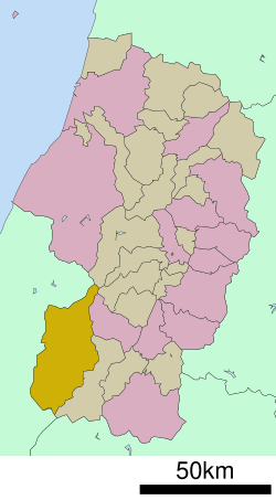 Location of Oguni in Yamagata Prefecture | |
 Oguni | |
| Coordinates: 38°03′41.3″N 139°44′36.1″E / 38.061472°N 139.743361°E | |
| Country | Japan |
| Region | Tōhoku |
| Prefecture | Yamagata |
| District | Nishiokitama |
| Area | |
| • Total | 737.56 km2 (284.77 sq mi) |
| Population (February 2020) | |
| • Total | 7,376 |
| • Density | 10/km2 (26/sq mi) |
| Time zone | UTC+9 (Japan Standard Time) |
| Phone number | 0238-62-2111 |
| Address | 2-70 Ogunikosaka, Oguni-chō, Yamagata-ken 999-1363 |
| Climate | Cfa/Dfa |
| Website | Official website |
| Symbols | |
| Bird | Japanese bush-warbler |
| Flower | Sakura |
| Tree | Japanese beech |

Geography edit
Oguni is located in mountainous southwestern Yamagata Prefecture, bordered by Niigata Prefecture to the west and south.
Neighboring municipalities edit
Climate edit
Oguni has a humid continental climate (Köppen climate classification Cfa) with large seasonal temperature differences, with warm to hot (and often humid) summers and cold (sometimes severely cold) winters. Precipitation is significant throughout the year, but is heaviest from August to October. The average annual temperature in Oguni is 10.9 °C (51.6 °F). The average annual rainfall is 3,051.6 mm (120.14 in) with December as the wettest month. The temperatures are highest on average in August, at around 23.8 °C (74.8 °F), and lowest in January, at around −0.3 °C (31.5 °F).[2] In the winter season, snow cover may exceed 2 meters even in the center of town due to the monsoon from the Sea of Japan.
| Climate data for Oguni (1991−2020 normals, extremes 1976−present) | |||||||||||||
|---|---|---|---|---|---|---|---|---|---|---|---|---|---|
| Month | Jan | Feb | Mar | Apr | May | Jun | Jul | Aug | Sep | Oct | Nov | Dec | Year |
| Record high °C (°F) | 13.3 (55.9) |
17.3 (63.1) |
19.9 (67.8) |
30.1 (86.2) |
34.2 (93.6) |
33.6 (92.5) |
36.2 (97.2) |
38.0 (100.4) |
35.6 (96.1) |
30.7 (87.3) |
25.2 (77.4) |
18.1 (64.6) |
38.0 (100.4) |
| Mean daily maximum °C (°F) | 2.9 (37.2) |
3.8 (38.8) |
7.3 (45.1) |
14.5 (58.1) |
21.2 (70.2) |
24.7 (76.5) |
27.7 (81.9) |
29.5 (85.1) |
25.1 (77.2) |
18.9 (66.0) |
12.2 (54.0) |
5.6 (42.1) |
16.1 (61.0) |
| Daily mean °C (°F) | −0.3 (31.5) |
−0.1 (31.8) |
2.2 (36.0) |
7.7 (45.9) |
14.4 (57.9) |
18.9 (66.0) |
22.7 (72.9) |
23.8 (74.8) |
19.5 (67.1) |
13.1 (55.6) |
6.9 (44.4) |
1.9 (35.4) |
10.9 (51.6) |
| Mean daily minimum °C (°F) | −3.0 (26.6) |
−3.5 (25.7) |
−2.1 (28.2) |
1.6 (34.9) |
8.2 (46.8) |
14.0 (57.2) |
18.8 (65.8) |
19.5 (67.1) |
15.5 (59.9) |
9.0 (48.2) |
2.9 (37.2) |
−0.8 (30.6) |
6.7 (44.0) |
| Record low °C (°F) | −16.0 (3.2) |
−17.9 (−0.2) |
−15.0 (5.0) |
−8.5 (16.7) |
−1.1 (30.0) |
5.1 (41.2) |
8.4 (47.1) |
11.2 (52.2) |
6.4 (43.5) |
0.4 (32.7) |
−5.4 (22.3) |
−11.1 (12.0) |
−17.9 (−0.2) |
| Average precipitation mm (inches) | 342.1 (13.47) |
243.2 (9.57) |
202.4 (7.97) |
163.0 (6.42) |
149.4 (5.88) |
191.7 (7.55) |
334.2 (13.16) |
234.7 (9.24) |
190.1 (7.48) |
234.9 (9.25) |
353.8 (13.93) |
416.7 (16.41) |
3,051.6 (120.14) |
| Average snowfall cm (inches) | 336 (132) |
257 (101) |
159 (63) |
23 (9.1) |
0 (0) |
0 (0) |
0 (0) |
0 (0) |
0 (0) |
0 (0) |
10 (3.9) |
176 (69) |
958 (377) |
| Average precipitation days (≥ 1.0 mm) | 25.6 | 22.5 | 20.8 | 15.0 | 12.9 | 12.3 | 16.0 | 13.2 | 14.2 | 16.1 | 20.4 | 24.3 | 213.3 |
| Average snowy days (≥ 3 cm) | 24.0 | 21.2 | 18.5 | 3.6 | 0 | 0 | 0 | 0 | 0 | 0 | 1.2 | 13.3 | 81.8 |
| Mean monthly sunshine hours | 25.5 | 42.4 | 92.3 | 147.8 | 189.7 | 163.4 | 144.9 | 179.6 | 131.8 | 108.6 | 65.4 | 31.3 | 1,322.6 |
| Source: Japan Meteorological Agency[3][2] | |||||||||||||
Demographics edit
Per Japanese census data,[4] the population of Oguni peaked in the 1950s, and is now considerably less than what it was a century ago.
| Year | Pop. | ±% |
|---|---|---|
| 1920 | 10,158 | — |
| 1930 | 11,288 | +11.1% |
| 1940 | 15,492 | +37.2% |
| 1950 | 17,899 | +15.5% |
| 1960 | 17,787 | −0.6% |
| 1970 | 13,999 | −21.3% |
| 1980 | 12,221 | −12.7% |
| 1990 | 11,315 | −7.4% |
| 2000 | 10,262 | −9.3% |
| 2010 | 8,862 | −13.6% |
| 2020 | 7,107 | −19.8% |
History edit
The area of present-day Oguni was part of ancient Dewa Province and was ruled as part of Yonezawa Domain during the Edo period. After the start of the Meiji period, most of the area became part of Nishiokitama District, Yamagata Prefecture. The village of Ogunimoto was established on April 1, 1889 with the creation of the modern municipalities system. It was elevated to town status on November 3, 1943, becoming the town of Oguni. It absorbed the neighboring villages of Minamioguni and Kitaoguni on March 31, 1954 and the village of Tsugawa on August 1, 1960.
Economy edit
The economy of Oguni is based on agriculture and forestry, and hydroelectric power production from numerous dams.
Education edit
Oguni has two public elementary schools and two public middle schools operated by the town government and one public high school operated by the Yamagata Prefectural Board of Education. There is also one private high school.
Transportation edit
Railway edit
![]() East Japan Railway Company - Yonesaka Line
East Japan Railway Company - Yonesaka Line
Highway edit
References edit
External links edit
 Media related to Oguni, Yamagata at Wikimedia Commons
- Official Website (in Japanese)