


Summary
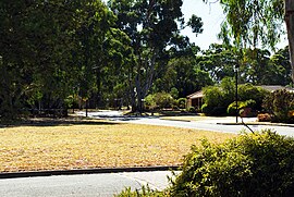
Onkaparinga Hills is a southern suburb of Adelaide, in the City of Onkaparinga. It covers an area of approximately 22 square kilometres (8.5 square miles).[1] It has a population of 2534 people (2011 Census).[4] It is a leafy suburb that includes parts of the Onkaparinga River National Park.[2]
| Onkaparinga Hills South Australia | |||||||||||||||
|---|---|---|---|---|---|---|---|---|---|---|---|---|---|---|---|
 Spriggs Road | |||||||||||||||
 Onkaparinga Hills | |||||||||||||||
| Coordinates | 35°08′49″S 138°33′04″E / 35.147°S 138.551°E | ||||||||||||||
| Population | 2,610 (SAL 2021)[1] | ||||||||||||||
| Established | 1840s | ||||||||||||||
| Postcode(s) | 5163 | ||||||||||||||
| Location | 33.5 km (21 mi) from Adelaide | ||||||||||||||
| LGA(s) | City of Onkaparinga | ||||||||||||||
| Region | Southern Adelaide[2] | ||||||||||||||
| County | Adelaide[3] | ||||||||||||||
| State electorate(s) | |||||||||||||||
| Federal division(s) | Kingston | ||||||||||||||
| |||||||||||||||
Nearly 60% of families in the area are couples with children, compared to an Australian average of 45.3%. The median rent in 2006 was $230.[3] The current median cost of a home in the area is $390 000.[4] 93.5% of people speak English only at home (Australian average 78.5%) and 91% are Australian citizens compared to the Australian average of 86.1%.[5] The Onkaparinga Hills are examples of folding.
History edit
Prior to European colonisation, the area was inhabited by the Kaurna people.[6] The name Onkaparinga is derived from the Kaurna word ngankiparrinnga, meaning 'The Women's River'.[7]
European settlement dates from the 1840s. Most of the settlers were initially farmers, with vineyards later being established. After the war[clarification needed] there was significant development and again in the early 1990s. The population is now relatively stable. There are still sections of the area used for vineyards, farming and grazing.[8]
Notes edit
- ^ Australian Bureau of Statistics (28 June 2022). "Onkaparinga Hills (suburb and locality)". Australian Census 2021 QuickStats. Retrieved 28 June 2022.
- ^ "Southern Adelaide SA Government region" (PDF). The Government of South Australia. Retrieved 17 April 2017.
- ^ "Search result for "County of Adelaide, CNTY" with the following data sets selected – "Counties" and "Local Government Areas"". Property Location SA Map Viewer. Government of South Australia. Retrieved 24 April 2017.
- ^ Australian Bureau of Statistics (31 October 2012). "Onkaparinga Hills". 2011 Census QuickStats. Retrieved 9 April 2016.
- ^ Bonzle.com [9]
- ^ Australian Bureau of Statistics [10]
- ^ City of Onkaparinga Council Website [11]
- ^ Aboriginal Culture and History, City of Onkaparinga Council Website [12]
- ^ History Overview, City of Onkaparinga Council Website [13]
- ^ Domain Suburb Profile, Domain.com [14]
- ^ History of the Population, City of Onkaparinga Council Website [15]