


Summary
Ono (小野町, Ono-machi) is a town located in Fukushima Prefecture, Japan. As of 1 March 2020[update], the town had an estimated population of 10,416 in 3464 households,[1] and a population density of 77 persons per km2. The total area of the town is 125.11 square kilometres (48.31 sq mi). The town is known locally for the "thousand cherry trees" which line the banks of the Natsui River. It is also one of the purported birthplaces of Heian period poet Ono no Komachi.
Ono
小野町 | |
|---|---|
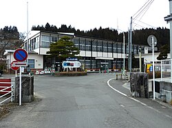 Ono Town Hall | |
 Flag  Seal | |
 Location of Ono in Fukushima Prefecture | |
 Ono | |
| Coordinates: 37°17′13″N 140°37′35″E / 37.28694°N 140.62639°E | |
| Country | Japan |
| Region | Tōhoku |
| Prefecture | Fukushima |
| District | Tamura |
| Area | |
| • Total | 125.11 km2 (48.31 sq mi) |
| Population (March 2020) | |
| • Total | 9,636 |
| • Density | 77/km2 (200/sq mi) |
| Time zone | UTC+9 (Japan Standard Time) |
| Phone number | 0247-72-2111 |
| Address | Ononiimachi Tatemawari 92, Ono-machi, Tamura District, Fukushima Prefecture 963-3401 |
| Climate | Cfa |
| Website | Official website |
| Symbols | |
| Bird | Common cuckoo |
| Flower | Azalea |
| Tree | Cryptomeria |
Geography edit
Ono is located in north-central Fukushima prefecture in the middle of Abukuma Highland, in eastern Nakadōri. It is surrounded by mountains over 700 meters above sea level. The Natsui River flows in the center of the town. Most of the town is within the borders of the Abukuma Kogen Chubu Prefectural Natural Park.
- Rivers: Natsui River
Neighboring municipalities edit
Climate edit
Ono has a humid continental climate (Köppen Cfa) characterized by mild summers and cold winters with heavy snowfall. The average annual temperature in Ono is 10.7 °C. The average annual rainfall is 1390 mm with September as the wettest month. The temperatures are highest on average in August, at around 23.0 °C, and lowest in January, at around -0.5 °C.[2]
| Climate data for Ono (1991−2020 normals, extremes 1976−present) | |||||||||||||
|---|---|---|---|---|---|---|---|---|---|---|---|---|---|
| Month | Jan | Feb | Mar | Apr | May | Jun | Jul | Aug | Sep | Oct | Nov | Dec | Year |
| Record high °C (°F) | 14.6 (58.3) |
19.3 (66.7) |
23.1 (73.6) |
28.9 (84.0) |
33.2 (91.8) |
34.8 (94.6) |
35.8 (96.4) |
36.0 (96.8) |
33.7 (92.7) |
28.3 (82.9) |
24.1 (75.4) |
18.0 (64.4) |
36.0 (96.8) |
| Mean daily maximum °C (°F) | 3.9 (39.0) |
4.9 (40.8) |
8.9 (48.0) |
15.3 (59.5) |
20.8 (69.4) |
23.9 (75.0) |
27.5 (81.5) |
28.7 (83.7) |
24.4 (75.9) |
18.5 (65.3) |
12.8 (55.0) |
6.8 (44.2) |
16.4 (61.4) |
| Daily mean °C (°F) | −0.7 (30.7) |
−0.1 (31.8) |
3.2 (37.8) |
8.8 (47.8) |
14.3 (57.7) |
18.2 (64.8) |
22.2 (72.0) |
23.1 (73.6) |
19.1 (66.4) |
12.9 (55.2) |
6.8 (44.2) |
1.8 (35.2) |
10.8 (51.4) |
| Mean daily minimum °C (°F) | −4.8 (23.4) |
−4.6 (23.7) |
−1.9 (28.6) |
2.7 (36.9) |
8.3 (46.9) |
13.6 (56.5) |
18.2 (64.8) |
19.0 (66.2) |
14.9 (58.8) |
8.1 (46.6) |
1.5 (34.7) |
−2.6 (27.3) |
6.0 (42.9) |
| Record low °C (°F) | −17.1 (1.2) |
−17.1 (1.2) |
−18.0 (−0.4) |
−8.5 (16.7) |
−1.8 (28.8) |
2.9 (37.2) |
6.9 (44.4) |
7.8 (46.0) |
1.4 (34.5) |
−3.6 (25.5) |
−7.7 (18.1) |
−18.8 (−1.8) |
−18.8 (−1.8) |
| Average precipitation mm (inches) | 43.6 (1.72) |
36.4 (1.43) |
76.0 (2.99) |
91.2 (3.59) |
97.7 (3.85) |
117.3 (4.62) |
175.5 (6.91) |
145.8 (5.74) |
197.5 (7.78) |
137.8 (5.43) |
60.8 (2.39) |
41.2 (1.62) |
1,220.6 (48.06) |
| Average precipitation days (≥ 1.0 mm) | 6.8 | 5.9 | 9.2 | 10.0 | 10.3 | 12.0 | 13.8 | 11.0 | 11.8 | 9.6 | 7.2 | 6.2 | 113.8 |
| Mean monthly sunshine hours | 156.5 | 162.2 | 188.3 | 193.5 | 197.8 | 143.6 | 146.0 | 167.9 | 131.4 | 136.3 | 150.2 | 151.8 | 1,933.3 |
| Source: Japan Meteorological Agency[3][4] | |||||||||||||
Demographics edit
Per Japanese census data,[5] the population of Ono has declined steadily over the past 60 years.
| Year | Pop. | ±% |
|---|---|---|
| 1920 | 11,423 | — |
| 1930 | 13,181 | +15.4% |
| 1940 | 13,547 | +2.8% |
| 1950 | 17,198 | +27.0% |
| 1960 | 17,441 | +1.4% |
| 1970 | 15,498 | −11.1% |
| 1980 | 14,085 | −9.1% |
| 1990 | 13,341 | −5.3% |
| 2000 | 12,555 | −5.9% |
| 2010 | 11,208 | −10.7% |
| 2020 | 9,471 | −15.5% |
History edit
The area of present-day Ono was part of ancient Mutsu Province. After the Meiji Restoration it was organized as part of Nakadōri region of Iwaki Province. The villages of Iitoyo, Natsui, and Ononiimachi were established with the formation of the modern municipalities system on April 1, 1889. Ononiimachi was raised to town status on July 1, 1896. On February 1, 1955, it merged with Iitoyo and Natsui to form the town of Ono.
Economy edit
The economy of Ono is primarily mixed agricultural and light manufacturing.
Education edit
Ono has one public elementary schools and one public junior high school operated by the town government, and one public high school operated by the Fukushima Board of Education.
Transportation edit
Railway edit
Highway edit
Local attractions edit
- Rika-chan Castle, a two-story museum, store and small-scale doll factory for the Licca-chan line of dolls.[6]
References edit
External links edit
 Media related to Ono, Fukushima at Wikimedia Commons
- Official Website (in Japanese)