Summary
Oog is a town in the Sool region of Somaliland, situated in the Aynaba district.[1] It is located between Aynaba and Las Anod.
Oog | |
|---|---|
Village | |
   | |
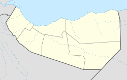
 Oog Location in Somaliland  Oog Oog (Somaliland) | |
| Coordinates: 8°56′N 46°38′E / 8.933°N 46.633°E | |
| Country | |
| Region | Sool |
| District | Aynabo |
| Time zone | UTC+3 (EAT) |
Overview edit
Oog acts as the junction of the road connecting the regional capitals of Burao and Erigavo.[2] Oog is situated on Somaliland's main road connecting towns and cities like Borama, Hargeisa, Berbera and Burao to Somalia.[3] Oog is located 151 km (94 mi) from Burao,[4] 100 km (62 mi) from Las Anod,[5] and 239 km (149 mi) from Erigavo.[6]
10 km (6.2 mi) north of Oog is the nearby town of Badweyn, home to a substantial mosque and a multiple-trunked tree that stands alongside the main road.[2]
South of Oog, in the Haud, the rare collared lark can be found as well as the native dibatag antelope.[2]
Oog is home to a Somaliland National Army base.[7]
Demographics edit
A 1951 British survey lists Oog as the home well of the branch of the clan.[8]: 165
History edit
Before Independence edit
Oog is written as "Ok" in a book published in England in 1951 as the coordinate 8°55′N 46°37′E / 8.917°N 46.617°E.[8]: 34
In February 1919, Oog was attacked by Mullah's forces.[8]: 151
Around the declaration of independence of Somaliland edit
On 2 February 1991, the SNM and a Dhulbahante delegation led by Garaad Abdiqani held a meeting in Oog, where ceasefire was agreed upon.[9][10]: 88
In October 1991, Habar Yunis, Habar Je'lo, and Dhulbahante held a Peace Conference at Oog.[10]: 106
Recent History edit
In 2008, one of the diaspora returned from the U.S. and attempted to convert his grazing lands to fields in Oog, which led to serious conflict between the clans.[11]: 22
In December 2011, a large delegation led by the Speaker of the House of Representatives of Somaliland and the Chairman of the Waddani visited Oog.[12]
In April 2012, Somtel's office was opened in Oog, and the mayor and others attended the event.[13]
In August 2013, fighting broke out between clans in the Oog region, resulting in deaths. A delegation led by the Somaliland Minister of Interior was sent to intercede.[14] At that time, it took only three days to resolve the issue through the efforts of national elders and others.[15]
In January 2014, a murder in the Oog neighborhood led to fighting in Gowsaweyne between Sa'ad Yonis and Jama Siyad that resulted in deaths.[16]
In November 2018, the Somaliland Water Development Agency installed new wells in the towns of Oog and Wadamago.[17]
In 2019, toxic Mesquite (Prosopis juliflora) bred and damaged livestock.[18]
In April 2019, two policemen were killed on the road connecting Garadag and Oog, causing an inter-clan struggle.[19]
See also edit
References edit
- ^ Food and Nutrition Security Resilience Programme: Report of the multidisciplinary context and fodder value chain analysis in Sool and Sanaag (Somaliland). Food and Agriculture Organization of the United Nations. 2021. p. 40. ISBN 9789251352809.
- ^ a b c Briggs, Philip (2012). Somaliland : with Addis Ababa & Eastern Ethiopia. Chalfont St. Peter, Bucks, England: Bradt Travel Guides. pp. 128–129. ISBN 978-1-84162-371-9. OCLC 766336307.
- ^ Briggs, Philip (2012). Somaliland : with Addis Ababa & Eastern Ethiopia. Chalfont St. Peter, Bucks, England: Bradt Travel Guides. p. 59. ISBN 978-1-84162-371-9. OCLC 766336307.
- ^ "Burco to Oog". Burco to Oog. Retrieved 2022-03-04.
- ^ "Oog to Laascaanood". Oog to Laascaanood. Retrieved 2022-03-04.
- ^ "Oog to Ceerigaabo". Oog to Ceerigaabo. Retrieved 2022-03-04.
- ^ Horn of Africa Bulletin. Life & Peace Institute. 2004. p. 26.
- ^ a b c John Anthony Hunt (1951). "A general survey of the Somaliland protectorate 1944-1950". Retrieved 2021-09-25.
- ^ Abdishakur Hassan-kayd (2020). Locally led peacebuilding : global case studies. Stacey L. Connaughton, Jessica Berns. Lanham, Maryland. p. 76. ISBN 978-1-5381-1411-7. OCLC 1099545093.
{{cite book}}: CS1 maint: location missing publisher (link) - ^ a b Marleen Renders (2012). "Consider Somaliland: State-Building with Traditional Leaders and Institutions". Consider Somaliland. Brill. ISBN 9789004222540. Retrieved 2022-03-06.
- ^ Mahdi Abdile (2014). Diasporas, Development and Peacemaking in the Horn of Africa. Liisa Laakso, Petri Hautaniemi. London: Zed Books. p. 87. ISBN 978-1-78360-099-1. OCLC 886112221.
- ^ "Shacabka Degmooyinka Caynaba, Oog iyo Gar-adag oo si isku mid ah ku qaabilay Weftiga Urur-siyaasadeedka WADANI oo Xafiisyo ka furtay". somalilandpost.net. 2011-12-03. Retrieved 2023-02-17.
- ^ "Shirkadda SOMTEL oo Xafiis cusub ka furatay Degmada Oog ee gobolka Sool". somalilandpost.net. 2012-04-16. Retrieved 2023-02-17.
- ^ "Odayaal u gurmaday beelo ku diraray Deegaanka Oog oo ka tirsan Gobolka Saraar ee Somaliland oo uu daad qaaday". hiiraan.com. 2013-08-22. Retrieved 2023-02-18.
- ^ Sadia Musse Ahmed (2017). Traditional Institutions in Contemporary African Governance. Taylor & Francis. p. 85. ISBN 9781351854658. Retrieved 2023-02-19.
- ^ "Dirir Beeleed ka Curatay Deegaanka Gawsa Weyne ee Gobolka Sool iyo Dhimashada oo Maraysa afar Qof". qurbejoog.com. 2014-01-12. Retrieved 2023-02-18.
- ^ "Wasaarada Horumarinta Biyaha oo Ceel ka Hirgelisay Gobolka Sool". wargeyskadawan.com. 2018-11-17. Retrieved 2023-02-18.
- ^ "Invasive trees hurt livelihoods of Somaliland herders and farmers in Sool". somalilandcurrent.com. 2019-06-13. Retrieved 2023-02-18.
- ^ "Somaliland: President Slams State of Emergency Rule on 3 Sanaag Districts". somtribune.com. 2019-04-30. Retrieved 2023-02-19.
8°56′N 46°38′E / 8.933°N 46.633°E


