


Summary
Orovada is a census-designated place in Humboldt County, Nevada.[2] The population was 155 at the 2010 census.[3]
Orovada, Nevada | |
|---|---|
 | |
 Orovada Location within the state of Nevada | |
| Coordinates: 41°34′12″N 117°47′2″W / 41.57000°N 117.78389°W | |
| Country | United States |
| State | Nevada |
| County | Humboldt |
| Area | |
| • Total | 22.18 sq mi (57.44 km2) |
| • Land | 22.18 sq mi (57.44 km2) |
| • Water | 0.00 sq mi (0.00 km2) |
| Elevation | 4,236 ft (1,291 m) |
| Population (2020) | |
| • Total | 117 |
| • Density | 5.28/sq mi (2.04/km2) |
| Time zone | UTC-8 (Pacific (PST)) |
| • Summer (DST) | UTC-7 (PDT) |
| ZIP codes | 89425 |
| FIPS code | 32-53000 |
| GNIS feature ID | 2583947[2] |
History edit
The first permanent settlement at Orovada was made in 1918.[4] The name is a combination of oro (Spanish "gold") and Nevada.[5] A post office has been in operation at Orovada since 1920.[6]
Geography edit
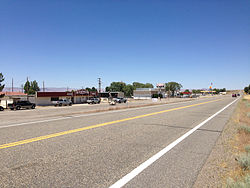
According to the United States Census Bureau, the Orovada CDP has an area of 45.3 square miles (117.3 km2), all land.[3] U.S. Route 95 runs through the CDP, leading south 43 miles (69 km) to Winnemucca and north 30 miles (48 km) to the Oregon state line at McDermitt.
Climate edit
According to the Köppen Climate Classification system, Orovada has a cold semi-arid climate, abbreviated "BSk" on climate maps. The hottest temperature recorded in Orovada was 115 °F (46.1 °C) on September 1–2, 1947, while the coldest temperature recorded was −35 °F (−37.2 °C) on December 19, 1924 and December 26, 1924.[7]
| Climate data for Orovada, Nevada, 1991–2020 normals, extremes 1911–present | |||||||||||||
|---|---|---|---|---|---|---|---|---|---|---|---|---|---|
| Month | Jan | Feb | Mar | Apr | May | Jun | Jul | Aug | Sep | Oct | Nov | Dec | Year |
| Record high °F (°C) | 67 (19) |
71 (22) |
81 (27) |
92 (33) |
105 (41) |
107 (42) |
109 (43) |
108 (42) |
115 (46) |
94 (34) |
80 (27) |
68 (20) |
115 (46) |
| Mean maximum °F (°C) | 54.0 (12.2) |
61.1 (16.2) |
71.2 (21.8) |
79.7 (26.5) |
89.2 (31.8) |
96.8 (36.0) |
102.3 (39.1) |
101.0 (38.3) |
94.8 (34.9) |
82.4 (28.0) |
68.3 (20.2) |
56.0 (13.3) |
103.3 (39.6) |
| Mean daily maximum °F (°C) | 42.2 (5.7) |
48.0 (8.9) |
56.2 (13.4) |
62.7 (17.1) |
72.4 (22.4) |
82.9 (28.3) |
93.6 (34.2) |
91.5 (33.1) |
82.0 (27.8) |
67.7 (19.8) |
52.5 (11.4) |
41.4 (5.2) |
66.1 (18.9) |
| Daily mean °F (°C) | 30.7 (−0.7) |
35.5 (1.9) |
41.5 (5.3) |
46.7 (8.2) |
55.4 (13.0) |
63.5 (17.5) |
71.9 (22.2) |
69.6 (20.9) |
60.7 (15.9) |
48.5 (9.2) |
37.9 (3.3) |
29.7 (−1.3) |
49.3 (9.6) |
| Mean daily minimum °F (°C) | 19.1 (−7.2) |
23.0 (−5.0) |
26.8 (−2.9) |
30.8 (−0.7) |
38.3 (3.5) |
44.0 (6.7) |
50.3 (10.2) |
47.7 (8.7) |
39.4 (4.1) |
29.4 (−1.4) |
23.3 (−4.8) |
18.1 (−7.7) |
32.5 (0.3) |
| Mean minimum °F (°C) | −0.8 (−18.2) |
7.0 (−13.9) |
12.9 (−10.6) |
17.2 (−8.2) |
23.7 (−4.6) |
31.5 (−0.3) |
39.7 (4.3) |
36.0 (2.2) |
26.7 (−2.9) |
15.2 (−9.3) |
6.1 (−14.4) |
−0.7 (−18.2) |
−7.0 (−21.7) |
| Record low °F (°C) | −30 (−34) |
−26 (−32) |
−1 (−18) |
7 (−14) |
15 (−9) |
23 (−5) |
32 (0) |
25 (−4) |
14 (−10) |
−5 (−21) |
−13 (−25) |
−35 (−37) |
−35 (−37) |
| Average precipitation inches (mm) | 1.26 (32) |
0.83 (21) |
1.04 (26) |
1.28 (33) |
1.31 (33) |
0.77 (20) |
0.21 (5.3) |
0.26 (6.6) |
0.51 (13) |
0.89 (23) |
0.72 (18) |
1.14 (29) |
10.22 (259.9) |
| Average snowfall inches (cm) | 4.9 (12) |
2.5 (6.4) |
1.4 (3.6) |
1.4 (3.6) |
0.1 (0.25) |
0.0 (0.0) |
0.0 (0.0) |
0.0 (0.0) |
0.0 (0.0) |
0.3 (0.76) |
1.1 (2.8) |
4.0 (10) |
15.7 (39.41) |
| Average precipitation days (≥ 0.01 in) | 6.5 | 6.1 | 6.6 | 6.5 | 6.9 | 3.5 | 1.9 | 1.8 | 2.3 | 3.7 | 5.0 | 6.7 | 57.5 |
| Average snowy days (≥ 0.1 in) | 1.9 | 1.4 | 0.5 | 0.5 | 0.0 | 0.0 | 0.0 | 0.0 | 0.0 | 0.1 | 0.6 | 2.0 | 7.0 |
| Source 1: NOAA[8] | |||||||||||||
| Source 2: National Weather Service[7] | |||||||||||||
Education edit
The Humboldt County School District operates schools serving areas with Orovada addresses. Some areas are zoned to Orovada School, a K-8 school. Other areas are zoned to Kings River School, a K-8 school.
In 1954 the Orovada School had 22 students.[9] A new 3,200-square-foot (300 m2) building, designed by Alegre and Hanson and built by A.T. Costa, opened in 1958.[10] The two classroom facility and two teacher apartment facilities were made of pumice.[11] Orovada School had 50 students in the 1963-1964 school year.[12] In 1966 some parents stated that the district needed a new heating system in the school and they would prevent their children from attending if this was not done.[13]
Kings River School had 15 students in the 1963-1964 school year.[12]
Notable person edit
Rodeo announcer Bob Tallman lived on Willow Creek Ranch, eight miles north of Orovada, during his early childhood.[14]
Demographics edit
| Census | Pop. | Note | %± |
|---|---|---|---|
| 2020 | 117 | — | |
| U.S. Decennial Census[15] | |||
References edit
- ^ "ArcGIS REST Services Directory". United States Census Bureau. Retrieved September 19, 2022.
- ^ a b c U.S. Geological Survey Geographic Names Information System: Orovada, Nevada
- ^ a b "Geographic Identifiers: 2010 Demographic Profile Data (G001): Orovada CDP, Nevada". U.S. Census Bureau, American Factfinder. Archived from the original on February 12, 2020. Retrieved January 24, 2013.
- ^ Federal Writers' Project (1941). Origin of Place Names: Nevada (PDF). W.P.A. p. 38.
- ^ Carlson, Helen S. (1985). Nevada Place Names: A Geographical Dictionary. University of Nevada Press. ISBN 9780874174038. Retrieved December 2, 2020.
- ^ U.S. Geological Survey Geographic Names Information System: Orovada Post Office
- ^ a b "NOAA Online Weather Data – NWS Elko". National Weather Service. Retrieved May 24, 2023.
- ^ "U.S. Climate Normals Quick Access – Station: Orovada 3 W, NV". National Oceanic and Atmospheric Administration. Retrieved May 24, 2023.
- ^ "Orovada School Enrollment 22". Reno Gazette-Journal. Reno, Nevada. October 3, 1954. p. 3. - Clipping from Newspapers.com.
- ^ "New School Dedicated". Reno Gazette-Journal. Reno, Nevada. March 11, 1958. p. 13. - Clipping from Newspapers.com.
- ^ "Orovada School Contract Is Let". Reno Gazette-Journal. Reno, Nevada. July 25, 1957. p. 11. - Clipping from Newspapers.com.
- ^ a b "Humboldt School Enrollment Gains". Reno Gazette-Journal. September 11, 1963. p. 2. - Clipping from Newspapers.com.
- ^ "Heat System At Orovada School Woe". Nevada State Journal. August 13, 1966. p. 7. - Clipping from Newspapers.com.
- ^ Tribe, Kristen (February 27, 2005). "The Voice of Rodeo". American Profile. Franklin, TN. Archived from the original on December 5, 2010. Retrieved April 4, 2010.
- ^ "Census of Population and Housing". Census.gov. Retrieved June 4, 2016.