


Summary
Orrell is a suburb of Wigan in the Metropolitan Borough of Wigan, Greater Manchester, England.[2] The population of the ward had fallen at the 2011 Census to 11,513.[3] The area lies 3 miles (4.8 km) to the west of Wigan town centre.[4] The area is contiguous with Pemberton.
| Orrell | |
|---|---|
 St. Luke's Parish Church | |
 Orrell Location within Greater Manchester | |
| Population | 12,000 [1] |
| OS grid reference | SD531051 |
| Metropolitan borough | |
| Metropolitan county | |
| Region | |
| Country | England |
| Sovereign state | United Kingdom |
| Post town | WIGAN |
| Postcode district | WN5 |
| Dialling code | 01942 01695 |
| Police | Greater Manchester |
| Fire | Greater Manchester |
| Ambulance | North West |
| UK Parliament | |
Historically in Lancashire, Orrell was a centre of the coal mining industry, though today no evidence of the area's industrial past is present. The electoral ward of Orrell has a population of 11,203,[5] however, the ward covers a larger area also containing parts of Billinge and Winstanley.
History edit
Orrell derives from the Anglo Saxon ora and hyll, a hill where ore is dug.[6] It has been variously recorded as Horul in 1212, Orel in 1292, Orhull in 1294 and Orul in 1307[7] and subsequently known as Orrell-in-Makerfield.[8] It was the extreme north-west berewick of the manor of Newton-in-Makerfield before the Norman Conquest of England.
In 1212 the manor was held by Richard de Orrell but became divided and was acquired by the Hollands of Upholland and descended to the Lovels and subsequently to the Earls of Derby. After several changes of ownership it belonged to Roger Leigh of Aspull.[7] Orrell was the family name of a number of landowners in the area and branches of the Orrell family held small estates here for centuries. There are records from 1558 showing William Orrell living at Orrell Hall.[8]
Industrial history edit
The coal measures of the Lancashire Coalfield were mined extensively at the Orrell Collieries between 1740 and 1850. A tramroad modelled on John Blenkinsop's railway at Middleton was built in 1812 from the pits to the Leeds and Liverpool Canal at Crooke. Robert Daglish was its engineer.[9] A cottage nail making industry flourished at the same time.[7] Another employer was the Sandbrook cotton mill where raw cotton was spun into thread. No significant industry is present in the area which is primarily a residential suburb for commuters.
Post war edit
Divided by the M6 and M58 motorways, the area has developed two unofficial 'sections': the southern section with railway station and Orrell Rugby Union Club's former 'Edge Hall Road;[10] and Orrell Post, at the northern side of the M58. The original Orrell 'post', signifying a halt on the turnpike road, is still outside the Stag public house at a crossroads[citation needed]. The area's proximity to Wigan town centre and its position at a junction of the M6, make it an attractive location from which to commute.
Governance edit
From 1894 to 1974, Orrell formed its own local government district; Orrell Urban District, and lay within the administrative county of Lancashire.[11]
With the coming of local government reforms in 1974, Orrell's urban district status was abolished and the area was amalgamated into the newly formed Metropolitan Borough of Wigan, in Greater Manchester.[12]
Orrell forms part of the Makerfield parliamentary constituency, which is represented in the House of Commons by Labour Member of Parliament, Yvonne Fovargue, replacing Ian McCartney who retired at the 2010 election.
Geography edit
The area's northern section surrounds junction 26 of the M6 motorway. The M6 motorway passes north-south through the area and the section of Orrell to the east of the M6 directly adjoins the district of Pemberton. Orrell and Pemberton form one contiguous residential area.
Orrell is one of twenty five electoral wards that make up the Metropolitan Borough of Wigan. It is the most westerly ward in Greater Manchester. Orrell is part of the Wigan Urban Area.
Education edit
St John Rigby College[13] is situated at the northern edge of the Orrell area. St Peter's Catholic High School[14] consistently top of the Wigan schools' league table[15] is located on the adjacent road to Orrell Library. Dean Trust Wigan[16] is located on the eastern side of the M6 Motorway.
Community facilities edit
Orrell Library[17] used to be located on Orrell Road but was closed in March 2010 and moved to the new nearby Abraham Guest High School, despite local attempts to keep the original site open. The former Orrell Library building on Orrell Road is now home to the local branch of 'Book Cycle', a volunteer-run community facility that allows users to exchange books for a small donation.
To the south of the area is Orrell Water Park,[18] a disused water storage reservoir, which has now been turned to leisure use and attracts walkers, fishermen and picnickers.
The broadcasting studios of Wish FM, radio for the Wigan/St Helens area, were located in the area.[19] on the eastern side of the M6. Wish FM discontinued its broadcast in 2020 when it merged with a number of other local stations to form Greatest Hits Radio North West. Its former studio building is now home to a training company, Expanse Learning.
Transport edit
The area's principal road is the A577-Boothstown to Ormskirk. The M6 motorway runs north-south through the area. The easily accessible East Lancashire Road and M62 give access to Salford and Manchester. The M58 provides the Wigan area with a link to West Lancashire and the Metropolitan Borough of Sefton and the areas to the north the City of Liverpool.[20] It was proposed that the Orrell area (Junction 26 of the M6) be the starting point of the A5225 Wigan and Hindley bypass road linking the M6 and the M58 with the M61 at Bolton. Orrell railway station is located at the southern section of the area providing services eastbound to Manchester Victoria (passing through Wigan Wallgate) and westbound to Kirkby (passing through Upholland railway station and Rainford railway station).
Sport edit
The area is the home of South Lancashire & Cheshire Division 2 side Orrell Rugby Union Football Club.[21] The senior and junior academy sides of Wigan RLFC[22] rugby league club play their home games at Edge Hall Road.[23] Orrell left Edge Hall Road at the end of the 2006–07 season and began playing at St John Rigby College.[24]
The Orrell Otters Football Club currently ply their trade in the South Lancs Counties Second Division after winning the Third Division championship in their debut season, and are also the current Houghton Memorial Cup holders after winning the trophy in 2010.
Gallery edit
-
 The Mount Public House
 -
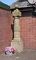 The Post at Orrell Post
 -
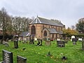 The Parish Church of St. Luke's
 -
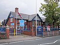 Newfold C.P. School


See also edit
References edit
Notes
- ^ Wigan Core Strategy 2013 (PDF), Wigan Council, 30 September 2013, retrieved 12 February 2014
- ^ "Greater Manchester Gazetteer". Greater Manchester County Record Office. Places names - O to R. Archived from the original on 18 July 2011. Retrieved 17 June 2008.
- ^ "Wigan ward population 2011". Archived from the original on 4 March 2016. Retrieved 10 January 2016.
- ^ "Archived copy" (PDF). Archived from the original (PDF) on 22 May 2013. Retrieved 19 February 2013.
{{cite web}}: CS1 maint: archived copy as title (link) - ^ "Orrell". 2001 England & Wales Census. neighbourhood.statistics.gov.uk. Archived from the original on 25 May 2011. Retrieved 16 February 2007.
- ^ Mills 1998, p. 262
- ^ a b c Farrer, William; Brownbill, J, eds. (1911), "Ince", A History of the County of Lancaster, Volume 4, Victoria County History, pp. 89–91, retrieved 17 December 2012
- ^ a b "Services". Archived from the original on 18 February 2007. Retrieved 10 February 2007.
- ^ Ashmore 1982, p. 120
- ^ "Ground". Orrell Rugby Union Club. Archived from the original on 29 April 2007.
- ^ Great Britain Historical GIS Project (2004), "Orrell UD through time. Census tables with data for the Local Government District", A vision of Britain through time, University of Portsmouth, retrieved 16 February 2007
- ^ HMSO. Local Government Act 1972. 1972 c.70.
- ^ "Welcome to St John Rigby College, Sixth Form, Wigan - St John Rigby College".
- ^ "St Peter's Catholic High School". Archived from the original on 28 September 2007.
- ^ "Schools in Wigan", BBC News, 19 January 2006, retrieved 16 February 2007
- ^ "Abraham Guest Academy Home". Archived from the original on 30 July 2013. Retrieved 22 October 2014.
- ^ "Orrell". Wigan Leisure & Culture Trust. Archived from the original on 2 January 2007.
- ^ "Wigan's Countryside - Orrell Water Park". Wigan Leisure & Culture Trust. Archived from the original on 24 April 2009. Retrieved 16 February 2007.
- ^ "Contact Us". Wish FM. Archived from the original on 23 February 2007. Retrieved 16 February 2007.
- ^ "M58". CBRD - Motorway Database. Retrieved 16 February 2007.
- ^ "Home". Orrell R.U.F.C. Archived from the original on 15 June 2006. Retrieved 13 June 2022.
- ^ Simon Collinson. "Overview". Wigan Warriors RLFC. Archived from the original on 14 October 2006. Retrieved 13 June 2022.
- ^ "Wigan Warriors - The Official Website". Archived from the original on 15 October 2006. Retrieved 8 February 2007.
- ^ "Orrell to quit Edge Hall Road". Wigan Observer. 24 January 2007. Retrieved 16 February 2007.[permanent dead link]
Bibliography
External links edit
- UK & Ireland Genealogy - Orrell, Genealogy and Gazetteer webspace about Orrell.
- Orrell, Billinge, Winstanley Township, Wigan MBC website.