


Summary
Orville (French pronunciation: [ɔʁvil] ⓘ) is a commune in the Pas-de-Calais department in the Hauts-de-France region of France.[3]
Orville | |
|---|---|
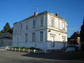 The town hall and school of Orville | |
 Coat of arms | |
Location of Orville .mw-parser-output .locmap .od{position:absolute}.mw-parser-output .locmap .id{position:absolute;line-height:0}.mw-parser-output .locmap .l0{font-size:0;position:absolute}.mw-parser-output .locmap .pv{line-height:110%;position:absolute;text-align:center}.mw-parser-output .locmap .pl{line-height:110%;position:absolute;top:-0.75em;text-align:right}.mw-parser-output .locmap .pr{line-height:110%;position:absolute;top:-0.75em;text-align:left}.mw-parser-output .locmap .pv>div{display:inline;padding:1px}.mw-parser-output .locmap .pl>div{display:inline;padding:1px;float:right}.mw-parser-output .locmap .pr>div{display:inline;padding:1px;float:left}html.skin-theme-clientpref-night .mw-parser-output .od,html.skin-theme-clientpref-night .mw-parser-output .od .pv>div,html.skin-theme-clientpref-night .mw-parser-output .od .pl>div,html.skin-theme-clientpref-night .mw-parser-output .od .pr>div{background:#000;color:#fff}html.skin-theme-clientpref-night .mw-parser-output .locmap{filter:grayscale(0.6)}@media(prefers-color-scheme:dark){html.skin-theme-clientpref-os .mw-parser-output .locmap{filter:grayscale(0.6)}html.skin-theme-clientpref-os .mw-parser-output .od,html.skin-theme-clientpref-os .mw-parser-output .od .pv>div,html.skin-theme-clientpref-os .mw-parser-output .od .pl>div,html.skin-theme-clientpref-os .mw-parser-output .od .pr>div{background:#000;color:#fff}}  Orville  Orville | |
| Coordinates: 50°08′04″N 2°24′45″E / 50.1344°N 2.4125°E | |
| Country | France |
| Region | Hauts-de-France |
| Department | Pas-de-Calais |
| Arrondissement | Arras |
| Canton | Avesnes-le-Comte |
| Intercommunality | CC Campagnes de l'Artois |
| Government | |
| • Mayor (2020–2026) | Alain Débureaux[1] |
| Area 1 | 11.95 km2 (4.61 sq mi) |
| Population (2021)[2] | 360 |
| • Density | 30/km2 (78/sq mi) |
| Time zone | UTC+01:00 (CET) |
| • Summer (DST) | UTC+02:00 (CEST) |
| INSEE/Postal code | 62640 /62760 |
| Elevation | 64–148 m (210–486 ft) (avg. 70 m or 230 ft) |
| 1 French Land Register data, which excludes lakes, ponds, glaciers > 1 km2 (0.386 sq mi or 247 acres) and river estuaries. | |
Geography edit
Orville is situated 20 miles (32 km) southwest of Arras, at the junction of the D24 and D938 roads, by the banks of the river Authie, on the border with the department of the Somme.
History edit
In the early 20th century, the village of Orville was home to more than a thousand people, among them more than 500 Belgian workers who had been attracted by the presence of phosphate mines. The discovery of phosphates could be compared at the time to the gold rush of America's far-west. There were up to 30 quarries extracting the phosphate-rich sand. The phosphate mines that had been discovered in 1887 were in use until the beginning of the 20th century, when richer and cheaper Moroccan and Tunisian imports became available. Extraction of sand for building and other use was still operating in the 1970s. The present name of this site is "the buttes of Orville" and is currently used as an international renowned clay pigeon shooting ground.
Population edit
| Year | Pop. | ±% p.a. |
|---|---|---|
| 1968 | 409 | — |
| 1975 | 318 | −3.53% |
| 1982 | 277 | −1.95% |
| 1990 | 325 | +2.02% |
| 1999 | 325 | +0.00% |
| 2007 | 339 | +0.53% |
| 2012 | 407 | +3.72% |
| 2017 | 402 | −0.25% |
| Source: INSEE[4] | ||
Places of interest edit
- The church of St.Martin, dating from the nineteenth century.
- The watermill on the river Authie.
- Two 18th-century farmhouses.
- Dovecotes.
See also edit
References edit
- ^ "Répertoire national des élus: les maires". data.gouv.fr, Plateforme ouverte des données publiques françaises (in French). 2 December 2020.
- ^ "Populations légales 2021". The National Institute of Statistics and Economic Studies. 28 December 2023.
- ^ INSEE commune file
- ^ Population en historique depuis 1968, INSEE