


Summary
Ossora (Russian: Оссора; Koryak: Асоран, Asoran) is a selo and the administrative center of Karaginsky District of Koryak Okrug of Kamchatka Krai, Russia.[4] Population: 2,133 (2010 Russian census);[5] 2,589 (2002 Census);[6] 4,074 (1989 Soviet census).[7]
Ossora
Оссора | |
|---|---|
 Ossora Airport, 2010 | |
Location of Ossora .mw-parser-output .locmap .od{position:absolute}.mw-parser-output .locmap .id{position:absolute;line-height:0}.mw-parser-output .locmap .l0{font-size:0;position:absolute}.mw-parser-output .locmap .pv{line-height:110%;position:absolute;text-align:center}.mw-parser-output .locmap .pl{line-height:110%;position:absolute;top:-0.75em;text-align:right}.mw-parser-output .locmap .pr{line-height:110%;position:absolute;top:-0.75em;text-align:left}.mw-parser-output .locmap .pv>div{display:inline;padding:1px}.mw-parser-output .locmap .pl>div{display:inline;padding:1px;float:right}.mw-parser-output .locmap .pr>div{display:inline;padding:1px;float:left}html.skin-theme-clientpref-night .mw-parser-output .od,html.skin-theme-clientpref-night .mw-parser-output .od .pv>div,html.skin-theme-clientpref-night .mw-parser-output .od .pl>div,html.skin-theme-clientpref-night .mw-parser-output .od .pr>div{background:#000;color:#fff}html.skin-theme-clientpref-night .mw-parser-output .locmap{filter:grayscale(0.6)}@media(prefers-color-scheme:dark){html.skin-theme-clientpref-os .mw-parser-output .locmap{filter:grayscale(0.6)}html.skin-theme-clientpref-os .mw-parser-output .od,html.skin-theme-clientpref-os .mw-parser-output .od .pv>div,html.skin-theme-clientpref-os .mw-parser-output .od .pl>div,html.skin-theme-clientpref-os .mw-parser-output .od .pr>div{background:#000;color:#fff}}  Ossora Location of Ossora 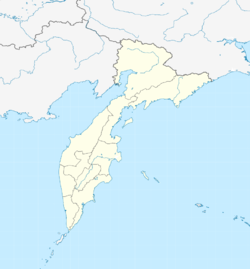 Ossora Ossora (Kamchatka Krai) | |
| Coordinates: 59°14′49″N 163°3′45″E / 59.24694°N 163.06250°E | |
| Country | Russia |
| Federal subject | Kamchatka Krai |
| Administrative district | Karaginsky District |
| Founded | 1937 |
| Elevation | 3 m (10 ft) |
| • Capital of | Karaginsky District |
| Time zone | UTC+12 (MSK+9 |
| Postal code(s)[2] | 688700 |
| OKTMO ID | 30824151101 |
Until 2012, Ossora was an urban locality (an urban-type settlement).
Climate edit
Ossora has a subarctic climate (Köppen: Dfc), The hottest month is July with a monthly mean of 13.4 °C or 56.1 °F, and the coldest month is January with a mean temperature of −15.0 °C or 5.0 °F. While there is a substantial maritime influence vis-à-vis inland areas of the Russian Far East and even vis-à-vis the Sea of Okhotsk coast, the climate is much colder than the western coasts of Europe and North America on similar latitudes, for instance being 6.9 °C (12.4 °F) colder than Juneau and 8.1 °C (14.6 °F) colder than Oslo.
| Climate data for Ossora (Climate ID:32246) | |||||||||||||
|---|---|---|---|---|---|---|---|---|---|---|---|---|---|
| Month | Jan | Feb | Mar | Apr | May | Jun | Jul | Aug | Sep | Oct | Nov | Dec | Year |
| Record high °C (°F) | 2.8 (37.0) |
2.5 (36.5) |
2.7 (36.9) |
10.0 (50.0) |
18.6 (65.5) |
28.3 (82.9) |
29.2 (84.6) |
26.3 (79.3) |
24.0 (75.2) |
14.4 (57.9) |
7.3 (45.1) |
3.5 (38.3) |
29.2 (84.6) |
| Mean daily maximum °C (°F) | −10.4 (13.3) |
−9.4 (15.1) |
−5.7 (21.7) |
−1.3 (29.7) |
4.6 (40.3) |
12.4 (54.3) |
16.8 (62.2) |
16.3 (61.3) |
12.2 (54.0) |
5.0 (41.0) |
−2.2 (28.0) |
−8.2 (17.2) |
2.5 (36.5) |
| Daily mean °C (°F) | −14.7 (5.5) |
−14.1 (6.6) |
−10.3 (13.5) |
−5.2 (22.6) |
1.6 (34.9) |
8.3 (46.9) |
12.9 (55.2) |
12.8 (55.0) |
8.5 (47.3) |
1.5 (34.7) |
−5.9 (21.4) |
−12.2 (10.0) |
−1.4 (29.5) |
| Mean daily minimum °C (°F) | −19.5 (−3.1) |
−19.2 (−2.6) |
−15.4 (4.3) |
−9.7 (14.5) |
−1.4 (29.5) |
4.6 (40.3) |
9.6 (49.3) |
9.5 (49.1) |
4.7 (40.5) |
−1.9 (28.6) |
−9.9 (14.2) |
−16.8 (1.8) |
−5.4 (22.2) |
| Record low °C (°F) | −41.1 (−42.0) |
−40.5 (−40.9) |
−40.3 (−40.5) |
−29.7 (−21.5) |
−16.9 (1.6) |
−4.4 (24.1) |
2 (36) |
−0.9 (30.4) |
−6.1 (21.0) |
−17.4 (0.7) |
−32.2 (−26.0) |
−39.4 (−38.9) |
−41.1 (−42.0) |
| Average precipitation mm (inches) | 47.9 (1.89) |
40.5 (1.59) |
58.3 (2.30) |
36.6 (1.44) |
45.1 (1.78) |
43.3 (1.70) |
48.7 (1.92) |
86.9 (3.42) |
75.1 (2.96) |
76.8 (3.02) |
66.3 (2.61) |
46.8 (1.84) |
672.3 (26.47) |
| Source: Roshydromet[8] | |||||||||||||
References edit
- ^ "Об исчислении времени". Официальный интернет-портал правовой информации (in Russian). 3 June 2011. Retrieved 19 January 2019.
- ^ Почта России. Информационно-вычислительный центр ОАСУ РПО. (Russian Post). Поиск объектов почтовой связи (Postal Objects Search) (in Russian)
- ^ Государственная Дума Российской Федерации. Федеральный Закон №131-ФЗ от 6 октября 2003 г. «Об общих принципах организации местного самоуправления в Российской Федерации», в ред. Федерального Закона №243-ФЗ от 28 сентября 2010 г. (State Duma of the Russian Federation. Federal Law #131-FZ of 6 October 2003 On the General Principles of Organization of the Local Self-Government in the Russian Federation, as amended by the Federal Law #243-FZ of 28 September 2010. ).
- ^ "Камчатский Край" (in Russian). Government of Kamchatka Krai. 2013. Retrieved 29 June 2018.
- ^ Russian Federal State Statistics Service (2011). Всероссийская перепись населения 2010 года. Том 1 [2010 All-Russian Population Census, vol. 1]. Всероссийская перепись населения 2010 года [2010 All-Russia Population Census] (in Russian). Federal State Statistics Service.
- ^ Federal State Statistics Service (21 May 2004). Численность населения России, субъектов Российской Федерации в составе федеральных округов, районов, городских поселений, сельских населённых пунктов – районных центров и сельских населённых пунктов с населением 3 тысячи и более человек [Population of Russia, Its Federal Districts, Federal Subjects, Districts, Urban Localities, Rural Localities—Administrative Centers, and Rural Localities with Population of Over 3,000] (XLS). Всероссийская перепись населения 2002 года [All-Russia Population Census of 2002] (in Russian).
- ^ Всесоюзная перепись населения 1989 г. Численность наличного населения союзных и автономных республик, автономных областей и округов, краёв, областей, районов, городских поселений и сёл-райцентров [All Union Population Census of 1989: Present Population of Union and Autonomous Republics, Autonomous Oblasts and Okrugs, Krais, Oblasts, Districts, Urban Settlements, and Villages Serving as District Administrative Centers]. Всесоюзная перепись населения 1989 года [All-Union Population Census of 1989] (in Russian). Институт демографии Национального исследовательского университета: Высшая школа экономики [Institute of Demography at the National Research University: Higher School of Economics]. 1989 – via Demoscope Weekly.
- ^ "Climate of Ossora" (in Russian). Weather and Climate (Погода и климат). Retrieved 1 November 2019.