


Summary
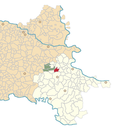
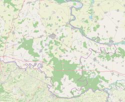
Ostrovo (Serbian Cyrillic: Острово,[4] Hungarian: Lászlófalva) is a village in Croatia, municipality Markušica, Vukovar-Syrmia County.
Ostrovo
| |
|---|---|
 | |
 | |
 Ostrovo  Ostrovo  Ostrovo | |
| Coordinates: 45°20′17″N 18°47′13″E / 45.338°N 18.787°E | |
| Country | |
| Region | Slavonia (Podunavlje) |
| County | |
| Municipality | Markušica |
| Government | |
| • Body | Local Committee |
| Area | |
| • Total | 16.3 km2 (6.3 sq mi) |
| Population (2024)[3] | |
| • Total | 250 |
| • Density | 15/km2 (40/sq mi) |
| Time zone | UTC+1 (CET) |
| Official languages | Croatian, Serbian[1] |
Education edit
Branch school of Elementary school Markušica is located in Ostrovo. Education at local schools is carried out in Serbian.[5]
History edit
Ostrovo was mentioned in 1381 when it was described as a ruined town leading some historians to believe it was originally established during the existence of the Valkó County.[6] During the Middle Ages it was a typical swampland castle.[6] Prior to the Ottoman conquest of the region the land around the village belonged to the Benedictine monks with contemporary village of Laslovo and historical settlements of Eginci and Čakanovci belonging to the Ostrovo property.[6] Ostrovo was abandoned following the Ottoman conquests with Eastern Orthodox people from the Balkans interior resettling it on 16th century and again in 17th century.[6] Following the 1699 Treaty of Karlowitz, in 1702 the village was included into the Nuštar estates with 1736 local census recording 40 predominantly Eastern Orthodox houses.[6] In 1866 629 residents lived in 105 inhabited houses with 618 of them belonging to Eastern Orthodox communities of Serbs or Vlachs.[6]
During the war in Croatia Ostrovo was within self-proclaimed Serb political entity SAO Eastern Slavonia, Baranja and Western Syrmia. In the final stages of conflict United Nations Mission conducted peaceful reintegration this region into Croatian jurisdiction.
Demographic history edit
According to the 1991 census, the village was inhabited by a majority of Serbs (85.18%), and minority of Croats (7.91%) and Yugoslavs (4.29%).[7]
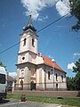
Gallery edit


See also edit
References edit
- ^ a b Government of Croatia (October 2013). "Peto izvješće Republike Hrvatske o primjeni Europske povelje o regionalnim ili manjinskim jezicima" (PDF) (in Croatian). Council of Europe. p. 36. Retrieved 30 November 2016.
- ^ Register of spatial units of the State Geodetic Administration of the Republic of Croatia. Wikidata Q119585703.
- ^ "Population by Age and Sex, by Settlements, 2021 Census". Census of Population, Households and Dwellings in 2021. Zagreb: Croatian Bureau of Statistics. 2022.
- ^ "Registar Geografskih Imena Nacionalnih Manjina Republike Hrvatske" (PDF). Archived from the original (PDF) on 2013-10-29. Retrieved 2013-03-08.
- ^ Popis osnovnih i srednjih škola s nastavom na jeziku i pismu nacionalnih manjina po modelu A, školska godina 2011./2012., Ministarstvo znanosti obrazovanja i sporta
- ^ a b c d e f Mirko Marković (2003). Istočna Slavonija: Stanovništvo i naselja. Zagreb: Naklada Jesenski i Turk. p. 71. ISBN 9532221239.
- ^ "попис становништва 1991" (PDF). Савезни завод за статистику и евиденцију ФНРЈ и СФРЈ.