
KNOWPIA
WELCOME TO KNOWPIA

Ostvorpommern 
Summary
Ostvorpommern was a Kreis (district) in the eastern part of Mecklenburg-Western Pomerania, Germany. Neighboring districts were (from east clockwise) Uecker-Randow, Mecklenburg-Strelitz, Demmin and Nordvorpommern. The Hanseatic city of Greifswald was enclosed by the district, but did not belong to it.
Ostvorpommern | |
|---|---|
 Coat of arms | |
 | |
| Country | Germany |
| State | Mecklenburg-Western Pomerania |
| Founded | 1994 |
| Disbanded | 2011 |
| Capital | Anklam |
| Area | |
| • Total | 1,899 km2 (733 sq mi) |
| Population (2010-12-31) | |
| • Total | 105,036 |
| • Density | 55/km2 (140/sq mi) |
| Time zone | UTC+01:00 (CET) |
| • Summer (DST) | UTC+02:00 (CEST) |
| Vehicle registration | OVP |
| Website | http://www.kreis-ovp.de |
History edit
Ostvorpommern District was established on June 12, 1994 by merging the former districts of Anklam, Greifswald and Wolgast. It was merged into Vorpommern-Greifswald on 4 September 2011.
Coat of arms edit
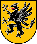
|
The coat of arms shows the griffin of Pomerania. |
Towns and municipalities edit
The subdivisions of the district were (situation August 2011):
| Amt-free towns | Amt-free municipalities |
|---|---|
| Ämter | ||
|---|---|---|
|
|
|
| 1 - seat of the Amt; 2 - town; 3 - former town/municipality | ||
References edit
External links edit
Wikimedia Commons has media related to Landkreis Ostvorpommern.
- Official website (German)
- Touristic website of Usedom (English, German, Polish)
- Regional Tourist Board Vorpommern (English, German, Swedish, Polish)
53°56′N 13°40′E / 53.93°N 13.67°E