


Summary
Otago Harbour is the natural harbour of Dunedin, New Zealand, consisting of a long, much-indented stretch of generally navigable water separating the Otago Peninsula from the mainland. They join at its southwest end, 21 km (13 mi) from the harbour mouth. It is home to Dunedin's two port facilities, Port Chalmers (half way along the harbour) and at Dunedin's wharf (at the harbour's end).[1] The harbour has been of significant economic importance for approximately 700 years, as a sheltered harbour and fishery, then deep water port.
| Otago Harbour | |
|---|---|
 Otago Harbour | |
 Otago Harbour | |
 Otago Harbour | |
| Location | Dunedin, Otago, New Zealand |
| Coordinates | 45°49′54″S 170°37′46″E / 45.8317°S 170.6294°E |
| River sources | Water of Leith and Toitū Stream |
| Ocean/sea sources | South Pacific Ocean |
| Basin countries | New Zealand |
| Max. length | 21 kilometres (13 mi) |
| Islands | Quarantine Island, Goat Island / Rakiriri, and Pudding Island |
| Settlements | Dunedin and Port Chalmers |
Geography edit
The harbour was formed from the drowned remnants of the giant Dunedin Volcano, centred close to what is now Port Chalmers. The remains of this violent origin can be seen in the basalt of the surrounding hills. The last eruptive phase ended some ten million years ago, leaving the prominent peak of Mount Cargill.[2][3] The ancient and modern channel runs along the western side of the harbour, the eastern side being shallow, with large sandbanks exposed at low tide. Two islands form a line between Port Chalmers and Portobello half way along the harbour—Goat Island / Rakiriri and Quarantine Island/Kamau Taurua. The nearby smaller island known as Pudding Island (Titeremoana)[4] lies close to the Peninsula shore and can be reached by foot at low tide. The Water of Leith flows into the harbour at its southern end, which along with numerous streams lowers the salinity of the harbour water.


Biology edit
Seabirds edit
Similar to the Otago Peninsula, the harbour water is known for various rare wildlife. The area is the home of many species of wading birds. Other bird species which visit the harbour include two species of penguins, the blue penguin and the rare yellow-eyed penguin. Taiaroa Head, at the tip of the Otago Peninsula, is home to the only "mainland" colony of northern royal albatrosses in the world.[citation needed]
Marine mammals edit
The bay and peninsula provides a critical habitat for Hooker's sea lions and New Zealand fur seals. Southern elephant and leopard seals are occasional visitors into the harbour. In total, four species of pinnipeds, and at least nine or more species of cetaceans are known to inhabit or migrate through the area.
The outer peninsula or adjacent to Taiaroa Head is one of three main congregating areas for dusky dolphins in New Zealand waters[5] and the harbour and peninsula hosts important areas for breeding and nursing.[6] Bottlenose dolphins and critically endangered, endemic Hector's dolphins also frequent the water. Other species such as common dolphins and orcas also visit the harbour entrance, where orcas and dusky dolphins have been seen interacting without violence. Southern right whales were historically seen inside the entrance of the harbour possibly up to Quarantine and Goat Island / Rakiriri.[7] They used the shallow, calm water for nursing calves before commercial whaling wiped them out lcally.[8] The number of humpback whales visiting the peninsula have increased as this species recovers much faster than the southern rights.[9] There have also been observations of blue whales, minke whales, and long-finned pilot whales.
History edit

Māori first arrived at Otago Harbour in the 1300s, soon after they first settled in New Zealand.[10] Being too far south for the cultivation of sweet potato they adopted a hunter-gatherer society. This initially involved sealing and fishing in the harbour, with the latter dominating as seal stocks diminished. This time in the history of the harbour is recorded in place names such as Kamau Taurua (Quarantine Island), which means "a place where nets are set".[11]
The first European ships edit

Captain Cook never entered Otago Harbour, but speculated that it existed when he was off the Pacific coast in 1770.[12] It is not known exactly when the first Europeans (likely sealers) entered the harbour, though Māori oral tradition puts it some time 'long before' 1810.[13] Written records of this time are restricted to a handful of journals and newspaper accounts of sailors who only stayed briefly.[14] George Bass made the Dunedin end of the harbour the north east limit of his proposed fishing monopoly in 1803.[15] The American ship Favourite and its supercargo Daniel Whitney may have called in the summer of 1805 to 1806. Daniel Cooper, master of the London sealer Unity, probably did call in the summer of 1808 to 1809 when his Chief Officer, Charles Hooper, probably gave his name to Hooper's Inlet on the Otago Peninsula.[16] William Tucker (1784–1817) was with a gang employed by Robert Campbell, a Sydney merchant, who were dropped on islands off the Dunedin coast in November 1809. Tucker and Daniel Wilson were at Otago Harbour on 3 May 1810 when Robert Mason, master of the Brothers, anchored in the harbour and picked him up. This is the first explicit and identifiable reference to a European ship in Otago Harbour. The court record containing it, made in 1810, refers to the harbour as 'Port Daniel', a name which stayed in use for some years.[17]
The sealers and whalers edit
Another English sealer, the Sydney Cove, under Captain Charles McLaren, was anchored in the harbour late in 1810 when Te Wahia's theft of a knife, a red shirt, and some other articles sparked what has been called "The Sealers' War".[18]

A much-discussed affray in that conflict occurred after James Kelly of Hobart anchored the Sophia in the harbour in December 1817 with William Tucker on board. After a visit to nearby Whareakeake (Murdering Beach), where Tucker had been living since 1815, and where he and two other men were killed, Kelly took revenge on Māori on his ship in the harbour, including local chief Korako. He then burnt a harbourside village, 'the beautiful City of Otago', probably on Te Rauone Beach.[19]
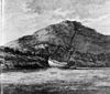
Peace was achieved in 1823, and on 17 July of that year John Rodolphus Kent of the Naval cutter Mermaid from New South Wales, while in the harbour, took 'the liberty of naming it (as it has not hitherto been named) "Port Oxley", in honour of the Surveyor General of the Colony', John Oxley (1783/85?–1828).[20] As noted, however, it had already been named. In 1826 Thomas Shepherd, one of a party of intending colonists, explored the site of Dunedin and left the oldest surviving pictures of the harbour and nearby coast, now in the Mitchell Library in Sydney.[21]
From its origins as a secret sealers' haven, Otago Harbour developed into a busy international whaling port after the Weller brothers established their whaling station at Te Umu Kuri, Wellers Rock, at what is now called Otakou in November 1831.[22] The busiest whaling port south of the Bay of Islands, it was also the hub of the largest European population in New Zealand after the Bay of Islands/Hokianga district by the end of 1839. By that time whaling had collapsed and Dumont D'Urville and his officers, visiting in 1840, observed the port had become the centre of a riotous trade in liquor and prostitution.[23] This continued until the Scottish settlers arrived in 1848 and made Port Chalmers and Dunedin the new population centres on the harbour.
Harbour developments and alterations edit

While Otago Harbour might have the appearance of an excellent deep-water port, it was not naturally suited to such a role, especially in the early days of settlement when ships needed to dock close to the city. The flat land at the southern end of the harbour and close to the isthmus of Otago Peninsula was ideally suited for a city (and was the site for Dunedin), but the harbour itself could naturally accommodate deep-drafted ships only as far as Port Chalmers. At Port Chalmers, two islands (Quarantine Island/Kamau Taurua and Goat Island / Rakiriri) almost bisect the harbour. Beyond them, the harbour is shallow and silty, and mudflats are often visible at low tide.[24] In 1946 Otakou Fisheries was started based out of the township of the same name on the eastern side of the harbour. This was later to become a major part of the Otago fishing industry.[25][26]
As the city grew, and particularly with the increase in commerce that developed following the Otago Gold Rush of the 1860s, it became desirable to provide a means for ships to reach the city's wharves. Though a contentious and expensive decision, it was agreed to dredge a channel along the northwestern side of the harbour. The channel was finally opened on 30 December 1881. The initial channel was narrow and shallow, and did not get off to an auspicious start, as the Union Steam Ship Company's SS Penguin, the first ship to use it, was temporarily grounded while using it. The channel was officially named the Victoria Channel by Keith Ramsay, chairman of the Otago Harbour Board.[24] A significant area at the head of the harbour — much of it referred to as the Southern Endowment — has been reclaimed since the founding of Dunedin, primarily for industrial use.[27] Smaller portions have also been reclaimed at a number of places around the harbour, including Port Chalmers, Macandrew Bay, and Broad Bay.
As finance allowed, the channel was gradually widened and deepened, and by 1907 twice as many ships were using Dunedin's wharves as used Port Chalmers. It was only with the advent of Port Chalmers' container port in the early 1970s that the Victoria Channel again became quiet. The channel is maintained by Port Otago Ltd, which keeps it dredged to a depth of eight metres, allowing ships of up to 40,000 tonnes deadweight to travel up the harbour to Dunedin.[24] Much of the channel's larger traffic in the early 21st century is oil transport to Dunedin city and chemicals and fertiliser to and from Ravensbourne's fertiliser works.
Aramoana, at the harbour mouth, has twice been projected as the site for New Zealand's second aluminium smelter. The proposals, in the mid-1970s and early 1980s, were abandoned after major public protest. The harbour is tidal, shallow and seldom rough and for that reason is popular for water sports such as yachting and windsurfing.
Infrastructure and transport edit
Substantial container port facilities exist at Port Chalmers, 9 km (6 mi) along the western shore from the harbour mouth. A channel along the western side of the harbour is regularly dredged, allowing vessels with a draught of 12.5 m to Port Chalmers, and 8 m all the way to the heart of Dunedin.[28] New Zealand's frozen meat export trade was inaugurated at Port Chalmers in 1882. Portobello is home to one of New Zealand's leading marine research establishments, the Portobello Marine Laboratory, a department of the University of Otago. This lies at the harbour's edge on the tip of a small arm of the Otago Peninsula, the Portobello Peninsula. There are currently numerous sightseeing and fishing boats that can be chartered and one scheduled ferry from Port Chalmers to Portobello.
The harbour is flanked by major roads leading from Dunedin to Port Chalmers (SH 88) and to Portobello and Otakou (Portobello Road). A long-distance cycleway and walkway, Te Aka Ōtākou, runs parallel to both roads along the harbour's edge for 36 kilometres (22 mi). It was completed in 2023 and links Port Chalmers and Portobello. The South Island Main Trunk railway also runs parallel to the state highway on the western side of the harbour.
Notable ships edit
This list is incomplete; you can help by adding missing items. (November 2018) |
| Image | Name | Year(s) in harbour | Type | Length (m) | Displacement(tonnes) | Crew/Passengers | Purpose | Note |
|---|---|---|---|---|---|---|---|---|
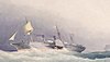 |
Atrato[29] | 1874 | Paddle steamer | 102 | 3,184 | Old Royal Mail ship | ||
 |
Dunedin | 1882 | Sail | 73 | 1,320 | /400 (design max) | Cargo | Refrigerated transport |
 |
Endeavour | 1770 | Sail (Barque) | 30 | 366 | 94/ | Exploration | Did not enter harbour |
 |
John Wickliffe | 1847 | sail | 662 | /97 | Colonisation | Scottish settler ship | |
 |
Mokoia[30] | Steam | 3502 | Wrecked at harbour mouth | ||||
 |
Monarch | 1952 (Launched) | 16.5 | Harbour ferry | ||||
| Oreti[31] | Steam | Wrecked at Quarantine Island | ||||||
| Philip Laing | 1848 | /247 | Colonisation | Scottish settler ship | ||||
 |
Rainbow Warrior[32] | 2018 | (A-frame staysail schooner) | 838 | 30 | |||
 |
Sootychaser[33] | 2018 | Custom built | Harbour ferry | Scheduled ferry and water taxi | |||
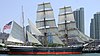 |
Star of India | 1871-1897 | 1247 | Colonisation | 100-day voyage from England | |||
| Sydney Cove | 1810 | 28.7 | 283 | 24 (typical crew) | Sealer | Sparked the Sealers' War | ||
| Waikana[31] | Steam | /800 (design max) | Harbour ferry | Wrecked at Quarantine Island |
Harbourside settlements edit

The settlements of Otago Harbour clock wise from the harbour mouth.
| Photo | Name | Harbour side | Population[34] | Feature |
|---|---|---|---|---|
 |
Harington Point | East | ||
| Weller's Rock | East | With access to the albatross colony, seal colony, and Fort Taiaroa | ||
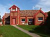 |
Otakou | East | Home of the Ōtākou Rūnanga of Ngāi Tahu
and starting place of Otakou Fisheries. | |
| Harwood | East | |||
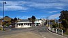
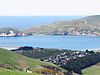
 |
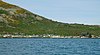
Portobello | East | 1110 | |
| Broad Bay | East | |||
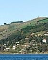
 |
Macandrew Bay | East | 1146 | |
 |
Challis | East | ||
 |
Andersons Bay | East | 2478 | |
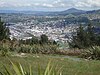 |
Dunedin (Central City) | South | ||
 |
Ravensbourne | West | 1230 | fertiliser works |
| Saint Leonards | West | 780 | ||
 |
Roseneath | West | ||
| |
Sawyers Bay | West | 1212 | with a tannery |
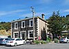
 |
Port Chalmers | West | 1365 | |
 |
Careys Bay | West | ||
 |
Aramoana | West | 270 | Māori for "pathway to the sea" |
Gallery edit
- Category:Otago Harbour on Wikimedia Commons
References edit
- ^ Harvey, Sarah (9 August 2007). "Otago Port to get into deep water". The New Zealand Herald. Retrieved 21 May 2008.
- ^ Coombs, D. S., Dunedin Volcano, Misc. Publ. 37B, pp. 2–28, Geol. Soc. of N. Z., Dunedin, 1987.
- ^ Coombs, D. S., R. A. Cas, Y. Kawachi, C. A. Landis, W. F. Mc-Donough, and A. Reay, Cenozoic volcanism in north, east and central Otago, Bull. R. Soc. N. Z., 23, 278–312, 1986.
- ^ "Valid Crown Protected Area Names". Archived from the original on 24 May 2010. Retrieved 1 September 2010.
- ^ Lineage—Scientific Methodology—Annual distribution of Dusky dolphin Archived 16 December 2014 at the Wayback Machine. Retrieved on 16 December. 2014
- ^ Würsig B.. Duprey N.. Weir J.. Dusky dolphins (Lagenorhynchus obscurus) in New Zealand waters—Present knowledge and research goals. Texas A&M University. Department of Conservation. Retrieved on 16 December. 2014
- ^ Brown T. (2015). "Whale heads fair way up harbour". The Otago Daily Times. Retrieved 25 October 2015.
- ^ "Research—Acoustics". New Zealand Whale and Dolphin Trust. Archived from the original on 5 May 2014. Retrieved 25 February 2014.
- ^ Monarch Wildlife Cruises. 2014. Whale of a time on Monarch yesterday!. Retrieved on 4 August 2014
- ^ West, Jonathan (March 2018). The Face of Nature: An Environmental History of the Otago Peninsula. Otago University Press. ISBN 9781927322383.
- ^ "Maori and early European history | Quarantine Island / Kamau Taurua". quarantineisland.org.nz. Retrieved 26 November 2018.
- ^ James Cook in J.C. Beaglehole (ed), The Journals of Captain James Cook, the Voyage of the Endeavour, 1768–1771, London, UK: Cambridge University Press for the Hakluyt Society, 1955, (1968), pp.257–259.
- ^ Quote from the Creed MS its text reproduced in Peter Entwisle,Taka: a Vignette Life of William Tucker 1784–1817, Dunedin, NZ: Port Daniel Press, 2005, pp.128–131, the quote at p.128.
- ^ "New thinking on early Otago history". webenzed.com. Retrieved 25 November 2018.
- ^ Robert McNab (ed) Historical Records of New Zealand, 2 vols Wellington, NZ:Government Printer, 1908 & 1914.
- ^ Peter Entwisle, Behold the Moon: the European Occupation of the Dunedin District 1770–1848, Dunedin, NZ: Port Daniel Press, 1998 p.21.
- ^ Peter Entwisle, Taka: A Vignette Life of William Tucker 1784–1817, Dunedin, NZ: Port Daniel Press, 2005, pp.53–66 & pp.110–115 for the relevant court records.
- ^ Peter Entwisle, Taka: a Vignette Life of William Tucker 1784–1817, Dunedin, NZ: Port Daniel Press, 2005, pp.70–71.
- ^ Peter Entwisle, Taka: a Vignette Life of William Tucker 1784–1817, Dunedin, NZ: Port Daniel Press, 2005, pp.94–97, quoting James Kelly in the Hobart Town Courier 12 April 1858. There has been some speculation, almost certainly inaccurate, that the site of the "city" was at Whareakeake.
- ^ John Rodolphus Kent, Journal kept from May to August 1823 on the cutter Mermaid of a voyage to New Zealand waters, manuscript ZA4037, Mitchell Library, State Library of New South Wales, Sydney.
- ^ Thomas Shepherd, [Journal], MS A1966, Mitchell Library, State Library of New South Wales, Sydney.
- ^ Peter Entwisle, Behold the Moon: The European Occupation of the Dunedin District 1770–1848, Dunedin, NZ: Port Daniel Press, 1998, p.83.
- ^ Olive Wright, ed & translator, The Voyage of the Astrolabe 1840, Wellington, NZ: A.H. & A.W. Reed, 1955.
- ^ a b c McLean, G. (2002) 100 Historic Places in New Zealand. Auckland: Hodder Moa Beckett. pp. 115–116. ISBN 1-86958-920-3
- ^ Taonga, New Zealand Ministry for Culture and Heritage Te Manatu. "Ellison, Raniera". Retrieved 26 November 2018.
- ^ "Ngai Tahu plays the long game". Otago Daily Times Online News. 6 November 2013. Retrieved 26 November 2018.
- ^ "Manufacturing in Dunedin". Otago Chamber of Commerce. Archived from the original on 5 July 2007. Retrieved 21 May 2008.
- ^ "Otago Harbour Information". Port Otago. Archived from the original on 29 April 2008. Retrieved 21 May 2008.
- ^ "Ships in Quarantine and Passenger lists | Quarantine Island / Kamau Taurua". quarantineisland.org.nz. Retrieved 29 November 2018.
- ^ Watson, Virginia. "Mokoia". diveotago.co.nz. Retrieved 24 November 2018.
- ^ a b "Attempts at farming and tourism 1924-1958 | Quarantine Island / Kamau Taurua". quarantineisland.org.nz. Retrieved 25 November 2018.
- ^ "Greenpeace's Rainbow Warrior III Vessel - Ship Technology". Ship Technology. Retrieved 25 November 2018.
- ^ Sinclair, Kay (14 September 2018). "Harbour ferry makes maiden voyage". Otago Daily Times Online News. Retrieved 9 December 2018.
- ^ "Detailed 2013 Census figures - Dunedin". Otago Daily Times Online News. 16 October 2013. Retrieved 24 November 2018.
External links edit
- Coasts and Harbours at the Otago Regional Council