


Summary
Oxton is a village in Nottinghamshire, England, with 568 residents at the 2011 census,[1] falling marginally to 566 at the 2021 census.[2] It is located 5 miles (8 km) west of Southwell, 5 miles (8 km) north of Lowdham, 10 miles (16 km) north-east of Nottingham and 2 miles (3 km) north-east of Calverton, and lies on the B6386, and is very close to the A6097 trunk road.
| Oxton | |
|---|---|
| Village and civil parish | |
 | |
Parish map.mw-parser-output .locmap .od{position:absolute}.mw-parser-output .locmap .id{position:absolute;line-height:0}.mw-parser-output .locmap .l0{font-size:0;position:absolute}.mw-parser-output .locmap .pv{line-height:110%;position:absolute;text-align:center}.mw-parser-output .locmap .pl{line-height:110%;position:absolute;top:-0.75em;text-align:right}.mw-parser-output .locmap .pr{line-height:110%;position:absolute;top:-0.75em;text-align:left}.mw-parser-output .locmap .pv>div{display:inline;padding:1px}.mw-parser-output .locmap .pl>div{display:inline;padding:1px;float:right}.mw-parser-output .locmap .pr>div{display:inline;padding:1px;float:left}html.skin-theme-clientpref-night .mw-parser-output .od,html.skin-theme-clientpref-night .mw-parser-output .od .pv>div,html.skin-theme-clientpref-night .mw-parser-output .od .pl>div,html.skin-theme-clientpref-night .mw-parser-output .od .pr>div{background:#000;color:#fff}html.skin-theme-clientpref-night .mw-parser-output .locmap{filter:grayscale(0.6)}@media(prefers-color-scheme:dark){html.skin-theme-clientpref-os .mw-parser-output .locmap{filter:grayscale(0.6)}html.skin-theme-clientpref-os .mw-parser-output .od,html.skin-theme-clientpref-os .mw-parser-output .od .pv>div,html.skin-theme-clientpref-os .mw-parser-output .od .pl>div,html.skin-theme-clientpref-os .mw-parser-output .od .pr>div{background:#000;color:#fff}} Oxton Location within Nottinghamshire | |
| Area | 5.76 sq mi (14.9 km2) |
| Population | 566 (2021) |
| • Density | 98/sq mi (38/km2) |
| OS grid reference | SK 62862 51305 |
| • London | 115 mi (185 km) SSE |
| District | |
| Shire county | |
| Region | |
| Country | England |
| Sovereign state | United Kingdom |
| Post town | SOUTHWELL |
| Postcode district | NG25 |
| Dialling code | 0115 |
| Police | Nottinghamshire |
| Fire | Nottinghamshire |
| Ambulance | East Midlands |
| UK Parliament | |
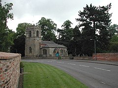
Oxton has a church dedicated to St Peter & St Paul;[3] a post office and two pubs. Oxton also has two fords – a small ford within the village itself, and a much larger ford on Beanford Lane – often as deep as 1-foot (0.30 m) whilst remaining open to all traffic. It is however closed each March, so that the toads found in the swamp-like area, which the ford crosses, can breed.
Toponymy edit
Oxton seems to contain the Old English word for an ox, oxa, + tūn (Old English), an enclosure; a farmstead; a village; an estate.., so 'Ox farm or settlement'.[4]
Notable people edit
- Robert St Vincent Sherbrooke, awarded the Victoria Cross, was born in Oxton.[5][failed verification]
Bus services edit
NottsBus
747: Oxton – Calverton – Lowdham
See also edit
References edit
- ^ UK Census (2011). "Local Area Report – Oxton Parish (E04007935)". Nomis. Office for National Statistics. Retrieved 14 September 2023.
- ^ UK Census (2021). "2021 Census Area Profile – Oxton (Newark and Sherwood) parish (E04007935)". Nomis. Office for National Statistics. Retrieved 5 February 2024.
- ^ N. Pevsner, The Buildings of England: Nottinghamshire (1979), p.286
- ^ J. Gover, A. Mawer & F. M. Stenton (eds.), Place Names of Nottinghamshire (Cambridge, 1940), p.172; A.D.Mills, Dictionary of English Place-Names (Oxford, 2002), p.265; E .Ekwall, Concise Oxford Dictionary of English Place-names (Oxford, 1960), p.356
- ^ "No. 35859". The London Gazette (Supplement). 8 January 1943. pp. 283–284.
External links edit
![]() Media related to Oxton, Nottinghamshire at Wikimedia Commons
Media related to Oxton, Nottinghamshire at Wikimedia Commons
- Parish council details on the Newark and Sherwood district council website