


Summary
Pallabi (Bengali: পল্লবী) is a thana of Dhaka District in the Division of Dhaka, Bangladesh. Its total area is 25.28 square kilometres (9.76 sq mi), located between 23°48' and 23°52' north latitudes and between 90°20' and 90°23' east longitudes.
Pallabi Thana
পল্লবী থানা | |
|---|---|
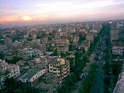 Skyline of Pallabi, Bangladesh | |
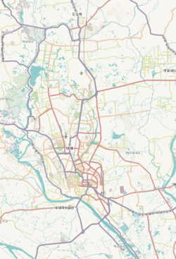
 Expandable map of vicinity of Pallabi Thana | |
 Pallabi Thana Location of Pallabi Thana within Dhaka  Pallabi Thana Location of Pallabi Thana within Dhaka Division  Pallabi Thana Location of Pallabi Thana within Bangladesh | |
| Coordinates: 23°49′30″N 90°22′10″E / 23.825°N 90.3694°E | |
| Country | |
| Division | Dhaka Division |
| District | Dhaka District |
| Established as a thana | 2005 |
| Area | |
| • Total | 25.28 km2 (9.76 sq mi) |
| Elevation | 23 m (75 ft) |
| Population (2011)[2] | |
| • Total | 596,835 |
| • Density | 23,609/km2 (61,150/sq mi) |
| Time zone | UTC+6 (BST) |

Origin of name edit
There are different opinions on the origin of the name of Pallabi:
- Pallabi is the daughter of late Jahurul Islam (owner of Eastern Housing). After 1971, when Eastern housing won the tender for the Mirpur extension project, the project was named after his daughter.
- Pallav Vai (Bangla: পল্লব ভাই) was the first freedom fighter of Pallabi and early residents named the place after him.
- Pallabi means nature, new leaves, greenery or a green environment, and Pallabi was previously one of the most greenest places in Dhaka.
Geography edit
Pallabi is bounded by Turag River and Uttara Thana on the north, Mirpur Model Thana and Shah Ali Thana on the south, Bimanbandar Thana, Cantonment Thana and Kafrul Thana on the east, and Savar Upazila on the west. Its total area is 17 km².[3]
Demographics edit
According to 2011 census, Pallabi Thana has a population of 596,835 with average household size of 4.2 members, and an average literacy rate of 70.6% vs national average of 51.8% literacy.[2]
Administration edit
Pallabi has one union/ward, 16+27 mauzas/mahallas, and no villages.
Mosque edit
- Pallabi Jhil Jame Masjid
- Pallabi Baitul Aman Jame Masjid
- Baitus Salah Jame Mosque
Education edit
- Pallabi Mazedul Islam Model High School
- Pallabi Govt Primary School
- Averroes International School
- Pallabi Nursing College
- ILM International School
- Apple Tree International School
- Cosmo School and College
- Markazud Dawah Al-islamia
- Madrasah Abdullah ibne Masud (RA)]
See also edit
References edit
- ^ "Geographic coordinates of Dhaka, Bangladesh". DATEANDTIME.INFO. Retrieved 7 July 2016.
- ^ a b Bangladesh Bureau of Statistics (2011). "Population & Housing Census" (PDF). Bangladesh Government. Archived from the original (PDF) on 3 September 2017. Retrieved 17 April 2015.
- ^ "Pallabi Thana". Banglapedia. Retrieved 2024-01-05.