
KNOWPIA
WELCOME TO KNOWPIA

Panay Gulf 
Summary
Panay Gulf is an extension of the Sulu Sea, reaching between the islands of Panay and Negros in the Philippines. The gulf contains the island-province of Guimaras and extends into the Iloilo Strait, between Panay and Guimaras, and into Guimaras Strait, between Guimaras and Negros. Guimaras Strait connects Panay Gulf with the Visayan Sea.
| Panay Gulf | |
|---|---|
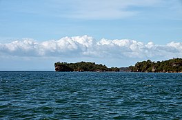 Guimaras' small islands in Panay Gulf | |
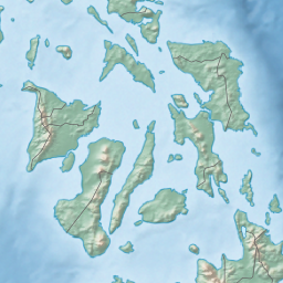 Panay Gulf Location within the Philippines  Panay Gulf Panay Gulf (Philippines) | |
| Location | |
| Coordinates | 10°15′00″N 122°14′55″E / 10.2500°N 122.2486°E |
| Type | gulf |
| Etymology | Panay |
| Part of | Sulu Sea |
| Settlements | |
The Port of Iloilo is the busiest port on the gulf, which is a major route used by ships plying the areas between Iloilo City, Bacolod, and Zamboanga further to the south.[1]
The Panay Landing during World War II occurred in Panay Gulf.[2]
References edit