
KNOWPIA
WELCOME TO KNOWPIA

Parenty 
Summary
Parenty (French pronunciation: [paʁɑ̃ti]) is a commune in the Pas-de-Calais department in the Hauts-de-France region of France.[3]
Parenty | |
|---|---|
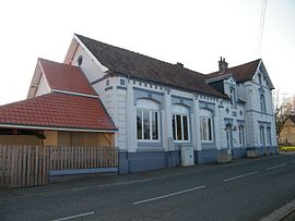 The town hall and school of Parenty | |
 Coat of arms | |
Location of Parenty .mw-parser-output .locmap .od{position:absolute}.mw-parser-output .locmap .id{position:absolute;line-height:0}.mw-parser-output .locmap .l0{font-size:0;position:absolute}.mw-parser-output .locmap .pv{line-height:110%;position:absolute;text-align:center}.mw-parser-output .locmap .pl{line-height:110%;position:absolute;top:-0.75em;text-align:right}.mw-parser-output .locmap .pr{line-height:110%;position:absolute;top:-0.75em;text-align:left}.mw-parser-output .locmap .pv>div{display:inline;padding:1px}.mw-parser-output .locmap .pl>div{display:inline;padding:1px;float:right}.mw-parser-output .locmap .pr>div{display:inline;padding:1px;float:left}html.skin-theme-clientpref-night .mw-parser-output .od,html.skin-theme-clientpref-night .mw-parser-output .od .pv>div,html.skin-theme-clientpref-night .mw-parser-output .od .pl>div,html.skin-theme-clientpref-night .mw-parser-output .od .pr>div{background:#000;color:#fff}html.skin-theme-clientpref-night .mw-parser-output .locmap{filter:grayscale(0.6)}@media(prefers-color-scheme:dark){html.skin-theme-clientpref-os .mw-parser-output .locmap{filter:grayscale(0.6)}html.skin-theme-clientpref-os .mw-parser-output .od,html.skin-theme-clientpref-os .mw-parser-output .od .pv>div,html.skin-theme-clientpref-os .mw-parser-output .od .pl>div,html.skin-theme-clientpref-os .mw-parser-output .od .pr>div{background:#000;color:#fff}}  Parenty  Parenty | |
| Coordinates: 50°35′19″N 1°48′36″E / 50.5886°N 1.81°E | |
| Country | France |
| Region | Hauts-de-France |
| Department | Pas-de-Calais |
| Arrondissement | Montreuil |
| Canton | Lumbres |
| Intercommunality | CC Haut Pays du Montreuillois |
| Government | |
| • Mayor (2020–2026) | Serge Depraiter[1] |
| Area 1 | 12.92 km2 (4.99 sq mi) |
| Population (2021)[2] | 537 |
| • Density | 42/km2 (110/sq mi) |
| Time zone | UTC+01:00 (CET) |
| • Summer (DST) | UTC+02:00 (CEST) |
| INSEE/Postal code | 62648 /62650 |
| Elevation | 50–194 m (164–636 ft) (avg. 77 m or 253 ft) |
| 1 French Land Register data, which excludes lakes, ponds, glaciers > 1 km2 (0.386 sq mi or 247 acres) and river estuaries. | |
Geography edit
Parenty lies about 10 miles (16 km) north of Montreuil-sur-Mer, on the D127.
Population edit
| Year | Pop. | ±% p.a. |
|---|---|---|
| 1968 | 406 | — |
| 1975 | 378 | −1.02% |
| 1982 | 369 | −0.34% |
| 1990 | 349 | −0.69% |
| 1999 | 396 | +1.41% |
| 2007 | 417 | +0.65% |
| 2012 | 528 | +4.83% |
| 2017 | 520 | −0.30% |
| Source: INSEE[4] | ||
Places of interest edit
- Vestiges of a Merovingian cemetery
- The Château, dated 1785
- Manorhouse of Parenty
- Manorhouse at Hodicq
- Manorhouse at Annezy
- A feudal motte
- Chapel of Saint-Eloi at Herimetz.
- The sixteenth century church of St. Wulmer
See also edit
References edit
- ^ "Répertoire national des élus: les maires" (in French). data.gouv.fr, Plateforme ouverte des données publiques françaises. 13 September 2022.
- ^ "Populations légales 2021". The National Institute of Statistics and Economic Studies. 28 December 2023.
- ^ INSEE commune file
- ^ Population en historique depuis 1968, INSEE
Wikimedia Commons has media related to Parenty.